world.wikisort.org - United_Kingdom
The London Borough of Redbridge is a London borough established in 1965.[2]
London Borough of Redbridge | |
|---|---|
London borough | |
 Coat of arms Council logo | |
 Redbridge shown within Greater London | |
| Sovereign state | United Kingdom |
| Constituent country | England |
| Region | London |
| Ceremonial county | Greater London |
| Historic county | Essex |
| Created | 1 April 1965 |
| Admin HQ | Ilford |
| Government | |
| • Type | London borough council |
| • Body | Redbridge London Borough Council |
| • Leadership | Leader & Cabinet Leader, Cllr Jas Athwal Deputy, Cllr Elaine Norman (Labour) |
| • Mayor | Roy Emmett |
| • London Assembly | Keith Prince (CON) AM for Havering and Redbridge |
| • MPs | John Cryer (LAB) Iain Duncan Smith (CON) Sam Tarry (LAB) Wes Streeting (LAB) |
| Area | |
| • Total | 21.78 sq mi (56.41 km2) |
| • Rank | 257th (of 309) |
| Population (mid-2019 est.) | |
| • Total | 305,222 |
| • Rank | 42nd (of 309) |
| • Density | 14,000/sq mi (5,400/km2) |
| • Ethnicity[1] | 34.5% White British 1.4% White Irish 0.1% White Gypsy or Irish Traveller 6.6% Other White 1.1% White & Black Caribbean 0.6% White & Black African 1.2% White & Asian 1.2% Other Mixed 16.4% Indian 11.1% Pakistani 5.7% Bangladeshi 1.1% Chinese 7.4% Other Asian 4.4% Black African 3.2% Black Caribbean 1.2% Other Black 0.6% Arab 2.1% Other |
| Time zone | UTC (GMT) |
| • Summer (DST) | UTC+1 (BST) |
| Postcodes | |
| Area code | 020 |
| ONS code | 00BC |
| GSS code | E09000026 |
| Police | Metropolitan Police |
| Website | https://www.redbridge.gov.uk/ |
The borough shares boundaries with the Epping Forest District and the ceremonial county of Essex to the north, with the London Borough of Waltham Forest to the west, the London Borough of Havering to the east, the London Borough of Barking and Dagenham in the south and east, and the London Borough of Newham to the south.
The principal settlements in the borough are Ilford, Wanstead, and Woodford.
Etymology
The name comes from a bridge over the River Roding which was demolished in 1921. The bridge was made of red brick, unlike other bridges in the area made of white stone. The name had first been applied to the Redbridge area and Redbridge tube station was opened in 1947. It was earlier known as Hocklee's Bridge.[3]
Places of interest
Parks and open spaces
Redbridge has more than 35 parks, playgrounds and open spaces. These include Hainault Forest Country Park, with 300 acres of countryside including adventure play areas, cafe and petting zoo; Roding Valley Park, a wildlife sanctuary with a range of flora and fauna and woodland areas; Valentines Park, including Valentines Mansion, ornamental gardens, bowling green and outdoor gym; and Claybury Woods and Park, a conservation area that features an ancient area of oak and hornbeam woodland, meadows and wildlife ponds.[4]
Arts and culture
Valentines Mansion is a Georgian country house and gardens in the grounds of Valentines Park, Ilford.[5]
Kenneth More Theatre in Oakfield Road, Ilford opened in 1975.[6]
Redbridge Museum, which opened in 2000, is situated on the second floor of Redbridge Central Library, Clements Road, Ilford, along with the Redbridge Heritage Centre.[7][8]
The Embassy Cinema is an Art Deco former cinema in Chadwell Heath. It opened in 1934 and closed in 1966, but is currently the focus of a major restoration project.[9]
Libraries
Redbridge has 13 libraries across the borough. This includes the Redbridge Central Library, in Clements Road, Ilford, which had a major refurbishment in 2012. The libraries offer a number of services including reading clubs, story time sessions, study areas and learning resources. The libraries in Redbridge are:[10]
- Aldersbrook Library
- Clayhall Library
- Fullwell Cross Library
- Gants Hill Library
- Goodmayes Library
- Hainault Library
- Redbridge Central Library
- Keith Axon Library
- Seven Kings Library
- South Woodford Library
- Uphall School Library
- Wanstead Library
- Woodford Green Library
Sport and leisure facilities
Redbridge has a number of sports and leisure facilities including the road and off-road cycling tracks at Redbridge Cycling Centre.[11]
There are two local football teams both playing in the Isthmian League Division One: Redbridge F.C. (not to be confused with Dagenham & Redbridge) and Ilford FC. In addition there is fellow Non-League football club Barkingside F.C. who play at The Oakside stadium.[12]
Valentines Park in Ilford acted as one of Essex County Cricket Club's home grounds in 1923-4 and from 1935 until 2002, when the club stopped playing there due to financial constraints.[13]
Geography

Demographics

In 2011 the population of Redbridge was recorded at 278,970.[14] In common with the other London boroughs this continues a period of growth; between the 1991 and 2001 censuses the increase was 7.5%[15] with a further rise of 15.3% by 2011.[14] Redbridge has the third highest proportion of children and a higher-than-average proportion of older adults while the proportion of working age adults is slightly lower than average.[16] The population density was last recorded at 4,945 residents per km2 (the London regional density is 5,199, far higher than the England and Wales figure of 371).[14]
The healthy life expectancy (HLE) at birth for Redbridge residents stands at 65.5 years for males and 62.4 years for females (the England average HLE is 63.4 for males and 64.1 for females).[17]
Redbridge is one of the most ethnically diverse local authorities in the UK. 34% of respondents to the 2011 census stated that they were born outside the UK and 65.5% identified as belonging to an ethnic group other than white British.[18] Redbridge's largest ethnic group is White British (34.5%), followed by Indian (16.4%),[18] and Pakistani (Redbridge has the highest proportion of Pakistani residents of any London borough).[18]
| Year | Pop. | ±% |
|---|---|---|
| 1801 | 4,909 | — |
| 1811 | 6,317 | +28.7% |
| 1821 | 7,829 | +23.9% |
| 1831 | 8,572 | +9.5% |
| 1841 | 9,290 | +8.4% |
| 1851 | 9,921 | +6.8% |
| 1861 | 16,409 | +65.4% |
| 1871 | 22,897 | +39.5% |
| 1881 | 29,385 | +28.3% |
| 1891 | 51,250 | +74.4% |
| 1901 | 77,621 | +51.5% |
| 1911 | 117,735 | +51.7% |
| 1921 | 152,209 | +29.3% |
| 1931 | 196,790 | +29.3% |
| 1941 | 230,876 | +17.3% |
| 1951 | 270,876 | +17.3% |
| 1961 | 254,605 | −6.0% |
| 1971 | 239,337 | −6.0% |
| 1981 | 224,724 | −6.1% |
| 1991 | 231,198 | +2.9% |
| 2001 | 238,628 | +3.2% |
| 2011 | 278,970 | +16.9% |
| Note:[19] | ||
Ethnic and religious change
In common with many London boroughs, the most recent (2011) census showed notable ethnic and religious population mobility in Redbridge. Ethnic groups whose proportions fell in Redbridge were White British (-23% of the borough's total), Irish (-0.9%), and Caribbean (-0.6%). Ethnic groups whose proportions rose include Pakistani (+4.9%), other Asians (+4.4%), Bangladeshis (+3.9%), and other White (+2.9%). Religious groups whose proportions fell in Redbridge were Christian (-13.9%) and Jews (-2.5%). For Jews this represented a fall of over 50% of their number in some wards. Religious groups whose proportions rose include Muslims (+11.4%) followed by Hindu (+3.6%).[18]
Ethnicity
| Ethnic Group | 1991[20] | 2001[21] | 2011[22] | |||
|---|---|---|---|---|---|---|
| Number | % | Number | % | Number | % | |
| White: Total | 177,797 | 78.5% | 151,587 | 63.5% | 118,646 | 42.6% |
| White: British | – | – | 137,097 | 57.5% | 96,253 | 34.5% |
| White: Irish | – | – | 5,559 | 2.3% | 3,900 | 1.4% |
| White: Gypsy or Irish Traveller | – | – | 140 | 0.1% | ||
| White: Other | – | – | 8,931 | 3.7% | 18,353 | 6.6% |
| Asian or Asian British: Total | 35,887 | 15.9% | 61,585 | 25.8% | 116,503 | 41.7% |
| Asian or Asian British: Indian | 23182 | 33,304 | 14.0% | 45,660 | 16.4% | |
| Asian or Asian British: Pakistani | 6332 | 14,888 | 6.2% | 31,051 | 11.1% | |
| Asian or Asian British: Bangladeshi | 1921 | 4,224 | 1.8% | 16,011 | 5.7% | |
| Asian or Asian British: Chinese | 1530 | 1,962 | 0.8% | 3,000 | 1.1% | |
| Asian or Asian British: Other Asian | 2922 | 7,207 | 3.0% | 20,781 | 7.4% | |
| Black or Black British: Total | 9,607 | 4.2% | 18,112 | 7.6% | 24,845 | 8.8% |
| Black or Black British: African | 2489 | 7,827 | 3.3% | 12,357 | 4.4% | |
| Black or Black British: Caribbean | 5546 | 9,126 | 3.8% | 9,064 | 3.2% | |
| Black or Black British: Other Black | 1572 | 1,159 | 0.5% | 3,424 | 1.2% | |
| Mixed or British Mixed: Total | – | – | 5,831 | 4.2% | 11,456 | 4.1% |
| Mixed: White and Black Caribbean | – | – | 1,884 | 1.5% | 3,204 | 1.1% |
| Mixed: White and Black African | – | – | 742 | 0.8% | 1,692 | 0.6% |
| Mixed: White and Asian | – | – | 1,853 | 0.8% | 3,251 | 1.2% |
| Mixed: Other Mixed | – | – | 1,352 | 2.5% | 3,309 | 1.2% |
| Other: Total | 2927 | 1.3% | 1,520 | 0.6% | 7,520 | 2.7% |
| Other: Arab | – | – | 1,551 | 0.6% | ||
| Other: Any other ethnic group | 2927 | 1,520 | 0.6% | 5,969 | 2.1% | |
| Ethnic minority: Total | 48,421 | 21.4% | 87,048 | 36.5% | 160,324 | 57.3% |
| Total | 226,218 | 100% | 238,635 | 100.00% | 278,970 | 100.00% |
Religion
According to the 2011 Census, the largest religious groupings are Christians (36.8 per cent), followed by Muslims (23.3 per cent), Hindus (11.4 per cent), those of no religion (11.0 per cent), no response (6.5 per cent), Sikhs (6.2 per cent), Jews (3.7 per cent), Buddhists (0.7 per cent) and other (0.5 per cent).
The number of Christians residing in Redbridge ranked fourth lowest in England and Wales, and 12 percent below the London average of 48.4%. The number of Muslims in Redbridge has more than doubled since 2001.[24]
Transport
Walking and cycling
The Roding Valley Way is a designated walking and cycling route between Woodford and Ilford.[25]
Elizabeth line
Hainault Loop | ||||||||||||||||||||||||||||||||||||||||||||||||||||||||||||||||||||||||||||||||||||||||||||||||||||||||||||||||||||||||||||||||||||||||||||||||||||||||||||||||||||||||||||||
|---|---|---|---|---|---|---|---|---|---|---|---|---|---|---|---|---|---|---|---|---|---|---|---|---|---|---|---|---|---|---|---|---|---|---|---|---|---|---|---|---|---|---|---|---|---|---|---|---|---|---|---|---|---|---|---|---|---|---|---|---|---|---|---|---|---|---|---|---|---|---|---|---|---|---|---|---|---|---|---|---|---|---|---|---|---|---|---|---|---|---|---|---|---|---|---|---|---|---|---|---|---|---|---|---|---|---|---|---|---|---|---|---|---|---|---|---|---|---|---|---|---|---|---|---|---|---|---|---|---|---|---|---|---|---|---|---|---|---|---|---|---|---|---|---|---|---|---|---|---|---|---|---|---|---|---|---|---|---|---|---|---|---|---|---|---|---|---|---|---|---|---|---|---|---|
| ||||||||||||||||||||||||||||||||||||||||||||||||||||||||||||||||||||||||||||||||||||||||||||||||||||||||||||||||||||||||||||||||||||||||||||||||||||||||||||||||||||||||||||||
| Route | Frequency |
|---|---|
| Shenfield to London Liverpool Street | 6 trains per hour |
| Station | Image | Opened[26] | Notes[26] |
|---|---|---|---|
| Ilford | 20 June 1839 | ||
| Seven Kings | 1 April 1899 | ||
| Goodmayes | 18 February 1901 | ||
| Chadwell Heath | 11 January 1864 |
These services serving these stations will be rebranded from TfL Rail to Elizabeth Line in late 2020.
London Underground
Central line: Epping Branch.
| Station | Image | Opened[26] | Notes[26] |
|---|---|---|---|
| Snaresbrook | 14 December 1947 | First opened by the Eastern Counties Railway in 1856 | |
| South Woodford | 14 December 1947 | First opened by the Eastern Counties Railway as South Woodford (George Lane) in 1856; renamed 1947 | |
| Woodford | 14 December 1947 | First opened by the Eastern Counties Railway in 1856. Terminus of Hainault Loop |
Central line: Hainault Loop (follows the route of the A12 from Wanstead to Newbury Park)
| Station | Image | Opened[26] | Notes[26] |
|---|---|---|---|
| Wanstead | 14 December 1947 | ||
| Redbridge | 14 December 1947 | ||
| Gants Hill | 14 December 1947 | ||
| Newbury Park | 14 December 1947 | First opened by the Great Eastern Railway in 1903 | |
| Barkingside | 31 May 1948 | First opened by the Great Eastern Railway in 1903 | |
| Fairlop | 31 May 1948 | First opened by the Great Eastern Railway in 1903 | |
| Hainault | 31 May 1948 | First opened by the Great Eastern Railway in 1903. Closed 1908 to 1930. | |
| Grange Hill | 21 November 1948 | First opened by the Great Eastern Railway in 1903 | |
| Roding Valley | 21 November 1948 | First opened by the London & North Eastern Railway in 1936 |
Buses
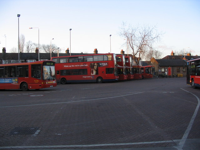
Numerous London buses run through and within the borough.
Travel to work
In March 2011, the main forms of transport that residents used to travel to work were: driving a car or van, 23.5% all residents aged 16–74; underground, metro, light rail, tram, 18.4%; train, 6.2%; bus, minibus or coach, 4.6%; on foot, 3.7%; work mainly at or from home, 2.6%; passenger in a car or van, 1.5%.[27]
History
The borough was formed in 1965 by the London Government Act 1963 as a merger of the former area of:
| Former local government district | Population (1961)[28] |
|---|---|
| Municipal Borough of Ilford | 178,024 |
| Municipal Borough of Wanstead and Woodford | 61,416 |
| northern part of the Municipal Borough of Dagenham around Hog Hill | 3,569 |
| south eastern part of Chigwell Urban District around Hainault | 7,071 |
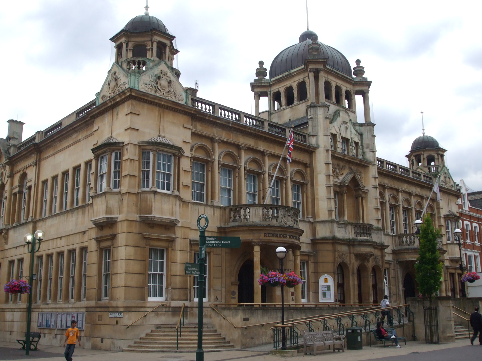
All of which had been transferred from Essex to Greater London by the Act. The former town hall in Ilford is now known as Redbridge Town Hall.[29]
Following a review by the Local Government Boundary Commission for England, minor changes were made on 1 April 1994 to the boundary with Barking & Dagenham[30] and Newham.[31] Further changes were made on 1 April 1995 to the boundary with Waltham Forest[32] and Epping Forest District.[33] The latter change transferred an area around Grange Hill and Roding Valley tube stations from Essex to Greater London.[33]
Awards
In November 2018, Redbridge Council was reported as the sixth-most productive council in England overall and the most productive in provision of adult social care in a report published by the public service consultancy iMPOWER.[34][35]
Redbridge London Borough Council
Summary of Council results:
| Overall control | Conservative | Labour | Lib Dem | Others | |
|---|---|---|---|---|---|
| 2014 | Labour | 25 | 35 | 3 | 0 |
| 2012 | No Overall Control | 29 | 25 | 7 | 2 |
| 2010[36][37] | No Overall Control | 30 | 26 | 7 | 0 |
| 2009 | No Overall Control | 31 | 14 | 13 | 5 |
| 2006[38] | Conservative | 33 | 18 | 10 | 2 |
| 2002 | Conservative | 33 | 21 | 9 | - |
| 1998 | No overall control | 23 | 30 | 9 | 0 |
| 1994 | No overall control | 24 | 29 | 9 | |
| 1990[39] | Conservative | 42 | 18 | 3 | |
| 1986 | Conservative | 45 | 17 | 1 | |
| 1982 | Conservative | 51 | 12 | ||
| 1978 | Conservative | 50 | 13 | ||
| 1974 | Conservative | 45 | 15 | ||
| 1971 | Conservative | 42 | 18 | ||
| 1968 | Conservative | 55 | 5 | ||
| 1964 | Conservative | 45 | 15 |
Education
Redbridge Council is the Local Education Authority. The Borough has the accolade of sending more young people to university than any other borough in the country in both 2011 and 2012. GCSE and A Level results are consistently higher than the Country's average. A 2017 report by Trust for London and the New Policy Institute found that Redbridge has the highest proportion of 19 year olds with Level 3 qualifications (equivalent to an A Level) of any London borough.[40]
All schools in the borough take part in the Redbridge Schools Choral Festival, a bi-annual music festival held in the Royal Albert Hall in Knightsbridge.[41]
Notable people
Gallery
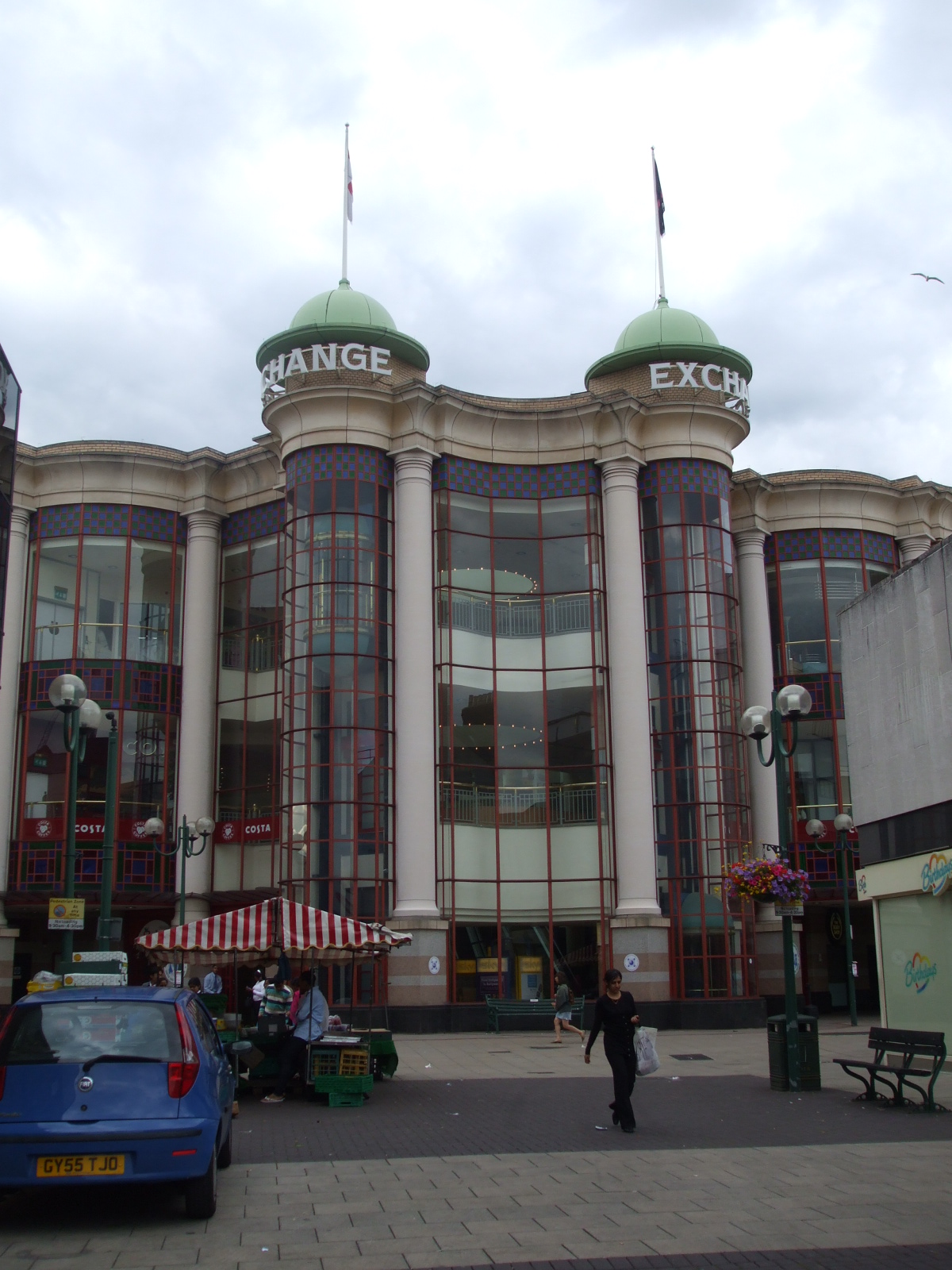
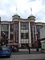 Exchange shopping centre, Ilford
 Fullwell Cross library, Barkingside
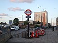 Gants Hill roundabout and station, Gants Hill
 Newbury Park station, Newbury Park


References
- 2011 Census: Ethnic group, local authorities in England and Wales, Office for National Statistics (2012). See Classification of ethnicity in the United Kingdom for the full descriptions used in the 2011 Census.
- "London Places" (PDF). Greater London Authority. GLA. Archived from the original (PDF) on 6 September 2015. Retrieved 11 October 2015.
- Mills, A., Dictionary of London Place Names, (2001)
- "Claybury Woods and Park, including Repton Park". London Gardens Trust. Retrieved 10 May 2020.
- Historic England, "Valentines Park (1000843)", National Heritage List for England, retrieved 12 September 2017
- "Kenneth More Theatre". Vision RCL. Retrieved 10 May 2020.
- "Redbridge Museum". Hidden London. Retrieved 10 May 2020.
- "Redbridge Heritage Centre". Vision RCL. Retrieved 10 May 2020.
- "Embassy Cinema: The Restoration Project". Chadwell Heath South Residents' Association. Retrieved 5 August 2020.
- "Libraries". Redbridge Council. Retrieved 10 May 2020.
- "UK | England | London | Cycle centre 'first 2012 legacy'". BBC News. 19 August 2008. Retrieved 10 May 2020.
- History Of Barkingside FC Barkingside F.C.
- "Valentine's Park". Cricinfo. ESPN. Retrieved 22 September 2015.
- "Population change 2001-2011". Office for National Statistics. Office for National Statistics. 2012. Retrieved 30 November 2014.
- "Population statistics". Redbridge i. Redbridge Council. Archived from the original on 7 December 2014. Retrieved 30 November 2014.
- "2011 Census - Population". Redbridge i. Redbridge Council. Archived from the original on 7 December 2014. Retrieved 30 November 2014.
- "How long can you expect to live in 'Good' general health?". Office for National Statistics. Office for National Statistics. 2014. Retrieved 30 November 2014.
- "2011 Census - Diversity". Redbridge i. Redbridge Council. Archived from the original on 7 December 2014. Retrieved 30 November 2014.
- "Redbridge: Total Population". A Vision of Britain Through Time. Great Britain Historical GIS Project. Retrieved 6 September 2011.
- "1991 census – theme tables". NOMIS. Retrieved 20 January 2017.
- "KS006 - Ethnic group". NOMIS. Retrieved 30 January 2016.
- "Ethnic Group by measures". NOMIS. Retrieved 8 January 2016.
- "2011 Census results". redbridge.gov.uk. 11 December 2012. Retrieved 7 December 2018.
- "Redbridge Census Results". Office of National Statistics.
- "Roding Valley Way". Sustrans.
- Rose, Douglas (1999). The London Underground, A Diagrammatic History. London: Douglas Rose/Capital Transport. ISBN 1-85414-219-4. OCLC 59556887.
- "2011 Census: QS701EW Method of travel to work, local authorities in England and Wales". Office for National Statistics. Retrieved 23 November 2013. Percentages are of all residents aged 16-74 including those not in employment. Respondents could only pick one mode, specified as the journey’s longest part by distance.
- Great Britain Historical GIS / University of Portsmouth, Redbridge. Retrieved {{{accessdate}}}.
- "Redbridge Register Office (Redbridge Town Hall)". London Borough off Redbridge. Retrieved 10 May 2020.
- "The East London Boroughs (London Borough Boundaries) Order 1993".
{{cite web}}: CS1 maint: url-status (link) - "The East London Boroughs (London Borough Boundaries) (No. 2) Order 1993".
{{cite web}}: CS1 maint: url-status (link) - "The Redbridge and Waltham Forest (London Borough Boundaries) Order 1993".
{{cite web}}: CS1 maint: url-status (link) - "The Essex and Greater London (County Boundaries) Order 1993".
{{cite web}}: CS1 maint: url-status (link) - "Top 10 most productive councils in England: 2018". iMPOWER. 22 November 2018. Retrieved 24 April 2019.
- "WHICH COUNCILS ARE BEST?" (PDF). iMPOWER. 22 November 2018. Retrieved 24 April 2019.
- "REDBRIDGE: Council election count - LIVE". East London and West Essex Guardian Series.
- "2010 local election ward results". Archived from the original on 10 May 2010. Retrieved 7 May 2010.
- "2006 Local election results". redbridge.gov.uk. Archived from the original on 10 May 2010. Retrieved 7 May 2010.
- GLA. "Archived copy" (PDF). Archived from the original (PDF) on 28 July 2011. Retrieved 31 January 2016.
{{cite web}}: CS1 maint: archived copy as title (link), London Borough Council Elections May 2010, March 2011, accessed 21 April 2011. - "London's Poverty Profile". Trust for London. Retrieved 19 June 2018.
- Redbridge Music Service - Redbridge Schools' Choral Festival
External links
| Districts |
|  |
|---|---|---|
| Attractions |
| |
| Constituencies |
| |
| Parks and open spaces |
| |
| Tube and rail stations | ||
| History |
| |
| Other topics |
| |
| ||
На других языках
- [en] London Borough of Redbridge
[ru] Редбридж (боро Лондона)
Лондонский боро Ре́дбридж (англ. London Borough of Redbridge, произношение (инф.)) — один из 32 лондонских боро, расположен на северо-востоке, во Внешнем Лондоне, часть исторического графства Эссекс.Другой контент может иметь иную лицензию. Перед использованием материалов сайта WikiSort.org внимательно изучите правила лицензирования конкретных элементов наполнения сайта.
WikiSort.org - проект по пересортировке и дополнению контента Википедии