world.wikisort.org - United_Kingdom
Broughton (/ˈbrɔːtən/,[2] BRAW-tən) is a historic village, modern district and civil parish in Milton Keynes, Buckinghamshire, England. As of 2020[update], it is governed by Broughton and Milton Keynes Joint Parish Council, which it shares with the neighboring Milton Keynes parish. Today, Broughton is a large district of (greater) Milton Keynes that has been developed around the original village and that grew substantially during the 2000s and 2010s.
| Broughton | |
|---|---|
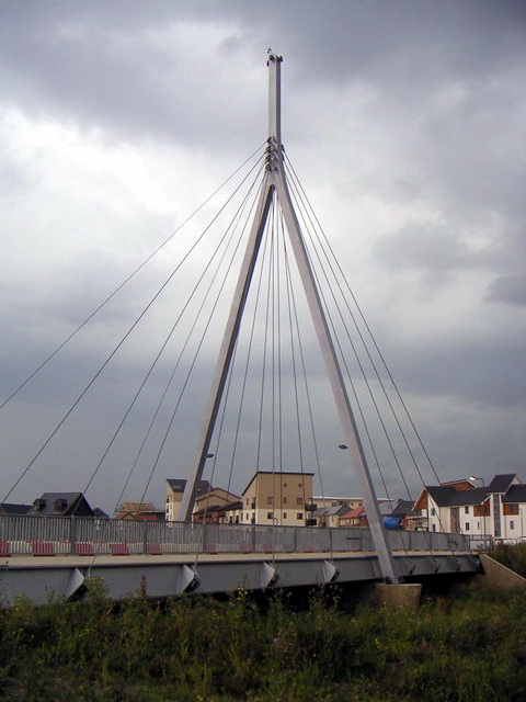 Bridge in Broughton | |
 Broughton Mapping © OpenStreetMap  Broughton Location within Buckinghamshire | |
| Population | 2,493 (2011 Census)[1] |
| OS grid reference | SP895399 |
| Civil parish |
|
| Unitary authority |
|
| Ceremonial county | |
| Region | |
| Country | England |
| Sovereign state | United Kingdom |
| Post town | MILTON KEYNES |
| Postcode district | MK10 |
| Dialling code | 01908 |
| Police | Thames Valley |
| Fire | Buckinghamshire |
| Ambulance | South Central |
| UK Parliament |
|
History and location
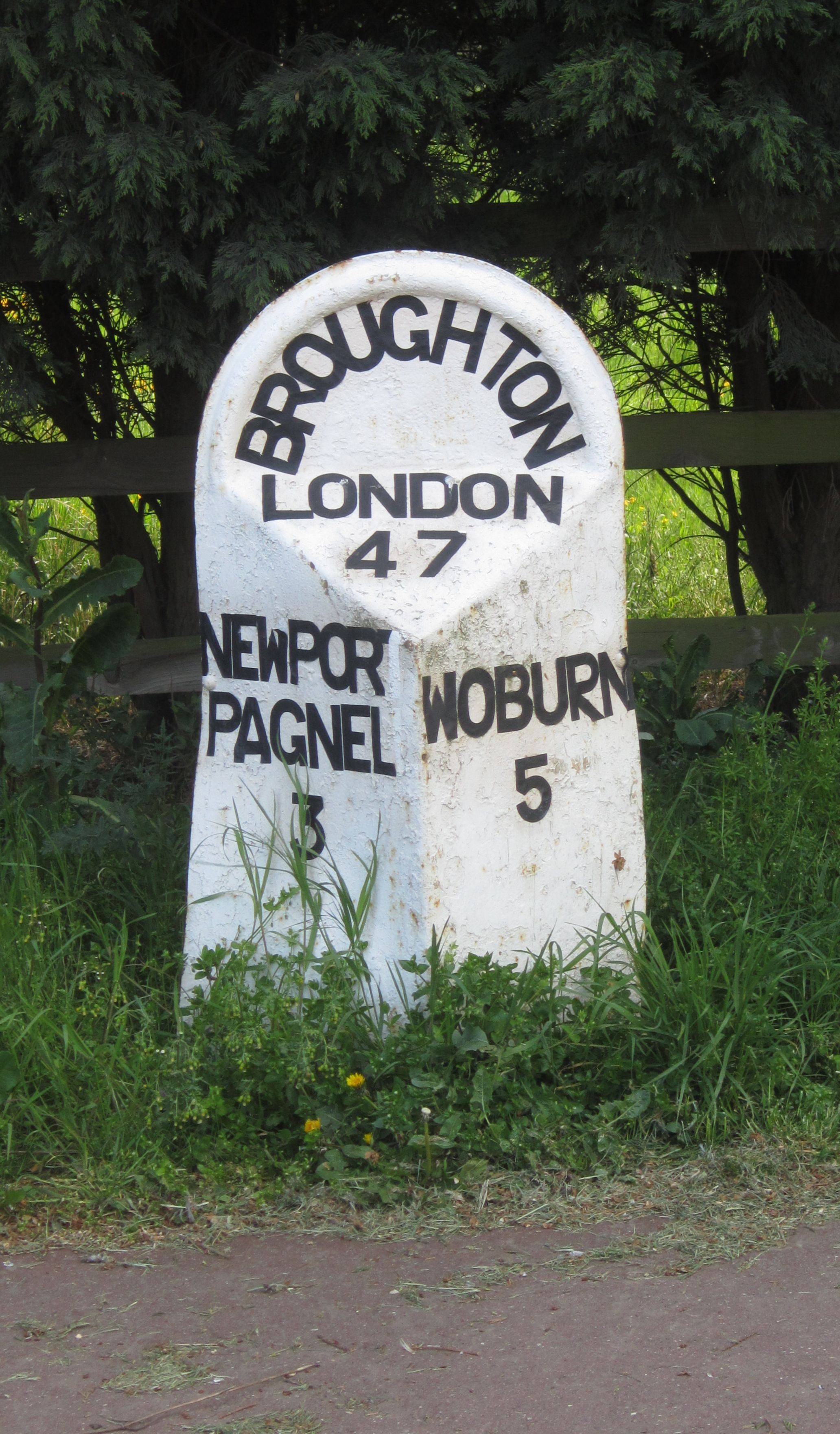
The name is Old English and meant 'brook farm'.[3] In the Domesday Book, it is listed as owned by a Walter Giffard and the tenant was a Hugh de Bolbec. In the 6th century, its name was spelt Brotone.[4] The original Northampton to London turnpike came through the village (to join Watling Street [now the A5 road] near Woburn).[4]
The Milton Keynes grid road, Child's Way (H6), forms the district's northern boundary while Tongwell Street (V11) provides its western, and the M1 motorway provides its eastern (which is easily accessible from the district, with Junction 14 being barely 0.5 miles (0.80 km) to the north (via the A509), and Junction 13 being approximately 2 miles (3.2 km) to the south-east (via the A421)). The section of the old London–Northampton turnpike, once the A50, later part of the A5130 (comprising Newport Road and Fen Street), is now declassified and called "Newport Rd". It connects to Kingston, Magna Park and the A421/Standing Way (H8) to the south. The original route through centre of the old village, named 'London Road', was bypassed in the early 1970s, and the newer route runs between it and another MK district, Brook Furlong, and provides what would be the eastern boundary if the district hadn't expanded. Finally, Chaffron Way (H7), provides the southern boundary: in mid-2009 this was extended to meet the A5130 and was opened to traffic in March 2010.
The district can be split into at least three areas. The original Broughton village forms part of a conservation area at the northern end, bounded by the brook and Newport Road. Atterbury is an area of new build housing, predominantly between the Western side of the brook and the V11 Tongwell Stret grid road. Broughton Gate and Brooklands are two new areas, part of the "Milton Keynes Eastern Expansion area" and cover the area to the east of the brook; the former covers the area on the western side Newport Rd, and the latter covers the eastern side of the road. A small cable-stayed bridge is one of two main road crossings across Broughton Brook, the third and newest is the extension of H7 Chaffron Way (as 'Countess Way') between Broughton and the neighbouring district of Kingston.
Education
Broughton Fields primary school and Brooklands Farm primary school serve the area, whilst secondary education is provided by Oakgrove School in nearby Middleton and the Walton High School campus in Brooklands. In addition, Broughton Manor Preparatory school, a private prep school, is also situated near to the old village.
Facilities
The facilities in the area include a "Hungry Horse" chain public house, and a range of small shops, hair dressers and convenience stores.
Broughton is within easy walking distance of the Milton Keynes Coachway. The Kingston Shopping Centre – which includes one of the UK's larger Tesco stores, a variety of retail outlets, a branch library and a community centre – is in the adjacent grid-square.
A site for a community playing fields has been also been identified between the old village and the primary school. Broughton Pavilion is located on the edge of this field and hosts a variety of groups.
The Broughton Brook linear park stretches the length of the brook as it travels through the area. This provides recreation space for residents. In the North end of Broughton, there is considerable open space and a conservation area. Although the population of this area has grown considerably, this open space is underused and provides a quiet retreat.
Civil parish
As of May 2019[update], Broughton CP operates as a joint parish council with Milton Keynes (village) CP, known as Broughton and Milton Keynes Parish Council.[5] This part of the combined parish includes Broughton itself, Broughton Manor and Brooklands. The latter two are modern development districts that are part of the 'Eastern Expansion Area'. Consequently they have "city streets" rather than grid roads: Countess Way is a continuation of Chaffron Way (H7) but is both a local service road and a city distributor road. The same is true of Fen Street.
Brooklands
Brooklands is primarily a housing area: a building of note is the Brooklands Campus of Walton High School, whose main campus is in Walnut Tree.
St Lawrence's Church
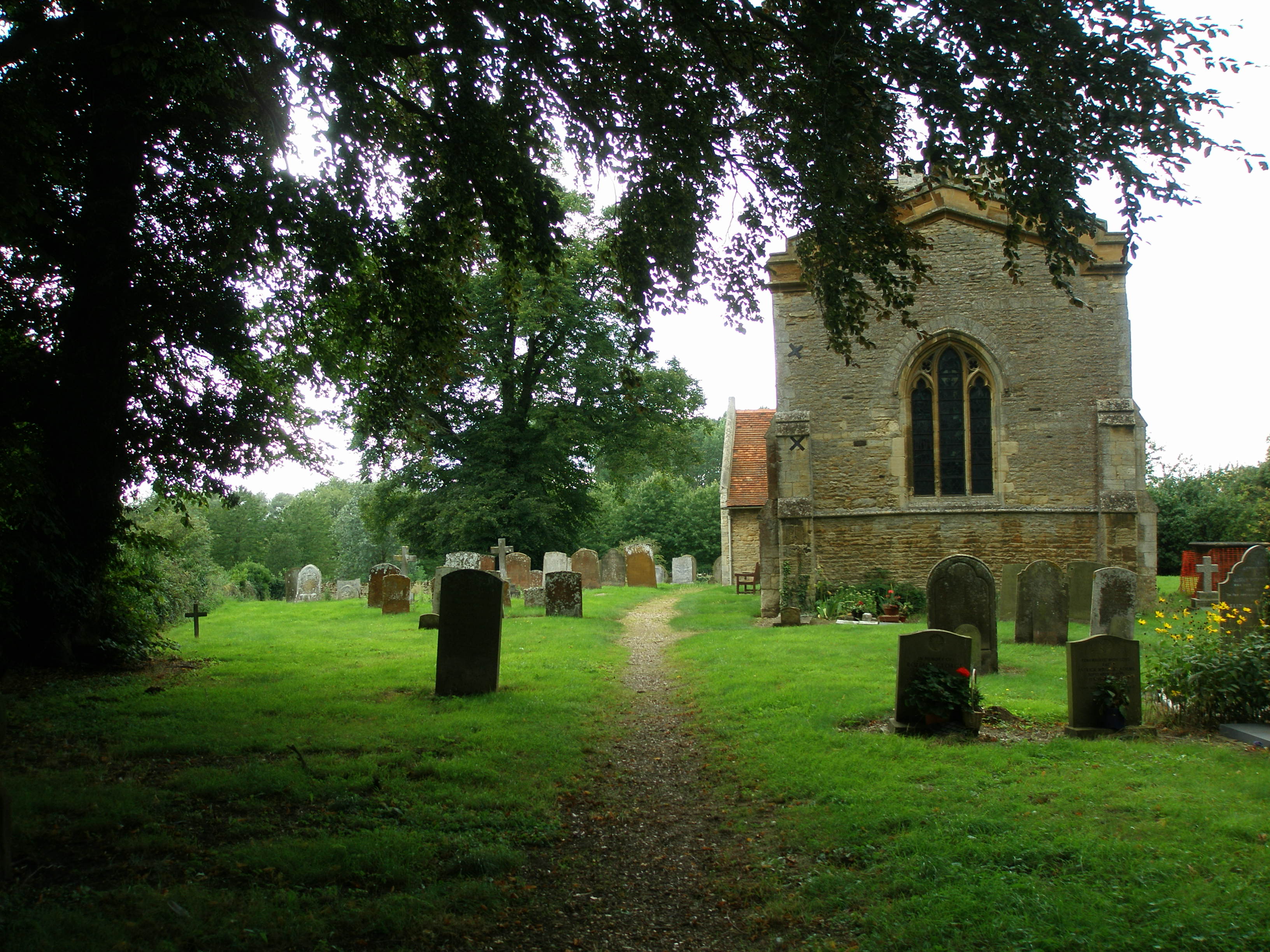
St Lawrence's Church in Broughton is 14th-century church with a 15th-century tower. A series of wall paintings covering large parts of the north and south walls, discovered during an 1849 restoration, are the chief interest of the church. The paintings include a 14th-century Pietà, a Doom, St Helena and St Eligius, and St George slaying the Dragon.[4][6]
The Rectors of St Lawrence are recorded from the end of 1261 to date, many may be interned within the grounds of St Lawrence.[7]
Canal development
Its promoters hope that a proposed new waterway between Milton Keynes and Bedford will run along the line of Broughton Brook.[8]
References
- UK Census (2011). "Local Area Report – Broughton (E04012179)". Nomis. Office for National Statistics. Retrieved 17 November 2019.
- Hanks, Patrick; Flavia Hodges; A. D. Mills; Adrian Room (2002). The Oxford Names Companion. Oxford: Oxford University Press. pp. 961–962.
- "Broughton (Survey of English Place-Names)". English Place-name Society. Retrieved 23 December 2021.
- William Page, ed. (1927). "Parishes : Broughton". A History of the County of Buckingham. Victoria History of the Counties of England. Vol. 4. London: Constable & Co. Ltd. pp. 303–308.
- "About us: Parish Overview". Broughton and Milton Keynes Parish Council. Retrieved 16 May 2019.
- "St Lawrence's Church, Broughton, Buckinghamshire". visitchurches.org.uk. Archived from the original on 19 October 2016. Retrieved 23 December 2021.
- Rectors of St Lawrence Broughton since 1261 Milton Keynes Heritage Association
- Bedford-MK Waterway
External links
- The website of the joint Broughton and Milton Keynes civil parish council.
- VisitChurches.org entry for St Lawrences.
![]() Media related to Broughton, Milton Keynes at Wikimedia Commons
Media related to Broughton, Milton Keynes at Wikimedia Commons
Authority control | |
|---|---|
| General |
|
| National libraries | |
Другой контент может иметь иную лицензию. Перед использованием материалов сайта WikiSort.org внимательно изучите правила лицензирования конкретных элементов наполнения сайта.
WikiSort.org - проект по пересортировке и дополнению контента Википедии