world.wikisort.org - United_Kingdom
Abbey Hill is a civil parish that covers the Two Mile Ash, Kiln Farm, and Wymbush districts of Milton Keynes in Buckinghamshire, England.[2] As the first tier of Local Government, the parish council is responsible for the people, living and working in this area of Milton Keynes.
| Abbey Hill | |
|---|---|
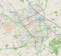
 Abbey Hill Mapping © OpenStreetMap  Abbey Hill Location within Buckinghamshire | |
| Population | 4,215 [1][lower-alpha 1] |
| OS grid reference | SP818389 |
| Civil parish |
|
| Unitary authority |
|
| Ceremonial county |
|
| Region | |
| Country | England |
| Sovereign state | United Kingdom |
| Post town | MILTON KEYNES |
| Postcode district | MK8, MK11 3 |
| Dialling code | 01908 |
| Police | Thames Valley |
| Fire | Buckinghamshire |
| Ambulance | South Central |
| UK Parliament |
|
The Parish was formed in 2008 as part of a revision of parishes of the Borough of Milton Keynes:[citation needed] the districts were previously part of a parish called Bradwell Abbey. It is bounded by Millers Way (H2), the A5, Watling Street (V4), and Dansteed Way (H4).[3]
Districts of the parish
Two Mile Ash
This residential district contains a primary school, a local centre and part of the eponymous Abbey Hill golf course.
Kiln Farm
This is an employment district of light industry and low-intensity warehousing and distribution. It also contains the remainder of the Abbey Hill golf course.
Wymbush
This is another employment district of light industry and low-intensity warehousing and distribution.
Electoral ward (Borough)
The Parish falls within the Bradwell Ward of the Borough of Milton Keynes.
References
- According to parish boundary recorded in the 2011 Census,[1] this parish included Bradwell Abbey, whereas the Milton Keynes Council table dated 2014 places it in Bradwell CP. However, as there are only three small dwellings on the Abbey site, the difference is not significant.
- UK Census (2011). "Local Area Report – Abbey Hill (1170221281)". Nomis. Office for National Statistics. Retrieved 21 January 2019.
- AREA-PARISH-WARD table Archived 21 January 2019 at the Wayback Machine – Milton Keynes Council, June 2014
- "Abbey Hill". ONS. Retrieved 2 March 2018.
External links
Другой контент может иметь иную лицензию. Перед использованием материалов сайта WikiSort.org внимательно изучите правила лицензирования конкретных элементов наполнения сайта.
WikiSort.org - проект по пересортировке и дополнению контента Википедии