world.wikisort.org - United_Kingdom
Woburn (/ˈwoʊbərn/, meaning twisted or crooked stream)[1] is a small village and civil parish in Bedfordshire, England. It is situated about 5 miles (8.0 km) southeast of the centre of Milton Keynes, and about 3 miles (4.8 km) south of junction 13 of the M1 motorway and is a tourist attraction. At the 2011 census, it had a population of 933.[2]
| Woburn | |
|---|---|
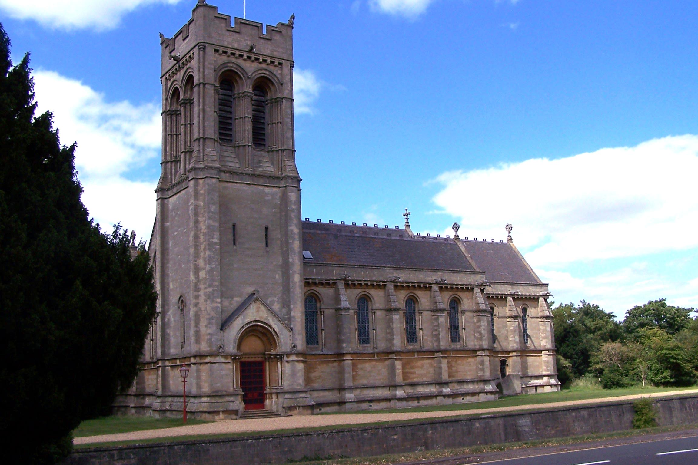 St Mary's parish church in Woburn | |
 Woburn Location within Bedfordshire | |
| Population | 933 (2011) |
| OS grid reference | SP949331 |
| Civil parish |
|
| Unitary authority |
|
| Ceremonial county |
|
| Region | |
| Country | England |
| Sovereign state | United Kingdom |
| Post town | MILTON KEYNES |
| Postcode district | MK17 |
| Dialling code | 01525 |
| Police | Bedfordshire |
| Fire | Bedfordshire and Luton |
| Ambulance | East of England |
| UK Parliament |
|
History

Woburn was first recorded as a hamlet in 969 and is found in the Domesday Book of 1086. It is best known as the location of Woburn Abbey (a stately home) and Woburn Safari Park. The abbey was founded by Cistercian monks in 1145 and granted to the first Earl of Bedford in 1538 after the dissolution of the monasteries. The village may have been called "Woburne Chapell" in Medieval times, in order to distinguish it from the abbey.[3][4] Woburn has been burned down and rebuilt three times. A mediaeval chimney fire spread due to the prevalence of thatched roofs and closely built houses. Then, during the English Civil War, the Cavaliers burned down much of the village and in 1724 a third fire destroyed much of the town, which was re-built in the Georgian style that remains today.[5]
During the nineteenth century, Woburn was an important staging post on the London–Newport Pagnell–Northampton turnpike. The town had 27 inns and the first 24-hour post office outside London. However, with Woburn being bypassed by (what became) the West Coast Main Line and the Grand Union canal (north–south}} and the Varsity Line (east–west), Woburn's location ceased to be so significant. The population fell from 2,100 in 1851 to 700 about a century later.
Woburn Town Hall, designed by Edward Blore, was completed in 1830.[6] Under the 8th Duke of Bedford, a new parish church was completed in Woburn in 1868. It was equipped with a crypt beneath, which was originally intended as the burial place of the Dukes of Bedford and their family. In the end the dukes continued to use the ancient mausoleum at St Michael's, Chenies, and the crypt of St Mary's parish church in Woburn is now used for events and meetings. The hatch through which coffins would have been lowered into the crypt is still visible.[7]
Modern Woburn
Woburn is a residential village and tourist attraction. Aside from Woburn Abbey and Woburn Safari Park, tourists visit Woburn's Georgian villiage centre and the Woburn Heritage Centre local history museum. Woburn hosts a popular Village Festival around the last weekend in August every year attracting thousands of visitors. Facilities for residents include a heated outdoor swimming pool open in the summer months, the Village Hall, St Mary's Church, Woburn Lower School and various independent shops. Woburn also has a monthly Farmers' Market on the third Sunday of the month organised by the Village Traders.
Woburn Abbey has played host to many outdoor live music concerts including Dire Straits, Elton John and Neil Diamond. In July 2007 the Abbey hosted the three-day Woburn Live concert featuring Classic FM Live, Van Morrison and Ronnie Scott's Big Band on three consecutive evenings.
Woburn was chosen by Center Parcs as the named location for its fifth holiday village at a cost of £250 million. The actual location is 7 miles (11 km) away between Millbrook and Steppingley; Center Parcs Woburn Forest sits on an ancient wood called Millbrook Warren. It opened to guests in spring 2014.
Sports and leisure facilities
Apart from the new Center Parcs, Woburn has its own lido.[8] In addition to the good walks and cycling opportunities afforded by the Estate and the local roads, Woburn lies across the routes of both the Greensand Ridge Walk and the Greensand Cycle Way.
Woburn Golf Club, 2.5 miles (4.0 km) west of Woburn, has hosted the Women's British Open eleven times between 1984 and 2019.
Climate
Woburn experiences an oceanic climate (Köppen climate classification Cfb) as is typical of almost all of the United Kingdom.
There is a Met Office weather station in Woburn.[9] Recorded temperature extremes range from 39.6 °C (103.3 °F) during July 2022,[10] to as low as −20.6 °C (−5.1 °F) on 25 February 1947; this is the lowest temperature ever reported in England in February.[11] In 2010, the temperature fell to −16.3 °C (2.7 °F)[12]
| Climate data for Woburn 1981–2010 | |||||||||||||
|---|---|---|---|---|---|---|---|---|---|---|---|---|---|
| Month | Jan | Feb | Mar | Apr | May | Jun | Jul | Aug | Sep | Oct | Nov | Dec | Year |
| Average high °C (°F) | 7.0 (44.6) |
7.4 (45.3) |
10.3 (50.5) |
13.1 (55.6) |
16.6 (61.9) |
19.6 (67.3) |
22.1 (71.8) |
21.9 (71.4) |
18.7 (65.7) |
14.4 (57.9) |
10.0 (50.0) |
7.2 (45.0) |
14.1 (57.4) |
| Average low °C (°F) | 1.3 (34.3) |
0.9 (33.6) |
2.7 (36.9) |
3.8 (38.8) |
6.5 (43.7) |
9.4 (48.9) |
11.7 (53.1) |
11.6 (52.9) |
9.6 (49.3) |
7.0 (44.6) |
3.8 (38.8) |
1.5 (34.7) |
5.8 (42.4) |
| Average precipitation mm (inches) | 54.2 (2.13) |
41.7 (1.64) |
45.3 (1.78) |
52.1 (2.05) |
54.3 (2.14) |
53.2 (2.09) |
53.1 (2.09) |
55.4 (2.18) |
57.5 (2.26) |
70.3 (2.77) |
63.0 (2.48) |
57.3 (2.26) |
657.4 (25.88) |
| Mean monthly sunshine hours | 52.0 | 69.4 | 105.5 | 147.4 | 183.4 | 179.9 | 197.1 | 189.0 | 137.0 | 105.6 | 61.7 | 43.5 | 1,471.6 |
| Source: Met Office[13] | |||||||||||||
References
- "Map of Woburn, Bedfordshire". Aboutbritain.com. Retrieved 10 August 2017.
- "Census 2011: Parish Headcounts: Mid Bedfordshire". Neighbourhood Statistics. Office for National Statistics. Retrieved 4 September 2013.
- "Plea Rolls of the Common Pleas; National Archives; CP 40 / 677 / 870". 1430.(third entry)
- "Plea Rolls of the Common Pleas; National Archives; CP 40 / 677 / 479". 1430. (first entry)
- "About Woburn". Woburn Heritage Museum. Archived from the original on 4 July 2011. Retrieved 20 April 2011.
- Historic England. "Town Hall, Market Place (1321662)". National Heritage List for England. Retrieved 18 December 2021.
- Saint Mary's Church Woburn, accessed 26 July 2015
- "Perfect Day Out at Woburn Swimming Pool". Retrieved 18 August 2014.
- "Synoptic and climate stations (map)". Met Office. Retrieved 23 July 2022.
- "Unprecedented extreme heatwave, July 2022" (PDF). Metoffice.gov.uk. Retrieved 23 July 2022.
- Booth, George (2007). "1947 minimum". Weather. 62 (3): 61–68. doi:10.1002/wea.66. S2CID 123612433.
- Rogers, Simon (21 December 2010). "2010 minimum". The Guardian. London. Archived from the original on 9 January 2021. Retrieved 3 March 2011.
- "Woburn 1981–2010 averages". Met Office. Archived from the original on 5 April 2022. Retrieved 29 November 2012.
External links
- Woburn pages at the Bedfordshire and Luton Archives and Records Service
 Woburn travel guide from Wikivoyage
| Unitary authorities |
|
|---|---|
| Major settlements |
|
| Topics |
|
Другой контент может иметь иную лицензию. Перед использованием материалов сайта WikiSort.org внимательно изучите правила лицензирования конкретных элементов наполнения сайта.
WikiSort.org - проект по пересортировке и дополнению контента Википедии