world.wikisort.org - Turkey
Bayat is a district of Çorum Province in the Black Sea region of Turkey. It is located at 83 km from the city of Çorum, near the town of İskilip. It covers an area of 770 km², and the population (2010) is 23,323 of which 8,479 live in the town of Bayat. It has an elevation of 625 m. The mayor is Ekrem Ünlü (AKP).
Bayat | |
|---|---|
 Bayat | |
| Coordinates: 40°38′46″N 34°15′40″E | |
| Country | |
| Province | Çorum |
| Government | |
| • Mayor | Ekrem Ünlü (AKP) |
| Area | |
| • District | 814.53 km2 (314.49 sq mi) |
| Population (2012)[2] | |
| • Urban | 8,028 |
| • District | 20,909 |
| • District density | 26/km2 (66/sq mi) |
| Climate | Csb |
Geography
Bayat is located at high altitude above the Black Sea coast, but has the character of a central Anatolian district. The town stands in a valley of the River Bayat, a tributary of the Kızılırmak that runs down from the surrounding mountains including the 2013 m Mount Öbek.
In the mountain villages in the north of the district people live on forestry and herding livestock, there are also a number of coal mines. Many families have migrated to larger cities in search of jobs, or go as seasonal labour in the construction industry. There is better farmland in the valley floor along with flour and feed mills.
The town of Bayat provides schools, health care and other basic amenities to the villages in the district.
History
Bayat was settled in the 13th century by the Bayat branch of the Oghuz Turk clan, who were widespread in Anatolia and have given their name to over 50 towns and villages in Turkey.
References
- "Area of regions (including lakes), km²". Regional Statistics Database. Turkish Statistical Institute. 2002. Retrieved 2013-03-05.
- "Population of province/district centers and towns/villages by districts - 2012". Address Based Population Registration System (ABPRS) Database. Turkish Statistical Institute. Retrieved 2013-02-27.
Bayat, Çorum in Çorum Province of Turkey | |||||||||||||||||||||||||||
|---|---|---|---|---|---|---|---|---|---|---|---|---|---|---|---|---|---|---|---|---|---|---|---|---|---|---|---|
| Districts |  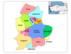 | ||||||||||||||||||||||||||
|
Metropolitan municipalities are bolded. | |||||||||||||||||||||||||||
| ||
This geographical article about a location in Çorum Province, Turkey is a stub. You can help Wikipedia by expanding it. |
На других языках
[de] Bayat (Çorum)
Bayat ist eine Stadt und ein Landkreis der türkischen Provinz Çorum. Die Stadt liegt etwa 60 Kilometer westlich der Provinzhauptstadt Çorum und südlich der 2044 Meter hohen Gecmiş Dağları im Tal des Flusses Bayat Çayı, der wenig südlich in den Kızılırmak mündet.- [en] Bayat, Çorum
Другой контент может иметь иную лицензию. Перед использованием материалов сайта WikiSort.org внимательно изучите правила лицензирования конкретных элементов наполнения сайта.
WikiSort.org - проект по пересортировке и дополнению контента Википедии