world.wikisort.org - South_Africa
Paulpietersburg is a small town in KwaZulu-Natal, South Africa. It was established in 1888 and was then part of the Transvaal Republic. It was named after then President Paul Kruger and Voortrekker hero Piet Joubert.
This article needs additional citations for verification. (December 2009) |
Paulpietersburg | |
|---|---|
 View up Hoog Street with Dumbe hill in background | |
 Paulpietersburg  Paulpietersburg | |
| Coordinates: 27°25′S 30°49′E | |
| Country | South Africa |
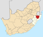
| Province | KwaZulu-Natal |
| District | Zululand |
| Municipality | eDumbe |
| Established | 1888[1] |
| Government | |
| • Councillor | BM Nxusa (NFP) |
| Area | |
| • Total | 36.56 km2 (14.12 sq mi) |
| Population (2011)[2] | |
| • Total | 1,859 |
| • Density | 51/km2 (130/sq mi) |
| Racial makeup (2011) | |
| • Black African | 56.7% |
| • Coloured | 1.0% |
| • Indian/Asian | 1.5% |
| • White | 37.3% |
| • Other | 3.6% |
| First languages (2011) | |
| • Zulu | 48.8% |
| • Afrikaans | 23.1% |
| • English | 11.5% |
| • Other | 16.6% |
| Time zone | UTC+2 (SAST) |
| Postal code (street) | 3180 |
| PO box | 3180 |
| Area code | 034 |
Town 72 km south of Piet Retief and 151 km north-east of Dundee. It was established in 1888, proclaimed a township in 1910, and attained municipal status in 1958. Named after President Paul Kruger and General Piet Joubert, it was first called Paulpietersrust, then Paulpietersdorp, and Paulpietersburg in 1896.[3]
Notable residents
References
- "Chronological order of town establishment in South Africa based on Floyd (1960:20-26)" (PDF). pp. xlv–lii.
- "Main Place Paulpietersburg". Census 2011.
- "Dictionary of Southern African Place Names (Public Domain)". Human Science Research Council. p. 360.
Municipalities and communities of Zululand District Municipality, KwaZulu-Natal | ||
|---|---|---|
District seat: Ulundi | ||
| Ulundi |
|  |
| Nongoma | ||
| Abaqulusi | ||
| uPhongolo | ||
| EDumbe | ||
This KwaZulu-Natal location article is a stub. You can help Wikipedia by expanding it. |
На других языках
[de] Paulpietersburg
Paulpietersburg ist eine Stadt in der südafrikanischen Provinz KwaZulu-Natal. Sie gehört zur Gemeinde eDumbe im Distrikt Zululand.[1] 2011 hatte sie 1859 Einwohner.[2]- [en] Paulpietersburg
[ru] Паулпитерсбург
Паулпитерсбург, африк. Paulpietersburg — городок на территории провинции Квазулу-Натал в ЮАР. Расположен в 72 км к югу от Пит-Ретифа и в 151 км к северо-востоку от Данди.Текст в блоке "Читать" взят с сайта "Википедия" и доступен по лицензии Creative Commons Attribution-ShareAlike; в отдельных случаях могут действовать дополнительные условия.
Другой контент может иметь иную лицензию. Перед использованием материалов сайта WikiSort.org внимательно изучите правила лицензирования конкретных элементов наполнения сайта.
Другой контент может иметь иную лицензию. Перед использованием материалов сайта WikiSort.org внимательно изучите правила лицензирования конкретных элементов наполнения сайта.
2019-2025
WikiSort.org - проект по пересортировке и дополнению контента Википедии
WikiSort.org - проект по пересортировке и дополнению контента Википедии