world.wikisort.org - Russia
Oryol or Orel (Russian: Орёл, IPA: [ɐˈrʲɵl], lit. eagle), also known as Oriol,[9] is a city and the administrative center of Oryol Oblast situated on the Oka River, approximately 368 kilometers (229 mi) south-southwest of Moscow. It is part of the Central Federal District, as well as the Central Economic Region.
Oryol
Орёл | |
|---|---|
City[1] | |
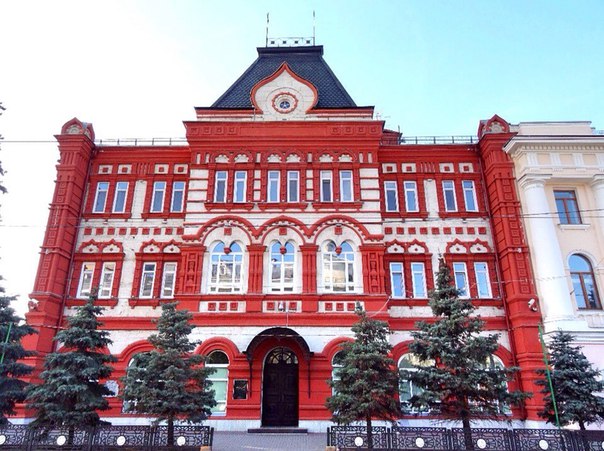
 Left:A 400th anniversary monument of Oryol, Oryol City Hall, Ivan Sergeyevich Turgenev nonument in Krituri Oddri Park, Right:Lenina (Lenin) Square and Theotokos Smolensk Church, Oryol Eagle Monument in Privokzalnaya Square, Orink River and Oryol financial heritage building, Orzol Saint Michael Church, (all item from above to bottom) | |
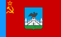 Flag  Coat of arms | |
Location of Oryol  | |
 Oryol Location of Oryol  Oryol Oryol (Oryol Oblast) | |
| Coordinates: 52°58′07″N 36°04′10″E | |
| Country | Russia |
| Federal subject | Oryol Oblast[1] |
| Founded | 1566 |
| Government | |
| • Mayor | Yuri Parakhin[2] |
| Area | |
| • Total | 121.21 km2 (46.80 sq mi) |
| Elevation | 170 m (560 ft) |
| Population | |
| • Total | 317,747 |
| • Estimate (2021) | 303,696 |
| • Rank | 57th in 2010 |
| • Density | 2,600/km2 (6,800/sq mi) |
Administrative status | |
| • Subordinated to | city of oblast significance of Oryol[1] |
| • Capital of | Oryol Oblast[1], city of oblast significance of Oryol[1] |
Municipal status | |
| • Urban okrug | Oryol Urban Okrug[5] |
| • Capital of | Oryol Urban Okrug[5], Orlovsky Municipal District[6] |
| Time zone | UTC+3 (MSK |
| Postal code(s)[8] | 302000–302999 |
| Dialing code(s) | +7 4862 |
| OKTMO ID | 54701000001 |
| City Day | August 5 |
| Website | www |
History

Kievan Rus
While there are no historical records, archaeological evidence shows that a fortress settlement existed between the Oka River and Orlik Rivers as early as the 12th century, when the land was a part of the Principality of Chernigov. The name of the fortress is unknown; it may not have been called Oryol at the time. In the 13th century, the fortress became a part of the Zvenigorod district of the Karachev Principality. In the early 15th century, the territory was conquered by the Grand Duchy of Lithuania. The city was soon abandoned by its population after being sacked either by Lithuanians or the Golden Horde. The territory became a part of the Tsardom of Russia in the 16th century.
Tsardom of Russia
Ivan IV Vasilyevich decreed that a new fortress be built on the spot in 1566 for the purpose of defending the southern borders of the country.[citation needed] The fortress was built starting in the summer of 1566 and ending in the spring of 1567. The location chosen was less than ideal strategically, as the fortress was located on a seasonally flooded low ground easily targeted from the neighboring high ground. False Dmitry I and his army passed through Oryol in 1605; Ivan Bolotnikov in 1606; False Dmitry II camped in Oryol for the winter of 1607–1608. Polish forces sacked it in 1611 and 1615. While the population fled after the second sacking and moved to Mtsensk, the Orlovsky Uyezd continued to exist administratively.
Oryol was rebuilt in 1636. The question of moving the fortress to the more advantageous high ground was debated until the 1670s, but the move was never made. The fortress was deemed unnecessary and taken apart in the early 18th century.
Russian Empire
In the mid-18th century Oryol became one of the major centers of grain production, with the Oka River being the major trade route until the 1860s when it was replaced by a railroad.
Oryol was granted town status in 1702. In 1708, Oryol was included as a part of Kiev Governorate; in 1719, Oryol Province was created within Kiev Governorate. The Province was transferred to the newly created Belgorod Governorate in 1727. On March 11 (February 28 old style), 1778 Oryol Vice-Royalty was created from parts of Voronezh and Belgorod Governorates. In 1779, the city was almost entirely rebuilt based on a new plan; and the Oryol River was renamed Orlik (lit: "little eagle").
Russian Republic
After the October Revolution of 1917, the city was in Bolshevik's hands, except for a brief period between October 13 and October 20, 1919, when it was controlled by Anton Denikin's White Army.
Soviet Union
Oryol was once again moved between different oblasts in the 1920s and 1930s: first as Oryol Governorate until 1928, then Central Black Earth Region between 1928 and 1934, finally in Kursk Oblast), finally becoming the administrative center of its own Oryol Oblast on September 27, 1937.
The Oryol Prison was a notable place of incarceration for political prisoners and war prisoners of the Second World War. Christian Rakovsky, Maria Spiridonova, Olga Kameneva and 160 other prominent political prisoners were shot on September 11, 1941 on Joseph Stalin's orders in the Medvedev Forest massacre outside Oryol.
During the German-Soviet War, Oryol was occupied by the Wehrmacht on October 7, 1941.
The French air squadron Normandie-Niemen fought in the skies over Oryol.
On September 19, 1943, in the Oryol, was the first parade of partisan units stationed in the Oryol region during the war.
Oryol was liberated on August 5, 1943 during the Oryol strategic offensive operation "Kutuzov" on the Oryol-Kursk Bulge. The city was almost completely destroyed. By Order No .2 of I. V. Stalin of August 5, 1943, on this day in Moscow, an artillery salute was given to the troops that liberated Oryol. Since then, the city has had the nickname, "City of the First Salute", and the day of the liberation from the German invaders was celebrated as the city's day.[citation needed]
Geography

Time zone
Oryol has the same time zone as Moscow (Moscow time). Time relative to UTC is +3.00 18.
Location
Oryol stands on the banks of the Oka River and its tributary Orlik river in the Central Russian Upland of the East European Plain, approximately 368 km (229 mi) south-southwest of Moscow.
Layout
Oryol was founded at the behest of Ivan the Terrible in 1566, in the area between the Oka and Orlik rivers. Little information exists about its early history; the earliest data available refers to 1636, when the city was rebuilt after its destruction during the Time of Troubles. According to historian T. G. Svistunova, the 16th-century Oryol fortress had three lines of fortifications and consisted of a city, an ostrog and a posad surrounded by gaps. The city housed a cathedral, a voivode's (warlord or military leader's) house, government buildings and courts for the boyar children; the prison consisted of gunners' yards, a blacksmith, and two parish churches near the prison towers. In the posad was a sloboda. In 1636, Oryol was rebuilt by the voivode B. Koltovsky; it expanded with annexation of land beyond the Oka. Oryol remained a fortress city with a corresponding garrison; Pushkarskaya Sloboda was still located in the prison, boyar children and nobles settled on the left bank of the Orlik, and a Cossack sloboda developed near the Oka. Oryol lost its military character after the 1689 fire, when the partially-burned city fortress was not rebuilt.
In central Oryol, streets fan out from the fortress; two main axes are the Upper and Lower Korchak Roads. Opposite the fortress was probably a second marketplace in the Zaotsk section, where the dragoon settlements had a relatively-regular layout along the river. Away from the river, the grid becomes a fan. The city – its fortress, three marketplaces, two monasteries and a number of parish churches – was developed from the river. Its structure was visible from the Oka: the central fortress, the fan-shaped center and the grid of the Zaotsk settlements. The city was connected by bridges, making Oryol a military fortress and a trade center.[10]
The city's earliest plans, by Mikhail Buzovlev and Petr Botvinev, date to 1728. A 1778 plan fixed its radial layout, and a radial-semicircular system was proposed the following year. In 1848, a new plan including Polesskaya Square was approved.
Oryol's modern layout was developed in 1939 by Suborov, an architect at the Leningrad branch of Giprogor. The first post-war reconstruction plan was made in Lengiprogor under the direction of architect V. A. Gaikovich. Oryol's development required a new general plan, which was drawn up in 1958 by V. A. Gaikovich and A. M. Suborov of Lengiprogor. The city's center was Lenin Square, on which the House of Soviets was built in 1961. In 1966, construction of flood-control embankments in the central city began.[11]
Climate
Oryol has a humid continental climate (Köppen climate classification Dfb). Winters are moderately cold and changeable. The first half is softer, second with often warmings. Summers are warm, in separate years — they can be rainy or hot and droughty.
| Climate data for Oryol (1991–2020, extremes 1948–present) | |||||||||||||
|---|---|---|---|---|---|---|---|---|---|---|---|---|---|
| Month | Jan | Feb | Mar | Apr | May | Jun | Jul | Aug | Sep | Oct | Nov | Dec | Year |
| Record high °C (°F) | 7.0 (44.6) |
9.4 (48.9) |
19.3 (66.7) |
29.0 (84.2) |
32.8 (91.0) |
35.4 (95.7) |
38.7 (101.7) |
39.5 (103.1) |
31.3 (88.3) |
26.3 (79.3) |
17.5 (63.5) |
9.7 (49.5) |
39.5 (103.1) |
| Average high °C (°F) | −3.6 (25.5) |
−2.8 (27.0) |
3.0 (37.4) |
12.9 (55.2) |
20.1 (68.2) |
23.5 (74.3) |
25.6 (78.1) |
24.6 (76.3) |
18.2 (64.8) |
10.5 (50.9) |
2.5 (36.5) |
−2.1 (28.2) |
11.0 (51.8) |
| Daily mean °C (°F) | −6.1 (21.0) |
−5.8 (21.6) |
−0.8 (30.6) |
7.6 (45.7) |
14.3 (57.7) |
17.9 (64.2) |
19.8 (67.6) |
18.5 (65.3) |
12.7 (54.9) |
6.4 (43.5) |
0.0 (32.0) |
−4.3 (24.3) |
6.7 (44.1) |
| Average low °C (°F) | −8.7 (16.3) |
−8.9 (16.0) |
−4.3 (24.3) |
2.8 (37.0) |
8.7 (47.7) |
12.4 (54.3) |
14.5 (58.1) |
12.9 (55.2) |
8.0 (46.4) |
3.0 (37.4) |
−2.2 (28.0) |
−6.7 (19.9) |
2.6 (36.7) |
| Record low °C (°F) | −35.4 (−31.7) |
−37.2 (−35.0) |
−37.8 (−36.0) |
−17.2 (1.0) |
−5 (23) |
−0.4 (31.3) |
3.9 (39.0) |
−2.2 (28.0) |
−5 (23) |
−13 (9) |
−26.4 (−15.5) |
−35 (−31) |
−37.8 (−36.0) |
| Average precipitation mm (inches) | 46 (1.8) |
41 (1.6) |
39 (1.5) |
40 (1.6) |
50 (2.0) |
69 (2.7) |
87 (3.4) |
54 (2.1) |
57 (2.2) |
56 (2.2) |
44 (1.7) |
47 (1.9) |
630 (24.8) |
| Average extreme snow depth cm (inches) | 14 (5.5) |
22 (8.7) |
15 (5.9) |
1 (0.4) |
0 (0) |
0 (0) |
0 (0) |
0 (0) |
0 (0) |
0 (0) |
2 (0.8) |
7 (2.8) |
22 (8.7) |
| Average rainy days | 6 | 5 | 8 | 13 | 14 | 15 | 15 | 12 | 15 | 14 | 11 | 8 | 136 |
| Average snowy days | 23 | 21 | 14 | 4 | 0.4 | 0 | 0 | 0 | 0.3 | 3 | 13 | 22 | 101 |
| Average relative humidity (%) | 84 | 82 | 77 | 68 | 64 | 71 | 72 | 72 | 78 | 82 | 87 | 86 | 77 |
| Source: Pogoda.ru.net[12] | |||||||||||||
Administrative and municipal status
Oryol is the administrative center of the oblast and, within the framework of administrative divisions, it also serves as the administrative center of Orlovsky District, even though it is not a part of it.[1] As an administrative division, it is incorporated separately as the city of oblast significance of Oryol—an administrative unit with the status equal to that of the districts.[1] As a municipal division, the city of oblast significance of Oryol is incorporated as Oryol Urban Okrug.[5]


City districts
Administratively, the city is divided into four districts:
- Severny (Северный) — population: 65,815 (2021)
- Sovetsky (Советский) — population: 74,315 (2021)
- Zheleznodorozhny (Железнодорожный) — population: 60,278 (2021)
- Zavodskoy (Заводской) — population: 103,288 (2021) (the biggest, oldest, and most populous)
Politics
In February 2012, the city duma abolished the direct election of mayor. In December 2013, a referendum was held and 71% of the people supported the return of direct mayoral election.[13]
Mayors
- 1991–1997: Alexander Kislyakov
- 1997–2002: Yefim Velkovsky
- 2002–2006: Vasily Uvarov
- 2006–2009: Alexander Kasyanov
- 2009–2010: Vasily Eremin
- 2010–2012: Viktor Safianov
- 2012–2015: Sergey Stupin
- 2015–2020: Vasily Novikov
- 2020–present: Yuri Parakhin
City-managers:
- 2012–2015: Mikhail Bernikov
- 2015–2017: Andrey Usikov
- 2017–2020: Alexander Muromsky
Demographics
| 1897 Census | 70 000 |
|---|---|
| 1926 Census | 76 000 |
| 1939 Census | 110 564 |
| 1959 Census | 151 521 |
| 1970 Census | 232 216 |
| 1979 Census | 304 971 |
| 1989 Census | 336 862 |
| 2002 Census | 333 310 |
| 2010 Census | 317 747 |
| Estimate 2021 | 303 696 |
According to the Federal State Statistics Service, in January 2020 the number of residents came to 308 838. It is the 66th place among 1117 cities of Russia for 2019.
Largest ethnic groups in 2010:
- Russians (96,8%)
- Ukrainians (1,1%)
- Armenians (0,4%)
- Belarusians (0,3%)
- Azerbaijanis (0,2%)
- Tatars (0,1%)
- Jews (0,1%)
Transportation
The formation of the Oryol as an important transportation hub is due to the favorable geographical position of the city on the borders of the Central and Central Black Earth economic regions.
The city has trolley, tram and bus systems. These kinds of public transport cover the entire territory of the city. Each bus, tram and trolley is equipped with route indicators that inform about the route through the city, designated stops. There are also taxis and rental cars.
In past years, in the summer on the Oka River waterbus operated as a form of transport excursion and walking orientation.
Automotive
In the Oryol converge important highways of federal and regional values:

 E105 / M2 "Crimea"
 R92
R92 R119
R119 R120
R120- 54А-1
- 54К-16
The main intercity terminal: Oryol Bus Station
Trolleybus

On 29 October 1968, a regular movement was opened. Length of the contact network 76.51 km (47.54 mi). There are 4 routes for 2019.
Railway
Since 1868, there has been a railway connection between Oryol and Moscow.[14] Here converge 5 railway lines: on Yelets, Moscow, Kursk, Bryansk, Mikhailovsky mine.
The main terminals: Oryol Station, Station Luzhki-Oryol.
Tram
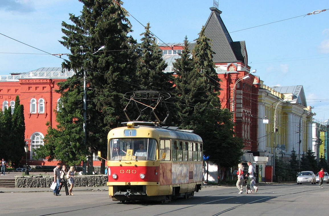

On November 3, 1898, Oryol inaugurated an electric tram. The draft was prepared by the Belgian entrepreneur FF Gilon and firm «Compagnie mutuelle de tramways», which won the right to build not only a tram, but also lighting in the city. Oryol tram is one of the oldest electric tram systems in Russia. It is 1 year older than Moscow and 9 years — St. Petersburg. In 2017, the length of the lines in double-track calculation was 18.3 km (11.4 mi). For 2019, there are 3 routes, which are operated: Tatra T3 (74 units), Tatra T6B5 (13 units), 71-403 (1 unit), 71-405 (1 unit).
Aerial

The city is served by the Oryol Yuzhny Airport, which is currently not working.
Education
There are six institutions of higher education in Oryol, as well as four branches of such institutions from other cities.
- Local
- Oryol Law Institute
- Oryol State Agrarian University
- Oryol State Institute of Culture
- Oryol State Institute of Economics and Trade
- Oryol State University
- Russian Federation Security Guard Service Federal Academy
- Branches
- Oryol Branch of the Russian University of Transport (Moscow)
- Oryol Branch of the Russian Presidential Academy of National Economy and Public Administration (Moscow)
- Oryol branch of the Financial University under the Government of the Russian Federation (Moscow)
- Oryol branch of the Voronezh Institute of Economics and Law (Voronezh)
International cooperation
Twin towns – sister cities

Oryol is twinned with:[15]
 Razgrad, Bulgaria (1968)
 Offenbach am Main, Germany (1988)
 Leeuwarden, The Netherlands (1990-2002)
 Zhodzina, Belarus (2016)
 Mary, Turkmenistan (2017)[16]
Partner cities
 Kaluga, Russia (2003)
- Kolpino, Russia (2010)
- Kolpinsky District, Russia (2010)
- Novosibirsk, Russia (2014)
- Volokolamsky District, Russia (2014)
 Novi Sad, Serbia (2017)
 Maribor, Slovenia (2017)
- Penza, Russia (2018)
Notable people

- Leonid Andreyev, writer
- Mikhail Bakhtin, literary critic[17]
- Fedor Baranov, fisheries scientist
- Denis Boytsov, boxer
- Yulia Bravikova, rhythmic gymnast
- Felix Dzerzhinsky, security chief
- Afanasy Fet, poet
- Nikolai Getman, painter and Gulag survivor
- Timofey Granovsky, historian
- Vasily Kalinnikov (1866-1901), composer
- Yakov Kasman, pianist
- Anna Petrovna Kern, socialite
- Stanislav Lebamba, association football player
- Nikolai Leskov, novelist
- Denis Menchov, cyclist
- Artem Mikoyan, founder of the MiG aircraft manufacturer
- Fritz Noether, mathematician
- Nikolai Polikarpov, aviation designer
- Yevgeni Preobrazhensky, statesman
- Vladimir Karlovich Roth, neuropathologist
- Valerian Safonovich, statesman
- Aleksandr Selikhov, footballer
- Alexey Stakhanov, celebrated miner/engineer
- Pyotr Stolypin, statesman
- Maksymilian Stratanowski, painter
- Yakov Sverdlov, Bolshevik revolutionary
- Ivan Turgenev, novelist and playwright
- Aleksey Petrovich Yermolov, military general
- Gennady Zyuganov, politician
- Korsak-Koulagnikov, collegiate secretary Aleksey Ivanovich, titular councilor Vasili Ivanovich, provincial secretary Petr Grigorievich and his brother Mardari Grigorievich were reckoned among the nobility of the province of Orel in 1815 after examination the proofs of nobility registered in the 6th part of the Noble Register of Chernigov province [18]
References
Notes
- Law #522-OZ
- "Мэр города Орла избран из состава депутатов горсовета". www.orelgorsovet.ru. Retrieved March 23, 2018.
- "Результат запроса". www.gks.ru. Retrieved March 23, 2018.
- Russian Federal State Statistics Service (2011). Всероссийская перепись населения 2010 года. Том 1 [2010 All-Russian Population Census, vol. 1]. Всероссийская перепись населения 2010 года [2010 All-Russia Population Census] (in Russian). Federal State Statistics Service.
- Law #467-OZ
- Law #466-OZ
- "Об исчислении времени". Официальный интернет-портал правовой информации (in Russian). June 3, 2011. Retrieved January 19, 2019.
- Почта России. Информационно-вычислительный центр ОАСУ РПО. (Russian Post). Поиск объектов почтовой связи (Postal Objects Search) (in Russian)
- "Oriol, Russia". Geographical Names. National Geospatial-Intelligence Agency. Retrieved October 26, 2020.
- Tatyana Guk. Scale in the planning of cities in central Russia (example of Kaluga, Tula, Ryazan, Orel, Bryansk, Kursk) pp. 84-86
- Tatyana Guk. Scale in the planning of cities in central Russia (example of Kaluga, Tula, Ryazan, Orel, Bryansk, Kursk), pp. 120-123
- "Weather and Climate - The Climate of IOryol" (in Russian). Weather and Climate (Погода и климат). Retrieved November 8, 2021.
- "В Орле голосуют за возвращение прямых выборов мэра". Rossiyskaya Gazeta. December 10, 2013. Retrieved January 25, 2014.
- Train Station in Oryol (in Russian) Archived March 23, 2012, at the Wayback Machine
- "Партнерские связи". orel-adm.ru (in Russian). Oryol. Retrieved February 2, 2020.
- "Орел и туркменский Мары стали городами-побратимами". October 3, 2017.
- David Lodge, After Bakhtin: Essays on Fiction and Criticism, London & New York: Routledge, 1990, p. 1
- Russian Heraldry Department, Fond 1343, inventory 23, file 7216 Korsak-Koulagenko family
Sources
- Орловский областной Совет народных депутатов. Закон №522-ОЗ от 6 июля 2005 г. «Об административно-территориальном устройстве Орловской области», в ред. Закона №1187-ОЗ от 1 апреля 2011 г «О внесении изменений в законодательные акты Орловской области». Вступил в силу с момента официального опубликования. Опубликован: "Орловская правда", №116, 13 июля 2005 г. (Oryol Oblast Council of People's Deputies. Law #522-OZ of July 6, 2005 On the Administrative-Territorial Structure of Oryol Oblast, as amended by the Law #1187-OZ of April 1, 2011 On Amending the Legislative Acts of Oryol Oblast. Effective as of the moment of the official publication.).
- Орловский областной Совет народных депутатов. Закон №467-ОЗ от 28 декабря 2004 г. «О статусе и границе города Орла как муниципального образования Орловской области», в ред. Закона №1059-ОЗ от 11 мая 2010 г «О внесении изменений в Закон Орловской области "О статусе и границе города Орла Орловской области"». Вступил в силу со дня официального опубликования. Опубликован: "Орловская правда", №233, 30 декабря 2004 г. (Oryol Oblast Council of People's Deputies. Law #467-OZ of December 28, 2004 On the Status and Borders of the City of Oryol as a Municipal Formation of Oryol Oblast, as amended by the Law #1059-OZ of May 11, 2010 On Amending the Law of Oryol Oblast "On the Status and Borders of the City of Oryol of Oryol Oblast". Effective as of the day of the official publication.).
- Орловский областной Совет народных депутатов. Закон №466-ОЗ от 28 декабря 2004 г. «О статусе, границах и административных центрах муниципальных образований на территории Орловского района Орловской области», в ред. Закона №1327-ОЗ от 2 марта 2012 г. «О внесении изменений в Закон Орловской области "О статусе, границах и административных центрах муниципальных образований на территории Орловского района Орловской области" и признании утратившими силу отдельных положений Закона Орловской области "О внесении изменений в Закон Орловской области "О статусе, границах и административных центрах муниципальных образований на территории Орловского района Орловской области"». Вступил в силу со дня официального опубликования. Опубликован: "Орловская правда", №233, 30 декабря 2004 г. (Oryol Oblast Council of People's Deputies. Law #466-OZ of December 28, 2004 On the Status, Borders, and Administrative Centers of the Municipal Formations on the Territory of Orlovsky District of Oryol Oblast, as amended by the Law #1327-OZ of March 2, 2012 On Amending the Law of Oryol Oblast "On the Status, Borders, and Administrative Centers of the Municipal Formations on the Territory of Orlovsky District of Oryol Oblast" and on Rescinding Parts of the Law of Oryol Oblast "On Amending the Law of Oryol Oblast "On the Status, Borders, and Administrative Centers of the Municipal Formations on the Territory of Orlovsky District of Oryol Oblast". Effective as of the day of the official publication.).
External links
- . Encyclopædia Britannica. Vol. 20 (11th ed.). 1911. p. 251.
- Official website of Oryol (in Russian)
- Unofficial website of Oryol (in Russian)
- The murder of the Jews of Oryol during World War II, at Yad Vashem website.
Authority control | |
|---|---|
| General | |
| National libraries | |
| Other |
|
На других языках
[de] Orjol
Orjol (russisch Орёл [.mw-parser-output .IPA a{text-decoration:none}ʌˈrʲoɫ], wörtlich „Adler“; dt. manchmal auch Orel) ist eine russische Stadt in der Oblast Orjol in Zentralrussland. Orjol liegt an der Oka, rund 350 km südwestlich von Moskau. Heute ist Orjol Verwaltungszentrum der gleichnamigen Oblast und hat 317.747 Einwohner (Stand 14. Oktober 2010).[1]- [en] Oryol
[ru] Орёл (город)
Орёл — город (населённый пункт существует не позднее, чем с середины XI века[1]) в России, административный центр Орловской области и Орловского муниципального округа (в состав которого не входит). Являясь городом областного значения, образует муниципальное образование городской округ город Орёл[4]. Расположен в 368 км к юго-западу от Москвы, на Среднерусской возвышенности в европейской части России, по обоим берегам реки Оки и её притока Орлика. Орёл и Орловская область входят в состав Центрального федерального округа, а также Центрального экономического района. Город первого салюта (5 августа 1943 года), город воинской славы (27 апреля 2007 года) и "Литературная столица России" (официально с 12 июня 2021 года).Другой контент может иметь иную лицензию. Перед использованием материалов сайта WikiSort.org внимательно изучите правила лицензирования конкретных элементов наполнения сайта.
WikiSort.org - проект по пересортировке и дополнению контента Википедии