world.wikisort.org - Philippines
Mabinay, officially the Municipality of Mabinay, is a 1st class municipality in the province of Negros Oriental, Philippines. According to the 2020 census, it has a population of 82,953 people [3], making it the most-populous municipality in Negros Oriental.
Mabinay | |
|---|---|
Municipality | |
| Municipality of Mabinay | |
 Mabinay Terminal Complex | |
 Seal | |
| Nickname: The Caves Capital of the Philippines | |
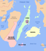
 Map of Negros Oriental with Mabinay highlighted | |
OpenStreetMap  | |
 Mabinay Location within the Philippines | |
| Coordinates: 9°44′N 122°55′E | |
| Country | Philippines |
| Region | Central Visayas |
| Province | Negros Oriental |
| District | 2nd district |
| Barangays | 32 (see Barangays) |
| Government | |
| • Type | Sangguniang Bayan |
| • Mayor | Ernie T. Uy (NPC) |
| • Vice Mayor | Joeterry A. Uy (NPC) |
| • Representative | Manuel T. Sagarbarria |
| • Municipal Council | Members |
| • Electorate | 44,938 voters (2019) |
| Area | |
| • Total | 319.44 km2 (123.34 sq mi) |
| Elevation | 153 m (502 ft) |
| Highest elevation | 426 m (1,398 ft) |
| Lowest elevation | 68 m (223 ft) |
| Population | |
| • Total | 82,953 |
| • Density | 260/km2 (670/sq mi) |
| • Households | 17,645 |
| Economy | |
| • Income class | 1st municipal income class |
| • Poverty incidence | 32.70% (2018)[4] |
| • Revenue | ₱282,101,506.00 (2020) |
| • Assets | ₱894,021,164.33 (2020) |
| • Expenditure | ₱216,829,283.76 (2020) |
| • Liabilities | ₱210,133,280.21 (2020) |
| Service provider | |
| • Electricity | Negros Oriental 1 Electric Cooperative (NORECO 1) |
| Time zone | UTC+8 (PST) |
| ZIP code | 6208 |
| PSGC | |
| IDD : area code | +63 (0)35 |
| Native languages | Cebuano Ata Tagalog Hiligaynon |
History

Folklore has it that a woman named Binay fell in love with the son of her father's rival chieftain. Her father ended the affair by having her lover killed. Binay grieved. Mother Nature took the weeping maiden into her bosom. Where Binay was laid to rest, a spring broke forth. According to the legend, she weeps to this day, feeding Mabinay Spring, one of the town's many alluring attractions.
It had over 100 known caves, including the popular Pandalihan, Panligawan and Gasidlak, each one with its own distinctive features ranging from fascinating to awesome. A team of Belgian and Dutch cavers determined Odloman Cave to be the second longest in the Philippines.
Mabinay was carved from barrios of Bais and created a municipality in 1960. In 1966 more barrios of Bais and Manjuyod were annexed to enlarge it. Mabinay produces rice and corn, copra, soybeans and peanuts. Its principal crop, sugar cane, makes it an important member of the north's sugar district. It is a border town: the Provincial Highway runs through it and links Negros Oriental with its sister province.
Travel from Dumaguete City is about two hours.[5]
Geography
Mabinay is situated roughly in the central part of the island of Negros abutting the western side of the provincial boundary. The municipality of Ayungon bounds it in the north, the City of Bais in the south, the municipalities of Bindoy and Manjuyod and a portion of Bais in the east, and the province of Negros Occidental in the west. It is 87 kilometres (54 mi) north-west of the provincial capital, Dumaguete and can be reached via the circumferential but well-paved national road that cuts across the middle of the province from Bais City to Negros Occidental.
Barangays
Mabinay is politically subdivided into 32 barangays.
- Abis
- Arebasore
- Bagtic
- Banban
- Barras
- Bato
- Bugnay
- Bulibulihan
- Bulwang
- Campanun-an
- Canggohob
- Cansal-ing
- Dagbasan
- Dahile
- Himocdongon
- Hagtu
- Inapoy
- Lamdas
- Lumbangan
- Luyang
- Manlingay
- Mayaposi
- Napasu-an
- New Namangka
- Old Namangka
- Pandanon
- Paniabonan
- Pantao
- Poblacion
- Samac
- Tadlong
- Tarâ
Climate
| Climate data for Mabinay, Negros Oriental | |||||||||||||
|---|---|---|---|---|---|---|---|---|---|---|---|---|---|
| Month | Jan | Feb | Mar | Apr | May | Jun | Jul | Aug | Sep | Oct | Nov | Dec | Year |
| Average high °C (°F) | 29 (84) |
30 (86) |
31 (88) |
32 (90) |
30 (86) |
29 (84) |
28 (82) |
28 (82) |
28 (82) |
28 (82) |
29 (84) |
29 (84) |
29 (85) |
| Average low °C (°F) | 21 (70) |
21 (70) |
22 (72) |
23 (73) |
24 (75) |
24 (75) |
24 (75) |
24 (75) |
24 (75) |
24 (75) |
23 (73) |
23 (73) |
23 (73) |
| Average precipitation mm (inches) | 45 (1.8) |
37 (1.5) |
62 (2.4) |
93 (3.7) |
190 (7.5) |
259 (10.2) |
284 (11.2) |
236 (9.3) |
244 (9.6) |
247 (9.7) |
162 (6.4) |
86 (3.4) |
1,945 (76.7) |
| Average rainy days | 10.8 | 8.4 | 12.7 | 16.3 | 26.7 | 28.5 | 29.1 | 28.0 | 27.4 | 28.5 | 23.4 | 15.5 | 255.3 |
| Source: Meteoblue (Use with caution: this is modeled/calculated data, not measured locally.)[6] | |||||||||||||
Demographics
| Year | Pop. | ±% p.a. |
|---|---|---|
| 1960 | 14,585 | — |
| 1970 | 33,785 | +8.75% |
| 1975 | 35,336 | +0.90% |
| 1980 | 46,871 | +5.81% |
| 1990 | 58,935 | +2.32% |
| 1995 | 62,939 | +1.24% |
| 2000 | 67,001 | +1.35% |
| 2007 | 70,548 | +0.71% |
| 2010 | 74,187 | +1.85% |
| 2015 | 78,864 | +1.17% |
| 2020 | 82,953 | +1.00% |
| Source: Philippine Statistics Authority [7] [8] [9][10] | ||
Economy
Tourism
Mabinay is known for its caves. The Odloman Cave is one of the largest cave in the Philippines with 8,870 metres (29,100 ft) long and Cayaso Cave, the ninth longest cave in the country measuring 2,222 metres (7,290 ft) long.
Aside from the caves, Mabinay also has rivers and natural springs. One of its known natural spring is located at the heart of the municipality, the Mabinay spring. Ideal for family outing, swimming, kayaking, it also serves as the main water resource of the main town. It is about a 3 to 5 minute ride with tricycle, jeepney or a bus from the town center.
Healthcare
Mabinay itself has a small government-run hospital. Mabinay Medicare Community Hospital provides both in emergency outpatients services and inpatient services. It is located directly behind the Municipal Hall. Mabinay Health Center, one of three Mabinay health centers.
Transportation
Motorcycles or "habal-habal", tricycles, jeepneys, and buses are the major modes of transportation in the municipality.
Education
The Mabinay National High School (formerly Mabinay Municipal High School) is a high standard accredited institution according to the Philippine Department of Education.
Mabinay Science High School is a Secondary Public Science High School system that is a DepEd-recognized institution.
The Santo Niño High School is a private Catholic institution located at Barangay Lumbangan.
On June 16, 1997, the Sangguniang Bayan (Municipal Council) Resolution No. 94 established the Mabinay Institute of Technology (MIT), a technical college operated with the approval of the Department of Education, Culture and Sports. On June 25, 2004, the Mabinay Institute of Technology (MIT) was integrated into the newly converted university,[18] Negros Oriental State University by virtue of the university charter, Republic Act No. 9299 signed by President Gloria Macapagal Arroyo on June 25, 2004, and to be known as Mabinay Campus (NORSU-M).
References
- Municipality of Mabinay | (DILG)
- "2015 Census of Population, Report No. 3 – Population, Land Area, and Population Density" (PDF). Philippine Statistics Authority. Quezon City, Philippines. August 2016. ISSN 0117-1453. Archived (PDF) from the original on May 25, 2021. Retrieved July 16, 2021.
- Census of Population (2020). "Region VII (Central Visayas)". Total Population by Province, City, Municipality and Barangay. PSA. Retrieved 8 July 2021.
- "PSA Releases the 2018 Municipal and City Level Poverty Estimates". Philippine Statistics Authority. 15 December 2021. Retrieved 22 January 2022.
- "About | Cities & Towns", Negros Oriental Tourism Office. Retrieved 2013-05-28.
- "Mabinay: Average Temperatures and Rainfall". Meteoblue. Retrieved 6 May 2020.
- Census of Population (2015). "Region VII (Central Visayas)". Total Population by Province, City, Municipality and Barangay. PSA. Retrieved 20 June 2016.
- Census of Population and Housing (2010). "Region VII (Central Visayas)". Total Population by Province, City, Municipality and Barangay. NSO. Retrieved 29 June 2016.
- Censuses of Population (1903–2007). "Region VII (Central Visayas)". Table 1. Population Enumerated in Various Censuses by Province/Highly Urbanized City: 1903 to 2007. NSO.
- "Province of". Municipality Population Data. Local Water Utilities Administration Research Division. Retrieved 17 December 2016.
- "Poverty incidence (PI):". Philippine Statistics Authority. Retrieved 28 December 2020.
- https://psa.gov.ph/sites/default/files/NSCB_LocalPovertyPhilippines_0.pdf; publication date: 29 November 2005; publisher: Philippine Statistics Authority.
- https://psa.gov.ph/sites/default/files/2003%20SAE%20of%20poverty%20%28Full%20Report%29_1.pdf; publication date: 23 March 2009; publisher: Philippine Statistics Authority.
- https://psa.gov.ph/sites/default/files/2006%20and%202009%20City%20and%20Municipal%20Level%20Poverty%20Estimates_0_1.pdf; publication date: 3 August 2012; publisher: Philippine Statistics Authority.
- https://psa.gov.ph/sites/default/files/2012%20Municipal%20and%20City%20Level%20Poverty%20Estima7tes%20Publication%20%281%29.pdf; publication date: 31 May 2016; publisher: Philippine Statistics Authority.
- https://psa.gov.ph/sites/default/files/City%20and%20Municipal-level%20Small%20Area%20Poverty%20Estimates_%202009%2C%202012%20and%202015_0.xlsx; publication date: 10 July 2019; publisher: Philippine Statistics Authority.
- "PSA Releases the 2018 Municipal and City Level Poverty Estimates". Philippine Statistics Authority. 15 December 2021. Retrieved 22 January 2022.
- "History of Negros Oriental State University Archived 2013-04-29 at the Wayback Machine", Negros Oriental State University. Dumaguete City, Negros Oriental. Retrieved 2013-05-28.
External links
- Philippine Standard Geographic Code
- Philippine Census Information
- Local Governance Performance Management System
Places adjacent to Mabinay | |
|---|---|
Dumaguete (capital) | |
| Municipalities | |
| Component cities | |
На других языках
[de] Mabinay
Mabinay ist eine philippinische Gemeinde in der Provinz Negros Oriental. Sie hat 78.864 Einwohner (Zensus 1. August 2015).- [en] Mabinay
Другой контент может иметь иную лицензию. Перед использованием материалов сайта WikiSort.org внимательно изучите правила лицензирования конкретных элементов наполнения сайта.
WikiSort.org - проект по пересортировке и дополнению контента Википедии