world.wikisort.org - Philippines
Daanbantayan, officially the Municipality of Daanbantayan (Cebuano: Lungsod sa Daanbantayan; Tagalog: Bayan ng Daanbantayan), is a 1st class municipality in the province of Cebu, Philippines. According to the 2020 census, it has a population of 93,502 people. [3]
This article needs additional citations for verification. (April 2013) |
Daanbantayan | |
|---|---|
Municipality | |
| Municipality of Daanbantayan | |
 Maya, Daanbantayan – northernmost point of Cebu island | |
 Seal | |
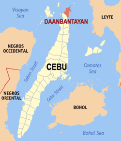 Map of Cebu with Daanbantayan highlighted | |
OpenStreetMap  | |
 Daanbantayan Location within the Philippines | |
| Coordinates: 11°15′01″N 123°59′56″E | |
| Country | Philippines |
| Region | Central Visayas |
| Province | Cebu |
| District | 4th district |
| Founded | 1886 |
| Barangays | 20 (see Barangays) |
| Government | |
| • Type | Sangguniang Bayan |
| • Mayor | Sun J. Shimura |
| • Vice Mayor | Elver Ali B. Abucay |
| • Representative | Janice Z. Salimbangon |
| • Municipal Council | Members |
| • Electorate | 56,557 voters (2022) |
| Area | |
| • Total | 92.27 km2 (35.63 sq mi) |
| Elevation | 11 m (36 ft) |
| Highest elevation | 120 m (390 ft) |
| Lowest elevation | 0 m (0 ft) |
| Population | |
| • Total | 93,502 |
| • Density | 1,000/km2 (2,600/sq mi) |
| • Households | 22,289 |
| Economy | |
| • Income class | 1st municipal income class |
| • Poverty incidence | 17.80% (2018)[4] |
| • Revenue | ₱447,643,137.60 (2020) |
| • Assets | ₱979,586,072.91 (2020) |
| • Expenditure | ₱376,453,188.65 (2020) |
| • Liabilities | ₱329,369,487.99 (2020) |
| Service provider | |
| • Electricity | Cebu 2 Electric Cooperative (CEBECO 2) |
| Time zone | UTC+8 (PST) |
| ZIP code | 6013 |
| PSGC | |
| IDD : area code | +63 (0)32 |
| Native languages | Cebuano Tagalog |
Located at the northern tip of Cebu island, Daanbantayan celebrates its annual fiesta along with the Haladaya Festival which starts 21 August and ends with street-dancing on 30 August, in honor of Datu Daya, the legendary founder of the town.
Daanbantayan is bordered on the north by the Visayan Sea, to the west by Bantayan Island, on the east by the Camotes Sea, and on the south by the town of Medellin. It is 136 kilometres (85 mi) from Cebu City.
History
The name Daanbantayan was derived from two words: the word "daan", which means "old" in Cebuano, and the word "bantayan", which refers to a place that served as a look out for Moro raiders during the Pre-Hispanic Philippines. The original site of the town might have been at an elevated vantage point near Punta, in Tapilon.
On 8 November 2013, 9 people were killed and 50 injured when Super Typhoon Haiyan (Yolanda in Philippines area of responsibility) passed over Daanbantayan.[5]
Geography
Islands and thalassic attractions
There are several small islands / islets and diving spots, with the list below arranged by latitude from nearest to farthest from Cebu island:
- Chocolate (11°18′20″N 124°03′48″E)
- Monad Shoal (11°18′30″N 124°11′30″E)
- Malapascua (11°20′00″N 124°07′00″E) 600 ha (1,483 acres)
- Gato cave & islet (11°26′48″N 124°01′13″E) 4.5 ha (11 acres)
- Maria (11°29′34″N 124°06′13″E) 1.5 ha (4 acres)
- Carnaza (11°30′50″N 124°05′58″E) 175 ha (432 acres)
Barangays
Daanbantayan comprises 20 barangays:
| PSGC | Barangay | Population | ±% p.a. | |||
|---|---|---|---|---|---|---|
| 2020 [3] | 2010 [6] | |||||
| 072221001 | Aguho | 6.1% | 5,726 | 4,836 | 1.61% | |
| 072221002 | Bagay | 4.9% | 4,549 | 4,015 | 1.19% | |
| 072221003 | Bakhawan | 2.7% | 2,540 | 2,267 | 1.08% | |
| 072221004 | Bateria | 3.9% | 3,664 | 3,252 | 1.14% | |
| 072221005 | Bitoon | 5.1% | 4,753 | 4,350 | 0.84% | |
| 072221006 | Calape | 2.4% | 2,233 | 2,518 | −1.13% | |
| 072221007 | Carnaza | 2.4% | 2,259 | 2,360 | −0.41% | |
| 072221008 | Dalingding | 2.3% | 2,137 | 2,069 | 0.31% | |
| 072221009 | Lanao | 3.5% | 3,313 | 2,968 | 1.05% | |
| 072221010 | Logon | 6.1% | 5,720 | 4,496 | 2.31% | |
| 072221011 | Malbago | 4.7% | 4,408 | 3,311 | 2.75% | |
| 072221012 | Malingin | 1.7% | 1,600 | 1,512 | 0.54% | |
| 072221013 | Maya | 9.4% | 8,822 | 7,815 | 1.16% | |
| 072221014 | Pajo | 3.9% | 3,634 | 2,970 | 1.93% | |
| 072221015 | Paypay | 3.1% | 2,888 | 2,741 | 0.50% | |
| 072221016 | Poblacion | 8.3% | 7,794 | 7,144 | 0.83% | |
| 072221017 | Talisay | 4.6% | 4,297 | 3,802 | 1.17% | |
| 072221018 | Tapilon | 8.9% | 8,323 | 7,281 | 1.28% | |
| 072221019 | Tinubdan | 2.1% | 2,002 | 2,050 | −0.22% | |
| 072221020 | Tominjao | 4.0% | 3,768 | 3,149 | 1.72% | |
| Total | 93,502 | 74,897 | 2.13% | |||
Climate
| Climate data for Daanbantayan, Cebu | |||||||||||||
|---|---|---|---|---|---|---|---|---|---|---|---|---|---|
| Month | Jan | Feb | Mar | Apr | May | Jun | Jul | Aug | Sep | Oct | Nov | Dec | Year |
| Average high °C (°F) | 28 (82) |
29 (84) |
29 (84) |
31 (88) |
31 (88) |
30 (86) |
30 (86) |
30 (86) |
30 (86) |
29 (84) |
29 (84) |
29 (84) |
30 (85) |
| Average low °C (°F) | 22 (72) |
22 (72) |
22 (72) |
23 (73) |
24 (75) |
25 (77) |
25 (77) |
25 (77) |
25 (77) |
24 (75) |
24 (75) |
23 (73) |
24 (75) |
| Average precipitation mm (inches) | 73 (2.9) |
56 (2.2) |
75 (3.0) |
71 (2.8) |
114 (4.5) |
174 (6.9) |
172 (6.8) |
163 (6.4) |
167 (6.6) |
161 (6.3) |
158 (6.2) |
125 (4.9) |
1,509 (59.5) |
| Average rainy days | 15.2 | 12.5 | 16.2 | 17.3 | 23.9 | 27.3 | 28.4 | 26.9 | 26.9 | 27.1 | 23.8 | 19.3 | 264.8 |
| Source: Meteoblue (modeled/calculated data, not measured locally)[7] | |||||||||||||
Demographics
| Year | Pop. | ±% p.a. |
|---|---|---|
| 1903 | 14,735 | — |
| 1918 | 21,334 | +2.50% |
| 1939 | 24,198 | +0.60% |
| 1948 | 29,484 | +2.22% |
| 1960 | 34,599 | +1.34% |
| 1970 | 40,649 | +1.62% |
| 1975 | 43,228 | +1.24% |
| 1980 | 45,926 | +1.22% |
| 1990 | 58,771 | +2.50% |
| 1995 | 64,845 | +1.86% |
| 2000 | 69,336 | +1.45% |
| 2007 | 73,254 | +0.76% |
| 2010 | 74,897 | +0.81% |
| 2015 | 84,430 | +2.31% |
| 2020 | 93,502 | +2.03% |
| Source: Philippine Statistics Authority [8] [6] [9][10] | ||
Economy
Transportation
Ceres Liner (And Sugbo Transit), White Stallion Express (Subsidiary Of Rough Riders) and Cebu Autobus are among the bus companies with regular service to and from Cebu city (North Bus Terminal). Jeepneys, tricycles, and trisikads are the main modes of transportation within the town.
Tourism
Daanbantayan is now known for its pristine, white powder-like sandy beaches – one of which is Malapascua Island. With its vast and rich marine resources, it hosts a long string of dive sites offering unique marine life and beauty.
As a tourist destination, Daanbantayan stages the Haladaya Festival every year as an added attraction to local vacationers, holidaymakers, Filipino expatriates, and foreign tourists from as far away as North America, South America, and Europe.
- Attractions
 Sta Rosa de Lima parish church
 Approaching Gato Islet
 Malapascua island from the air
 Malapascua Island


- Municipal hall – built in 1916.
- Santa Rosa de Lima parish church – inaugurated on 10 April 1858 and finished in 1886. Its façade is still intact with its original design.[18]
- Town plaza – site of a battle between the so-called Daanbantayan Volunteers and 19 well-armed bandits led by Capitan Berinoin 1898.[18]
- San Pedro River - its northern bank has an abandoned Muslim settlement founded by Datu Daya during the pre-Spanish era.[18]
- Tapilon point (also known as Punta Sampero) – site of the watchtower of Kandaya, called "daang bantayanan". But there are no remains of the watchtower.[18]
- Malapascua Island – is situated across a shallow strait from the northernmost tip of Cebu. This small island is known for its wide white sand beach, Bounty Beach; it has also become known as a superior diving destination.
- Gato Cave and Islet – a small sharp rocky island rising in the middle of the Visayan Sea, about 15 kilometres (9 miles) from Malapascua. The 83-metre-high (272 ft) island is home to nesting seabirds, a colony of flying foxes, soft coral canyons, and rare and unusual nudibranchs.[18]
- Monad Shoal – a 20-metre-deep (66 ft) seamount known for its thresher sharks, making the shoal popular for recreational divers. The common thresher shark (alopias vulpinus) and pelagic thresher shark (alopias pelagicus) normally live in depths as deep as 350 metres (1,148 feet), but the shoal offers opportunities to see them in less than 20 metres of water.[18]
References
- Municipality of Daanbantayan | (DILG)
- "2015 Census of Population, Report No. 3 – Population, Land Area, and Population Density" (PDF). Philippine Statistics Authority. Quezon City, Philippines. August 2016. ISSN 0117-1453. Archived (PDF) from the original on May 25, 2021. Retrieved July 16, 2021.
- Census of Population (2020). "Region VII (Central Visayas)". Total Population by Province, City, Municipality and Barangay. PSA. Retrieved 8 July 2021.
- "PSA Releases the 2018 Municipal and City Level Poverty Estimates". Philippine Statistics Authority. 15 December 2021. Retrieved 22 January 2022.
- The Economist (16 November 2013). "Typhoon Haiyan Damage Is 'Worse Than Hell'". Business Insider Australia. Archived from the original on 18 November 2013.
- Census of Population and Housing (2010). "Region VII (Central Visayas)". Total Population by Province, City, Municipality and Barangay. NSO. Retrieved 29 June 2016.
- "Bantayan: Average Temperatures and Rainfall". Meteoblue. Retrieved 10 May 2020.
- Census of Population (2015). "Region VII (Central Visayas)". Total Population by Province, City, Municipality and Barangay. PSA. Retrieved 20 June 2016.
- Censuses of Population (1903–2007). "Region VII (Central Visayas)". Table 1. Population Enumerated in Various Censuses by Province/Highly Urbanized City: 1903 to 2007. NSO.
- "Province of Cebu". Municipality Population Data. Local Water Utilities Administration Research Division. Retrieved 17 December 2016.
- "Poverty incidence (PI):". Philippine Statistics Authority. Retrieved 28 December 2020.
- https://psa.gov.ph/sites/default/files/NSCB_LocalPovertyPhilippines_0.pdf; publication date: 29 November 2005; publisher: Philippine Statistics Authority.
- https://psa.gov.ph/sites/default/files/2003%20SAE%20of%20poverty%20%28Full%20Report%29_1.pdf; publication date: 23 March 2009; publisher: Philippine Statistics Authority.
- https://psa.gov.ph/sites/default/files/2006%20and%202009%20City%20and%20Municipal%20Level%20Poverty%20Estimates_0_1.pdf; publication date: 3 August 2012; publisher: Philippine Statistics Authority.
- https://psa.gov.ph/sites/default/files/2012%20Municipal%20and%20City%20Level%20Poverty%20Estima7tes%20Publication%20%281%29.pdf; publication date: 31 May 2016; publisher: Philippine Statistics Authority.
- https://psa.gov.ph/sites/default/files/City%20and%20Municipal-level%20Small%20Area%20Poverty%20Estimates_%202009%2C%202012%20and%202015_0.xlsx; publication date: 10 July 2019; publisher: Philippine Statistics Authority.
- "PSA Releases the 2018 Municipal and City Level Poverty Estimates". Philippine Statistics Authority. 15 December 2021. Retrieved 22 January 2022.
- "Local Heritage". Municipality of Daanbantayan, Cebu. Archived from the original on March 8, 2016. Retrieved 5 April 2013.
External links
Places adjacent to Daanbantayan | ||||||||||||||||
|---|---|---|---|---|---|---|---|---|---|---|---|---|---|---|---|---|
| ||||||||||||||||
Cebu City (capital) | |
| Municipalities |
|
| Component cities | |
| Highly urbanized cities | (Administratively independent from the province but grouped under Cebu by the Philippine Statistics Authority. However, qualified voters in Mandaue are allowed to vote in elections for Cebu provincial officials by virtue of Republic Act No. 6641, in accordance with Section 452-c of the Local Government Code of 1991.) |
На других языках
[de] Daanbantayan
Daanbantayan ist eine Großraumgemeinde in der Provinz Cebu auf den Philippinen. Sie hat 84.430 Einwohner (Zensus 1. August 2015), die in 20 Barangays leben. Sie gehört zur ersten Einkommensklasse der Gemeinden auf den Philippinen und wird als partiell urbanisiert beschrieben.- [en] Daanbantayan
Другой контент может иметь иную лицензию. Перед использованием материалов сайта WikiSort.org внимательно изучите правила лицензирования конкретных элементов наполнения сайта.
WikiSort.org - проект по пересортировке и дополнению контента Википедии