world.wikisort.org - Peru
Lluta District is one of twenty districts of the Caylloma Province in Peru.[1]
Lluta | |
|---|---|
District | |
 Lluta District | |
| Country | |
| Region | Arequipa |
| Province | Caylloma |
| Capital | Lluta |
| Government | |
| • Mayor | Jacinto Leodor Neyra Jacobo |
| Area | |
| • Total | 1,226.46 km2 (473.54 sq mi) |
| Elevation | 3,000 m (10,000 ft) |
| Population (2005 census) | |
| • Total | 1,859 |
| • Density | 1.5/km2 (3.9/sq mi) |
| Time zone | UTC-5 (PET) |
| UBIGEO | 040511 |
Geography
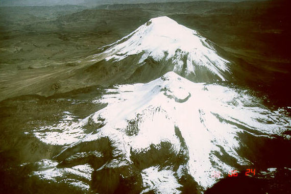
The highest peaks of the district is Ampato (Jamp'atu) at 6,288 m (20,630 ft). Other mountains are listed below:[2]
- Aqu Pukyu
- Chawpi Wasi
- Chiri Yaku
- Jichu Qullu
- Iru Pata
- Kuntur
- Kunturi
- Pallqa
- Paxsi
- Pisqu P'unqu
- Pukarilla
- Qala
- Q'achi Q'achi
- Siraq
- Tarujani
- Tawrisma
- Tinku
- T'astayuq Muqu
- T'uturayuq
- Urquña
- Warkhu
- Yana Qaqa
- Yawri Chuku
- Yuraq Muqu
References
- (in Spanish) Instituto Nacional de Estadística e Informática. Banco de Información Distrital Archived 2008-04-23 at the Wayback Machine. Retrieved April 11, 2008.
- escale.minedu.gob.pe/ UGEL map Arequipa norte (Arequipa Region)
| |
|---|---|
| Arequipa |
|
| Camaná |
|
| Caravelí |
|
| Castilla |
|
| Caylloma | |
| Condesuyos |
|
| Islay |
|
| La Unión |
|
This Arequipa Region geography article is a stub. You can help Wikipedia by expanding it. |
Текст в блоке "Читать" взят с сайта "Википедия" и доступен по лицензии Creative Commons Attribution-ShareAlike; в отдельных случаях могут действовать дополнительные условия.
Другой контент может иметь иную лицензию. Перед использованием материалов сайта WikiSort.org внимательно изучите правила лицензирования конкретных элементов наполнения сайта.
Другой контент может иметь иную лицензию. Перед использованием материалов сайта WikiSort.org внимательно изучите правила лицензирования конкретных элементов наполнения сайта.
2019-2026
WikiSort.org - проект по пересортировке и дополнению контента Википедии
WikiSort.org - проект по пересортировке и дополнению контента Википедии