world.wikisort.org - Peru
Cotahuasi District is one of eleven districts of the province La Unión in Peru.[1]
Cotahuasi Kutawasi | |
|---|---|
District | |
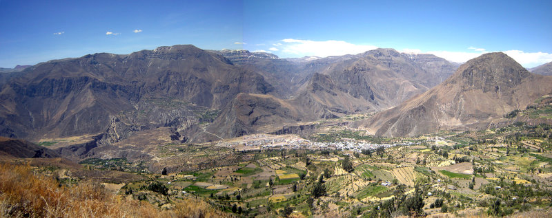 Cotahuasi canyon with the village of Cotahuasi and the mountain Wiñaw (on the right) as seen from the southwest | |
| Country | |
| Region | Arequipa |
| Province | La Unión |
| Capital | Cotahuasi |
| Government | |
| • Mayor | Justo Pastor Totocayo Garate |
| Area | |
| • Total | 166.5 km2 (64.3 sq mi) |
| Elevation | 2,683 m (8,802 ft) |
| Population (2005 census) | |
| • Total | 2,974 |
| • Density | 18/km2 (46/sq mi) |
| Time zone | UTC-5 (PET) |
| UBIGEO | 040801 |
Cotahuasi is located at the highest Andean point of the department of Arequipa, in southern Peruvian. This province is characterized by its steep relief: cut here and as far back as rivers and gullies, with an altitude that ranges between 1,000 and 6,093 meters above sea level, with 19 different ecosystems. Its customs and traditions have been preserved partly on account of its relative isolation, something that has not happened in neighboring villages (REF).
See also
- Cotahuasi Subbasin Landscape Reserve
- Saraqutu
- Sulimana
- Wiñaw
References
- (in Spanish) Instituto Nacional de Estadística e Informática. Banco de Información Distrital Archived April 23, 2008, at the Wayback Machine. Retrieved April 11, 2008.
| |
|---|---|
| Arequipa |
|
| Camaná |
|
| Caravelí | |
| Castilla |
|
| Caylloma | |
| Condesuyos |
|
| Islay |
|
| La Unión |
|
This Arequipa Region geography article is a stub. You can help Wikipedia by expanding it. |
Текст в блоке "Читать" взят с сайта "Википедия" и доступен по лицензии Creative Commons Attribution-ShareAlike; в отдельных случаях могут действовать дополнительные условия.
Другой контент может иметь иную лицензию. Перед использованием материалов сайта WikiSort.org внимательно изучите правила лицензирования конкретных элементов наполнения сайта.
Другой контент может иметь иную лицензию. Перед использованием материалов сайта WikiSort.org внимательно изучите правила лицензирования конкретных элементов наполнения сайта.
2019-2026
WikiSort.org - проект по пересортировке и дополнению контента Википедии
WikiSort.org - проект по пересортировке и дополнению контента Википедии