world.wikisort.org - Pakistan
Chitral District (Urdu: ضِلع چترال) was the largest district in the Khyber-Pakhtunkhwa province of Pakistan, covering an area of 14,850 km², before splitting into Upper Chitral District and Lower Chitral District in 2018.[2] Part of the Malakand Division, it is the northernmost district of Pakistan.[3] It shares a border with Gilgit-Baltistan to the east, with Kunar, Badakshan and Nuristan provinces of Afghanistan to the north and west, and with the Khyber-Pakhtunkhwa districts of Swat and Dir to the south.[4] A narrow strip of Wakhan Corridor separates Chitral from Tajikistan in the north.[5]
Chitral District
ضلع چترال | |
|---|---|
District | |
 A view of the city of Chitral | |
 Location of the Chitral District (highlighted in red) in Pakistan | |
| Country | |
| Province | Khyber Pakhtunkhwa |
| Capital | Chitral |
| Established | 1970 |
| Area | |
| • District | 14,850 km2 (5,730 sq mi) |
| Population (2017)[1] | |
| • District | 447,362 |
| • Density | 30/km2 (78/sq mi) |
| • Urban | 49,794 |
| • Rural | 397,568 |
| Time zone | UTC+5 (PKT) |
| Number of Tehsils | 6 |
| Website | www.khyberpakhtunkhwa.gov.pk |
History


Chitral shares much of its history and culture with the neighboring Hindu Kush territories of Gilgit-Baltistan, a region sometimes called "Peristan" because of the common belief in fairies (peri) inhabiting the high mountains.
The entire region that now forms the Chitral District was an independent monarchical state until 1895, when the British negotiated a treaty with its hereditary ruler, the Mehtar, under which Chitral became a semi-autonomous princely state within the Indian Empire. Chitral retained this status even after its accession to Pakistan in 1947, finally being made an administrative district of Pakistan in 1969, disestablishing the Princely state.[6]
Topography and access
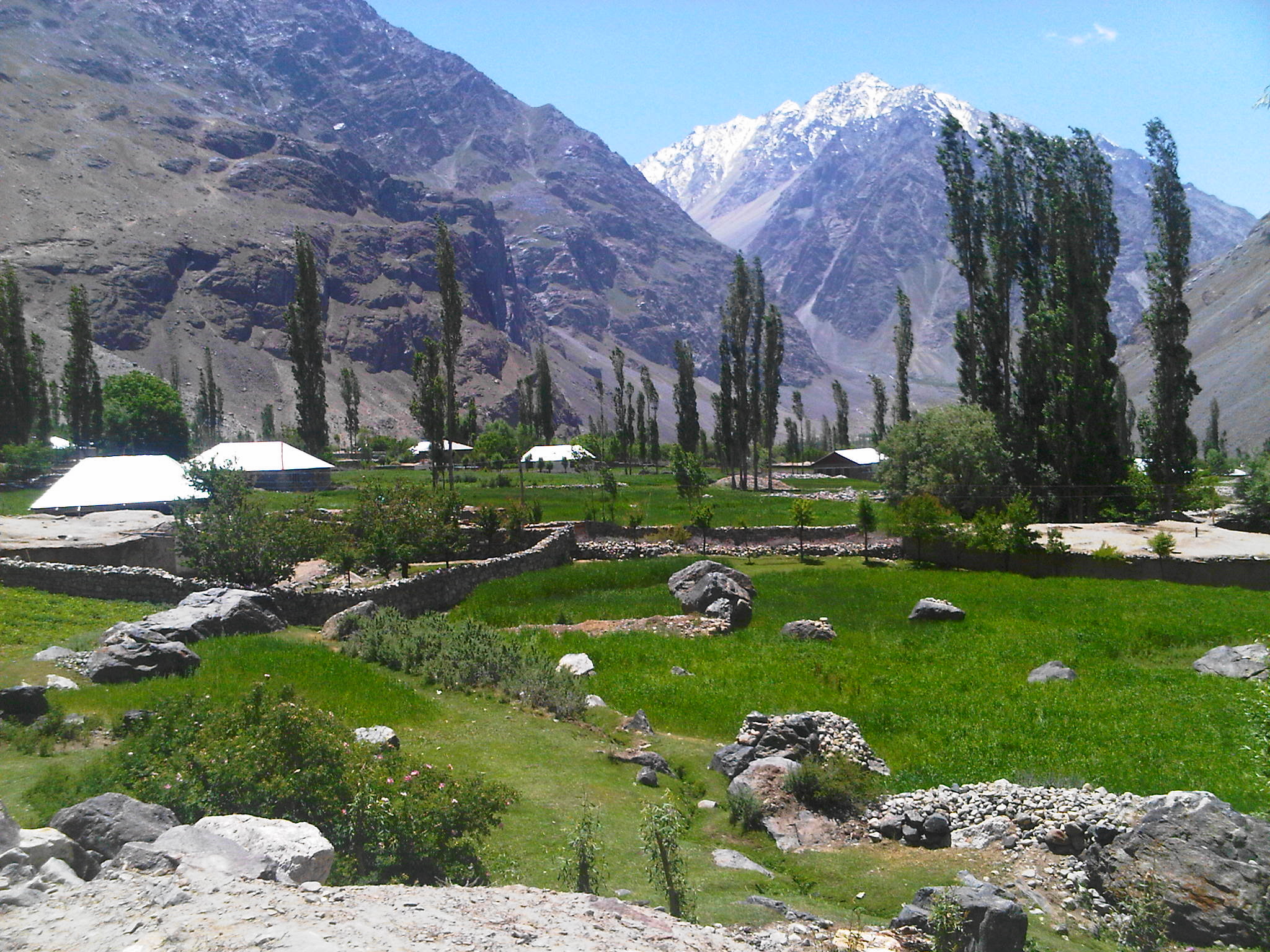
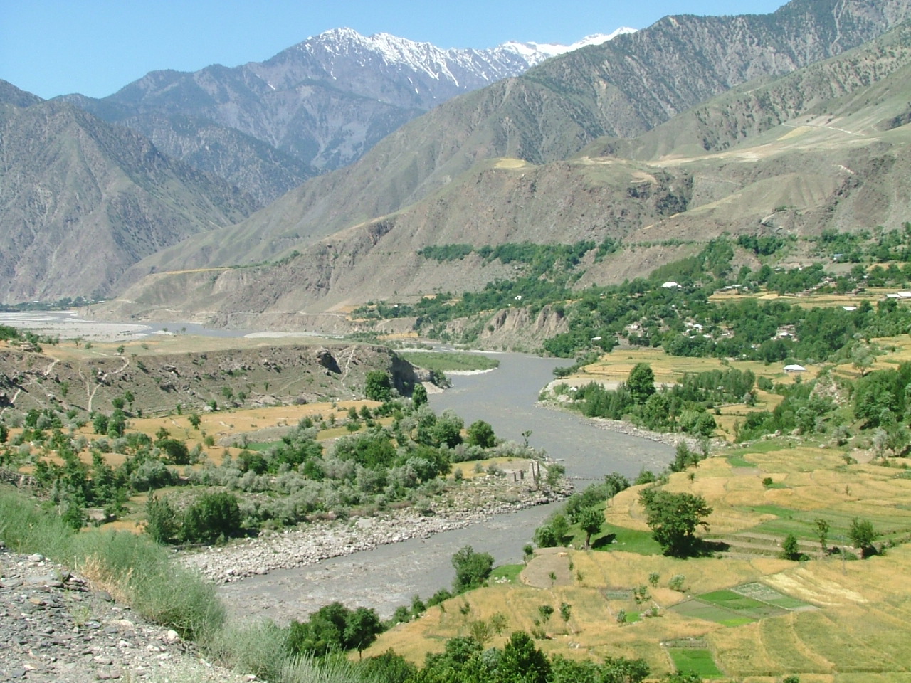
Chitral is counted amongst the highest regions of the world, sweeping from 1,094 meters at Arandu to 7,726 meters at Tirichmir, and packing over 40 peaks more than 6,100 meters in height. The terrain of Chitral is very mountainous and Tirich Mir (25,289 feet) the highest peak of the Hindu Kush, rises in the north of the district.[7] Around 4.8 per cent of the land is covered by forest and 76 per cent is mountains and glaciers.[8]
Chitral is connected to the rest of Pakistan by two major road routes, the Lowari Pass (el. 10,230 ft.) from Dir and Shandur Top (elevation 12,200 ft.) from Gilgit. Both routes used to be closed in winter, but circa 2017 the highway Lowari Tunnel under the Lowari Pass opened to vehicular traffic for at least ten hours per day.[9] A number of other high passes, including Darkot Pass, Thoi Pass and Zagaran Pass, provide access on foot to Chitral from Gilgit-Baltistan.
- Arandu Pass, on the border between Pakistan and Afghanistan
- Broghol Pass, on the border between Pakistan and Afghanistan
- Dorah Pass, on the border between Pakistan and Afghanistan
- Darkot Pass, on the border between Chitral and Gupis-Yasin District
- Shandur Pass, on the border between Chitral and Gilgit-Baltistan
- Lowari Pass, on the border between Chitral and upper Dir
- Lowari Tunnel, highway under Lowari Pass[9]
- Thoi Pass, on the border between Chitral and Gilgit-Baltistan
- Zagaran Pass, on the border between Chitral and Gilgit-Baltistan
Demographics
The district has a population of about 414,000.[3] The general population is mainly of the Kho people, who speak the Khowar, which is also spoken in parts of Yasin, Gilgit, Dir and Swat. Chitral is also home to the Kalash tribe, who live in Bumburet and two other remote valleys southwest of Chitral town. A few thousand Nuristani people are also known to live in Chitral.
The main language of the region is Khowar. There are also smaller communities of speakers of Dameli, Gawar-Bati, Gojri, Kalasha, Kyrgyz, Kataviri/Kamviri, Mdaglashti Dari, Palula, Sariquli, Wakhi, and Yidgha.[10] Urdu has official status.
Chitral Town
The town of Chitral is the main town in the district and serves as its capital. It is situated on the west bank of the Chitral River (also known as the Kunar River) at the foot of Tirich Mir which at 7,708 m (25,289 ft) is the highest peak of the Hindu Kush. Until 1969, it served as the capital of the princely state of Chitral.
Administration
The district of Chitral is divided into twenty-four union councils and two tehsils:[11][12][13]
- Chitral
- Mastuj
National Assembly
This district is represented by one elected MNA (Member of National Assembly) in Pakistan National Assembly. Its constituency is NA-32.[14]
| Member of National Assembly | Party Affiliation | Year |
|---|---|---|
| Abdul Akbar Khan | Muttahida Majlis-e-Amal | 2002 |
| Shahzada Mohiuddin | Pakistan Muslim League | 2008 |
| Shahzada Iftikhar Uddin | All Pakistan Muslim League | 2013 |
Provincial Assembly
The district is represented by two elected MPAs in the provincial assembly who represent the following constituencies:
- PK-89 (Chitral-I)
- PK-90 (Chitral-II)
See also
|
|
|
References
- "DISTRICT AND TEHSIL LEVEL POPULATION SUMMARY WITH REGION BREAKUP: KHYBER PAKHTUNKHWA" (PDF). Pakistan Bureau of Statistics. 3 January 2018. Archived from the original (PDF) on 24 April 2018. Retrieved 23 April 2018.
- "Upper Chitral gets status of separate district". dawn.com. 21 November 2018. Retrieved 15 August 2020.
- "District Government Chitral". Chitral District Government Web Portl. Archived from the original on 28 September 2015.
- Cutherell, Danny. "Governance and Militancy in Pakistan's Chitral district" (PDF). Center for Strategic and International Studies.
- Nusser, Marcus; Dickoré, Wolf Bernhard (2002). "A Tangle in the Triangle: Vegetation Map of the Eastern Hindukush (Chitral, Northern Pakistan)" (PDF). Erdkunde. 56 (1): 37–59. doi:10.3112/erdkunde.2002.01.03. JSTOR 23218603.
- Marsden, Magnus (2010). "A tour not so grand: mobile Muslims in northern Pakistan". In Osella; Filippo; Soares; Benjamin (eds.). Islam, Politics, Anthropology. Chichester, England: Royal Anthropological Institute by Wiley-Blackwell. pp. 57–75, page 58. ISBN 978-1-4443-3295-7.
- "Disaster Vulnerability Assessment Report, District Chitral, KPK, Pakistan" (PDF). Archived from the original (PDF) on 13 November 2013. Retrieved 13 November 2013.
- "Chitral, Pakistan Flash flood risk assessment, capacity building, and awareness raising" (PDF).
- Zahiruddin (30 September 2018). "Lowari tunnel: opportunities and challenges". Dawn. Retrieved 26 November 2019.
- "About [Lower Chitral]". Retrieved 16 June 2022.
- Chitral National Reconstruction Bureau website Archived 28 April 2012 at the Wayback Machine
- "Pakistan: North West Frontier Province: District, Tehsil and Union Code Reference Map (MA518-pak-NWFP UCs A3-v01)" (PDF). Pakistan: United Nations Office for the Coordination of Humanitarian Affairs (OCHA). 1 July 2009. Archived from the original (PDF) on 13 November 2013.
- "List of Tehsils/Talukas with Respect to Their Districts". Statistics Division, Ministry of Economic Affairs and Statistics, Government of Pakistan. Archived from the original on 5 March 2010.
- "Election Commission of Pakistan". Archived from the original on 10 November 2015. Retrieved 6 November 2015.
External links
Places adjacent to Chitral District | |
|---|---|
Pakistan articles | |||||||||||||||||||
|---|---|---|---|---|---|---|---|---|---|---|---|---|---|---|---|---|---|---|---|
| |||||||||||||||||||
| |||||||||||||||||||
| |||||||||||||||||||
| |||||||||||||||||||
| |||||||||||||||||||
| |||||||||||||||||||
Districts of Khyber Pakhtunkhwa | ||
|---|---|---|
Provincial capital: Peshawar | ||
| Abaseen |
|  |
| Bannu |
| |
| Dera Ismail Khan |
| |
| Hazara |
| |
| Kohat | ||
| Malakand | ||
| Mardan |
| |
| Peshawar | ||
Administrative divisions of Chitral District | ||
|---|---|---|
| Capital | ||
| Tehsils |
| |
| Union councils | ||
Authority control | |
|---|---|
| General |
|
| National libraries | |
На других языках
[de] Chitral (Distrikt)
Chitral (Urdu .mw-parser-output .Arab a,.mw-parser-output a bdi.Arab{text-decoration:none!important}.mw-parser-output .Arab{font-size:120%}چترال .mw-parser-output .Latn{font-family:"Akzidenz Grotesk","Arial","Avant Garde Gothic","Calibri","Futura","Geneva","Gill Sans","Helvetica","Lucida Grande","Lucida Sans Unicode","Lucida Grande","Stone Sans","Tahoma","Trebuchet","Univers","Verdana"}Tschitral; paschtunisch چترال ولسوالۍ) ist heute ein Distrikt in der pakistanischen Provinz Khyber Pakhtunkhwa mit der Hauptstadt Chitral.- [en] Chitral District
[ru] Читрал (округ)
Читра́л (урду چترال, англ. Chitral) — самый северный округ провинции Хайбер-Пахтунхва Исламской Республики Пакистан с центром в одноимённом городе Читрал. Расположен в труднодоступной высокогорной долине реки Читрал (Кунар) к югу от главного хребта Гиндукуша. Площадь 14,850 км². Население 378 тыс. чел. (2004 г.)Другой контент может иметь иную лицензию. Перед использованием материалов сайта WikiSort.org внимательно изучите правила лицензирования конкретных элементов наполнения сайта.
WikiSort.org - проект по пересортировке и дополнению контента Википедии