world.wikisort.org - Norway
Nordreisa (Northern Sami: Ráisa [ˈraːjːsa]; Kven: Raisi)[3][4] is a municipality in Troms og Finnmark county, Norway. The administrative centre of the municipality is the village of Storslett. Other villages include Oksfjordhamn, Sørkjosen, and Rotsund.
Nordreisa kommune
Ráissa suohkan Raisin komuuni | |
|---|---|
Municipality | |
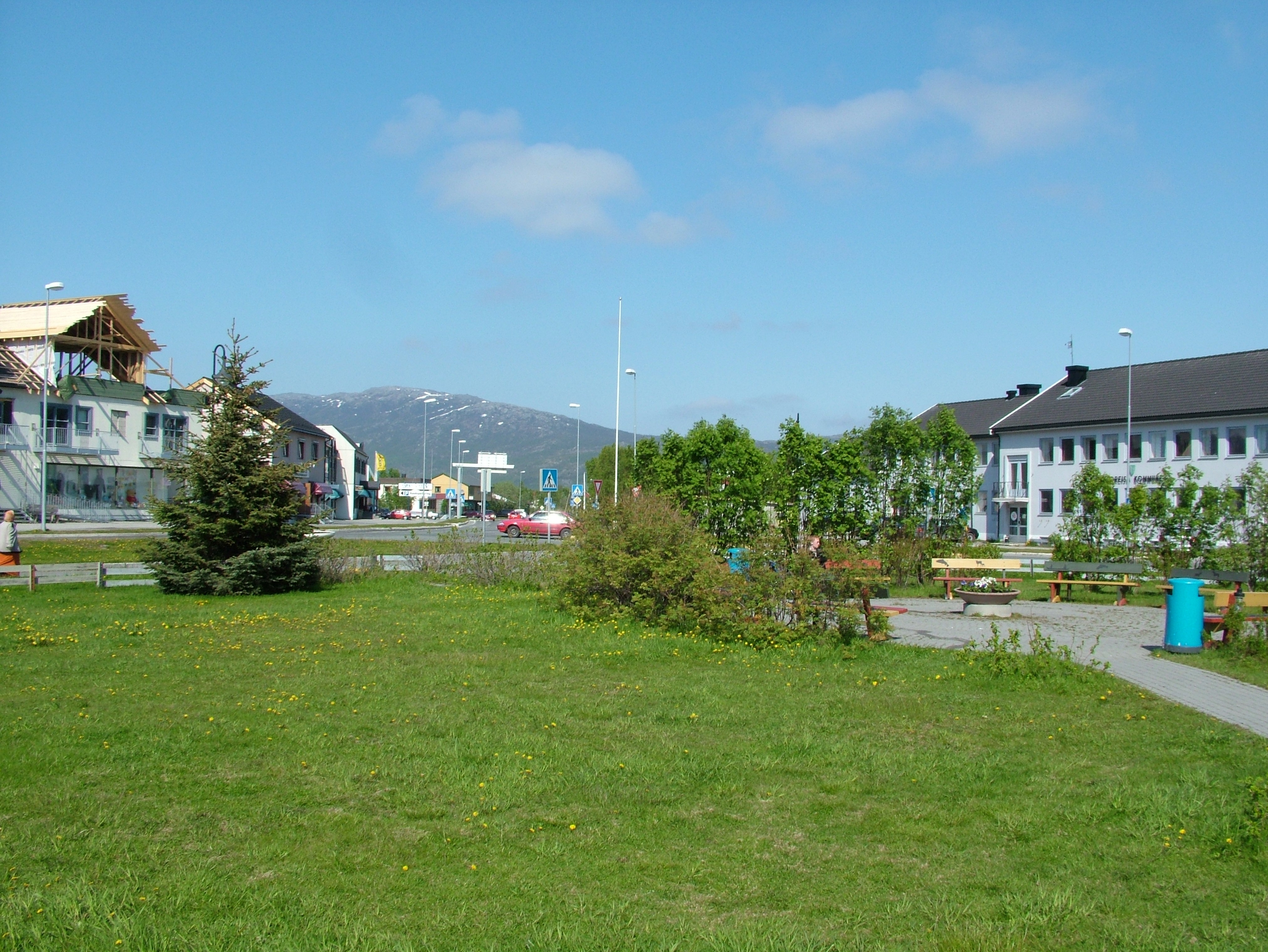 View of Storslett | |
 Flag  Coat of arms  Troms og Finnmark within Norway | |
 Nordreisa within Troms og Finnmark | |
| Coordinates: 69°42′18″N 21°12′33″E | |
| Country | Norway |
| County | Troms og Finnmark |
| District | Nord-Troms |
| Established | 1 Jan 1886 |
| • Preceded by | Skjervøy Municipality |
| Administrative centre | Storslett |
| Government | |
| • Mayor (2019) | Hilde Anita Nyvoll (Ap) |
| Area | |
| • Total | 3,437.81 km2 (1,327.35 sq mi) |
| • Land | 3,334.74 km2 (1,287.55 sq mi) |
| • Water | 103.07 km2 (39.80 sq mi) 3% |
| • Rank | #9 in Norway |
| Population (2022) | |
| • Total | 4,746 |
| • Rank | #183 in Norway |
| • Density | 1.4/km2 (4/sq mi) |
| • Change (10 years) | |
| Demonym | Reisaværing[1] |
| Official language | |
| • Norwegian form | Bokmål |
| Time zone | UTC+01:00 (CET) |
| • Summer (DST) | UTC+02:00 (CEST) |
| ISO 3166 code | NO-5428 |
| Website | Official website |
The municipality consists of the Reisadalen valley, with the river Reisaelva and deep pine forests, surrounded by mountains and high plateaus. Most people live in Storslett, where the river meets the Reisafjorden. Sørkjosen, just northwest of Storslett, is the location of Sørkjosen Airport with flights to Tromsø and several destinations in Finnmark. The European route E6 runs through the northern part of the municipality.
The 3,437-square-kilometre (1,327 sq mi) municipality is the 9th largest by area out of the 356 municipalities in Norway. Nordreisa is the 183rd most populous municipality in Norway with a population of 4,746. The municipality's population density is 1.4 inhabitants per square kilometre (3.6/sq mi) and its population has decreased by 1.3% over the previous 10-year period.[5][6]
General information
The municipality of Nordreisa was established on 1 January 1886 when Skjervøy Municipality was divided in two. The southern part of Skjervøy (population: 1,057) was separated to form the new municipality. On 1 January 1890, the Trætten and Loppevolden farms (population: 32) were transferred to Nordreisa from Skjervøy. The parts of Skjervøy lying on the mainland (population: 1,556) were transferred from Skjervøy to Nordreisa on 1 January 1972. On 1 January 1982, the southern part of the island of Uløya (population: 128) was transferred from Skjervøy to Nordreisa.[7]
On 1 January 2020, the municipality became part of the newly formed Troms og Finnmark county. Previously, it had been part of the old Troms county.[8]
Name
The municipality is named after the Reisafjorden (originally Reisa), which again is named after Reisaelva ("Reisa river" - originally Reisa). The river name is probably derived from the verb rísa which means "raise" (referring to flooding).
The first element Nord ("northern") was added to distinguish the municipality from Sørreisa Municipality to the south. The municipality was originally named Nordreisen, but the ending was later changed to the present form.[9]
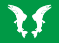
Coat of arms
The coat of arms was granted on 21 December 1984. The arms show two white salmon on a green background. This was chosen since the river Reisaelva is one of the country's best salmon rivers.[10]
Churches
The Church of Norway has one parish (sokn) within the municipality of Nordreisa. It is part of the Nord-Troms prosti (deanery) in the Diocese of Nord-Hålogaland.
| Parish (sokn) | Church name | Location of the church | Year built |
|---|---|---|---|
| Nordreisa | Nordreisa Church | Storslett | 1856 |
| Rotsund Chapel | Rotsund | 1932 |
History
Most inhabitants are descendants of settlers from Finland who came over in the 18th century, escaping famine and war. Today, only a few old people can speak Finnish. Some inhabitants have Sami or Norwegian backgrounds, and today the Norwegian language is most commonly used.
Few old buildings survive in Nordreisa, as virtually everything was destroyed in early 1945 by retreating German troops. The two major attractions are the old trading post at Havnnes, with picturesque old houses that escaped the war damages, and the waterfall of Mollisfossen, which is 269 metres (883 ft) high. The upper, or southernmost, areas of the municipality are covered by the Reisa National Park with unique forest and high plateau vegetation.
In the 2007 municipal elections, Nordreisa recorded the highest vote for the right-wing Progress Party in Norway at 49.3%.
Government
All municipalities in Norway, including Nordreisa, are responsible for primary education (through 10th grade), outpatient health services, senior citizen services, unemployment and other social services, zoning, economic development, and municipal roads. The municipality is governed by a municipal council of elected representatives, which in turn elect a mayor.[11] The municipality falls under the Nord-Troms District Court and the Hålogaland Court of Appeal.
Municipal council
The municipal council (Kommunestyre) of Nordreisa is made up of 21 representatives that are elected to four year terms. The party breakdown of the council is as follows:
| Party Name (in Norwegian) | Number of representatives | |
|---|---|---|
| Labour Party (Arbeiderpartiet) | 5 | |
| Progress Party (Fremskrittspartiet) | 3 | |
| Conservative Party (Høyre) | 4 | |
| Christian Democratic Party (Kristelig Folkeparti) | 2 | |
| Centre Party (Senterpartiet) | 5 | |
| Socialist Left Party (Sosialistisk Venstreparti) | 2 | |
| Total number of members: | 21 | |
| Party Name (in Norwegian) | Number of representatives | |
|---|---|---|
| Labour Party (Arbeiderpartiet) | 6 | |
| Progress Party (Fremskrittspartiet) | 3 | |
| Green Party (Miljøpartiet De Grønne) | 1 | |
| Conservative Party (Høyre) | 4 | |
| Christian Democratic Party (Kristelig Folkeparti) | 3 | |
| Centre Party (Senterpartiet) | 2 | |
| Socialist Left Party (Sosialistisk Venstreparti) | 2 | |
| Total number of members: | 21 | |
| Party Name (in Norwegian) | Number of representatives | |
|---|---|---|
| Labour Party (Arbeiderpartiet) | 9 | |
| Progress Party (Fremskrittspartiet) | 4 | |
| Conservative Party (Høyre) | 3 | |
| Christian Democratic Party (Kristelig Folkeparti) | 2 | |
| Centre Party (Senterpartiet) | 2 | |
| Socialist Left Party (Sosialistisk Venstreparti) | 1 | |
| Total number of members: | 21 | |
| Party Name (in Norwegian) | Number of representatives | |
|---|---|---|
| Labour Party (Arbeiderpartiet) | 5 | |
| Progress Party (Fremskrittspartiet) | 10 | |
| Conservative Party (Høyre) | 1 | |
| Christian Democratic Party (Kristelig Folkeparti) | 1 | |
| Centre Party (Senterpartiet) | 2 | |
| Socialist Left Party (Sosialistisk Venstreparti) | 2 | |
| Total number of members: | 21 | |
| Party Name (in Norwegian) | Number of representatives | |
|---|---|---|
| Labour Party (Arbeiderpartiet) | 6 | |
| Progress Party (Fremskrittspartiet) | 7 | |
| Conservative Party (Høyre) | 3 | |
| Christian Democratic Party (Kristelig Folkeparti) | 1 | |
| Centre Party (Senterpartiet) | 2 | |
| Socialist Left Party (Sosialistisk Venstreparti) | 2 | |
| Total number of members: | 21 | |
| Party Name (in Norwegian) | Number of representatives | |
|---|---|---|
| Labour Party (Arbeiderpartiet) | 9 | |
| Progress Party (Fremskrittspartiet) | 5 | |
| Conservative Party (Høyre) | 3 | |
| Christian Democratic Party (Kristelig Folkeparti) | 3 | |
| Centre Party (Senterpartiet) | 2 | |
| Socialist Left Party (Sosialistisk Venstreparti) | 4 | |
| Cross-party list (Tverrpolitisk liste) | 3 | |
| Total number of members: | 29 | |
| Party Name (in Norwegian) | Number of representatives | |
|---|---|---|
| Labour Party (Arbeiderpartiet) | 12 | |
| Conservative Party (Høyre) | 3 | |
| Christian Democratic Party (Kristelig Folkeparti) | 3 | |
| Centre Party (Senterpartiet) | 5 | |
| Socialist Left Party (Sosialistisk Venstreparti) | 2 | |
| Cross-party list (Tverrpolitisk liste) | 4 | |
| Total number of members: | 29 | |
| Party Name (in Norwegian) | Number of representatives | |
|---|---|---|
| Labour Party (Arbeiderpartiet) | 11 | |
| Conservative Party (Høyre) | 3 | |
| Christian Democratic Party (Kristelig Folkeparti) | 3 | |
| Centre Party (Senterpartiet) | 3 | |
| Socialist Left Party (Sosialistisk Venstreparti) | 3 | |
| Cross-party list (Tverrpolitisk liste) | 4 | |
| Election list for Oksfjord and Straumfjord (Valgliste for Oksfjord og Straumfjord) | 2 | |
| Total number of members: | 29 | |
| Party Name (in Norwegian) | Number of representatives | |
|---|---|---|
| Labour Party (Arbeiderpartiet) | 15 | |
| Conservative Party (Høyre) | 4 | |
| Christian Democratic Party (Kristelig Folkeparti) | 3 | |
| Centre Party (Senterpartiet) | 1 | |
| Socialist Left Party (Sosialistisk Venstreparti) | 2 | |
| Liberal Party (Venstre) | 1 | |
| Cross-party list (Tverrpolitisk liste) | 3 | |
| Total number of members: | 29 | |
| Party Name (in Norwegian) | Number of representatives | |
|---|---|---|
| Labour Party (Arbeiderpartiet) | 17 | |
| Conservative Party (Høyre) | 4 | |
| Christian Democratic Party (Kristelig Folkeparti) | 3 | |
| Centre Party (Senterpartiet) | 2 | |
| Socialist Left Party (Sosialistisk Venstreparti) | 2 | |
| Liberal Party (Venstre) | 1 | |
| Total number of members: | 29 | |
| Party Name (in Norwegian) | Number of representatives | |
|---|---|---|
| Labour Party (Arbeiderpartiet) | 14 | |
| Conservative Party (Høyre) | 6 | |
| Christian Democratic Party (Kristelig Folkeparti) | 3 | |
| Centre Party (Senterpartiet) | 4 | |
| Socialist Left Party (Sosialistisk Venstreparti) | 2 | |
| Total number of members: | 29 | |
| Party Name (in Norwegian) | Number of representatives | |
|---|---|---|
| Labour Party (Arbeiderpartiet) | 14 | |
| Conservative Party (Høyre) | 6 | |
| Christian Democratic Party (Kristelig Folkeparti) | 2 | |
| Centre Party (Senterpartiet) | 5 | |
| Socialist Left Party (Sosialistisk Venstreparti) | 1 | |
| Liberal Party (Venstre) | 1 | |
| Total number of members: | 29 | |
| Party Name (in Norwegian) | Number of representatives | |
|---|---|---|
| Labour Party (Arbeiderpartiet) | 16 | |
| Conservative Party (Høyre) | 3 | |
| Centre Party (Senterpartiet) | 2 | |
| Socialist People's Party (Sosialistisk Folkeparti) | 2 | |
| Liberal Party (Venstre) | 5 | |
| Local List(s) (Lokale lister) | 1 | |
| Total number of members: | 29 | |
| Party Name (in Norwegian) | Number of representatives | |
|---|---|---|
| Labour Party (Arbeiderpartiet) | 9 | |
| Conservative Party (Høyre) | 3 | |
| Centre Party (Senterpartiet) | 2 | |
| Socialist People's Party (Sosialistisk Folkeparti) | 1 | |
| Liberal Party (Venstre) | 3 | |
| List of workers, fishermen, and small farmholders (Arbeidere, fiskere, småbrukere liste) | 3 | |
| Total number of members: | 21 | |
| Party Name (in Norwegian) | Number of representatives | |
|---|---|---|
| Labour Party (Arbeiderpartiet) | 11 | |
| Conservative Party (Høyre) | 3 | |
| Communist Party (Kommunistiske Parti) | 1 | |
| Centre Party (Senterpartiet) | 3 | |
| Socialist People's Party (Sosialistisk Folkeparti) | 1 | |
| Liberal Party (Venstre) | 2 | |
| Total number of members: | 21 | |
| Party Name (in Norwegian) | Number of representatives | |
|---|---|---|
| Labour Party (Arbeiderpartiet) | 11 | |
| Communist Party (Kommunistiske Parti) | 2 | |
| List of workers, fishermen, and small farmholders (Arbeidere, fiskere, småbrukere liste) | 2 | |
| Joint List(s) of Non-Socialist Parties (Borgerlige Felleslister) | 6 | |
| Total number of members: | 21 | |
| Party Name (in Norwegian) | Number of representatives | |
|---|---|---|
| Labour Party (Arbeiderpartiet) | 10 | |
| Communist Party (Kommunistiske Parti) | 4 | |
| List of workers, fishermen, and small farmholders (Arbeidere, fiskere, småbrukere liste) | 3 | |
| Joint List(s) of Non-Socialist Parties (Borgerlige Felleslister) | 4 | |
| Total number of members: | 21 | |
| Party Name (in Norwegian) | Number of representatives | |
|---|---|---|
| Labour Party (Arbeiderpartiet) | 5 | |
| Communist Party (Kommunistiske Parti) | 3 | |
| Local List(s) (Lokale lister) | 8 | |
| Total number of members: | 16 | |
| Party Name (in Norwegian) | Number of representatives | |
|---|---|---|
| Labour Party (Arbeiderpartiet) | 7 | |
| Communist Party (Kommunistiske Parti) | 5 | |
| Local List(s) (Lokale lister) | 4 | |
| Total number of members: | 16 | |
| Party Name (in Norwegian) | Number of representatives | |
|---|---|---|
| Labour Party (Arbeiderpartiet) | 6 | |
| Communist Party (Kommunistiske Parti) | 6 | |
| List of workers, fishermen, and small farmholders (Arbeidere, fiskere, småbrukere liste) | 4 | |
| Total number of members: | 16 | |
| Party Name (in Norwegian) | Number of representatives | |
|---|---|---|
| Labour Party (Arbeiderpartiet) | 9 | |
| List of workers, fishermen, and small farmholders (Arbeidere, fiskere, småbrukere liste) | 3 | |
| Local List(s) (Lokale lister) | 4 | |
| Total number of members: | 16 | |
| Note: Due to the German occupation of Norway during World War II, no elections were held for new municipal councils until after the war ended in 1945. | ||
Geography

Nordreisa Municipality is located around the Reisafjorden and the Reisadalen valley. The municipality also includes the southern part of the island of Uløya. The Lyngen fjord lies on the northwestern edge of the municipality. The island municipality of Skjervøy lies to the north; Kvænangen and Kautokeino municipalities are to the east; Finland is to the south; and the municipalities of Gáivuotna–Kåfjord and Lyngen to the west. The large mountain Halti lies in the southern part of the municipality, near Reisa National Park.
Climate
Nordreisa has a boreal climate, although with autumn as the wettest season. The wettest month, October, sees almost three times as much precipitation as the driest month, April. The all-time high 31.6 °C (88.9 °F) was recorded August 2018. The weather station near the small airport has been recording since 1974.
| Climate data for Sørkjosen Airport, Nordreisa 1991-2020 (6 m, extremes 2005-2022) | |||||||||||||
|---|---|---|---|---|---|---|---|---|---|---|---|---|---|
| Month | Jan | Feb | Mar | Apr | May | Jun | Jul | Aug | Sep | Oct | Nov | Dec | Year |
| Record high °C (°F) | 10.6 (51.1) |
11.4 (52.5) |
13 (55) |
16.8 (62.2) |
23.3 (73.9) |
31.2 (88.2) |
30.7 (87.3) |
31.6 (88.9) |
22.8 (73.0) |
19.2 (66.6) |
15 (59) |
14.2 (57.6) |
31.6 (88.9) |
| Daily mean °C (°F) | −4.9 (23.2) |
−5.2 (22.6) |
−2.6 (27.3) |
1.4 (34.5) |
6.1 (43.0) |
9.9 (49.8) |
13 (55) |
12 (54) |
8.4 (47.1) |
2.9 (37.2) |
−1.3 (29.7) |
−3.2 (26.2) |
3.0 (37.5) |
| Record low °C (°F) | −22.5 (−8.5) |
−26.6 (−15.9) |
−18.6 (−1.5) |
−12.9 (8.8) |
−4.5 (23.9) |
0.1 (32.2) |
3 (37) |
−0.2 (31.6) |
−2.5 (27.5) |
−11.9 (10.6) |
−19.1 (−2.4) |
−18.8 (−1.8) |
−26.6 (−15.9) |
| Average precipitation mm (inches) | 78 (3.1) |
56.2 (2.21) |
69.3 (2.73) |
37.4 (1.47) |
45.3 (1.78) |
58.9 (2.32) |
61.8 (2.43) |
75.6 (2.98) |
89.1 (3.51) |
99 (3.9) |
68.2 (2.69) |
69.9 (2.75) |
808.7 (31.87) |
| Source 1: Norwegian Meteorological Institute[30] | |||||||||||||
| Source 2: yr.no/met.no[31] | |||||||||||||
| Climate data for Storslett 1961-1990 | |||||||||||||
|---|---|---|---|---|---|---|---|---|---|---|---|---|---|
| Month | Jan | Feb | Mar | Apr | May | Jun | Jul | Aug | Sep | Oct | Nov | Dec | Year |
| Average high °C (°F) | −4.3 (24.3) |
−3.6 (25.5) |
−0.8 (30.6) |
3.5 (38.3) |
8.3 (46.9) |
13.3 (55.9) |
16.1 (61.0) |
14.6 (58.3) |
10.2 (50.4) |
4.4 (39.9) |
−0.4 (31.3) |
−3.1 (26.4) |
4.9 (40.8) |
| Daily mean °C (°F) | −8.0 (17.6) |
−7.4 (18.7) |
−4.6 (23.7) |
−0.1 (31.8) |
5.1 (41.2) |
9.7 (49.5) |
12.6 (54.7) |
11.3 (52.3) |
6.8 (44.2) |
1.8 (35.2) |
−3.5 (25.7) |
−6.6 (20.1) |
1.4 (34.5) |
| Average low °C (°F) | −12.2 (10.0) |
−11.4 (11.5) |
−8.8 (16.2) |
−4.0 (24.8) |
1.3 (34.3) |
5.9 (42.6) |
8.7 (47.7) |
7.6 (45.7) |
3.5 (38.3) |
−1.3 (29.7) |
−6.9 (19.6) |
−10.5 (13.1) |
−2.3 (27.9) |
| Average precipitation mm (inches) | 59 (2.3) |
50 (2.0) |
42 (1.7) |
34 (1.3) |
34 (1.3) |
45 (1.8) |
60 (2.4) |
64 (2.5) |
62 (2.4) |
80 (3.1) |
65 (2.6) |
67 (2.6) |
662 (26.1) |
| Average precipitation days (≥ 1 mm) | 10.3 | 9.8 | 9.1 | 7.8 | 8.2 | 9.8 | 11.3 | 11.4 | 11.8 | 12.6 | 11.6 | 11.3 | 125.0 |
| Source: Norwegian Meteorological Institute[32] | |||||||||||||
Notable residents

- Anne Marie Blomstereng (born 1940 in Nordreisa) a Norwegian politician, deputy mayor of Nordreisa from 1983 to 1995
- Ian Haugland (born 1964 in Storslett) the drummer in the Swedish rock band Europe
- Thomas Braaten (born 1987 in Nordreisa) a football defender with over 300 club caps
- Ruben Kristiansen (born 1988 in Nordreisa) a Norwegian international footballer with over 200 club caps
- and
- Eirik Høgbakk, professional football player
- Bjørn Arne Olsen, actor in Titanic [33]
- Dag Rune Stangeland, Strongman
Gallery

References
- "Navn på steder og personer: Innbyggjarnamn" (in Norwegian). Språkrådet.
- "Forskrift om målvedtak i kommunar og fylkeskommunar" (in Norwegian). Lovdata.no.
- "Fastsettelse av samisk og kvensk navn på Nordreisa kommune, Troms" (in Norwegian). Lovdata.no. 27 April 2018. Retrieved 13 July 2018.
- "Saksprotokoll fra Nordreisa kommunestyre 26.10.17 - PS 52/17" (in Norwegian). Nordreisa kommune. 26 October 2017. Retrieved 13 July 2018.
- Statistisk sentralbyrå. "Table: 06913: Population 1 January and population changes during the calendar year (M)" (in Norwegian).
- Statistisk sentralbyrå. "09280: Area of land and fresh water (km²) (M)" (in Norwegian).
- Jukvam, Dag (1999). "Historisk oversikt over endringer i kommune- og fylkesinndelingen" (PDF) (in Norwegian). Statistisk sentralbyrå.
- Mæhlum, Lars, ed. (24 December 2019). "Troms og Finnmark". Store norske leksikon (in Norwegian). Kunnskapsforlaget. Retrieved 26 December 2019.
- Rygh, Oluf (1911). Norske gaardnavne: Troms amt (in Norwegian) (17 ed.). Kristiania, Norge: W. C. Fabritius & sønners bogtrikkeri. p. 185.
- "Civic heraldry of Norway - Norske Kommunevåpen". Heraldry of the World. Retrieved 4 August 2018.
- Hansen, Tore, ed. (12 May 2016). "kommunestyre". Store norske leksikon (in Norwegian). Kunnskapsforlaget. Retrieved 2 August 2018.
- "Tall for Norge: Kommunestyrevalg 2019 - Troms og Finnmark". Valg Direktoratet. Retrieved 26 October 2019.
- "Table: 04813: Members of the local councils, by party/electoral list at the Municipal Council election (M)" (in Norwegian). Statistics Norway.
- "Tall for Norge: Kommunestyrevalg 2011 - Troms Romsa". Valg Direktoratet. Retrieved 26 October 2019.
- "Kommunestyrevalget 1995" (PDF) (in Norwegian). Oslo-Kongsvinger: Statistisk sentralbyrå. 1996. Retrieved 18 March 2020.
- "Kommunestyrevalget 1991" (PDF) (in Norwegian). Oslo-Kongsvinger: Statistisk sentralbyrå. 1993. Retrieved 18 March 2020.
- "Kommunestyrevalget 1987" (PDF) (in Norwegian). Oslo-Kongsvinger: Statistisk sentralbyrå. 1988. Retrieved 18 March 2020.
- "Kommunestyrevalget 1983" (PDF) (in Norwegian). Oslo-Kongsvinger: Statistisk sentralbyrå. 1984. Retrieved 18 March 2020.
- "Kommunestyrevalget 1979" (PDF) (in Norwegian). Oslo: Statistisk sentralbyrå. 1979. Retrieved 18 March 2020.
- "Kommunevalgene 1975" (PDF) (in Norwegian). Oslo: Statistisk sentralbyrå. 1977. Retrieved 18 March 2020.
- "Kommunevalgene 1972" (PDF) (in Norwegian). Oslo: Statistisk sentralbyrå. 1973. Retrieved 18 March 2020.
- "Kommunevalgene 1967" (PDF) (in Norwegian). Oslo: Statistisk sentralbyrå. 1967. Retrieved 18 March 2020.
- "Kommunevalgene 1963" (PDF) (in Norwegian). Oslo: Statistisk sentralbyrå. 1964. Retrieved 18 March 2020.
- "Kommunevalgene og Ordførervalgene 1959" (PDF) (in Norwegian). Oslo: Statistisk sentralbyrå. 1960. Retrieved 18 March 2020.
- "Kommunevalgene og Ordførervalgene 1955" (PDF) (in Norwegian). Oslo: Statistisk sentralbyrå. 1957. Retrieved 18 March 2020.
- "Kommunevalgene og Ordførervalgene 1951" (PDF) (in Norwegian). Oslo: Statistisk sentralbyrå. 1952. Retrieved 18 March 2020.
- "Kommunevalgene og Ordførervalgene 1947" (PDF) (in Norwegian). Oslo: Statistisk sentralbyrå. 1948. Retrieved 18 March 2020.
- "Kommunevalgene og Ordførervalgene 1945" (PDF) (in Norwegian). Oslo: Statistisk sentralbyrå. 1947. Retrieved 18 March 2020.
- "Kommunevalgene og Ordførervalgene 1937" (PDF) (in Norwegian). Oslo: Statistisk sentralbyrå. 1938. Retrieved 18 March 2020.
- "eKlima Web Portal". Norwegian Meteorological Institute. Archived from the original on 14 June 2004.
- "yr.no". NRK.
- "eKlima Web Portal". Norwegian Meteorological Institute. Archived from the original on 14 June 2004.
- IMDb Database retrieved 17 August 2020
External links
- Municipal fact sheet from Statistics Norway (in Norwegian)
Troms og Finnmark county, Norway | |||||||||
|---|---|---|---|---|---|---|---|---|---|
| |||||||||
 | Towns and cities |
|   | ||||||
| Municipalities |
| ||||||||
На других языках
[de] Nordreisa
Nordreisa (nordsamisch Ráissa, kvenisch Raisi[2]) ist eine Kommune im norwegischen Fylke Troms og Finnmark. Die Kommune hat 4746 Einwohner (Stand: 1. Januar 2022). Verwaltungssitz ist die Ortschaft Storslett.- [en] Nordreisa
[ru] Нуррейса
Ну́ррейса (норв. Nordreisa) — коммуна в губернии Тромс в Норвегии. Административный центр коммуны — город Сторслетт. Официальный язык коммуны — букмол. Население коммуны на 2007 год составляло 4665 чел. Площадь коммуны Нуррейса — 3437,64 км², код-идентификатор — 1942.Другой контент может иметь иную лицензию. Перед использованием материалов сайта WikiSort.org внимательно изучите правила лицензирования конкретных элементов наполнения сайта.
WikiSort.org - проект по пересортировке и дополнению контента Википедии