world.wikisort.org - Norway
Kautokeino (Norwegian: Kautokeino; Northern Sami: Guovdageaidnu [ˈkuo̯vːtaˌkea̯jːtnuː]; Kven: Koutokeino; Finnish: Koutokeino)[3] is a municipality in Troms og Finnmark county, Norway. The administrative centre of the municipality is the village of Guovdageaidnu/Kautokeino. Other villages include Láhpoluoppal and Máze.
Kautokeino kommune
Guovdageainnu suohkan | |
|---|---|
Municipality | |
 | |
 Flag  Coat of arms  Troms og Finnmark within Norway | |
 Kautokeino within Troms og Finnmark | |
| Coordinates: 69°00′42″N 23°02′36″E | |
| Country | Norway |
| County | Troms og Finnmark |
| Established | 1851 |
| • Preceded by | Kistrand Municipality |
| Administrative centre | Kautokeino |
| Government | |
| • Mayor (2019) | Hans Isak Olsen (LL) |
| Area | |
| • Total | 9,707.34 km2 (3,748.02 sq mi) |
| • Land | 8,968.86 km2 (3,462.90 sq mi) |
| • Water | 738.48 km2 (285.13 sq mi) 7.6% |
| • Rank | #1 in Norway |
| Population (2022) | |
| • Total | 2,877 |
| • Rank | #235 in Norway |
| • Density | 0.3/km2 (0.8/sq mi) |
| • Change (10 years) | |
| Demonym | Kautokeinoværing[1] |
| Official languages | |
| • Norwegian form | Bokmål |
| • Sámi form | Northern Sami |
| Time zone | UTC+01:00 (CET) |
| • Summer (DST) | UTC+02:00 (CEST) |
| ISO 3166 code | NO-5430 |
| Website | Official website |
The 9,707-square-kilometre (3,748 sq mi) municipality is the largest by area out of the 356 municipalities in Norway. Kautokeino is the 235th most populous municipality in Norway with a population of 2,877. The municipality's population density is 0.3 inhabitants per square kilometre (0.78/sq mi) and its population has decreased by 1.7% over the previous 10-year period.[4][5]
Guovdageaidnu-Kautokeino is one of two cultural centers of Northern Sápmi today (the other being Kárášjohka-Karasjok). The most significant industries are reindeer herding, theatre/movie industry, and the public education system. Kautokeino is one of the coldest places in the Nordics.
General information
The municipality of Kautokeino was established in 1851 when the southern part of the old Kistrand municipality was separated to form this new municipality. Initially, there were 869 residents in the new municipality. The municipal boundaries have not changed since that time.[6]
On 1 January 2020, the municipality became part of the newly formed Troms og Finnmark county. Previously, it had been part of the old Finnmark county.[7]
Name
The first element in Guovdageaidnu is guovda which means "middle" or "half" and the last element is geaidnu which means "road". Combined it means "half way", since the location is halfway between two traditional migrating points. It is also the geographic centre of Northern Sápmi. Kautokeino is a Finnicized form of the Sámi name Guovdageaidnu, and it is also used by Norwegians.
The name of the municipality was Kautokeino until 1987 when it was changed to Guovdageaidnu-Kautokeino.[8] It was the first municipality in Norway to get a Sami name. In 2005, the name was again changed, such that either Guovdageaidnu or Kautokeino can be used.[9]
Coat of arms
The Coat of arms of Kautokeino were granted on 4 September 1987. The arms show a gold-colored lavvu on a blue background. The lavvu (often spelled as 'lavvo') is still in use by reindeer herders who follow their herds according to the season and food availability of food for the animals, and so it was chosen as the symbol for the municipality.[10]
History
The ice age
The area where the Kautokeino settlement is located became ice-free approximately 10,500 years ago after the last Ice age. The northern part of today's Kautokeino municipality became ice-free first, approximately 500–800 years before the area where the settlement of Kautokeino is located today. The ice edge retreated south before disappearing completely from Fennoscania 9,600 years ago, most recently in Sarek in Sweden.[11]
The stone age
In Kautokeino there are traces of human activity stretching back 7,000–9,000 years. The people entering the Kautokeino area when the ice retreated has belonged to one of the three main genetic groups in the postglacial period of early Europe; Eastern Hunter-Gatherers ,Western Hunter-Gatherers or the Scandinavian Hunter-Gatherers. At Kautokeino church, arrowheads have been found where the dating extends over a large period of time. The oldest arrowheads date to 5000–7000 BC, while the youngest date to 1000–000 BC.[12] In 2020, the University of Tromsø conducted archaeological excavations at Gáidnomanjávri I Kautokeino, approximately 300 meters northeast of the church. There, among other things, burnt bone remains were found, the oldest of which were dated to 4846-5009 BC.[12]
In Juntevađđa, about 10 kilometers north of Kautokeino, archaeological excavations were carried out in 2018. The results from the samples show that there has been human activity in the area which has been dated back to 5560–5520 BC, mesolithic period. Among other things, bone remains of reindeer were identified.[13]
The iron age
Junttevađđa has traces of human activity spanning a long period of time. In 1967, the archaeologist Povl Simonsen excavated at Junttevađđa, where he uncovered a total of 10 stone piles that lay in a row at intervals of between 5 and 13 metres. He found layers of charcoal in the stone piles, and thought these were fire pits. These stone piles are dated to approximately AD 1050.[14] However, later research has concluded that it is not fire pits, but solid hearths associated with tent settlements that have been used by the Sami population.[15]
1550–1751
Until 1751, Kautokeino was part of Sweden.[16]
There is little written source material about Kautokeino from before around 1550. From 1553, Gustav Vasa's bailiffs began systematic taxation of the Sami in the Kautokeino area.[17] There are tax lists from 1553 to 1608, except for the year 1565. In addition, there is an overview of the population and accounting list for 1553. Peter Lorenz Smith writes in the book Kautokeino og Kautokeino lappene: a historical and ergological regional study from 1938 that the "lapp village" in Kautokeino had 8 people in the tax man count in 1553. Today, the term siida is used for what Smith called "lapp village". He further estimates the total population of the Kautokeino siida to 48 people based on an assumption of 6 people per household.[17] In the Swedish tax accounts from 1553, Kautokeino is called the town of Kwothekyla. Smith believes it may be a combination of the words goahti (Sami for a large tent) and kylla (Finnish for hamlet).[18] The siida was located on Goahtedievva, which is near today's Kautokeino church.[19] Findings from the Stone Age to our time show that the area has been influenced by human activity for 9,000 years.[12]
In addition to the siida in Kautokeino, there was also a siida at Lahpojávri within today's Kautokeino municipality. In 1553 there were 6 people in the tax census and with Smith's assumption of 6 people per household a population of 36 people.[20]
The first priest to hold a service in Kautokeino was Johannes Torneaus from Övertorneå. This happened in 1641. The service was held in a small log cabin that had just been set up. It is said to have been Kautokeino's first wooden building.[21] Today, the rest of this log cabin is preserved in the Kautokeino museum.[22]
The first resident priest was Swedish Amund Isaksen Curtelius. He wintered in Masi from 1674 to 1675.[23] He was succeeded by Johan Tornberg. In 1682 he was again succeeded by his brother, Anders Nicolai Tornensis.[23][24] Tornensis had a vicarage built in Kautokeino, and started construction of Kautokeino's old church in 1701. The church was consecrated on 11 February 1703, and was named "St. Charles' Church".[25] The old Kautokeino church was consecrated as a church for 241 years and 296 days before it was burned down by the German occupation forces on 3 December 1944,[26] and was then Finnmark's oldest Protestant church.[27]
1752–1940
In 1845, measurements were made for Struve Geodetic Arc at the mountain tops of Lodiken (Luvdiidcohkka) and Bealjasvarri in Kautokeino.[28]
In 1852, Kautokeino was the site of a Sami uprising against representatives of the Norwegian authorities. This was one of the few violent reactions by the Sami against the exploitation policies of the Norwegian government and was the only known confrontation between Samis and Norwegians with loss of human lives.
World War 2
1940–1943
During the war at the Narvik front in the spring of 1940, four soldiers from Kautokeino took part; they belonged to the Alta Battalion.[29]
In August 1940, four German soldiers came to Kautokeino by riverboat; they were the first German soldiers on the scene. They traveled again, and there was no permanent German presence in Kautokeino until the winter of 1941. Then they requisitioned the boarding school for accommodation.[29]
A Serbian prisoner of war named Bora Ivankovic was arrested by the Germans in autumn 1942 and executed in Kautokeino. Together with Petar Filipovic, he had managed to escape from the prison camp in Karasjok. After 28 days on the run, Petar Filipovic managed to get into Sweden.[30]
In 1942, the Germans planned to build a railway line through Kautokeino municipality. The line was to go via Reisadalen to Kautokeino and on to Karasjok. The railway was part of the German Polar Railway, which was planned to run all the way from Fauske to Kirkenes. The plan was stated in 1943.[31]
In 1943, the Germans built a field airport with a runway of 1,200 meters in Kautokeino. At the end of the runway there is still the wreckage of a German Junkers Ju 52.[32]
1944
The Sámi author Odd Mathis Hætta writes in the book Samebygder på Finnmarksvidda 2 about 3 Serbian prisoners who had escaped from a prison camp and who were surprised and taken by the Germans and executed. This happened at Áidejávri, 30 kilometers south of Kautokeino in August 1944. The bodies were dug up and transported to Kautokeino by Norwegian soldiers in the spring of 1945.[33] It is likely that they were not Serbian prisoners but from another nationality, this since the Serbian prisoners were held captive in Karasjok from 23 July 1942 to 15 December 1942, and this incident happened two years later.[30]
A German Focke-Wulf Fw 189 reconnaissance aircraft made an emergency landing on 15 October 1944 at Flyvarjávri 13 kilometers south of Kautokeino. The water was named Flyvarjávri as a result of the accident, which means "plane lake" in Sámi.
In the autumn of 1944, the German 139th Mountain Brigade was stationed in and around Kautokeino. The force consisted of approximately 5,000 soldiers and had arrived in the Kautokeino area no later than 29 October 1944.[34] The 139th Mountain Brigade was formed on 5 June 1944 from the remnants of the 139th Mountain Regiment from the 3rd Mountain Division.[35][36] The commander of the brigade in the Kautokeino area was Colonel Schirmbacker. He was on loan from the 6th SS Gebirgsjäger division.[37] Incidentally, the 139th Mountain Regiment was the German unit that was about to be defeated by Norwegian forces at Bjørnfjell in June 1940, during the battles of Narvik before Norway had to capitulate when the Allies withdrew. Alta Battalion, where soldiers from Kautokeino also participated, were among the Norwegian units that took part in the battles at Bjørnfjell. The Austrian soldier Toni Russold took part in the battle against the Alta battalion in Narvik in 1940, and was part of the force that made up the flank protection in Kautokeino in the autumn of 1944.[37]
The brigade's mission in Kautokeino in the autumn of 1944 was to form the flank protection for the Sturmbock-Stellun line which ran across the Finnish wedge north of Karesuando. The Germans established the positions at Kautokeino since they feared an Allied landing at Hammerfest and an attack via Alta, straight south towards Finland across the Finnmarksvidda with the aim of cutting off the 20th Mountains Armys 18th Army Corps' retreat out of Finland through the Finnish wedge.[38] South and southwest of Kautokeino, defensive positions were established at Máttavárri, Joppevárri, Áddjit, Gálggovárri and Junkkavárri.[39] The last German soldiers withdrew from the position in Kautokeino on 3 January 1945. The route they followed was a makeshift cart road that went south-west from Kautokeino to Goathteluoppal, on to Hirvas in Finland and finally the road through the Finnish wedge to Skibotn in Norway.[40][34] In June 2022, shells were found in the area around the German positions from 1944 at Máttavárri, 5 kilometers south of Kautokeino.[41] In the autumn of 1941, only 100 of the 2,000 soldiers were left from the 139th Mountain Regiment of those who had taken part in the campaign in Narvik, in that sense Toni Russold's period in the regiment and the brigade, from the campaign in Narvik all the way to Kautokeino in the autumn of 1944, must have been one of the longest.[42]
On 23 October 1944, a meeting was held in Kautokeino with representatives of the Germans, the Nazi police, police chief Hoem and representatives of Kautokeino municipality. The municipality reached an agreement with the Nazis and the Germans that the population of Kautokeino together with the large herds of reindeer should evacuate to the Helligskogen in Troms and meet the Germans there. The Germans wanted to take control of the reindeer herds because it constituted a large food reserve for the Germans, they wanted to prevent the Allies from getting hold of this food reserve, and because they feared that Soviet red army could use driving reindeer for transport, in a similar way to reindeer had been used for transport on the Murmansk front.[43] The agreement was announced to the population in Norwegian. However, the verbal order to the population was given in Sámi and there the population was asked to evacuate to Helligskogen at Anarjohka in the east. Police Chief Hoem was aware that the oral order in Sámi was different from the written order in Norwegian. The population had to leave Kautokeino by 30 November 1944. The result was that the population listened to the oral order in Sámi and failed to evacuate to the Helligskogen in Troms, instead they escaped to the Finnmarksvidda and spread out over a large area. The Germans missed out on the meat reserve that the reindeer herds would have represented, and the population avoided forced evacuation.[44] Of Kautokeino's 1,330 inhabitants, 47 were forcibly evacuated south. The fate of two women who fell ill and were forcibly evacuated south is still unknown.[45]
Kautokeino was burned down by retreating German forces. The Germans began the burning of the Kautokeino church site on November 20, 1944, and the burning was completed in the first week of December.[46][45] Of 220 buildings, 168 were burned, including the old Kautokeino church from 1701, which was burned on December 3, 1944.[47]
2000 to present
In August 2016, the third Sápmi Pride LGBT festival was moved to Kautokeino to protest that the local church council refused to wed gays and lesbians in its church, and to protest that the lead priest for the parish said that homosexuality is something that people can rid themselves of.[48]
Churches
The Church of Norway has one parish (sokn) within the municipality of Kautokeino. It is part of the Indre Finnmark prosti (deanery) in the Diocese of Nord-Hålogaland.
| Parish (sokn) | Church name | Location | Year built |
|---|---|---|---|
| Kautokeino | Kautokeino Church | Kautokeino | 1958 |
| Láhpoluoppal Chapel | Láhpoluoppal | 1967 | |
| Masi Church | Masi | 1965 |
Government
All municipalities in Norway, including Kautokeino, are responsible for primary education (through 10th grade), outpatient health services, senior citizen services, unemployment and other social services, zoning, economic development, and municipal roads. The municipality is governed by a municipal council of elected representatives, which in turn elect a mayor.[49] The municipality falls under the Indre Finnmark District Court and the Hålogaland Court of Appeal.
Municipal council
The municipal council (Kommunestyre) of Kautokeino is made up of 19 representatives that are elected to four year terms. The party breakdown of the council is as follows:
| Party Name (in Norwegian) | Number of representatives | |
|---|---|---|
| Labour Party (Arbeiderpartiet) | 2 | |
| Conservative Party (Høyre) | 1 | |
| Centre Party (Senterpartiet) | 3 | |
| Liberal Party (Venstre) | 2 | |
| Kautokeino Permanent Resident List (Kautokeino Fastboendes liste) | 5 | |
| Kautokeino Travelling Sámi List (Kautokeino Flyttsameliste) | 4 | |
| Sámeálbmot List (Sámeálbmot Listu) | 2 | |
| Total number of members: | 19 | |
| Party Name (in Norwegian) | Number of representatives | |
|---|---|---|
| Labour Party (Arbeiderpartiet) | 5 | |
| Conservative Party (Høyre) | 1 | |
| Liberal Party (Venstre) | 2 | |
| Kautokeino Permanent Resident List (Kautokeino Fastboendes liste) | 5 | |
| Kautokeino Travelling Sámi List (Kautokeino Flyttsameliste) | 4 | |
| Sámeálbmot List (Sámeálbmot Listu) | 2 | |
| Total number of members: | 19 | |
| Party Name (in Norwegian) | Number of representatives | |
|---|---|---|
| Labour Party (Arbeiderpartiet) | 2 | |
| Conservative Party (Høyre) | 2 | |
| Sámi People's Party (Samefolkets Parti) | 5 | |
| Liberal Party (Venstre) | 2 | |
| Kautokeino Permanent Resident List (Kautokeino Fastboendes liste) | 3 | |
| Kautokeino Travelling Sámi List (Kautokeino Flyttsameliste) | 5 | |
| Total number of members: | 19 | |
| Party Name (in Norwegian) | Number of representatives | |
|---|---|---|
| Labour Party (Arbeiderpartiet) | 1 | |
| Progress Party (Fremskrittspartiet) | 1 | |
| Conservative Party (Høyre) | 1 | |
| Sámi People's Party (Samefolkets Parti) | 4 | |
| Centre Party (Senterpartiet) | 2 | |
| Liberal Party (Venstre) | 2 | |
| Kautokeino Permanent Resident List (Kautokeino Fastboendes liste) | 5 | |
| Kautokeino Travelling Sámi List (Kautokeino Flyttsameliste) | 3 | |
| Total number of members: | 19 | |
| Party Name (in Norwegian) | Number of representatives | |
|---|---|---|
| Labour Party (Arbeiderpartiet) | 1 | |
| Conservative Party (Høyre) | 1 | |
| Sámi People's Party (Samefolkets Parti) | 2 | |
| Centre Party (Senterpartiet) | 3 | |
| Socialist Left Party (Sosialistisk Venstreparti) | 1 | |
| Liberal Party (Venstre) | 4 | |
| Kautokeino Permanent Resident List (Kautokeino Fastboendes liste) | 3 | |
| Kautokeino Travelling Sámi List (Kautokeino Flyttsameliste) | 4 | |
| Total number of members: | 19 | |
| Party Name (in Norwegian) | Number of representatives | |
|---|---|---|
| Labour Party (Arbeiderpartiet) | 2 | |
| Conservative Party (Høyre) | 1 | |
| Centre Party (Senterpartiet) | 2 | |
| Liberal Party (Venstre) | 4 | |
| Sami List (Samefolkets liste) | 2 | |
| Johttisâpmelaččaid list (Johttisâpmelaččaid listu) | 3 | |
| Dâlonüd list (Dâlonüd listu) | 3 | |
| Máze list (Mázelista) | 1 | |
| Total number of members: | 19 | |
| Party Name (in Norwegian) | Number of representatives | |
|---|---|---|
| Labour Party (Arbeiderpartiet) | 3 | |
| Conservative Party (Høyre) | 1 | |
| Christian Democratic Party (Kristelig Folkeparti) | 2 | |
| Centre Party (Senterpartiet) | 2 | |
| Liberal Party (Venstre) | 5 | |
| Sami List (Samefolkets liste) | 1 | |
| Johttisâpmelaččaid list (Johttisâpmelaččaid listu) | 3 | |
| Total number of members: | 19 | |
| Party Name (in Norwegian) | Number of representatives | |
|---|---|---|
| Labour Party (Arbeiderpartiet) | 2 | |
| Conservative Party (Høyre) | 4 | |
| Christian Democratic Party (Kristelig Folkeparti) | 1 | |
| Centre Party (Senterpartiet) | 1 | |
| Socialist Left Party (Sosialistisk Venstreparti) | 1 | |
| Liberal Party (Venstre) | 2 | |
| Guovdageainnu Dáloniid list (Guovdageainnu Dáloniid listu) | 3 | |
| Boazu Ealáhus list (Boazu Ealáhus listu) | 1 | |
| Johttisâpmelaččaid list (Johttisâpmelaččaid listu) | 2 | |
| Total number of members: | 19 | |
| Party Name (in Norwegian) | Number of representatives | |
|---|---|---|
| Labour Party (Arbeiderpartiet) | 4 | |
| Conservative Party (Høyre) | 5 | |
| Christian Democratic Party (Kristelig Folkeparti) | 2 | |
| Centre Party (Senterpartiet) | 1 | |
| Liberal Party (Venstre) | 2 | |
| Sami List (Samefolkets liste) | 3 | |
| Johttisâpmelaččaid list (Johttisâpmelaččaid listu) | 2 | |
| Total number of members: | 19 | |
| Party Name (in Norwegian) | Number of representatives | |
|---|---|---|
| Labour Party (Arbeiderpartiet) | 6 | |
| Conservative Party (Høyre) | 4 | |
| Christian Democratic Party (Kristelig Folkeparti) | 1 | |
| Centre Party (Senterpartiet) | 1 | |
| Liberal Party (Venstre) | 1 | |
| Sami List (Samefolkets liste) | 3 | |
| Jåttisabmelazzait List (Jåttisabmelazzait listo) | 3 | |
| Total number of members: | 19 | |
| Party Name (in Norwegian) | Number of representatives | |
|---|---|---|
| Labour Party (Arbeiderpartiet) | 5 | |
| Conservative Party (Høyre) | 4 | |
| Christian Democratic Party (Kristelig Folkeparti) | 1 | |
| Centre Party (Senterpartiet) | 2 | |
| Liberal Party (Venstre) | 1 | |
| Sami List (Samefolkets liste) | 3 | |
| Jåttisabmelazzait List (Jåttisabmelazzait listo) | 3 | |
| Total number of members: | 19 | |
| Party Name (in Norwegian) | Number of representatives | |
|---|---|---|
| Labour Party (Arbeiderpartiet) | 4 | |
| Conservative Party (Høyre) | 3 | |
| Christian Democratic Party (Kristelig Folkeparti) | 2 | |
| Centre Party (Senterpartiet) | 1 | |
| Liberal Party (Venstre) | 1 | |
| Sami List (Samefolkets liste) | 3 | |
| Jåttisabmelazzait List (Jåttisabmelazzait listo) | 3 | |
| Total number of members: | 17 | |
| Party Name (in Norwegian) | Number of representatives | |
|---|---|---|
| Labour Party (Arbeiderpartiet) | 7 | |
| Conservative Party (Høyre) | 3 | |
| Christian Democratic Party (Kristelig Folkeparti) | 1 | |
| Centre Party (Senterpartiet) | 1 | |
| Liberal Party (Venstre) | 2 | |
| Local List(s) (Lokale lister) | 3 | |
| Total number of members: | 17 | |
| Party Name (in Norwegian) | Number of representatives | |
|---|---|---|
| Labour Party (Arbeiderpartiet) | 7 | |
| Conservative Party (Høyre) | 4 | |
| Centre Party (Senterpartiet) | 1 | |
| Liberal Party (Venstre) | 3 | |
| Local List(s) (Lokale lister) | 2 | |
| Total number of members: | 17 | |
| Party Name (in Norwegian) | Number of representatives | |
|---|---|---|
| Labour Party (Arbeiderpartiet) | 5 | |
| Conservative Party (Høyre) | 3 | |
| Local List(s) (Lokale lister) | 7 | |
| Total number of members: | 15 | |
| Party Name (in Norwegian) | Number of representatives | |
|---|---|---|
| Labour Party (Arbeiderpartiet) | 4 | |
| Conservative Party (Høyre) | 2 | |
| Local List(s) (Lokale lister) | 9 | |
| Total number of members: | 15 | |
| Party Name (in Norwegian) | Number of representatives | |
|---|---|---|
| Labour Party (Arbeiderpartiet) | 2 | |
| Local List(s) (Lokale lister) | 13 | |
| Total number of members: | 15 | |
| Party Name (in Norwegian) | Number of representatives | |
|---|---|---|
| Local List(s) (Lokale lister) | 12 | |
| Total number of members: | 12 | |
| Party Name (in Norwegian) | Number of representatives | |
|---|---|---|
| List of workers, fishermen, and small farmholders (Arbeidere, fiskere, småbrukere liste) | 1 | |
| Local List(s) (Lokale lister) | 11 | |
| Total number of members: | 12 | |
| Party Name (in Norwegian) | Number of representatives | |
|---|---|---|
| List of workers, fishermen, and small farmholders (Arbeidere, fiskere, småbrukere liste) | 6 | |
| Local List(s) (Lokale lister) | 8 | |
| Total number of members: | 12 | |
| Party Name (in Norwegian) | Number of representatives | |
|---|---|---|
| Joint List(s) of Non-Socialist Parties (Borgerlige Felleslister) | 8 | |
| Local List(s) (Lokale lister) | 4 | |
| Total number of members: | 12 | |
| Note: Due to the German occupation of Norway during World War II, no elections were held for new municipal councils until after the war ended in 1945. | ||
Mayors
The mayors of Kautokeino (incomplete list):
- 2019–present: Hans Isak Olsen (LL)
- 2015-2019: Johan Vasara (Ap)
Geography

Guovdageaidnu/Kautokeino is the southernmost municipality of Finnmark county and it shares a border with several municipalities: Alta Municipality to the north, Kárášjohka - Karasjok Municipality to the east, Nordreisa Municipality and Kvænangen Municipality (in Troms county) to the west, and Enontekiö Municipality (in Finland) to the south.
At 9,707 square kilometres (3,748 sq mi), it is the largest municipality in Norway. A total of approximately 10,000 lakes cover 737 square kilometres (285 sq mi). A significant part of the Finnmarksvidda plateau is located inside Kautokeino municipality. Øvre Anárjohka National Park is partially located in the municipality. The rivers Anarjohka and Karasjohka have their headwaters inside the park.
The Guovdageaidnu-Kautokeino River runs from a lake at the Finnish border, north through the villages of Guovdageaidnu (Kautokeino) and Máze before it leaves into Alta municipality and changes name to Altaelva. The river is collectively known as the Kautokeino/Alta-vassdraget and was the site of a major political controversy in the late 1970s and early 1980s. The lake Šuoikkatjávri is located on the border of the municipality with Kvænangen. Other lakes in the municipality include Bajášjávri, Bajit Spielgajávri, Biggejávri, Čárajávri, Dátkojávri, Gahččanjávri, Gavdnjajávri, Geađgejávri, Geašjávri, Guolehis Suolojávri, Heammojávri, Iešjávri, Láhpojávri, Latnetjávri, Nuorbejávri, Rágesjávri, Sálganjávri, Soagŋojávri, Stuora Galbajávri, Stuorajávri, Šuoikkatjávri, Suolojávri, Virdnejávri, and Vuolit Spielgajávri.

Climate
Kautokeino has a subarctic climate (Dfc) with cool to mild summers and long, cold and fairly dry winters. Kautokeino is the coldest town in mainland Norway by annual mean temperature. The all-time low −50.3 °C (−59 °F) was recorded in January 1999. The all-time high 30 °C (86 °F) was recorded in July 2018, which was the warmest month recorded with mean 18 °C (64 °F) and average daily high 23.6 °C (74.5 °F). The coldest month on record is, as for much of Norway, February 1966. That month Kautokeino had mean −25.8 °C (−14.4 °F), average daily high −20.7 °C (−5.3 °F), average daily low −32.1 °C (−25.8 °F) - and the warmest high that February was −8.9 °C (16.0 °F).
Guovdageaidnu-Kautokeino is located in the Arctic highlands of the Finnmarksvidda plateau of Northern Norway. During five weeks of summer, the sun doesn't set, and during six weeks of winter, the sun doesn't rise.
Average precipitation ranges from 360 millimetres (14.2 in) to 424 millimetres (16.7 in) per year depending on normal period, which is among the lowest amounts in Norway.
During summer, daytime temperatures typically range between 10 °C (50 °F) and 20 °C (68 °F). While this is nice for humans, the temperature, combined with 10,000 lakes, makes it a haven for mosquitos. Consequently, both humans and reindeer tend to flee to the coast for the summer.
While winter usually lasts from mid-October until well into April, the hard winter is only for December–February. During hard winter, temperatures can drop as far as −40 °C (−40 °F) and beyond.
| Climate data for Kautokeino 1991-2020 (307 m, extremes 1891-2022) | |||||||||||||
|---|---|---|---|---|---|---|---|---|---|---|---|---|---|
| Month | Jan | Feb | Mar | Apr | May | Jun | Jul | Aug | Sep | Oct | Nov | Dec | Year |
| Record high °C (°F) | 7 (45) |
7 (45) |
8.3 (46.9) |
13.8 (56.8) |
28 (82) |
29.8 (85.6) |
30 (86) |
28.4 (83.1) |
22.8 (73.0) |
13.4 (56.1) |
7.6 (45.7) |
7.2 (45.0) |
30 (86) |
| Average high °C (°F) | −10 (14) |
−9 (16) |
−4 (25) |
2 (36) |
8 (46) |
14 (57) |
18 (64) |
15 (59) |
10 (50) |
2 (36) |
−5 (23) |
−8 (18) |
3 (37) |
| Daily mean °C (°F) | −14.1 (6.6) |
−13.6 (7.5) |
−9.1 (15.6) |
−3 (27) |
3.7 (38.7) |
9.9 (49.8) |
13.4 (56.1) |
11.2 (52.2) |
6 (43) |
−1.2 (29.8) |
−8.4 (16.9) |
−11.7 (10.9) |
−1.4 (29.5) |
| Average low °C (°F) | −18 (0) |
−18 (0) |
−14 (7) |
−7 (19) |
0 (32) |
6 (43) |
9 (48) |
6 (43) |
3 (37) |
−3 (27) |
−10 (14) |
−15 (5) |
−5 (23) |
| Record low °C (°F) | −50.3 (−58.5) |
−48.8 (−55.8) |
−41.5 (−42.7) |
−33.7 (−28.7) |
−20.7 (−5.3) |
−5 (23) |
−3.9 (25.0) |
−6.2 (20.8) |
−12.7 (9.1) |
−33.8 (−28.8) |
−40.7 (−41.3) |
−45 (−49) |
−50.3 (−58.5) |
| Average precipitation mm (inches) | 22.1 (0.87) |
19.4 (0.76) |
13.8 (0.54) |
17.5 (0.69) |
33.5 (1.32) |
58.5 (2.30) |
71.5 (2.81) |
64.8 (2.55) |
42.4 (1.67) |
31.3 (1.23) |
24.4 (0.96) |
25 (1.0) |
424.2 (16.7) |
| Source 1: yr.no/eklima/Norwegian Meteorological Institute[68] | |||||||||||||
| Source 2: Weatheronline climate robot (average high/low)[69] | |||||||||||||
| Climate data for Kautokeino (1981-2010 normals) | |||||||||||||
|---|---|---|---|---|---|---|---|---|---|---|---|---|---|
| Month | Jan | Feb | Mar | Apr | May | Jun | Jul | Aug | Sep | Oct | Nov | Dec | Year |
| Record high °C (°F) | 7.0 (44.6) |
7.0 (44.6) |
7.6 (45.7) |
12.0 (53.6) |
28.0 (82.4) |
29.8 (85.6) |
29.1 (84.4) |
28.2 (82.8) |
22.8 (73.0) |
13.3 (55.9) |
7.6 (45.7) |
7.2 (45.0) |
29.8 (85.6) |
| Average high °C (°F) | −9.6 (14.7) |
−9.2 (15.4) |
−5.4 (22.3) |
0.2 (32.4) |
6.4 (43.5) |
13.6 (56.5) |
17.0 (62.6) |
14.3 (57.7) |
8.6 (47.5) |
1.1 (34.0) |
−5.5 (22.1) |
−8.2 (17.2) |
2.0 (35.6) |
| Daily mean °C (°F) | −14.7 (5.5) |
−14.3 (6.3) |
−10.5 (13.1) |
−4.8 (23.4) |
2.2 (36.0) |
9.0 (48.2) |
12.4 (54.3) |
9.9 (49.8) |
4.8 (40.6) |
−2.1 (28.2) |
−9.8 (14.4) |
−13.4 (7.9) |
−2.5 (27.5) |
| Average low °C (°F) | −19.9 (−3.8) |
−19.4 (−2.9) |
−15.7 (3.7) |
−9.8 (14.4) |
−1.9 (28.6) |
4.3 (39.7) |
7.3 (45.1) |
5.5 (41.9) |
1.0 (33.8) |
−5.3 (22.5) |
−14.0 (6.8) |
−18.5 (−1.3) |
−7.1 (19.2) |
| Record low °C (°F) | −50.5 (−58.9) |
−48.8 (−55.8) |
−40.8 (−41.4) |
−33.7 (−28.7) |
−19.3 (−2.7) |
−3.5 (25.7) |
−1.9 (28.6) |
−6.2 (20.8) |
−12.0 (10.4) |
−30.0 (−22.0) |
−40.8 (−41.4) |
−42.0 (−43.6) |
−50.5 (−58.9) |
| Average precipitation mm (inches) | 18.7 (0.74) |
16.2 (0.64) |
17.4 (0.69) |
18.8 (0.74) |
26.8 (1.06) |
48.0 (1.89) |
68.2 (2.69) |
66.3 (2.61) |
44.2 (1.74) |
35.8 (1.41) |
25.5 (1.00) |
18.5 (0.73) |
405.2 (15.95) |
| Average precipitation days (≥ 1 mm) | 6.2 | 5.4 | 5.8 | 5.9 | 6.9 | 8.7 | 11.0 | 10.6 | 9.6 | 8.9 | 7.8 | 5.8 | 92.6 |
| Source: Météo Climat[70][71] | |||||||||||||
Birdlife
Lying south in the county, and bordering with Finland, Guovdageaidnu/Kautokeino has a very interesting birdlife. There are virtually thousands of lakes in the municipality, and these combined with the Altaelva waterway system provide habitats for a whole host of wetland species. Whooper swan can sometimes be found while spotted redshank are not uncommon.
Transportation
The nearest airports are Alta Airport, about 140 kilometres (87 mi) from Kautokeino, and Enontekiö Airport, about 90 kilometres (56 mi) from Kautokeino. The small Kautokeino Airport is located in the village, but it has no commercial services. European route E45 runs through Kautokeino, part of the shortest and fastest route between western Finnmark and southern Scandinavia.
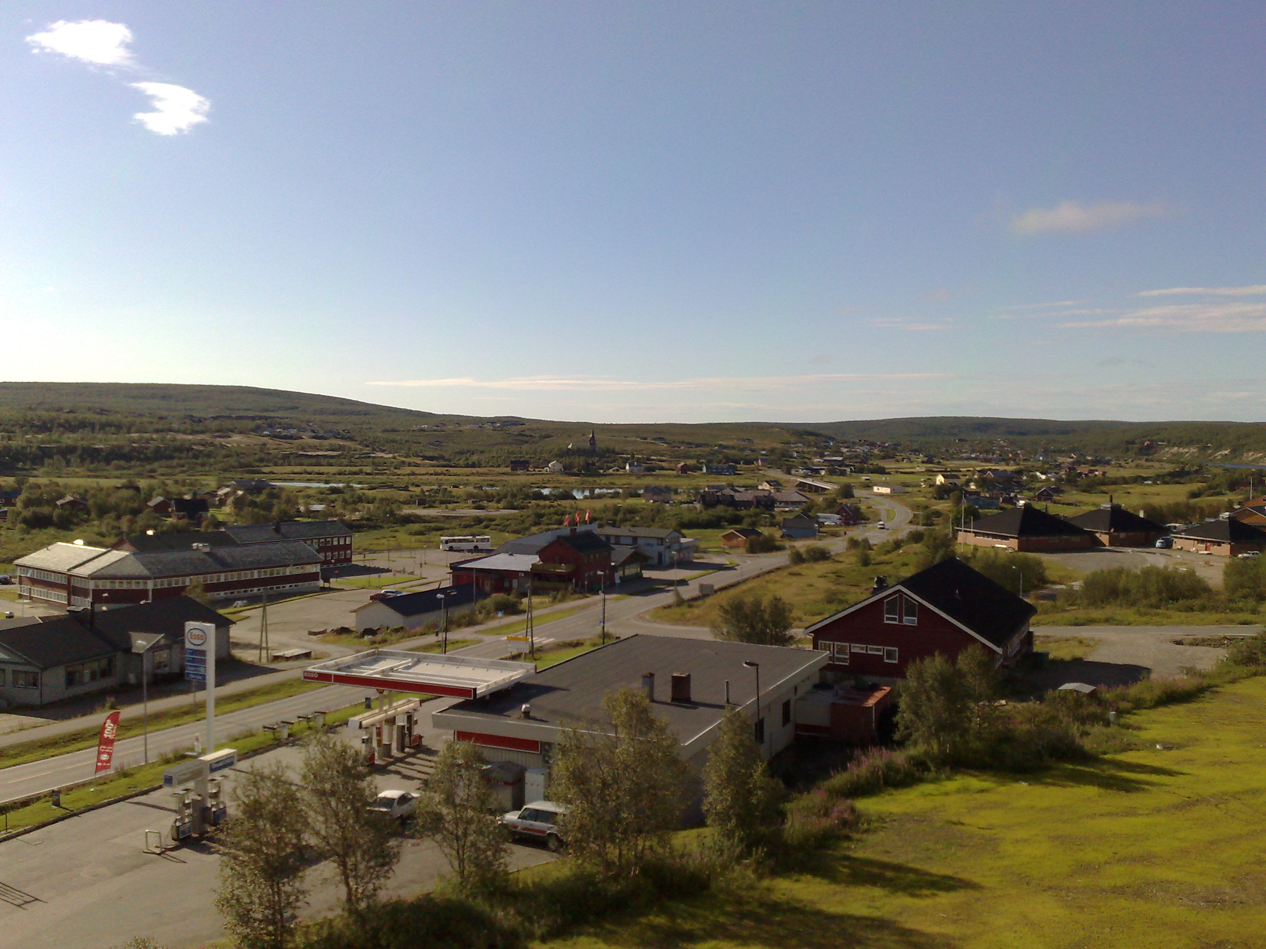
Population
In the village of Guovdageaidnu/Kautokeino, about 1,300 of the 3,000 people in the municipality reside. The village of Máze has about 400 people, while the remaining people in the municipality live in 14 smaller villages scattered around the area. The population has been declining about 3% over the last 10 years.
Guovdageaidnu/Kautokeino has different demographics than Finnmark county and Norway as a whole: more than 50% of the population is younger than 30 years. Also, the number of people older than 66 years is half of the national average. The gender ratio amounts to 86 women for every 100 men.[72] For the last couple of years, Kautokeino has been plagued by high rates of unemployment, peaking at 10% in 2006/2007.[73]
Villages
In addition to the administrative centre of Guovdageaidnu (Kautokeino), the municipality has 15 smaller villages:
- Máze (Masi) is the largest of the villages. Máze is located in a river valley. There is a school and Masi Church located in Máze. The current church has 150 seats and was built of wood in 1965. The first chapel was built in the 17th century. The second by Thomas von Westen in 1721. This church was burnt during World War II in 1944. The village was the site of a major political controversy in the late 1970s and early 80s, when it was proposed to flood village to build a large hydroelectric dam.
- Láhpoluoppal is a village located northeast of Guovdageaidnu at the southern end of the Láhppojávri lake. The village has a school, Láhpoluoppal Chapel, and mountain hut (Norwegian: fjellstue). The chapel has 70 seats and was built in 1967.
- Šihččajávri is located southeast of Guovdageaidnu (Kautokeino) village. The Norwegian Meteorological Institute has a weather observation station in the village, and often the place has the lowest temperature in Norway.
- Ávži is a village 10 kilometres (6 mi) east of Guovdageaidnu. During the Sami revolt in Guovdageaidnu, the group of Samis that captured the rebellions was organized here.
- Siebe is a village south of Guovdageaidnu.
- Mieron is a village north of Guovdageaidnu. Many of the Samis who traveled to Canada to teach the Inuit about reindeer herding were from Mieron.
- Stornes is a village north of Guovdageaidnu. Close to Stornes is a slate field with distinct green quartzite marketed as Naranas.

Naranas quartzite. - Šuoššjávri is a village northeast of Guovdageaidnu near the border with Karasjok with a chapel and a mountain hut. The chapel was built in 1968 and has 75 seats.
- Čunovuohppi is a small village with few houses and is 11 kilometres (7 mi) west of Guovdageaidnu. The village has a mountain hut (called Madame Bongos fjellstue).
- Suolovuopmi is north of Guovdageaidnu near the border with Alta. It is the location of a mountain hut, and is used for metrological observations.
- Gálaniitu is southwest of Guovdageaidnu and has a mountain hut.
- Áidejávri is south of Guovdageaidnu close to the Finnish border.
- Ákšomuotki (Økseidet) is south of Guovdageaidnu.
- Soahtefielbma is about 10 kilometres (6 mi) west of Guovdageaidnu.

Institutions and media
Several Sámi institutions are located in Guovdageaidnu/Kautokeino, including:
- Beaivváš Sámi Theatre. The National Sámi Theatre. As a national stage company, they play a major role in making Sámi history and culture visible.
- Sámi Joatkkaskuvla ja Boazodoalloskuvla is the Sámi High School and Reindeer Herding School. The high school has emphasis on Sámi, rather than Norwegian culture. Most teachers speak Sámi as their mother tongue allowing for classes to be taught in Sámi. In addition to ordinary courses, students can also study duodji (traditional Sámi crafts) and reindeer herding. In fact, it is the only high school in the world that features a reindeer herding class.
- Sámi allaskuvla - the Sámi University College. The college has national responsibility for Sámi higher education, including teacher-, and journalist-training. The college attempts to develop the syllabuses on the basis of Sámi needs, and attempts to develop Sámi as an academic language.
- Nordic Sámi Institute. The Nordic Sámi Institute is a Sámi research institution. Research topics include the Sámi language, culture, reindeer husbandry and legal research. The institute published the DIEĐUT magazine.
- Sámi giellaossodat; The department of language at the Norwegian Sami Parliament. This department is the administration for the Sámi language board, it allocates the extra funding given to the municipalities that have Sámi as an official language (like Guovdageaidnu-Kautokeino), and it administrates various projects related to Sámi languages.
- The department of education of the Norwegian Sami Parliament.
The Sámi are also internationally active with regards to indigenous people issues and reindeer husbandry. Therefore, the following institutions are also located in Guovdageaidnu/Kautokeino:
- Resource Centre for the Rights of Indigenous Peoples. The center attempts to collect, organize, and disseminate the knowledge and understanding of indigenous peoples' and Sami peoples' rights.
- International Centre For Reindeer Husbandry.
Guovdageaidnu/ Kautokeino is home to the following Sami media companies:
- Ávvir a Sami language newspaper.
- DAT Sami publishing house and record company.
Cultural events

Guovdageaidnu-Kautokeino is perhaps the cultural center of Northern Sámi today, and hosts several of the most well known Sami cultural events. The biggest event is the Sámi Easter Festival. Easter has traditionally been the time when the Sámis gather to celebrate weddings and confirmations. Today, also the Sami culture is celebrated with many yoik concerts, Sami theater shows, reindeer races, snowmobile races, ice fishing competitions, parties, and the Sámi Grand Prix; a Sámi version of the Eurovision Song Contest where in addition to the best song, the best yoik is also selected. In addition, the Sami Film Festival is usually held during the Easter, which is notable for having an outdoor cinema made of snow.[74]
In June, the annual Guovdageaidnu-Kautokeino Walk/Bicycle Ride, has Sámis return to Guovdageaidnu-Kautokeino, just to walk a few kilometers, or ride a bicycle for twice the distance.
In August, there is the White Fish festival, as well as the Autumn Festival. The latter is a weekend-long party full of concerts, but also includes snowmobile skipping races on the (unfrozen) river. If the riders go too slow or make too sharp a turn, the snowmobile sinks.
Notable residents


1852 Kautokeino uprising
- Aslak Hætta (1824–1854) a leader of the Sami revolt in Guovdageaidnu, called the Kautokeino Rebellion
- Mons Somby (1825 in Kautokeino – 1854) a leader of the Sami rioters
- Ellen Aslaksdatter Skum (1827 in Kautokeino – 1895) a Norwegian Sami reindeer herder, who took part in the 1852 Kautokeino uprising
- Lars Hætta (1834 in Kautokeino – 1896) a Norwegian Sami reindeer herder, prisoner, wood carver and Bible translator
Public Service
- Johan Turi (1854 in Kautokeino – 1936) the first Sami author to publish a secular work in a Sami language
- Edel Hætta Eriksen (born 1921 in Kautokeino) a Norwegian schoolteacher and politician
- Lajla Mattsson Magga (born 1942) a Southern Sami teacher, children's writer and lexicographer, lives in Kautokeino
- Ole Henrik Magga (born 1947) a Sámi linguist, professor and politician from Kautokeino; the first president of the Sami Parliament of Norway and currently the president of the United Nations Permanent Forum on Indigenous Issues
- Ellen Inga O. Hætta (born 1953 in Kautokeino) a Norwegian Sami school principal and politician
- Berit Marie Eira (born 1968) Norwegian Sami reindeer owner and politician, works in Kautokeino municipality
- Unni Turrettini (born 1972 in Kautokeino) a writer, lawyer, citizen activist and international speaker; author of The Mystery of the Lone Wolf Killer: Anders Behring Breivik and the Threat of Terror in Plain Sight.[75]
- Barbro-Lill Hætta-Jacobsen (born 1972 in Kautokeino) a physician and Norwegian politician
- Inger Elin Utsi (born 1975) a Norwegian-Sami politician and actor, grew up in Kautokeino and lives in Alta
- Láilá Susanne Vars (born 1976 in Láhpoluoppal) a Norwegian-Sami lawyer and former politician, academic and first Sámi women to achieve a PhD in law, expert member of the United Nations Permanent Forum on Indigenous Issues
The Arts
- Ailo Gaup (1944 in Kautokeino - 2014) a Sámi author, involved in founding the Sámi theater Beaivváš Sámi Theatre
- Nils Gaup (born 1955 in Kautokeino) a Sámi film director, Academy Award nominee for Pathfinder [76]
- Ellen Marie Vars (born 1957 in Láhpoluoppal) a Norwegian Sami writer
- Mattis Hætta (born 1959 in Masi) a Norwegian Sami singer, represented Norway in the Eurovision Song Contest 1980
- Ingor Ánte Áilo Gaup (born 1960 in Kautokeino) a Sámi actor, composer and folk musician
- Johan Sara (born 1963 in Alta) a Sami musician and composer, producer, teacher, arranger and actor
- Roger Ludvigsen (born 1965 in Alta) a Sami guitarist, percussionist and composer from Kautokeino
- Sollaug Sárgon (born 1965 in Kautokeino) a Norwegian Sami poet and child protective pedagogue
- Niko Valkeapää (born 1968 in Enontekiö, Finland) a Sami musician and joiker (Sami folk singer), winner of the Norwegian Spelemannsprisen in 2004; lives in Kautokeino
- Rawdna Carita Eira (born 1970) a Norwegian and Sámi playwright and author, lives in Kautokeino
- Sara Margrethe Oskal (born 1970 in Kautokeino) a Norwegian Sami writer, actress, artisan, director and film producer [77]
- Máret Ánne Sara (born 1983) a Sami artist and author, lives and works in Kautokeino
- Unni Turrettini (born 1972 in Kautokeino) a Norwegian attorney, international speaker and best selling author
- Fred Buljo (born 1988 in Kautokeino) a Sámi rapper and member of supergroup KEiiNO, named after the village
Sport
- Håvard Klemetsen (born 1979 in Kautokeino) a Nordic combined skier with a gold and bronze team medals at the FIS Nordic World Ski Championships
References
- "Navn på steder og personer: Innbyggjarnamn" (in Norwegian). Språkrådet.
- "Forskrift om målvedtak i kommunar og fylkeskommunar" (in Norwegian). Lovdata.no.
- "Stadnamn og rettskriving" (in Norwegian). Kartverket. Archived from the original on 1 July 2018. Retrieved 13 July 2018.
- Statistisk sentralbyrå. "Table: 06913: Population 1 January and population changes during the calendar year (M)" (in Norwegian).
- Statistisk sentralbyrå. "09280: Area of land and fresh water (km²) (M)" (in Norwegian).
- Jukvam, Dag (1999). "Historisk oversikt over endringer i kommune- og fylkesinndelingen" (PDF) (in Norwegian). Statistisk sentralbyrå. Archived (PDF) from the original on 1 September 2012. Retrieved 5 April 2013.
- Mæhlum, Lars, ed. (24 December 2019). "Troms og Finnmark". Store norske leksikon (in Norwegian). Kunnskapsforlaget. Archived from the original on 27 October 2019. Retrieved 26 December 2019.
- "Ot.prp. nr. 111 (2001-2002)" (in Norwegian). Regjeringen.no. 5 July 2002. Archived from the original on 10 February 2012. Retrieved 23 April 2007.
- "Endring av skrivemåten for tospråklige kommuner. Endring av skrivemåten for tospråklige kommunenavn, Guovdageaidnu-Kautokeino" (in Norwegian). Archived from the original on 28 March 2014. Retrieved 25 April 2007.
- "Civic heraldry of Norway - Norske Kommunevåpen". Heraldry of the World. Archived from the original on 14 December 2018. Retrieved 5 June 2018.
- Stroeven, Arjen P.; Haettestrand, Clas; Kleman, Johan; Heyman, Jakob; Fabel, Derek; Fredin, Ola; Goodfellow, Bradley W.; Harbor, Jonathan M.; Jansen, John D.; Olsen, Lars; Caffee, Marc W.; Fink, David; Lundqvist, Jan; Rosqvist, Gunhild C.; Strømberg + Jansson, Bo+Krister N. (2016). "Deglaciation of Fennoscandia". Quaternary Science Reviews. Elseiver. 147: 105. Bibcode:2016QSRv..147...91S. doi:10.1016/j.quascirev.2015.09.016. S2CID 43158326. Archived from the original on 18 June 2022. Retrieved 28 August 2022.
- Blom, Jon Gunnar (2021). "Gáidnomanjávri Sikringsundersøkelse av aktivitetsområder fra steinalder ved Kautokeino kirkested" (PDF). Tromsø Museums Rapportserie (in Norwegian). 62 (University in Tromsø): 18. Archived (PDF) from the original on 26 August 2022. Retrieved 29 August 2022.
- Niemi, Anja Roth; Oppvang, Janne. "Juntavadda Undersøkelse av sein-mesolittiske aktivitetsområder i Kautokeino k./Guovdageaidnu s." (PDF). Tromura 2019 (in Norwegian). 54 (TROMSØ MUSEUMS RAPPORTSERIE NR. 54). Archived (PDF) from the original on 25 August 2022. Retrieved 28 August 2022 – via uit.no.
- Simonsen, Povl (1979). "Juntavadda og Assebakte : to utgravninger på Finnmarksvidda - Nasjonalbiblioteket". www.nb.no (in Norwegian). p. 11. Archived from the original on 26 August 2022. Retrieved 28 August 2022.
- Hedman, Sven-Donald; Olsen, Bjørnar; Maria, Vretemark (24 January 2015). "Hunters, herders and hearths: interpreting new results from hearth row sites in Pasvik, Arctic Norway". Rangifer. 35: 1–24. doi:10.7557/2.35.1.3334. Archived from the original on 26 August 2022. Retrieved 28 August 2022 – via Septentrio.
- Norgeshistorie, Om; Institutt for arkeologi, konservering og historie (IAKH) ved UiO. "Noregs grenser: det historiske målebord - Norgeshistorie". www.norgeshistorie.no (in Norwegian). Retrieved 29 August 2022.
- Smith, P.L. "Nasjonalbiblioteket". www.nb.no. pp. 3, 7. Retrieved 29 August 2022.
- "Nasjonalbiblioteket". www.nb.no. Retrieved 29 August 2022.
- "Nasjonalbiblioteket". www.nb.no. Retrieved 29 August 2022.
- "Nasjonalbiblioteket". www.nb.no. Retrieved 29 August 2022.
- "Nasjonalbiblioteket". www.nb.no. Retrieved 29 August 2022.
- "About the museum". rdm.no. Retrieved 29 August 2022.
- "Nasjonalbiblioteket". www.nb.no. Retrieved 29 August 2022.
- Strømstad, Alf (2006). Slekter i Indre Finnmark : de eldste generasjoner (1. opplag utg.) (in Norwegian) (1st ed.). Hvalstad: Alf Strmsdat. ISBN 82-996598-1-7.
- "Nasjonalbiblioteket". www.nb.no. Retrieved 29 August 2022.
- Hætta, Odd Mathis (2016). Samebygder på Finnmarksvidda (in Norwegian). Alta: Hætta, Odd Mathis. p. 254. ISBN 978-82-690262-0-7.
- "Nasjonalbiblioteket". www.nb.no. Retrieved 29 August 2022.
- "Kuriosetet ved HiST" (in Norwegian). Archived from the original on 1 January 2015.
- Hætta Eriksen, Edel. "Nasjonalbiblioteket". www.nb.no. p. 52. Retrieved 29 August 2022.
- "Fangeleirer i Karasjok". RiddoDuottarMuseat (in Norwegian Bokmål). Retrieved 29 August 2022.
- Jaklin, Asbjørn (2006). Nordfronten Hitlers skjebneområde (in Norwegian). Finalnd: Gyldendal. p. 143. ISBN 978-82-05-34537-9.
- "Junkers 52/3m Kautokeino". flyvrak.info. Retrieved 29 August 2022.
- Hætta, Odd Mathis (2016). Samebygder på Finnmarksvidda 2 (in Norwegian) (2 ed.). Alta: Odd Mathis Hætta. pp. 314–315. ISBN 978-82-690262-1-4.
- Berge, Kjell-Ragnar (2019). Lyngenlinjen Hitlers siste skanse i Norge 1945 (in Norwegian). Skallestad: Ares Forlag. pp. 46, 47, 69, 180. ISBN 978-82-92938-90-4.
- "Gebrirgsjäger". www.lexikon-der-wehrmacht.de. Retrieved 29 August 2022.
- "Gebirgsjäger-Regiment 139". www.ordersofbattle.com. Retrieved 29 August 2022.
- Westrheim, Harry (1978). Landet de brente: tvangsevakuering av Finnmark og Nord-Troms høsten 1944 (in Norwegian). Tiden. p. 139. ISBN 8210017101.
- "Nasjonalbiblioteket". www.nb.no. Retrieved 29 August 2022.
- historielag, Årsmøteuttalelse GHS/Kautokeino (11 December 2019). "Om krigsminner – Kautokeino historielaget". iFinnmark (in Norwegian). Retrieved 29 August 2022.
- Aarseth, Ola. "Muitalusat ja dáhpáhusat Guovdageainnus 13 Kautokeino 1944-45. Da sameland brant". Muitalusat ja dáhpáhusat Guovdageainnus. 13 (Kautokeino Historielag): 10.
- Kristensen, Nils Martin. "Bombekastergranater funnet i Kautokeino" (in Norwegian Bokmål). Retrieved 29 August 2022.
- Westrheim, Harry (1978). Landet de brente: tvangsevakueringen av Finnmark og Nord-Troms høsten 1944 (in Norwegian). Tiden. p. 139. ISBN 8210017101.
- "Nasjonalbiblioteket". www.nb.no. Retrieved 29 August 2022.
- Hætta Eriksen, Edel. "Muitalusat ja dahpahusat Guovdageainnus 13.«Evakueringsvinteren 1944-45»". Muitalusat Ja Dahpahusat Guovdageainnus. 13 (Kautokeino historielag): t.
- Petterson, Arvid (2008). Fortiet fortid Tragedien Norge aldri forsto (in Norwegian). Hammerfest: Gjenreisningsmuseet for Finnmark og Nord-Troms. pp. 147, 351. ISBN 978-82-997554-1-2.
- Jaklin, Asbjørn (2016). Brent jord, 1944-1945 : heltene, ofrene, de skyldige (in Norwegian). Oslo: Gyldendal. pp. 193–195. ISBN 978-82-05-48429-0.
- Hætta, Odd Mathis (2016). Samebygder på Finnmarksvidda (in Norwegian). Alta: Odd Mathis Hætta. p. 254. ISBN 978-82-690262-0-7.
- Larsen, Dan Robert (2 June 2016). "Flytter Sápmi Pride til Kautokeino". NRK Sapmi (in Norwegian). Archived from the original on 7 January 2017. Retrieved 3 July 2018.
- Hansen, Tore, ed. (12 May 2016). "kommunestyre". Store norske leksikon (in Norwegian). Kunnskapsforlaget. Archived from the original on 27 March 2019. Retrieved 5 June 2018.
- "Tall for Norge: Kommunestyrevalg 2019 - Troms og Finnmark". Valg Direktoratet. Archived from the original on 19 March 2020. Retrieved 20 October 2019.
- "Table: 04813: Members of the local councils, by party/electoral list at the Municipal Council election (M)" (in Norwegian). Statistics Norway. Archived from the original on 19 April 2020. Retrieved 22 October 2019.
- "Tall for Norge: Kommunestyrevalg 2011 - Finnmark". Valg Direktoratet. Archived from the original on 19 March 2020. Retrieved 21 October 2019.
- "Kommunestyrevalget 1995" (PDF) (in Norwegian). Oslo-Kongsvinger: Statistisk sentralbyrå. 1996. Archived (PDF) from the original on 20 September 2014. Retrieved 18 March 2020.
- "Kommunestyrevalget 1991" (PDF) (in Norwegian). Oslo-Kongsvinger: Statistisk sentralbyrå. 1993. Archived (PDF) from the original on 22 May 2015. Retrieved 18 March 2020.
- "Kommunestyrevalget 1987" (PDF) (in Norwegian). Oslo-Kongsvinger: Statistisk sentralbyrå. 1988. Archived (PDF) from the original on 19 October 2014. Retrieved 18 March 2020.
- "Kommunestyrevalget 1983" (PDF) (in Norwegian). Oslo-Kongsvinger: Statistisk sentralbyrå. 1984. Archived (PDF) from the original on 19 October 2014. Retrieved 18 March 2020.
- "Kommunestyrevalget 1979" (PDF) (in Norwegian). Oslo: Statistisk sentralbyrå. 1979. Archived (PDF) from the original on 29 September 2014. Retrieved 18 March 2020.
- "Kommunevalgene 1975" (PDF) (in Norwegian). Oslo: Statistisk sentralbyrå. 1977. Archived (PDF) from the original on 15 March 2016. Retrieved 18 March 2020.
- "Kommunevalgene 1972" (PDF) (in Norwegian). Oslo: Statistisk sentralbyrå. 1973. Archived (PDF) from the original on 21 April 2016. Retrieved 18 March 2020.
- "Kommunevalgene 1967" (PDF) (in Norwegian). Oslo: Statistisk sentralbyrå. 1967. Archived (PDF) from the original on 21 April 2016. Retrieved 18 March 2020.
- "Kommunevalgene 1963" (PDF) (in Norwegian). Oslo: Statistisk sentralbyrå. 1964. Archived (PDF) from the original on 21 April 2016. Retrieved 18 March 2020.
- "Kommunevalgene og Ordførervalgene 1959" (PDF) (in Norwegian). Oslo: Statistisk sentralbyrå. 1960. Archived (PDF) from the original on 17 March 2016. Retrieved 18 March 2020.
- "Kommunevalgene og Ordførervalgene 1955" (PDF) (in Norwegian). Oslo: Statistisk sentralbyrå. 1957. Archived (PDF) from the original on 14 February 2020. Retrieved 18 March 2020.
- "Kommunevalgene og Ordførervalgene 1951" (PDF) (in Norwegian). Oslo: Statistisk sentralbyrå. 1952. Archived (PDF) from the original on 17 March 2016. Retrieved 18 March 2020.
- "Kommunevalgene og Ordførervalgene 1947" (PDF) (in Norwegian). Oslo: Statistisk sentralbyrå. 1948. Archived (PDF) from the original on 16 March 2016. Retrieved 18 March 2020.
- "Kommunevalgene og Ordførervalgene 1945" (PDF) (in Norwegian). Oslo: Statistisk sentralbyrå. 1947. Archived (PDF) from the original on 25 August 2014. Retrieved 18 March 2020.
- "Kommunevalgene og Ordførervalgene 1937" (PDF) (in Norwegian). Oslo: Statistisk sentralbyrå. 1938. Archived (PDF) from the original on 6 March 2016. Retrieved 18 March 2020.
- "Last 13 months". www.yr.no. Norwegian Meteorological Institute. Archived from the original on 29 August 2022. Retrieved 26 February 2021.
- "Weatheronline climate robot 1996-2020 (average high and low)". Archived from the original on 29 August 2022. Retrieved 9 April 2021.
- "Météo climat stats for Kautokeino". Météo Climat. Archived from the original on 28 February 2018. Retrieved 24 March 2017.
- "Météo climat stats Records for Kautokeino". Météo Climat. Archived from the original on 28 December 2017. Retrieved 24 March 2017.
- "Kautokeino kommune" (in Norwegian). Archived from the original on 5 December 2004. Retrieved 31 October 2004.
- "Finnmarkstatistikken: Yrkesdeltaking 2006" (in Norwegian). Archived from the original on 26 June 2008.
- Bevanger, Lars (4 June 2004). "Drive-in cinema is Norway's coolest". BBC News. Archived from the original on 25 April 2006. Retrieved 21 April 2007.
- Kraly, Paul T. (7 March 2017). "The Writing Life: 10 Questions for Unni Turrettini". medium.com: thrive global. Archived from the original on 20 June 2019. Retrieved 22 October 2019.
- IMDb Database Archived 2020-06-04 at the Wayback Machine retrieved 16 August 2020
- IMDb Database Archived 2021-07-26 at the Wayback Machine retrieved 16 August 2020
External links
- Kautokeino Municipality Official Website (in Norwegian)
- Municipal fact sheet from Statistics Norway (in Norwegian)
- Destinasjon Kautokeino Tourist office (in Norwegian)
- Kautokeino.Com is the major online "meeting point"
- Sámi Joatkkaskuvla ja Boazodoalloskuvla (in Norwegian)
- Sámi University College
- Beaivvas Sámi Teahter
- kautokeino.net News and information about events in Kautokeino
Troms og Finnmark county, Norway | |||||||||
|---|---|---|---|---|---|---|---|---|---|
| |||||||||
 | Towns and cities |
|   | ||||||
| Municipalities |
| ||||||||
Authority control | |
|---|---|
| General | |
| National libraries | |
| Other |
|
На других языках
[de] Kautokeino
Kautokeino (nordsamisch Guovdageaidnu; finnisch und kvenisch: Koutokeino) ist eine Kommune in der Provinz (Fylke) Troms og Finnmark in Norwegen.- [en] Kautokeino
[ru] Кёутукейну
Кёутукейну[3] (норв. Kautokeino, сев.‑саам. Guovdageaidnu) — коммуна в губернии Тромс-ог-Финнмарк в Норвегии. Административный центр — населённый пункт Кёутукейну. Площадь коммуны Кёутукейну — 9708,13 км², код-идентификатор — 2011.Другой контент может иметь иную лицензию. Перед использованием материалов сайта WikiSort.org внимательно изучите правила лицензирования конкретных элементов наполнения сайта.
WikiSort.org - проект по пересортировке и дополнению контента Википедии