world.wikisort.org - Norway
Eigersund is a municipality in Rogaland county, Norway. It is in the traditional district of Dalane. The administrative centre of the municipality is the town of Egersund. The town was known for its pottery factory (closed in 1979) and it is among Norway's biggest fishing ports. The villages of Helleland, Hellvik, and Hestnes are also in Eigersund.
Eigersund kommune | |
|---|---|
Municipality | |
 View of the town of Egersund | |
 Flag  Coat of arms  Rogaland within Norway | |
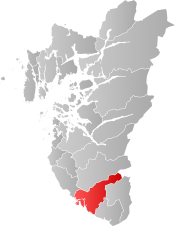 Eigersund within Rogaland | |
| Coordinates: 58°28′42″N 06°03′47″E | |
| Country | Norway |
| County | Rogaland |
| District | Dalane |
| Established | 1 Jan 1838 |
| • Created as | Formannskapsdistrikt |
| Administrative centre | Egersund |
| Government | |
| • Mayor (2015) | Odd Stangeland (Ap) |
| Area | |
| • Total | 432.49 km2 (166.99 sq mi) |
| • Land | 387.45 km2 (149.60 sq mi) |
| • Water | 45.04 km2 (17.39 sq mi) 10.4% |
| • Rank | #228 in Norway |
| Population (2022) | |
| • Total | 14,860 |
| • Rank | #82 in Norway |
| • Density | 38.4/km2 (99/sq mi) |
| • Change (10 years) | |
| Demonym | Eigersunder[1] |
| Official language | |
| • Norwegian form | Bokmål |
| Time zone | UTC+01:00 (CET) |
| • Summer (DST) | UTC+02:00 (CEST) |
| ISO 3166 code | NO-1101 |
| Website | Official website |
The island of Eigerøya lies just off shore from Egersund. The island has several well-known businesses and attractions including the Eigerøy war memorial from World War II.
The 432-square-kilometre (167 sq mi) municipality is the 228th largest by area out of the 356 municipalities in Norway. Eigersund is the 82nd most populous municipality in Norway with a population of 14,860. The municipality's population density is 38.4 inhabitants per square kilometre (99/sq mi) and its population has increased by 2.7% over the previous 10-year period.[3][4]
General information


The rural parish surrounding the town of Egersund was established as the municipality of Egersund landdisstrikt (Egersund rural district) on 1 January 1838 (see formannskapsdistrikt law). In 1839, the northwestern district of Augne (population: 825) was separated to form its own municipality. On 12 December 1868, a small area of Eigersund municipality (population: 41) was transferred to neighboring Sokndal. In 1947, an area of Eigersund immediately surrounding the town of Egersund (population: 515) was transferred to the town of Egersund and another area in Sokndal (population: 7) was transferred to Eigersund.
During the 1960s, there were many municipal mergers in Norway due to the work of the Schei Committee. On 1 January 1965, the town of Egersund (population: 3,787) was merged with the surrounding municipalities of Eigersund (population: 4,664), Helleland (population: 851), and the Gyadalen and Grøsfjel areas of Heskestad (population: 114). The new municipality was also called Eigersund. On 1 January 1967, the Tjørn farm (population: 10) was transferred from Eigersund to Sokndal.[5]
Name
The Old Norse form of the name was Eikundarsund. The first element is the genitive case of the name of the island of Eikund (now Eigerøya) and the last element is sund which means "strait" or "sound". The first element in the name of the island is eik which means "oak" and the last element is the suffix -und which means "plentiful of" (i.e. "the island covered with oak trees").[6]
- "Egersund" vs. "Eigersund"
The form of the name spelled without the diphthong [ei] (Egersund) is the Danish language form of the name which is still preserved in the name of the town Egersund, but the municipality name is spelled using the Norwegian language form.
Coat of arms
The coat of arms was granted on 20 October 1972. The arms show a gold/yellow oak leaf on a green background. The arms are partly a canting since the name is supposedly derived from Eikundarsund and eik means oak. Oaks are also very common in the municipality.[7]
Churches
The Church of Norway has three parishes (sokn) within the municipality of Eigersund. It is part of the Dalane prosti (deanery) in the Diocese of Stavanger.
| Parish (sokn) | Church name | Location of the church | Year built |
|---|---|---|---|
| Egersund | Egersund Church | Egersund | 1607 |
| Bakkebø Church | Egersund | 1960 | |
| Eigerøy | Eigerøy Church | Eigerøya | 1998 |
| Helleland | Helleland Church | Helleland | 1832 |
History
The place is mentioned in Snorri Sturluson's writings. Later, Christian IV set up a battery there.
Government
All municipalities in Norway, including Eigersund, are responsible for primary education (through 10th grade), outpatient health services, senior citizen services, unemployment and other social services, zoning, economic development, and municipal roads. The municipality is governed by a municipal council of elected representatives, which in turn elect a mayor.[8] The municipality falls under the Sør-Rogaland District Court and the Gulating Court of Appeal.
Municipal council
The municipal council (Kommunestyre) of Eigersund is made up of 31 representatives that are elected to four year terms. Currently, the party breakdown is as follows:
| Party Name (in Norwegian) | Number of representatives | |
|---|---|---|
| Labour Party (Arbeiderpartiet) | 10 | |
| Progress Party (Fremskrittspartiet) | 6 | |
| Conservative Party (Høyre) | 5 | |
| Christian Democratic Party (Kristelig Folkeparti) | 3 | |
| Centre Party (Senterpartiet) | 4 | |
| Socialist Left Party (Sosialistisk Venstreparti) | 2 | |
| Liberal Party (Venstre) | 1 | |
| Total number of members: | 31 | |
| Party Name (in Norwegian) | Number of representatives | |
|---|---|---|
| Labour Party (Arbeiderpartiet) | 10 | |
| Progress Party (Fremskrittspartiet) | 5 | |
| Conservative Party (Høyre) | 6 | |
| Christian Democratic Party (Kristelig Folkeparti) | 5 | |
| Centre Party (Senterpartiet) | 3 | |
| Socialist Left Party (Sosialistisk Venstreparti) | 1 | |
| Liberal Party (Venstre) | 1 | |
| Total number of members: | 31 | |
| Party Name (in Norwegian) | Number of representatives | |
|---|---|---|
| Labour Party (Arbeiderpartiet) | 8 | |
| Progress Party (Fremskrittspartiet) | 4 | |
| Conservative Party (Høyre) | 8 | |
| Christian Democratic Party (Kristelig Folkeparti) | 6 | |
| Centre Party (Senterpartiet) | 2 | |
| Socialist Left Party (Sosialistisk Venstreparti) | 1 | |
| Liberal Party (Venstre) | 2 | |
| Total number of members: | 31 | |
| Party Name (in Norwegian) | Number of representatives | |
|---|---|---|
| Labour Party (Arbeiderpartiet) | 9 | |
| Progress Party (Fremskrittspartiet) | 6 | |
| Conservative Party (Høyre) | 10 | |
| Christian Democratic Party (Kristelig Folkeparti) | 5 | |
| Centre Party (Senterpartiet) | 2 | |
| Socialist Left Party (Sosialistisk Venstreparti) | 1 | |
| Liberal Party (Venstre) | 2 | |
| Total number of members: | 35 | |
| Party Name (in Norwegian) | Number of representatives | |
|---|---|---|
| Labour Party (Arbeiderpartiet) | 8 | |
| Progress Party (Fremskrittspartiet) | 6 | |
| Conservative Party (Høyre) | 10 | |
| Christian Democratic Party (Kristelig Folkeparti) | 4 | |
| Centre Party (Senterpartiet) | 3 | |
| Socialist Left Party (Sosialistisk Venstreparti) | 1 | |
| Liberal Party (Venstre) | 3 | |
| Total number of members: | 35 | |
| Party Name (in Norwegian) | Number of representatives | |
|---|---|---|
| Labour Party (Arbeiderpartiet) | 18 | |
| Progress Party (Fremskrittspartiet) | 4 | |
| Conservative Party (Høyre) | 9 | |
| Christian Democratic Party (Kristelig Folkeparti) | 8 | |
| Centre Party (Senterpartiet) | 3 | |
| Liberal Party (Venstre) | 3 | |
| Total number of members: | 45 | |
| Party Name (in Norwegian) | Number of representatives | |
|---|---|---|
| Labour Party (Arbeiderpartiet) | 16 | |
| Progress Party (Fremskrittspartiet) | 3 | |
| Conservative Party (Høyre) | 8 | |
| Christian Democratic Party (Kristelig Folkeparti) | 9 | |
| Centre Party (Senterpartiet) | 5 | |
| Liberal Party (Venstre) | 4 | |
| Total number of members: | 45 | |
| Party Name (in Norwegian) | Number of representatives | |
|---|---|---|
| Labour Party (Arbeiderpartiet) | 16 | |
| Progress Party (Fremskrittspartiet) | 2 | |
| Conservative Party (Høyre) | 9 | |
| Christian Democratic Party (Kristelig Folkeparti) | 7 | |
| Centre Party (Senterpartiet) | 6 | |
| Socialist Left Party (Sosialistisk Venstreparti) | 2 | |
| Liberal Party (Venstre) | 3 | |
| Total number of members: | 45 | |
| Party Name (in Norwegian) | Number of representatives | |
|---|---|---|
| Labour Party (Arbeiderpartiet) | 13 | |
| Progress Party (Fremskrittspartiet) | 3 | |
| Conservative Party (Høyre) | 12 | |
| Christian Democratic Party (Kristelig Folkeparti) | 9 | |
| Centre Party (Senterpartiet) | 4 | |
| Socialist Left Party (Sosialistisk Venstreparti) | 1 | |
| Liberal Party (Venstre) | 3 | |
| Total number of members: | 45 | |
| Party Name (in Norwegian) | Number of representatives | |
|---|---|---|
| Labour Party (Arbeiderpartiet) | 14 | |
| Progress Party (Fremskrittspartiet) | 2 | |
| Conservative Party (Høyre) | 13 | |
| Christian Democratic Party (Kristelig Folkeparti) | 9 | |
| Centre Party (Senterpartiet) | 3 | |
| Socialist Left Party (Sosialistisk Venstreparti) | 1 | |
| Liberal Party (Venstre) | 3 | |
| Total number of members: | 45 | |
| Party Name (in Norwegian) | Number of representatives | |
|---|---|---|
| Labour Party (Arbeiderpartiet) | 11 | |
| Conservative Party (Høyre) | 16 | |
| Christian Democratic Party (Kristelig Folkeparti) | 10 | |
| Liberal People's Party (Liberale Folkepartiet) | 1 | |
| Centre Party (Senterpartiet) | 3 | |
| Socialist Left Party (Sosialistisk Venstreparti) | 1 | |
| Liberal Party (Venstre) | 3 | |
| Total number of members: | 45 | |
| Party Name (in Norwegian) | Number of representatives | |
|---|---|---|
| Labour Party (Arbeiderpartiet) | 11 | |
| Conservative Party (Høyre) | 9 | |
| Christian Democratic Party (Kristelig Folkeparti) | 11 | |
| New People's Party (Nye Folkepartiet) | 3 | |
| Centre Party (Senterpartiet) | 5 | |
| Socialist Left Party (Sosialistisk Venstreparti) | 1 | |
| Liberal Party (Venstre) | 2 | |
| Cross-Party Alternative (Tverrpolitisk Alternativ) | 3 | |
| Total number of members: | 45 | |
| Party Name (in Norwegian) | Number of representatives | |
|---|---|---|
| Labour Party (Arbeiderpartiet) | 14 | |
| Conservative Party (Høyre) | 6 | |
| Christian Democratic Party (Kristelig Folkeparti) | 8 | |
| Centre Party (Senterpartiet) | 6 | |
| Liberal Party (Venstre) | 5 | |
| Total number of members: | 39 | |
| Party Name (in Norwegian) | Number of representatives | |
|---|---|---|
| Labour Party (Arbeiderpartiet) | 15 | |
| Conservative Party (Høyre) | 5 | |
| Christian Democratic Party (Kristelig Folkeparti) | 7 | |
| Centre Party (Senterpartiet) | 5 | |
| Liberal Party (Venstre) | 7 | |
| Total number of members: | 39 | |
| Party Name (in Norwegian) | Number of representatives | |
|---|---|---|
| Labour Party (Arbeiderpartiet) | 7 | |
| Conservative Party (Høyre) | 3 | |
| Christian Democratic Party (Kristelig Folkeparti) | 4 | |
| Centre Party (Senterpartiet) | 3 | |
| Liberal Party (Venstre) | 4 | |
| Total number of members: | 21 | |
| Party Name (in Norwegian) | Number of representatives | |
|---|---|---|
| Labour Party (Arbeiderpartiet) | 6 | |
| Christian Democratic Party (Kristelig Folkeparti) | 4 | |
| Centre Party (Senterpartiet) | 3 | |
| Liberal Party (Venstre) | 6 | |
| Local List(s) (Lokale lister) | 2 | |
| Total number of members: | 21 | |
| Party Name (in Norwegian) | Number of representatives | |
|---|---|---|
| Labour Party (Arbeiderpartiet) | 6 | |
| Christian Democratic Party (Kristelig Folkeparti) | 4 | |
| Farmers' Party (Bondepartiet) | 4 | |
| Liberal Party (Venstre) | 7 | |
| Total number of members: | 21 | |
| Party Name (in Norwegian) | Number of representatives | |
|---|---|---|
| Labour Party (Arbeiderpartiet) | 4 | |
| Christian Democratic Party (Kristelig Folkeparti) | 4 | |
| Farmers' Party (Bondepartiet) | 2 | |
| Liberal Party (Venstre) | 6 | |
| Total number of members: | 16 | |
| Party Name (in Norwegian) | Number of representatives | |
|---|---|---|
| Labour Party (Arbeiderpartiet) | 4 | |
| Christian Democratic Party (Kristelig Folkeparti) | 3 | |
| Farmers' Party (Bondepartiet) | 3 | |
| Liberal Party (Venstre) | 6 | |
| Total number of members: | 16 | |
| Party Name (in Norwegian) | Number of representatives | |
|---|---|---|
| Labour Party (Arbeiderpartiet) | 5 | |
| Liberal Party (Venstre) | 8 | |
| Local List(s) (Lokale lister) | 3 | |
| Total number of members: | 16 | |
| Party Name (in Norwegian) | Number of representatives | |
|---|---|---|
| Labour Party (Arbeiderpartiet) | 2 | |
| Joint List(s) of Non-Socialist Parties (Borgerlige Felleslister) | 13 | |
| Local List(s) (Lokale lister) | 1 | |
| Total number of members: | 16 | |
| Note: Due to the German occupation of Norway during World War II, no elections were held for new municipal councils until after the war ended in 1945. | ||
Geography
Eigersund extends from the North Sea coast to the border of Agder county. It borders the municipalities of Hå and Bjerkreim to the north and Sokndal to the south. The municipality is centered on the town of Egersund, and includes the island of Eigerøya. The landscape includes many rivers and lakes, as well as woods and several barren rocky and heather-clad moors. The lakes Grøsfjellvatnet, Eiavatnet, Nodlandsvatnet, and Teksevatnet lie in the municipality.
Eigerøya
Eigerøya is an island off the coast of Egersund. The island is connected to the mainland over Eigerøy bridge, which was completed in 1951. The island's coastline is characterized by a number of small bays, as well as Lundarviga. Eigerøya is divided almost in two of the large bay of Lundarviga. The island is surrounded by a number of small islets. Eigerøy Lighthouse and Vibberodden Lighthouse are both located along the shores of Eigerøya.
Climate
| Climate data for Eigerøya | |||||||||||||
|---|---|---|---|---|---|---|---|---|---|---|---|---|---|
| Month | Jan | Feb | Mar | Apr | May | Jun | Jul | Aug | Sep | Oct | Nov | Dec | Year |
| Average high °C (°F) | 3.0 (37.4) |
2.8 (37.0) |
4.3 (39.7) |
7.4 (45.3) |
12.2 (54.0) |
14.8 (58.6) |
16.2 (61.2) |
16.6 (61.9) |
13.6 (56.5) |
10.8 (51.4) |
7.1 (44.8) |
4.8 (40.6) |
9.5 (49.1) |
| Daily mean °C (°F) | 1.1 (34.0) |
0.7 (33.3) |
2.3 (36.1) |
4.8 (40.6) |
9.0 (48.2) |
12.1 (53.8) |
13.4 (56.1) |
14.1 (57.4) |
11.7 (53.1) |
9.1 (48.4) |
5.2 (41.4) |
2.7 (36.9) |
7.2 (45.0) |
| Average low °C (°F) | −0.5 (31.1) |
−1.0 (30.2) |
0.5 (32.9) |
2.4 (36.3) |
7.0 (44.6) |
9.6 (49.3) |
11.4 (52.5) |
12.1 (53.8) |
9.6 (49.3) |
7.0 (44.6) |
3.3 (37.9) |
1.1 (34.0) |
5.2 (41.4) |
| Average precipitation mm (inches) | 121 (4.8) |
80 (3.1) |
95 (3.7) |
68 (2.7) |
77 (3.0) |
76 (3.0) |
96 (3.8) |
117 (4.6) |
154 (6.1) |
168 (6.6) |
163 (6.4) |
135 (5.3) |
1,350 (53.1) |
| Average precipitation days (≥ 1 mm) | 16.2 | 10.7 | 13.1 | 10.9 | 9.9 | 9.5 | 10.3 | 11.2 | 15.9 | 17.3 | 19.3 | 17.5 | 161.8 |
| Source: Norwegian Meteorological Institute[27] | |||||||||||||
Transportation
European route E39 runs through the municipality, passing the village of Helleland. The Sørlandet Line runs through the municipality, stopping at Egersund Station and Hellvik Station.
Notable people

- Michael Birkeland (1830 in Eigersund – 1896) an historian, civil servant and politician
- Peter C. Assersen (1839 in Egersund – 1906) civil engineer and Rear Admiral in US Navy
- Bernt B. Lomeland (1836 in Helleland – 1900) a school teacher and lay minister
- Elisabeth Fedde (1850-1921) a Lutheran Deaconess, lived in Egersund from 1895
- Anna Bugge (1862 in Egersund – 1928) a Norwegian & Swedish feminist, lawyer, diplomat and politician
- Jacob Thorkelson (1876 in Egersund – 1945) US Congressman from Montana
- Jack Nielsen (1896 in Egersund – 1981) Norwegian tennis player, six-time national champion
- Paulus Svendsen (1904 in Egersund – 1989) literary historian, wrote biographies of Western philosophers
- Thorbjørn Feyling (1907 in Egersund – 1985) a ceramist with Stavangerflint AS
- Johnny Stenberg (born 1925 in Eigersund - 1990) politician, Mayor of Meråker, 1966-1973
- John Olav Larssen (1927 in Hellvik – 2009) an evangelical preacher and missionary
- Gunnar Kvassheim (born 1953 in Eigersund) a Norwegian journalist and politician
- Bengt Sæternes (born 1975 in Egersund) a former footballer with 478 club caps and 7 for Norway
References
- "Navn på steder og personer: Innbyggjarnamn" (in Norwegian). Språkrådet.
- "Forskrift om målvedtak i kommunar og fylkeskommunar" (in Norwegian). Lovdata.no.
- Statistisk sentralbyrå. "Table: 06913: Population 1 January and population changes during the calendar year (M)" (in Norwegian).
- Statistisk sentralbyrå. "09280: Area of land and fresh water (km²) (M)" (in Norwegian).
- Jukvam, Dag (1999). "Historisk oversikt over endringer i kommune- og fylkesinndelingen" (PDF) (in Norwegian). Statistisk sentralbyrå.
- Rygh, Oluf (1915). Norske gaardnavne: Stavanger amt (in Norwegian) (10 ed.). Kristiania, Norge: W. C. Fabritius & sønners bogtrikkeri. p. 78.
- "Civic heraldry of Norway - Norske Kommunevåpen". Heraldry of the World. Retrieved 5 July 2016.
- Hansen, Tore, ed. (12 May 2016). "kommunestyre". Store norske leksikon (in Norwegian). Kunnskapsforlaget. Retrieved 28 June 2020.
- "Tall for Norge: Kommunestyrevalg 2019 - Rogaland". Valg Direktoratet. Retrieved 29 June 2020.
- "Table: 04813: Members of the local councils, by party/electoral list at the Municipal Council election (M)" (in Norwegian). Statistics Norway.
- "Tall for Norge: Kommunestyrevalg 2011 - Rogaland". Valg Direktoratet. Retrieved 29 June 2020.
- "Kommunestyrevalget 1995" (PDF) (in Norwegian). Oslo-Kongsvinger: Statistisk sentralbyrå. 1996. Retrieved 30 June 2020.
- "Kommunestyrevalget 1991" (PDF) (in Norwegian). Oslo-Kongsvinger: Statistisk sentralbyrå. 1993. Retrieved 30 June 2020.
- "Kommunestyrevalget 1987" (PDF) (in Norwegian). Oslo-Kongsvinger: Statistisk sentralbyrå. 1988. Retrieved 30 June 2020.
- "Kommunestyrevalget 1983" (PDF) (in Norwegian). Oslo-Kongsvinger: Statistisk sentralbyrå. 1984. Retrieved 30 June 2020.
- "Kommunestyrevalget 1979" (PDF) (in Norwegian). Oslo: Statistisk sentralbyrå. 1979. Retrieved 30 June 2020.
- "Kommunevalgene 1975" (PDF) (in Norwegian). Oslo: Statistisk sentralbyrå. 1977. Retrieved 30 June 2020.
- "Kommunevalgene 1972" (PDF) (in Norwegian). Oslo: Statistisk sentralbyrå. 1973. Retrieved 30 June 2020.
- "Kommunevalgene 1967" (PDF) (in Norwegian). Oslo: Statistisk sentralbyrå. 1967. Retrieved 30 June 2020.
- "Kommunevalgene 1963" (PDF) (in Norwegian). Oslo: Statistisk sentralbyrå. 1964. Retrieved 30 June 2020.
- "Kommunevalgene og Ordførervalgene 1959" (PDF) (in Norwegian). Oslo: Statistisk sentralbyrå. 1960. Retrieved 30 June 2020.
- "Kommunevalgene og Ordførervalgene 1955" (PDF) (in Norwegian). Oslo: Statistisk sentralbyrå. 1957. Retrieved 30 June 2020.
- "Kommunevalgene og Ordførervalgene 1951" (PDF) (in Norwegian). Oslo: Statistisk sentralbyrå. 1952. Retrieved 30 June 2020.
- "Kommunevalgene og Ordførervalgene 1947" (PDF) (in Norwegian). Oslo: Statistisk sentralbyrå. 1948. Retrieved 30 June 2020.
- "Kommunevalgene og Ordførervalgene 1945" (PDF) (in Norwegian). Oslo: Statistisk sentralbyrå. 1947. Retrieved 30 June 2020.
- "Kommunevalgene og Ordførervalgene 1937" (PDF) (in Norwegian). Oslo: Statistisk sentralbyrå. 1938. Retrieved 30 June 2020.
- "eKlima Web Portal". Norwegian Meteorological Institute. Archived from the original on 14 June 2004.
External links
- Municipal fact sheet from Statistics Norway (in Norwegian)
Rogaland county, Norway | |||||||
|---|---|---|---|---|---|---|---|
| |||||||
 | Towns and cities |
|  | ||||
| Municipalities | |||||||
На других языках
[de] Eigersund
Eigersund ist eine Kommune im norwegischen Fylke Rogaland.- [en] Eigersund
[ru] Эйгерсунн
Эйгерсунн (норв. Eigersund) — коммуна в губернии Ругаланн в Норвегии. Административный центр коммуны — город Эгерсунн. Официальный язык коммуны — букмол. Население коммуны на 2016 год составляло 14 942 человека. Площадь коммуны Эигерсунн — 432,46 км², код-идентификатор — 1101. На территории коммуны частично расположен геопарк Magma Geopark.Другой контент может иметь иную лицензию. Перед использованием материалов сайта WikiSort.org внимательно изучите правила лицензирования конкретных элементов наполнения сайта.
WikiSort.org - проект по пересортировке и дополнению контента Википедии