world.wikisort.org - Netherlands
Son en Breugel (Dutch pronunciation: [ˈsɔn ɛm ˈbrøːɣəl] (![]() listen)) is a municipality in the southern Netherlands just outside Eindhoven. The municipality covers an area of 26.51 km2 (10.24 sq mi) of which 0.56 km2 (0.22 sq mi) is water. It had a population of 16,904 in 2019. Son en Breugel used to be two different villages: 'Son' and 'Breugel', with the stream the Dommel separating the two villages. Son en Breugel also borders the following larger municipalities: Eindhoven, Meierijstad, Nuenen, Gerwen en Nederwetten, and Best.
The spoken language is North Meierijs (an East Brabantian dialect, which is very similar to colloquial Dutch).[5]
listen)) is a municipality in the southern Netherlands just outside Eindhoven. The municipality covers an area of 26.51 km2 (10.24 sq mi) of which 0.56 km2 (0.22 sq mi) is water. It had a population of 16,904 in 2019. Son en Breugel used to be two different villages: 'Son' and 'Breugel', with the stream the Dommel separating the two villages. Son en Breugel also borders the following larger municipalities: Eindhoven, Meierijstad, Nuenen, Gerwen en Nederwetten, and Best.
The spoken language is North Meierijs (an East Brabantian dialect, which is very similar to colloquial Dutch).[5]
Son en Breugel | |
|---|---|
Municipality | |
 Monumental home in Son | |
 Flag  Coat of arms | |
 Location in North Brabant | |
| Coordinates: 51°31′N 5°30′E | |
| Country | Netherlands |
| Province | North Brabant |
| Government | |
| • Body | Municipal council |
| • Mayor | Hans Gaillard (VVD) |
| Area | |
| • Total | 26.51 km2 (10.24 sq mi) |
| • Land | 25.95 km2 (10.02 sq mi) |
| • Water | 0.56 km2 (0.22 sq mi) |
| Elevation | 16 m (52 ft) |
| Population (January 2019)[4] | |
| • Total | 16,904 |
| • Density | 651/km2 (1,690/sq mi) |
| Time zone | UTC+1 (CET) |
| • Summer (DST) | UTC+2 (CEST) |
| Postcode | 5690–5694 |
| Area code | 0499 |
| Website | www |
Population centres
- Breugel
- Son
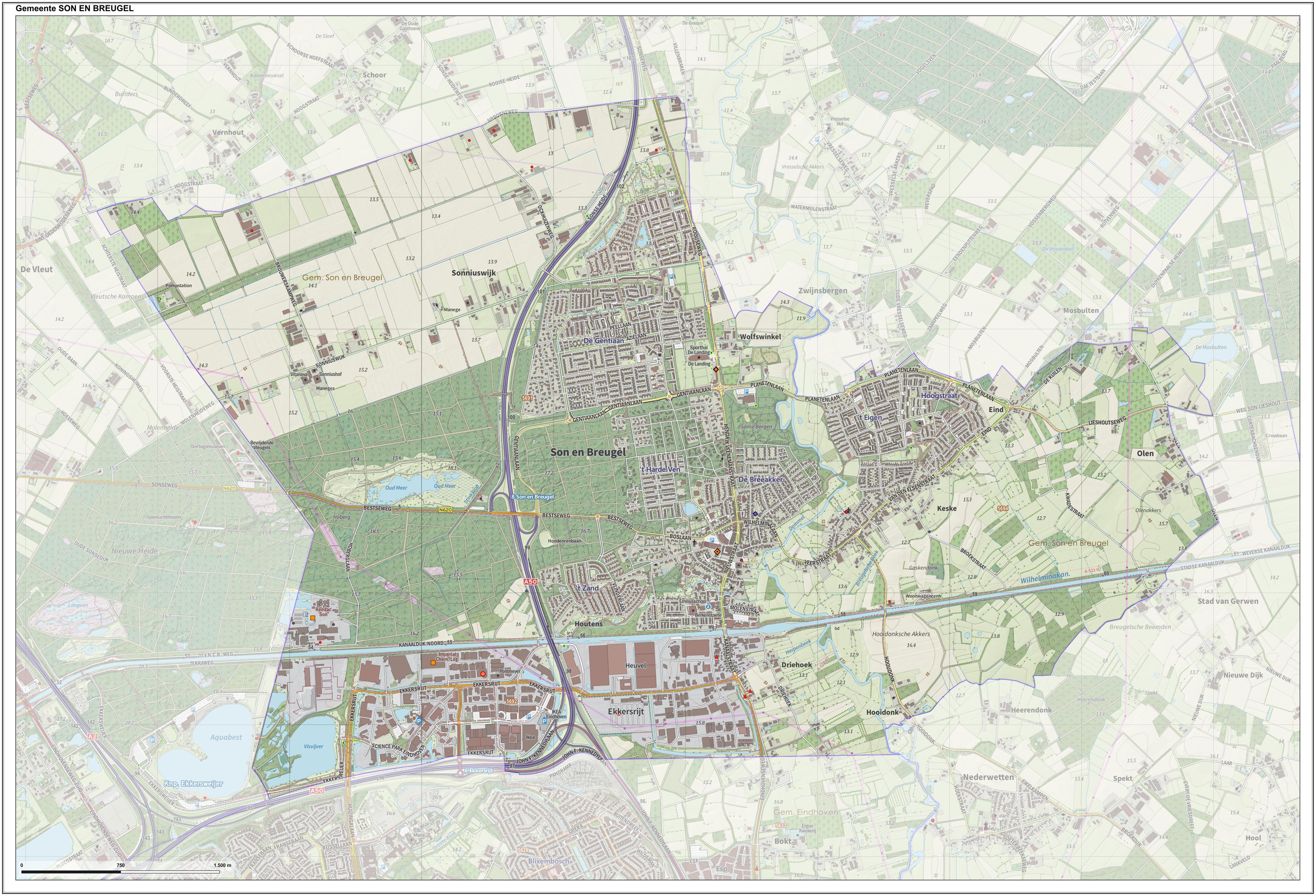
Dutch topographic map of the municipality of Son en Breugel, June 2015
History
The villages of Son and Breugel were founded between the 12th and 14th centuries. The villages developed quickly; some 300 households (150 household for each village) occupied the two villages during the 15th century.
According to Karel van Mander's 1604 Schilder-boeck,[6] the painter Pieter Bruegel the Elder was born in the village of Breugel.
Both Son as well as Breugel were hit badly during the Eighty Years' War, and the number of households in the two villages shrank down to approximately 140 (which translates to approximately 600 - 800 inhabitants). However, both villages managed to recover from this setback.
During the reign of Napoleon, both villages were finally combined into one municipality. Until the beginning of the 20th century, the population stayed relatively stable at about 1,500 inhabitants. However, between 1910 and 1940 the population increased from 1,600 to 3,500 inhabitants when people started moving to the village for economic reasons. It was the scene of heavy fighting at the end of the Second World War, particularly during Operation Market Garden. From 1960 onwards, Son en Breugel continued to grow. As of August 2002, the number of inhabitants was estimated at 15,000.
Future
Currently, the number of households in Son en Breugel has reached 6,000. The combined village is expected to grow by about 3,000 households in the coming years, a growth of 50% (to be confirmed after a MER investigation as of March 2008), the result of which would prevent the municipality from being absorbed within the larger neighbouring municipality of Eindhoven.
Starting early 2009, a new neighbourhood will be developed within the combined village. This neighbourhood, called 'Sonniuspark', will contain 600 households and will be finished in 2013.
Politics
| Party | Seats | |
|---|---|---|
| Village Vision Son en Breugel | 6 / 17 | |
| People's Party for Freedom and Democracy | 3 / 17 | |
| Christian Democratic Appeal | 3 / 17 | |
| Village Interests Son en Breugel | 2 / 17 | |
| Labour Party-GreenLeft | 2 / 17 | |
| Democrats 66 | 1 / 17 | |

Notable people born in Son en Breugel
- Franciscus Sonnius (1506-1576) - a theologian, the first Bishop of 's-Hertogenbosch and later the first Bishop of Antwerp
- Antoon van de Ven (1867-1934) - farmer and mayor
- Menno Oosting (1964-1999) - a professional tennis player
- Bart Oomen (1964) - Dutch actor
- Adri Vogels (1941-2022) - soccer player and coach
- Michiel de Vaan (1973) - Dutch linguist and Indo-Europeanist
- Willemijn Verkaik (1975) - Dutch singer and actress[7]
Gallery
 Genovevapastorie-Breugel
 SonenBreugel
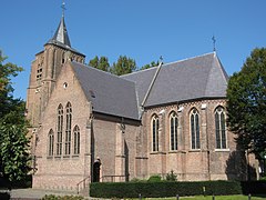 Breugel RKK St. Genovevakerk
 Herdenkingsplaquette-bij-brug-Son-overzicht


References
- "Samenstelling college" [Members of the board] (in Dutch). Gemeente Son en Breugel. Retrieved 4 June 2014.
- "Kerncijfers wijken en buurten 2020" [Key figures for neighbourhoods 2020]. StatLine (in Dutch). CBS. 24 July 2020. Retrieved 19 September 2020.
- "Postcodetool for 5691AL". Actueel Hoogtebestand Nederland (in Dutch). Het Waterschapshuis. Retrieved 4 June 2014.
- "Bevolkingsontwikkeling; regio per maand" [Population growth; regions per month]. CBS Statline (in Dutch). CBS. 1 January 2019. Retrieved 1 January 2019.
- Jos & Cor Swanenberg: Taal in stad en land: Oost-Brabants, ISBN 9012090105
- van Mander's Bruegel biography in Dutch
- IMDb Database retrieved 01 January 2020
External links
 Media related to Son en Breugel at Wikimedia Commons
- Official website
Places adjacent to Son en Breugel | ||||||||||||||||
|---|---|---|---|---|---|---|---|---|---|---|---|---|---|---|---|---|
| ||||||||||||||||
Municipalities of North Brabant | ||
|---|---|---|
|  | |
| ||
Другой контент может иметь иную лицензию. Перед использованием материалов сайта WikiSort.org внимательно изучите правила лицензирования конкретных элементов наполнения сайта.
WikiSort.org - проект по пересортировке и дополнению контента Википедии