world.wikisort.org - Netherlands
Moerdijk (Dutch pronunciation: [muːrˈdɛik] (![]() listen)) is a municipality and a town in the South of the Netherlands, in the province of North Brabant.
listen)) is a municipality and a town in the South of the Netherlands, in the province of North Brabant.
Moerdijk | |
|---|---|
Municipality | |
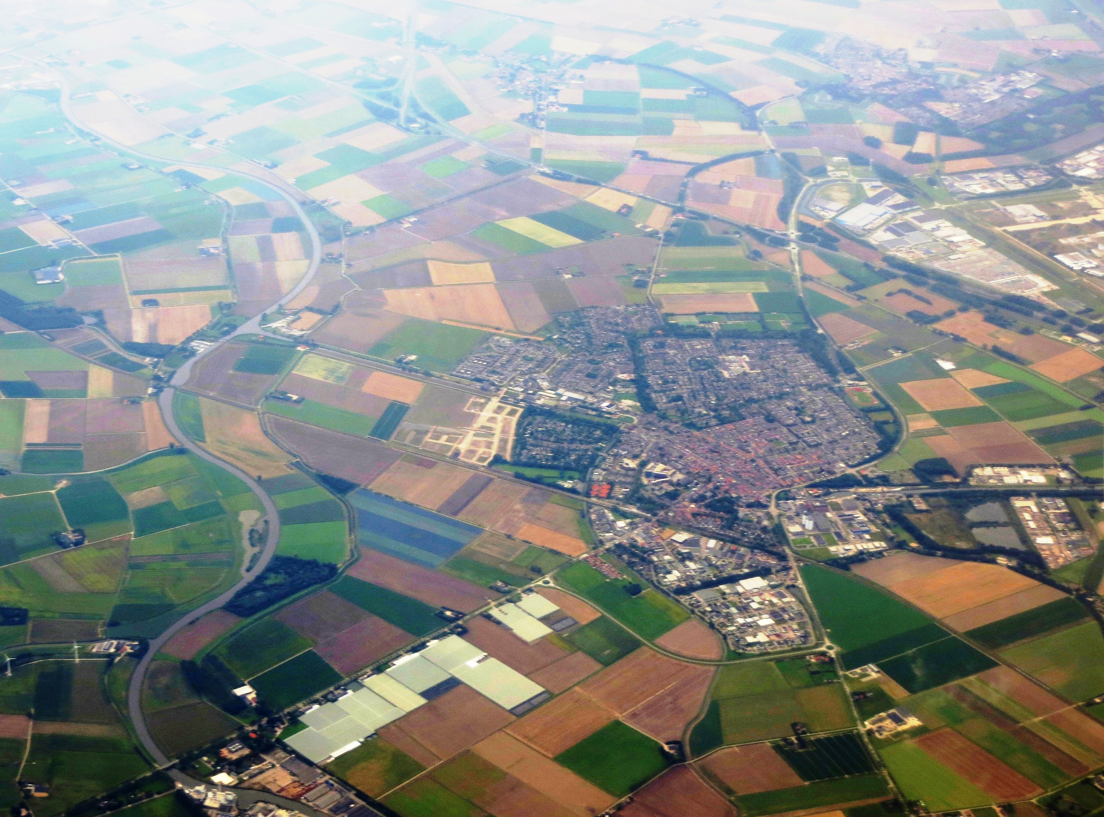 Aerial view over Moerdijk (Zevenbergen in centre) | |
 Flag  Coat of arms | |
 Location in North Brabant | |
| Coordinates: 51°39′N 4°36′E | |
| Country | Netherlands |
| Province | North Brabant |
| Government | |
| • Body | Municipal council |
| • Mayor | Aart-Jan Moerkerke (VVD) |
| Area | |
| • Total | 184.03 km2 (71.05 sq mi) |
| • Land | 159.15 km2 (61.45 sq mi) |
| • Water | 24.88 km2 (9.61 sq mi) |
| Elevation | 1 m (3 ft) |
| Population (January 2019)[4] | |
| • Total | 36,961 |
| • Density | 232/km2 (600/sq mi) |
| Time zone | UTC+1 (CET) |
| • Summer (DST) | UTC+2 (CEST) |
| Postcode | 4758–4797 |
| Area code | 0168 |
| Website | www |
History
The municipality of Moerdijk was founded in 1997 following the merger of the municipalities of Fijnaart en Heijningen, Klundert, Standdaarbuiten, Willemstad, and Zevenbergen. At that time the new municipality was called Zevenbergen. The name changed to Moerdijk on 1 April 1998.
- List of mayors of Moerdijk
Population centres
- Fijnaart en Heijningen
- Klundert
- Langeweg
- Moerdijk
- Noordhoek
- Standdaarbuiten
- Willemstad
- Zevenbergen
- Zevenbergschen Hoek
Topography

Dutch Topographic map of the municipality of Moerdijk, June 2015
The village of Moerdijk
The village of Moerdijk is one of the smaller villages of the municipality. Population as of 2002 is 1,205. Moerdijk is however a well-known name in the Netherlands, because of the large Moerdijk industrial area, with a large power plant, and because of the well-known Moerdijk bridges (highway and railway bridges) across the Hollands Diep. This was the last bridge available for the retreat from the vital Scheldt Estuary of the rapidly collapsing German defences near Antwerp in World War II. (Noteworthy as well, the Moerdijk bridges were one of the first targets of guided, or "smart bombs"- by American heavy bombers in late 1944.)
Moerdijk made headlines on January 5, 2011, because of a large fire at Chemie-Pack (a firm processing numerous chemicals) causing a large cloud of toxic smoke to blow over the surrounding area, mostly to the north of Moerdijk.
Above the Moerdijk (meaning "north of Moerdijk") is used as an expression in Belgium and the southern parts of the Netherlands to mean "in the Netherlands" or "in Holland".
Below the Moerdijk (meaning "south of Moerdijk" or "below the major rivers") is also a Dutch expression for the Catholic provinces North Brabant and Limburg. This expression is used particularly around Mardi Gras in relation to the region's traditional carnival culture, which (with a few local exceptions) does not exist north of the major rivers.
Across the Moerdijk is used by either party to mean the other one.
Zevenbergen
Zevenbergen is the largest town of the municipality (population as of 2002[update]: 14,006). It is located about 10 km northwest of Breda. It received city rights in 1427.
Zevenbergen has a train station with connections to Dordrecht and Roosendaal.
Transport
Railway Dordrecht to Roosendaal (part of line 11), with stations and official station abbreviations:
- Dordrecht (Ddr) (mun. Dordrecht)
- Dordrecht Zuid (Ddzd) (mun. Dordrecht)
- Lage Zwaluwe (Zlw) (mun. Moerdijk)
- Zevenbergen (Zvb) (mun. Moerdijk)
- Oudenbosch (Odb) (mun. Halderberge)
- Roosendaal (Rsd) (mun. Roosendaal)edit
Close to Hollands Diep, the area is now used for industrial movements by water, with great inland access as well the access into the North Sea, transport company Van der Vlist have their own port located in the area, and many other transport companies have nearby offices.
Notable people


- Emanuel Sweert (1552 in Zevenbergen – 1612) a Dutch painter and nurseryman
- François Vranck (ca. 1555 in Zevenbergen – 1617) a Dutch lawyer and statesman, helped found the Dutch Republic
- Hendrick Berckman (1629 in Klundert – 1679) a Dutch Golden Age painter
- Jaap Burger (1904 in Willemstad – 1986) a Dutch politician
- Leo Riemens (1910 in Zevenbergen – 1985) a Dutch musicologist and cultural journalist
- Fons van der Stee (1928 in Zevenbergen – 1999) a Dutch politician
- Ad Bax (born 1956 in Zevenbergen) a Dutch-American molecular biophysicist
- Frans Bauer (born 1973 in Roosendaal) a Dutch singer of levenslied
- O'G3NE (formed 2007 in Fijnaart) a Dutch three-piece girl group
Sport
- Piet van der Horst (1903 in Klundert – 1983) a Dutch racing cyclist, silver medallist at the 1928 Summer Olympics
- Nico van Gageldonk (1913 in Klundert – 1995) a Dutch cyclist, competed at the 1936 Summer Olympics
- Angelique Seriese (born 1968 in Zevenbergen) a former Dutch judoka, gold medallist at the 1988 Summer Olympics
Gallery
 Vue de Willemsdorp, et du passage du Moerdyk
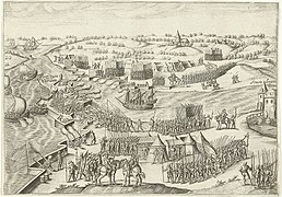 Defense of the Fort Noordam in 1590 against the Spanish army
 Landmeterskaart van de polder van West Heijningen, 1723


References
- "Portefeuilleverdeling College" [Task division board] (in Dutch). Gemeente Moerdijk. Retrieved 30 May 2014.
- "Kerncijfers wijken en buurten 2020" [Key figures for neighbourhoods 2020]. StatLine (in Dutch). CBS. 24 July 2020. Retrieved 19 September 2020.
- "Postcodetool for 4761BJ". Actueel Hoogtebestand Nederland (in Dutch). Het Waterschapshuis. Retrieved 30 May 2014.
- "Bevolkingsontwikkeling; regio per maand" [Population growth; regions per month]. CBS Statline (in Dutch). CBS. 1 January 2019. Retrieved 1 January 2019.
External links
 Media related to Moerdijk at Wikimedia Commons
- Official website
Places adjacent to Moerdijk | ||||||||||||||||
|---|---|---|---|---|---|---|---|---|---|---|---|---|---|---|---|---|
| ||||||||||||||||
Municipalities of North Brabant | ||
|---|---|---|
|  | |
| ||
This North Brabant location article is a stub. You can help Wikipedia by expanding it. |
На других языках
[de] Moerdijk
Moerdijk ( anhören?/i) ist eine Gemeinde in den Niederlanden, Noord-Brabant. Ihre Gesamtfläche ist etwa 184 km². Sie hat 37.314 Einwohner (Stand 1. Januar 2022).- [en] Moerdijk
Другой контент может иметь иную лицензию. Перед использованием материалов сайта WikiSort.org внимательно изучите правила лицензирования конкретных элементов наполнения сайта.
WikiSort.org - проект по пересортировке и дополнению контента Википедии