world.wikisort.org - Netherlands
Heemstede (Dutch pronunciation: [ˈɦeːmsteːdə] (![]() listen)) is a town and a municipality in the Netherlands, in the province of North Holland. It is the fourth richest municipality of the Netherlands.[citation needed]
listen)) is a town and a municipality in the Netherlands, in the province of North Holland. It is the fourth richest municipality of the Netherlands.[citation needed]
Heemstede | |
|---|---|
Municipality | |
 | |
 Flag  Coat of arms | |
 Location in North Holland | |
| Coordinates: 52°21′N 4°37′E | |
| Country | Netherlands |
| Province | North Holland |
| Government | |
| • Body | Municipal council |
| • Mayor | Astrid Nienhuis (VVD) |
| Area | |
| • Total | 9.64 km2 (3.72 sq mi) |
| • Land | 9.18 km2 (3.54 sq mi) |
| • Water | 0.46 km2 (0.18 sq mi) |
| Elevation | 1 m (3 ft) |
| Population (January 2019)[4] | |
| • Total | 27,286 |
| • Density | 2,972/km2 (7,700/sq mi) |
| Demonym(s) | Heemstedenaar, Heemsteder |
| Time zone | UTC+1 (CET) |
| • Summer (DST) | UTC+2 (CEST) |
| Postcode | 2100–2106 |
| Area code | 023 |
| Website | www |
 | |
History
Heemstede formed around the Castle Heemstede that was built overlooking the Spaarne River around 1286. Before 1296, Floris V, Count of Holland, granted Heemstede as a fiefdom to Reinier of Holy. During the 14th century, a village formed near the castle, which was destroyed and rebuilt several times in this period. A resident of this castle was Adriaan Pauw, who bought it in 1620. In 1653, Bennebroek split off from Heemstede, becoming a separate fiefdom.
Growth was slow, and in 1787 Heemstede counted 196 families. Even at that early date Heemstede had already gained the reputation it has today, of being primarily a "bedroom community" for the cities of Haarlem and Amsterdam. Wealthy city families left the cities in the summer, escaping "canal fever" which caused illness from the putrid canals. As a result, many estates were built in the 17th and 18th centuries, some of which (partially) remain until today such as Oud-Berkenroede, Berkenrode, Ipenrode, Huis te Manpad, Hartekamp, Bosbeek, Meer en Bosch, Meer en Berg, and Gliphoeve.
In 1857, the municipality Berkenrode was merged with Heemstede. In 1927, the northern portion of Heemstede, including a large part of the Haarlem Forest, was in turn added to the city of Haarlem.
Monuments and parks
- Groenendaal park: Designed by John Hope, it was formed by merging several country estates into one.
- Vrijheidsbeeld (Freedom Statue), statue by Mari Andriessen to celebrate freedom and commemorate Heemstede victims of the Dutch Revolt. Located on the Vrijheidsdreef in Groenendaal park.
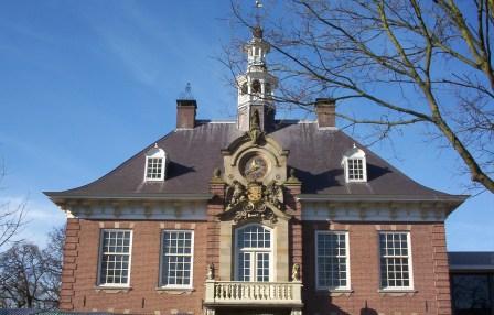
- Slot Heemstede: The site of the Heemstede castle.
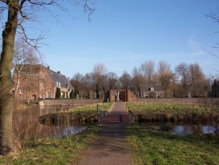
- Hartekamp: Heemstede summer home of George Clifford, who hired Linnaeus to write his 'Hortus Cliffortianus', a detailed catalogue of the plant specimens in the herbarium and gardens of Hartecamp. George Clifford's house is closed to the public, but the surrounding gardens are used as a campus and are open to visitors.
- Linnaeusbos (Linnaeus Forest): Originally a part of Hartekamp that was planted by George Clifford and documented by Linnaeus. In 2007, Heemstede celebrated Linnaeus's 300th birthday.
- De Naald: The 'needle' is a monument placed by D.J. van Lennep to honor Witte van Haemstede, the savior of Haarlem at a battle which on April 26, 1304 and to honor the wounded of another battle fought against the Spanish on July 8, 1573. Both battles supposedly took place right at the corner of David Jacob van Lennep's house Huis te Manpad, where the monument stands.
Transport
The town is served by Heemstede-Aerdenhout railway station, which lies on the Oude Lijn between Haarlem and Leiden.
Local government
The municipal council of Heemstede consists of 21 seats, which are divided as follows:
- Heemsteeds Burger Belang HBB - 5 seats
- VVD - 5 seats
- D66 - 4 seat
- GroenLinks - 3 seats
- CDA - 2 seats
- PvdA - 2 seats
Notable residents


- Adriaan Pauw (1585–1653) bought the town in 1621, Grand Pensionary of Holland 1631 to 1636
- Jan Hope (1737–1784) a Dutch banker, summered in his Groenendaal Park 1767 to 1784
- Christiaan van Pol (1752–1813) a flower painter and teacher
- Thomas Hope (1769–1830/1831) a Dutch and British merchant banker, author, philosopher and art collector [5]
- Ivan Smirnov (1895–1956) a Russian WWI flying ace and naturalized Dutch aviator, lived in Heemstede 1936-1947
- Johan Limpers (1915–1944) Dutch sculptor and WWII resistance fighter
- Jan Knappert (1927-2005) an Esperantist and expert on the Swahili language
- Pieter Kooijmans (1933-2013) Dutch politician, jurist and diplomat
- Jan Gmelich Meijling (1936–2012) a Dutch politician and naval officer
- Els Moor (1937 – 9 March 2016) was a Dutch-born Surinamese educator, editor and book publisher[6]
- Astrid Schulz (born 1939) a Dutch model and actress, Playboy Playmate of the Month in September 1964
- Gijs Kuenen (born 1940) a Dutch microbiologist and academic
- Mieke Bal (born 1946) a Dutch cultural theorist, video artist and academic
- Joost Swarte (born 1947) a Dutch cartoonist and graphic designer
- Dick Maas (born 1951) a Dutch film director, screenwriter and film producer[7]
- Floortje Dessing (born 1970) a Dutch radio and TV presenter, producer and travel writer[8]
- Thierry Baudet (born 1983) Dutch politician and leader of the Forum for Democracy
- Julian Ras - Dutch Wiki (born 2001) a Dutch actor[9]

Sport
- Joop van Dort (1889–1967) a footballer, team bronze medallist at the 1920 Summer Olympics
- Roepie Kruize (1925-1992) field hockey player and coach, team bronze medallist at the 1948 Summer Olympics and team silver medallist at the 1952 Summer Olympics
- Johan Neeskens (born 1951) a Dutch former footballer with 480 club caps and manager
- Annemieke Fokke (born 1967) a Dutch field hockey player, team bronze medallist at the 1988 Summer Olympics
- Jeroen Bleekemolen (born 1981) a Dutch professional racing driver
- Frank Korpershoek (born 1984) a Dutch professional footballer, 351 caps with SC Telstar
Image gallery
 Church: Onze Lieve Vrouw Hemelvaartskerk
 Windmill, Groenendaal landmark
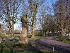 Vrijheidsbeeld by Andriessen
 Oude Slot, site of the former Castle of Heemstede
 Hartekamp or Hartecamp, Heemstede/Bennebroek
 Heemstede, panoramio
 Countryhouse: Huys te Manpad
 Watertower
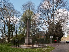 Memorial near Herenweg-Manpadslaan


References
- "Samenstelling & portefeuilles" [Members and tasks] (in Dutch). Gemeente Heemstede. Retrieved 5 March 2014.
- "Kerncijfers wijken en buurten 2020" [Key figures for neighbourhoods 2020]. StatLine (in Dutch). CBS. 24 July 2020. Retrieved 19 September 2020.
- "Postcodetool for 2101HA". Actueel Hoogtebestand Nederland (in Dutch). Het Waterschapshuis. Archived from the original on 21 September 2013. Retrieved 5 March 2014.
- "Bevolkingsontwikkeling; regio per maand" [Population growth; regions per month]. CBS Statline (in Dutch). CBS. 1 January 2019. Retrieved 1 January 2019.
- . Encyclopædia Britannica. Vol. 13 (11th ed.). 1911.
- "Moor, Elisabeth Henriette Pauline (1937-2016)". Digital Women Lexicon of the Huygens Institute (in Dutch). Retrieved 24 March 2021.
- IMDb Database retrieved 03 February 2020
- IMDb Database retrieved 03 February 2020
- IMDb Database retrieved 03 February 2020
External links
 Media related to Heemstede, North Holland at Wikimedia Commons
- Official website
Places adjacent to Heemstede | ||||||||||||||||
|---|---|---|---|---|---|---|---|---|---|---|---|---|---|---|---|---|
| ||||||||||||||||
Municipalities of North Holland | ||
|---|---|---|
|  | |
| ||
| Authority control |
|
|---|
На других языках
[de] Heemstede
Heemstede ( anhören?/i) ist eine Gemeinde in der niederländischen Provinz Nordholland, in der Region Zuid-Kennemerland, am Rande des gleichnamigen Nationalparks. Heemstede liegt südlich der Stadt Haarlem, mit dem es vollständig zusammengewachsen ist. Die Gemeinde zählt 27.560 Einwohner (Stand 1. Januar 2022) und hat eine Fläche von 9,64 km² (davon 0,46 km² Wasser).[2]- [en] Heemstede
[ru] Хемстеде
Хемстеде (нидерл. Heemstede) — город и община в нидерландской провинции Северная Голландия. Расположена к западу от Амстердама. Площадь общины — 9,64 км², из них 9,2 км² составляет суша. Население по данным на 1 января 2007 года — 25 555 человек. Средняя плотность населения — 2650,9 чел/км².Другой контент может иметь иную лицензию. Перед использованием материалов сайта WikiSort.org внимательно изучите правила лицензирования конкретных элементов наполнения сайта.
WikiSort.org - проект по пересортировке и дополнению контента Википедии