world.wikisort.org - Netherlands
Doldersum is a hamlet in the Dutch province of Drenthe. It is a part of the municipality of Westerveld, and lies about 24 km northwest of Hoogeveen.
Doldersum | |
|---|---|
Hamlet | |
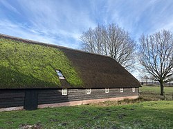 Farm in Doldersum | |
 The village (dark red) and the statistical district (light green) of Doldersum in the municipality of Westerveld. | |
 Doldersum Location in province of Drenthe in the Netherlands  Doldersum Doldersum (Netherlands) | |
| Coordinates: 52°53′N 6°15′E | |
| Country | Netherlands |
| Province | Drenthe |
| Municipality | Westerveld |
| Area | |
| • Total | 9.28 km2 (3.58 sq mi) |
| Elevation | 6 m (20 ft) |
| Population (2021)[1] | |
| • Total | 125 |
| • Density | 13/km2 (35/sq mi) |
| Time zone | UTC+1 (CET) |
| • Summer (DST) | UTC+2 (CEST) |
| Postal code | 8386[1] |
| Dialing code | 0521 |
It was first mentioned in 1402 as Doldersem. The etymology is unknown.[3]
On 7 to 8 September 1944, 21 young men escaped from a forced labour camp in Vledder. The resistance hid them in the forest of Doldersum. One of the hiding places was discovered, and seven were shot. One survived, but remained handicapped. A monument has been placed on the heath in their honour.[4]
References
- "Kerncijfers wijken en buurten 2021". Central Bureau of Statistics. Retrieved 12 March 2022.
- "Postcodetool for 8386XA". Actueel Hoogtebestand Nederland (in Dutch). Het Waterschapshuis. Retrieved 10 March 2022.
- "Doldersum - (geografische naam)". Etymologiebank (in Dutch). Retrieved 12 March 2022.
- "Doldersum". Plaatsengids (in Dutch). Retrieved 12 March 2022.
Wikimedia Commons has media related to Doldersum.
This Drenthe location article is a stub. You can help Wikipedia by expanding it. |
Текст в блоке "Читать" взят с сайта "Википедия" и доступен по лицензии Creative Commons Attribution-ShareAlike; в отдельных случаях могут действовать дополнительные условия.
Другой контент может иметь иную лицензию. Перед использованием материалов сайта WikiSort.org внимательно изучите правила лицензирования конкретных элементов наполнения сайта.
Другой контент может иметь иную лицензию. Перед использованием материалов сайта WikiSort.org внимательно изучите правила лицензирования конкретных элементов наполнения сайта.
2019-2026
WikiSort.org - проект по пересортировке и дополнению контента Википедии
WikiSort.org - проект по пересортировке и дополнению контента Википедии