world.wikisort.org - Netherlands
Wilhelminaoord is a village in the Dutch province of Drenthe. It is a part of the municipality of Westerveld, and lies about 26 km northwest of Hoogeveen.
Wilhelminaoord | |
|---|---|
Village | |
 Farm in Wilhelminaoord | |
 The village centre (dark green) and the statistical district (light green) of Wilhelminaoord in the municipality of Westerveld. | |
 Wilhelminaoord Location in province of Drenthe in the Netherlands  Wilhelminaoord Wilhelminaoord (Netherlands) | |
| Coordinates: 52°51′N 6°10′E | |
| Country | Netherlands |
| Province | Drenthe |
| Municipality | Westerveld |
| Established | 1821 |
| Area | |
| • Total | 2.49 km2 (0.96 sq mi) |
| Elevation | 5 m (16 ft) |
| Population (2021)[1] | |
| • Total | 935 |
| • Density | 380/km2 (970/sq mi) |
| Time zone | UTC+1 (CET) |
| • Summer (DST) | UTC+2 (CEST) |
| Postal code | 8384[1] |
| Dialing code | 0521 |
| Major roads | N353 |
Wilhelminaoord was one of the farming colonies established by the Society of Benevolence in 1821 to decrease poverty by providing sustainable employment for able-bodied poor people. Along with the other colonies constructed by the Society, it was inscribed on the UNESCO World Heritage List in 2021 because of its testimony to a unique method of housing reform and its urban planning. [3][4] The settlement was named after Wilhelmina of Prussia.[4]
The Colony Church is a Dutch Reformed church which dates from 1853. Attendance used to be mandatory. In 2009, it was decommissioned and is nowadays used for weddings, conferences and parties.[5]
Gallery
 Church of Wilhelminaoord
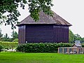 Hay shed
 Farm in Wilhelminaoord
 School


References
- "Kerncijfers wijken en buurten 2021". Central Bureau of Statistics. Retrieved 12 April 2022.
- "Postcodetool for 8384DA". Actueel Hoogtebestand Nederland (in Dutch). Het Waterschapshuis. Retrieved 12 April 2022.
- "Colonies of Benevolence". UNESCO World Heritage Centre. United Nations Educational, Scientific, and Cultural Organization. Retrieved 14 August 2021.
- "Wilhelminaoord - (geografische naam)". Etymologiebank (in Dutch). Retrieved 12 April 2022.
- "Wilhelminaoord". Plaatsengids (in Dutch). Retrieved 12 April 2022.
Authority control | |
|---|---|
| General |
|
| National libraries | |
This Drenthe location article is a stub. You can help Wikipedia by expanding it. |
Другой контент может иметь иную лицензию. Перед использованием материалов сайта WikiSort.org внимательно изучите правила лицензирования конкретных элементов наполнения сайта.
WikiSort.org - проект по пересортировке и дополнению контента Википедии