world.wikisort.org - Japan
Tōin (東員町, Tōin-chō) is a town located in Inabe District, Mie Prefecture, Japan. As of 31 May 2021[update], the town had an estimated population of 25,887 in 10027 households and a population density of 1100 persons per km².[1] The total area of the town was 22.66 square kilometres (8.75 sq mi).
This article needs additional citations for verification. (October 2022) |
Tōin
東員町 | |
|---|---|
Town | |
 Tōin Town Office | |
 Flag  Seal | |
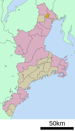 Location of Tōin in Mie Prefecture | |
 Tōin | |
| Coordinates: 35°4′N 136°36′E | |
| Country | Japan |
| Region | Kansai |
| Prefecture | Mie |
| District | Inabe |
| Area | |
| • Total | 22.66 km2 (8.75 sq mi) |
| Population (August 2021) | |
| • Total | 25,887 |
| • Density | 1,100/km2 (3,000/sq mi) |
| Time zone | UTC+9 (Japan Standard Time) |
| Symbols | |
| • Tree | Prunus mume |
| • Flower | Paeonia lactiflora |
| • Bird | Eurasian skylark |
| Phone number | 0594-86-2800 |
| Address | 1600 Yamada, Tōin-chō, Inabe-gun, Mie-ken 511-0295 |
| Website | Official website |
Geography
Tōin is located near the far northeastern tip of the Kii Peninsula. The Inabe River flows eastward in the center of the town, and as it goes to the north it forms a gentle hill with an elevation of about 100 meters. The city with an administrative area is approximately five kilometers east-west by 7.3 kilometers north-south.
Neighboring municipalities
Mie Prefecture
Climate
Tōin has a Humid subtropical climate (Köppen Cfa) characterized by warm summers and cool winters with light to no snowfall.
Demographics
Per Japanese census data,[2] the population of Tōin has remained steady over the past 40 years.
| Year | Pop. | ±% |
|---|---|---|
| 1950 | 9,016 | — |
| 1960 | 8,255 | −8.4% |
| 1970 | 9,562 | +15.8% |
| 1980 | 15,538 | +62.5% |
| 1990 | 25,447 | +63.8% |
| 2000 | 26,304 | +3.4% |
| 2010 | 25,662 | −2.4% |
History
The area of Tōin is part of ancient Ise Province and was largely administered by Kuwana Domain during the Edo period. With the creation of the modern municipalities system on April 1, 1889, the villages of Daicho, Inabe and Kanda were established within Inabe District, Mie. These villages merged to form the village of Tōin on November 3, 1954. Tōin was elevated to town status on April 1, 1967.
Government
Tōin has a mayor-council form of government with a directly elected mayor and a unicameral town council of 14 members. Tōin, collectively with the city of Inabe, contributes two members to the Mie Prefectural Assembly. In terms of national politics, the town is part of Mie 4rd
Education
Tōin has six public elementary schools and two public middle schools operated by the town government. The town does not have a high school.
Transportation
Railway
![]() Sangi Railway – Hokusei Line
Sangi Railway – Hokusei Line
Highway
 National Route 365
 National Route 421
Notable people
- Matsumoto Kōshirō VII, kabuki actor
- Tomoki Hoshino, professional baseball player
References
- "Tōin town official statistics" (in Japanese). Japan.
- Tōin population statistics
External links
![]() Media related to Tōin, Mie at Wikimedia Commons
Media related to Tōin, Mie at Wikimedia Commons
- Tōin official website (in Japanese)
Tsu (capital) | ||
| Special city | ||
| Cities | ||
| Districts | ||
List of mergers in Mie Prefecture | ||
На других языках
- [en] Tōin, Mie
[ru] Тоин
Тоин (яп. 東員町 То:ин-тё:) — посёлок в Японии, находящийся в уезде Инабе префектуры Миэ. Площадь посёлка составляет 22,66 км²[1], население — 25 485 человек (1 июня 2014)[2], плотность населения — 1124,67 чел./км².Другой контент может иметь иную лицензию. Перед использованием материалов сайта WikiSort.org внимательно изучите правила лицензирования конкретных элементов наполнения сайта.
WikiSort.org - проект по пересортировке и дополнению контента Википедии