world.wikisort.org - Japan
Nichinan (日南町, Nichinan-chō) is a town located in Hino District, Tottori Prefecture, Japan. As of 2016, the town had an estimated population of 4,665 and a density of 13.7 persons per square kilometre. The total area is 340.87 square kilometres (131.61 sq mi), representing 10% of the total area of Tottori Prefecture, and making it the largest administrative district in the prefecture. 90% of the town is covered by forest,[1] and 5% of the land is arable.[2] Areas of Nichinan are part of Hiba-Dogo-Taishaku Quasi-National Park.
Nichinan
日南町 | |
|---|---|
Town | |
 | |
 Flag | |
 Location of Nichinan in Tottori Prefecture | |
 Nichinan | |
| Coordinates: 35°10′N 133°18′E | |
| Country | Japan |
| Region | Chūgoku San'in |
| Prefecture | Tottori Prefecture |
| District | Hino |
| Area | |
| • Total | 340.96 km2 (131.65 sq mi) |
| Population (June 1, 2016) | |
| • Total | 4,665 |
| • Density | 13.7/km2 (35/sq mi) |
| Time zone | UTC+9 (Japan Standard Time) |
| Phone number | 0859-82-1111 |
| Address | 800 Kasumi, Nichinan, Hino-gun, Tottori-ken 689-5292 |
| Climate | Cfa |
| Website | Town of Nichinan |
Geography
Nichinan is a landlocked town located at the south-western tip of Hino District. The town is mountainous and located on the backbone of the Chūgoku Mountains.
Mountains
- Mount Dōgo (道後山, Dōgōyama)–1,271 m (4,170 ft)
- Mount Hanami (花見山, Hanamiyama)–1,188 m (3,898 ft)
- Mount Inazumi (稲積山, Inazumiyama)–1,143.3 m (3,751 ft)
- Mount Sentsū (船通山, Sentsūzan)–1,142 m (3,747 ft)
- Mount Ōkura (大倉山, Ōkurasan)–1,112 m (3,648 ft)
- Mount Kirin (鬼林山, Kirinzan)–1,031 m (3,383 ft)
- Mount Mikuni (三国山, Mikunisan)–1,004.1 m (3,294 ft)
- Mount Ohaka (御墓山, Ohakayama)–758 m (2,487 ft)[3][4]
Lake
- Lake Nichinan (日南湖, Nichinanko)[5]
Dam
- Sugesawa Dam (菅沢ダム, Sugesawa Damu)[6]
Rivers
The Hino River originates in Nichinan. Four of its major tributaries in Nichinan include:
- Inga River (印賀川, Inga-gawa)
- Iwami River (石見川, Iwami-gawa)
- Kobara River (小原川, Kobara-gawa)
- Kutsuka River (九塚川, Kutsuka-gawa)[7]
Bordering municipalities
Nichinan, while located in Tottori Prefecture, borders three other prefectures: Okayama Prefecture, Hiroshima Prefecture, and Shimane Prefecture.
- Hiroshima Prefecture
- Shōbara
- Tottori Prefecture
- Hino
- Nanbu
- Okayama Prefecture
- Niimi
- Shimane Prefecture
- Okuizumo
- Yasugi
Climate
Nichinan has a Humid climate (Köppen Cfa) characterized by warm, wet summers and cold winters with heavy snowfall. The average annual temperature in Nichinan is 11.3 °C (52.3 °F). The average annual rainfall is 1,894.1 mm (74.57 in) with July as the wettest month. The temperatures are highest on average in August, at around 23.4 °C (74.1 °F), and lowest in January, at around −0.2 °C (31.6 °F).[8] Its record high is 34.9 °C (94.8 °F), reached on 19 August 2020, and its record low is −17.7 °C (0.1 °F), reached on 16 February 2011.[9]
| Climate data for Nichinan (1991−2020 normals, extremes 1978−present) | |||||||||||||
|---|---|---|---|---|---|---|---|---|---|---|---|---|---|
| Month | Jan | Feb | Mar | Apr | May | Jun | Jul | Aug | Sep | Oct | Nov | Dec | Year |
| Record high °C (°F) | 15.3 (59.5) |
19.1 (66.4) |
22.5 (72.5) |
29.7 (85.5) |
31.7 (89.1) |
31.6 (88.9) |
33.9 (93.0) |
34.9 (94.8) |
32.9 (91.2) |
28.8 (83.8) |
23.3 (73.9) |
18.2 (64.8) |
34.9 (94.8) |
| Average high °C (°F) | 3.9 (39.0) |
5.1 (41.2) |
9.7 (49.5) |
16.4 (61.5) |
21.4 (70.5) |
24.3 (75.7) |
27.8 (82.0) |
28.8 (83.8) |
24.3 (75.7) |
18.9 (66.0) |
13.2 (55.8) |
6.9 (44.4) |
16.7 (62.1) |
| Daily mean °C (°F) | −0.2 (31.6) |
0.3 (32.5) |
3.9 (39.0) |
9.6 (49.3) |
15.0 (59.0) |
18.9 (66.0) |
22.9 (73.2) |
23.4 (74.1) |
19.0 (66.2) |
12.9 (55.2) |
7.3 (45.1) |
2.2 (36.0) |
11.3 (52.3) |
| Average low °C (°F) | −4.5 (23.9) |
−4.7 (23.5) |
−1.8 (28.8) |
2.7 (36.9) |
8.6 (47.5) |
14.0 (57.2) |
18.8 (65.8) |
19.1 (66.4) |
14.6 (58.3) |
7.3 (45.1) |
1.9 (35.4) |
−2.1 (28.2) |
6.2 (43.1) |
| Record low °C (°F) | −17.4 (0.7) |
−17.7 (0.1) |
−14.0 (6.8) |
−6.9 (19.6) |
−2.5 (27.5) |
3.2 (37.8) |
6.3 (43.3) |
10.3 (50.5) |
1.0 (33.8) |
−3.2 (26.2) |
−9.2 (15.4) |
−14.5 (5.9) |
−17.7 (0.1) |
| Average precipitation mm (inches) | 137.1 (5.40) |
114.2 (4.50) |
138.2 (5.44) |
121.4 (4.78) |
131.9 (5.19) |
194.1 (7.64) |
253.9 (10.00) |
162.7 (6.41) |
234.4 (9.23) |
147.2 (5.80) |
110.8 (4.36) |
150.7 (5.93) |
1,894.1 (74.57) |
| Average precipitation days (≥ 1.0 mm) | 19.2 | 15.6 | 15.4 | 11.6 | 11.0 | 12.5 | 14.1 | 12.0 | 12.5 | 10.8 | 13.3 | 18.6 | 166.6 |
| Mean monthly sunshine hours | 57.7 | 72.2 | 129.8 | 178.0 | 195.1 | 139.4 | 139.4 | 172.1 | 120.0 | 133.0 | 104.0 | 67.3 | 1,508.5 |
| Source: Japan Meteorological Agency[9][8] | |||||||||||||
Cultural Institutions
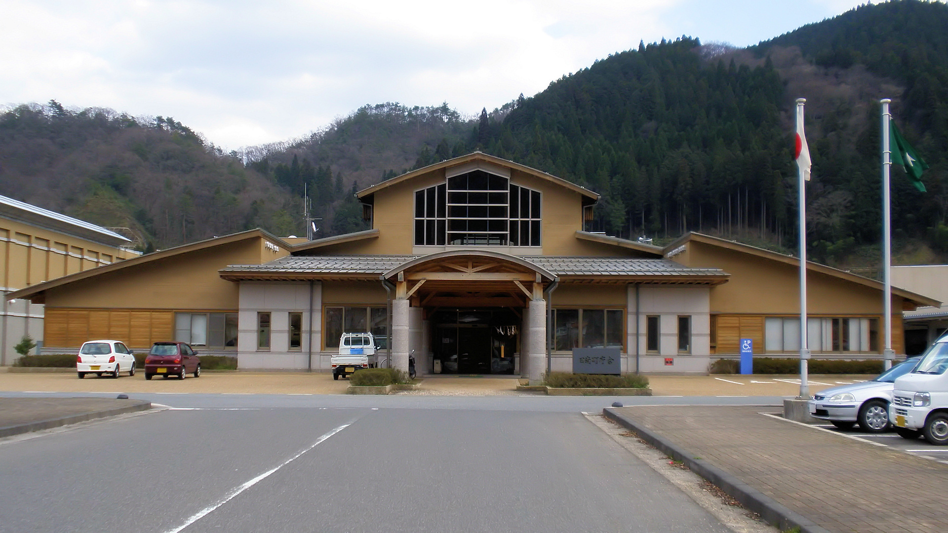
The Nichinan Cultural Center (785 Kasumi, Nichinan, Tottori), located next to the Nichinan Town Hall, houses the town's three main cultural facilities in one building.[10] The Cultural Center is accessible by bus, or a 30-minute walk, from the JR West Hakubi Line Shōyama Station.
Schools
Junior high school
- Nichinan Junior High School
Elementary school
- Nichinan Elementary School (est. 2009, replaced six existing elementary schools)
Preschools
- Nichinan Preschool
- Tari Preschool
- Iwami Preschool
- Fukue Preschool
- Yamanoue Preschool[14]
Notable places
- Sekka Valley[15]
- Nichinan Historic Village[16]
- Nichinan Apple Village[17]
- Hanamiyama Ski Resort[18]
- Sasaraku-jinja[19]
- Gedatsu-ji[20]
Transportation

Rail
- JR West: Hakubi Line
- Kami-Iwami Station–Shōyama Station
Bus
- Nichinan Municipal Bus (日南町営バス, Nichinan Chōei Basu)
Highways
- National Routes
- Japan National Route 180 Kōfu-Miyoshi Bypass -- Kōfu, Tottori to Miyoshi, Hiroshima
- Japan National Route 180
- Japan National Route 183
- Prefectural Routes
- Okayama Prefecture/Tottori Prefecture Route 11
- Okayama Prefecture/Tottori Prefecture Route 8
- Okayama Prefecture/Tottori Prefecture Route 9
- Shimane Prefecture/Tottori Prefecture Route 107
- Shimane Prefecture/Tottori Prefecture Route 15
- Tottori Prefecture Route 210
- Tottori Prefecture Route 211
- Tottori Prefecture Route 223
- Tottori Prefecture Route 257
- Tottori Prefecture Route 286
- Tottori Prefecture Route 48
- Tottori Prefecture/Okayama Prefecture Route 111
- Tottori Prefecture/Shimane Prefecture Route 105
- Tottori Prefecture/Shimane Prefecture Route 106
- Tottori Prefecture/Shimane Prefecture Route Route 108
References
- にちなんの森(in Japanese)
- "Inga-gawa". Nihon Rekishi Chimei Taikei (日本歴史地名大系 "Compendium of Japanese Historical Place Names") (in Japanese). Tokyo: Netto Adobansusha. 2012. Archived from the original on 2007-08-25. Retrieved 2012-02-14.
- 鳥取県の山岳信仰の山一覧(in Japanese)
- "Inga-gawa". Nihon Rekishi Chimei Taikei (日本歴史地名大系 "Compendium of Japanese Historical Place Names") (in Japanese). Tokyo: Netto Adobansusha. 2012. Archived from the original on 2007-08-25. Retrieved 2012-02-14.
- 日南湖(にちなんこ)(in Japanese)
- 菅沢ダム OfficialWeb(in Japanese)
- "Inga-gawa". Nihon Rekishi Chimei Taikei (日本歴史地名大系 "Compendium of Japanese Historical Place Names") (in Japanese). Tokyo: Netto Adobansusha. 2012. Archived from the original on 2007-08-25. Retrieved 2012-02-14.
- 気象庁 / 平年値(年・月ごとの値). JMA. Retrieved March 24, 2022.
- 観測史上1~10位の値(年間を通じての値). JMA. Retrieved March 24, 2022.
- 日南町総合文化センター(in Japanese)
- さつきホール Archived 2011-07-22 at the Wayback Machine(in Japanese)
- 日南町図書館(in Japanese)
- 日南町美術館(in Japanese)
- 保育園(in Japanese)
- "Sekka-kei". Nihon Daihyakka Zensho (Nipponika) (日本大百科全書(ニッポニカ) "Large Encyclopedia of Japan (Nipponika)") (in Japanese). Tokyo: Netto Adobansusha. 2012. Archived from the original on 2007-08-25. Retrieved 2012-02-14.
- ふるさと日南邑[permanent dead link](in Japanese)
- 日南りんご村[permanent dead link](in Japanese)
- 花見山スキー場[permanent dead link](in Japanese)
- 楽楽福神社社叢[permanent dead link](in Japanese)
- "Gedatsu-ji". Nihon Rekishi Chimei Taikei (日本歴史地名大系 "Compendium of Japanese Historical Place Names") (in Japanese). Tokyo: Netto Adobansusha. 2012. Archived from the original on 2007-08-25. Retrieved 2012-01-12.
External links
 Media related to Nichinan, Tottori at Wikimedia Commons
- Nichinan official website (in Japanese)
Tottori (capital) | ||
| Core city |
|  |
| Cities |
| |
| Districts | ||
List of mergers in Tottori Prefecture | ||
Authority control | |
|---|---|
| General | |
| National libraries | |
На других языках
- [en] Nichinan, Tottori
[ru] Нитинан (посёлок)
Нитинан (яп. 日南町 Нитинан-тё:) — посёлок в Японии, находящийся в уезде Хино префектуры Тоттори. Площадь посёлка составляет 340,87 км²[1], население — 4950 человек (1 августа 2014)[2], плотность населения — 14,52 чел./км².Другой контент может иметь иную лицензию. Перед использованием материалов сайта WikiSort.org внимательно изучите правила лицензирования конкретных элементов наполнения сайта.
WikiSort.org - проект по пересортировке и дополнению контента Википедии