world.wikisort.org - India
Thoothukudi District is one of the 38 districts of Tamil Nadu state in southern India. The district was formed by bifurcation of Tirunelveli district on 20 October 1986. Thoothukudi is the district headquarters and largest city of the district. The district is known for fishing as well as pearl cultivation, with an abundance of pearls being found in the seas offshore. Thoothukudi district has many historical sites such as Adichanallur and the ancient trade port of Korkai.[2]
Thoothukudi | |
|---|---|
District of Tamil Nadu | |
    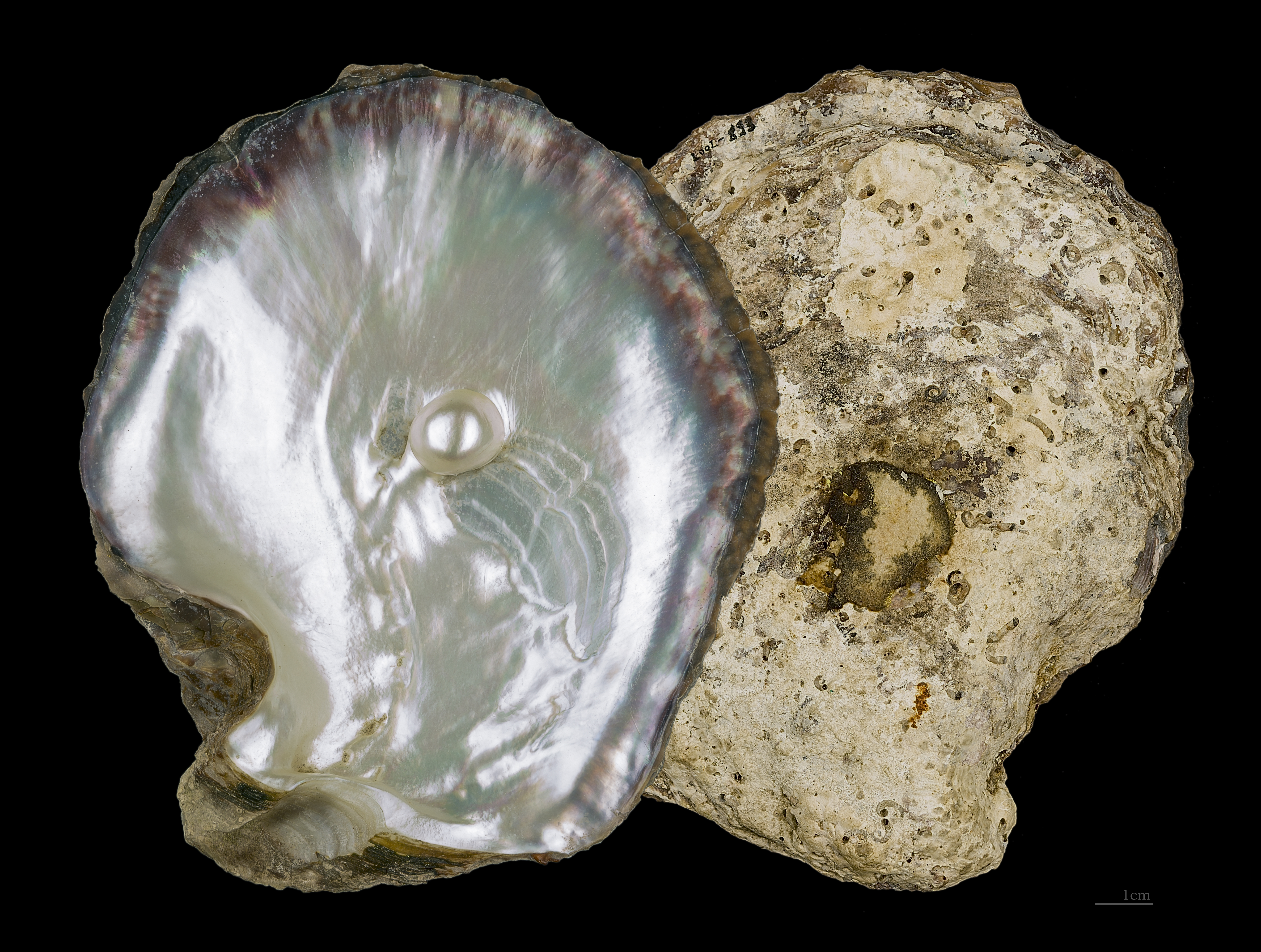 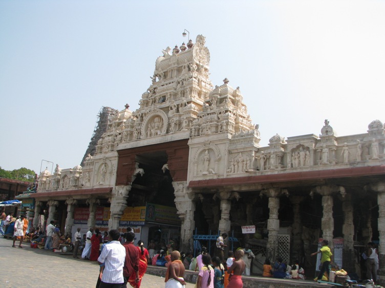 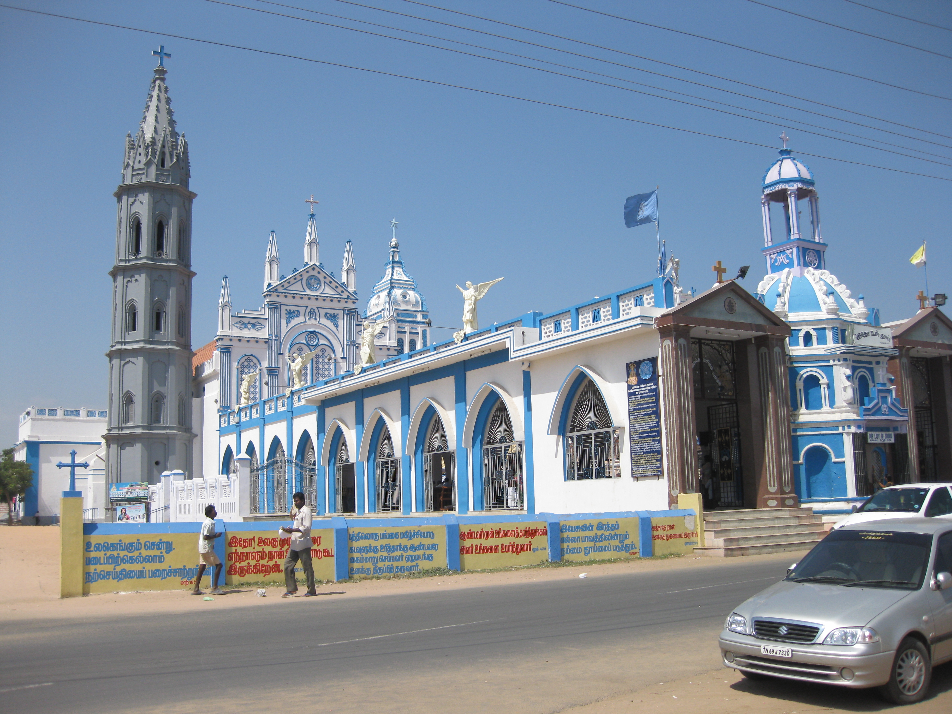 Clockwise from the top Thoothukudi Thermal Power Station, Thoothukudi Airport, Pearl Oyster of Pearl City, Our Lady Of Snows Church, Tiruchendur Murugan temple, Salt Pans in Thoothukudi and V.O. Chidambaranar Port Authority | |
 Thoothukudi district Location in Tamil Nadu | |
| Coordinates: 8°48′10.8″N 78°8′40.2″E | |
| Country | |
| State | |
| Established | 20 October 1986 |
| Founded by | M. G. Ramachandran |
| Headquarters | Thoothukudi |
| Talukas | Thoothukudi, Thiruvaikundam, Kovilpatti, Ottapidaram, Ettayapuram, Vilathikulam, Kayathar, Tiruchendur, Sathankulam, Eral |
| Government | |
| • Type | District Administration |
| • Body | Thoothukudi District Collectorate |
| • District Collector | K. Senthil Raj, I.A.S. |
| • Superintendent of Police | L. Balaji Saravanan, I.P.S. |
| • District Revenue Officer | S. Kannabiran |
| • Project Director | V. Saravanan |
| Area | |
| • Total | 4,707 km2 (1,817 sq mi) |
| • Rank | 8 |
| Population (2011) | |
| • Total | 1,750,176 |
| • Rank | 18 |
| • Density | 372/km2 (960/sq mi) |
| Languages | |
| • Official | Tamil |
| Time zone | UTC+5:30 (IST) |
| PIN | 628xxx |
| Telephone code | 0461 |
| ISO 3166 code | ISO 3166-2:IN-TN |
| Vehicle registration | TN-69, TN-96, TN-92[1] |
| Central location: | 8°48′N 78°8′E |
| Website | thoothukudi |
Geography
Thoothukudi district is situated in the south-eastern corner of Tamil Nadu. It is bounded by the districts of Virudhunagar on the north, Ramanathapuram on the north-east, Tirunelveli on the west and south-west, Tenkasi on the north-west and Gulf of Mannar on the east and southeast. The total area of the district is 4,621 km2 (1,784 sq mi).
Demographics
| Year | Pop. | ±% p.a. |
|---|---|---|
| 1901 | 705,534 | — |
| 1911 | 762,625 | +0.78% |
| 1921 | 787,166 | +0.32% |
| 1931 | 840,656 | +0.66% |
| 1941 | 910,729 | +0.80% |
| 1951 | 957,735 | +0.50% |
| 1961 | 1,052,970 | +0.95% |
| 1971 | 1,228,295 | +1.55% |
| 1981 | 1,370,289 | +1.10% |
| 1991 | 1,475,872 | +0.75% |
| 2001 | 1,592,769 | +0.77% |
| 2011 | 1,750,176 | +0.95% |
| source:[3] | ||
According to 2011 census, Thoothukudi district had a population of 1,750,176 with a sex-ratio of 1,023 females for every 1,000 males, much above the national average of 929.[4] A total of 183,763 were under the age of six, constituting 93,605 males and 90,158 females. It has a large numbers of Nadars (Thiruchendur, Sathankulam, Thoothukudi, Eral), Appanad Maravars (Kovilpatti, Tiruvaikuntam, Ottapidaram, Kayatharu), Vellalars (Ettayapuram, Ottapidaram),Devendra Kula velalars(Thoothukudi, Kovilpatti, Vilathikulam, Ootaipidaram), Nayakars/Naidu (Kovilpatti and Vilathikulam) and Parathars (Thoothukudi and Tiruchendur). Scheduled Castes and Scheduled Tribes accounted for 19.88% and 0.28% of the population, respectively, mostly in Ottapidaram and Puthiyamputhur. The average literacy of the district was 77.12%, compared to the national average of 72.99%.[4] The district had a total of 462,010 households. There were a total of 748,095 workers, comprising 44,633 cultivators, 161,418 main agricultural labourers, 17,872 in house hold industries, 433,524 other workers, 90,648 marginal workers, 3,882 marginal cultivators, 39,226 marginal agricultural labourers, 4,991 marginal workers in household industries and 42,549 other marginal workers.[5]
Water bodies
There are no large reservoirs in this district so the Papanasam and Manimuthar dams located in the Tirunelveli district in the Thamirabarani River's flow are the main sources of irrigation. Other than the Thamirabarani River, the river Vaipar in Vilathikulam taluk, the river Karumeni which traverses through Sathankulam, and Tiruchendur taluks, Palayakayal are all sources.
Politics
| District | No. | Constituency | Name | Party | Alliance | Remarks | ||
|---|---|---|---|---|---|---|---|---|
| Thoothukudi district | 213 | Vilathikulam | Markandayan V | Dravida Munnetra Kazhagam | UPA | |||
| 214 | Thoothukkudi | P. Geetha Jeevan | Dravida Munnetra Kazhagam | UPA | ||||
| 215 | Tiruchendur | Anitha Radhakrishnan | Dravida Munnetra Kazhagam | UPA | ||||
| 216 | Srivaikuntam | S. Amirtharaj | Indian National Congress | UPA | ||||
| 217 | Ottapidaram (SC) | C. Shunmugaiah | Dravida Munnetra Kazhagam | UPA | ||||
| 218 | Kovilpatti | Kadambur C. Raju | All India Anna Dravida Munnetra Kazhagam | NDA | ||||
Administrative divisions
Thoothukudi District is divided into three revenue divisions and ten taluks.[6] There are forty-one revenue firkas and 480 revenue villages.[7]
| Revenue Divisions |
Talukas | Number of Revenue Villages |
|---|---|---|
| Thoothukudi | Thoothukudi | 33 |
| Thiruvaikundam | 46 | |
| Kovilpatti | Kovilpatti | 33 |
| Ottapidaram | 63 | |
| Ettayapuram | 56 | |
| Vilathikulam | 89 | |
| Kayathar | 54 | |
| Tiruchendur | Tiruchendur | 36 |
| Sathankulam | 25 | |
| Eral | 45 |
The district is divided into twelve revenue blocks for rural and urban development. The twelve revenue blocks are Thoothukudi, Tiruchendur, Udangudi, Sathankulam, Thiruvaikundam, Alwarthirunagari, Karunkulam, Ottapidaram, Kovilpatti, Kayathar, Vilathikulam, and Pudur. The district has one municipal corporation: Thoothukudi; three municipalities: Kayalpattinam, Kovilpatti and Tiruchendur; eighteen town panchayats: Alwarthirunagiri, Arumuganeri, Athur, Eral, Ettayapuram, Kadambur, Kalugumalai, Kanam, Kayatharu, Nazerath, Perungulam, Sathankulam, Sayapuram, Srivaikuntam, Thenthiruperai, Udangudi, V. Pudur and Vilathikulam[8] and 403 panchayat villages.[9]
Parliamentary Lok Sabha Constituency
| Constituency Number |
Constituency Name |
Elected Representative |
Term of Office | Lok Sabha (Election) |
Political Party | ||
|---|---|---|---|---|---|---|---|
| Assumed Office |
Left Office | ||||||
| 36 | Thoothukkudi | Kanimozhi Karunanidhi | 18 June 2019 | Incumbent | 17th (2019 election) |
Dravida Munnetra Kazhagam | |
Tamil Nadu Assembly Constituencies
| No. | Constituency Number | Constituency Name | Elected Representative | Political Party | Reserved for (SC/ST/None) | |
|---|---|---|---|---|---|---|
| 1 | 213 | Vilathikulam | V. Markandayan | DMK | None | |
| 2 | 214 | Thoothukkudi | P. Geetha Jeevan | DMK | None | |
| 3 | 215 | Tiruchendur | Anitha R. Radhakrishnan | DMK | None | |
| 4 | 216 | Srivaikuntam | Oorvasi S. Amirtharaj | INC | None | |
| 5 | 217 | Ottapidaram | C. Shunmugaiah | DMK | SC | |
| 6 | 218 | Kovilpatti | Kadambur C. Raju | AIADMK | None | |
Economy
The V. O. Chidambaranar Port Trust contributes majorly to the economy of the district besides providing employment. Thoothukudi hosts industries such as SPIC, Thoothukudi alkaline chemicals, DCW zirconium plant and numerous salt packing companies. Many coal based power plants are at various stages of commissioning. Kovilpatti consists of many small sized industry especially match stick industries.
Agriculture
Paddy is the most cultivated crop in most of the villages like Uzhakkudi, Vallanadu, Aarumugamangalam, Palayakayal, Thiruvaikundam, Sattankulam and Tiruchendur taluks. Cumbu, Cholam, Kuthiraivali and other pulses are raised in the dry tracts of Kovilpatti, Vilathikulam, Nagalapuram Ottapidaram, and Thoothukudi taluks. Cotton is cultivated in Kovilpatti, Ottapidaram and Thoothukudi Taluks. Groundnut cultivation is undertaken in Kovilpatti, Tiruchendur, and Sattankulam taluks. Groundnut cake is being used as manure and cattle feed. Nagalapuram makes its economy to be solely dependent agriculture. Sugarcane and Plantain (Banana) are cultivated on a large scale along the stretch of Uzhakkudi. Banana and Beetel cultivation is more prominent in villages like Aarumugamanagalam and Yeral. Also vegetables like tomato, chillies, brinjal, lady's finger, beans are cultivated in village of Uzhakkudi. Summers are made use to cultivate cotton on a smaller scale. Main business of this area is dry chilly, cholam, cumbu, wood charcoal, etc. With 35% share, the district is the top producer of Cumbu in Tamil Nadu.[10] Palmyrah trees are grown mostly in Tiruchendur, Srivaikundam, Sattankulam and Vilathikulam taluks. Jaggery is produced from palmyrah juice; the production of jaggery is the main occupation of the people of Tiruchendur and Sattankulam taluks. Banana and other vegetables are raised in Srivaikundam and Tiruchendur taluks.
Salt production
The district constitutes 70 percent of the total salt production of Tamil Nadu and 30 percent of that of India. Tamil Nadu is the second largest producer of Salt in India next to Gujarat.
Transport
National Highway 45B, 7A and State Highways SH-32,33,40,44,75,76,77,93,176 connect to other parts of the State. Government buses connect the district with other parts of state. Thoothukudi and Kovilpatti railway station are the major stations of Indian Railways. V.O. Chidambaranar Port Authority in the district was declared as the tenth major seaport in India also provides container services. Tuticorin Airport is situated at Vaigaikulam and currently has flights to and from Chennai and Bengaluru. Thoothukudi is the one of the cities which is having four ways of transportation (Roadways, Railways, Airways and Seaways).
Spaceport
The Government of India is to set up a new Rocket launch pad near Kulasekaranpattinam in Thoothukudi district. The Indian Space Research Organisation (ISRO) has begun work on its second Rocket launching pad or Spaceport, which will be Kulasekaranpattinam, Thoothukudi in Tamil Nadu. Like the Sriharikota spaceport in the Satish Dhawan Space Centre, Thoothukudi was selected as a spaceport due to its nearness to the equator. "A rocket launch site should be on the east coast and near the equator. And Thoothukudi district satisfies that condition", a former ISRO official stated.[11]
Education
There are numerous educational institutions, colleges, schools providing education. The Agricultural College and Research Institute, Killikulam was established in 1984 – 85 as the third constituent College of Tamil Nadu Agricultural University. These include:[12]
Notable people
- Angela Lincy, Sportsperson who set the national record of 1.72m in high jump at the National games in Thiruvananthapuram at the age of 15.
- Appukutty, Film actor
- Beela Rajesh, Former Health and Family Welfare Secretary of Tamil Nadu
- Charle, Film actor
- Cottalango Leon, Oscar awardee
- Dinesh Karthik, National cricketer
- Hari, Film director
- J. Kanakaraj, Former State Election Commissioner of Andhra Pradesh
- J. P. Chandrababu, Film actor
- Jaguar Thangam, Film stunt choreographer
- K. P. Kandasamy, Founder of the dinakaran newspaper group
- Ki. Rajanarayanan, Tamil folklorist and writer
- Ku. Alagirisami, Tamil writer
- Kadambur M. R. Janarthanan, Former Union Minister of State for Personnel, Public Grievances and Pensions
- Kaali Venkat, Film actor
- Kumaragurupara Desikar, Poet and Saivite ascetic
- Mari Selvaraj, Film director
- Maveeran Alagumuthu Kone, Freedom fighter
- Naveen Raja Jacob, Volleyball sportsperson
- Nivetha Pethuraj, Film actress
- Oomaithurai, Indian Poligar
- P. Rajagopal, Founder of Saravana Bhavan
- P. Sri Acharya, Tamil scholar
- Pon Mariappan, Barber who equipped his salon with mini library and got appreciated by PM Narendra Modi in the "Mann Ki Baat" radio programme
- Poomani, Tamil writer and receiver of Sahitya Akademi for his work Agnaadi
- R. Nallakannu, Politician and social activist
- R. Parthiban, Film actor
- Ramanichandran, Tamil romance novelist
- Rajendran, Film actor and stunt double
- S. P. Adithanar, Founder of the Dina Thanthi newspaper group
- S. Anantharamakrishnan, Founder of Amalgamations Group
- Shenbaga, Film actress
- Shiv Nadar, Founder of HCL Technologies
- Sivanthi Aditanar, Tamil media baron
- Stunt Silva, Film stunt actor
- Subramanya Bharathi, Freedom fighter and writer
- Thengai Srinivasan, Film actor
- T. S. Balaiah, Film actor
- Umaru Pulavar, Tamil poet
- V. O. Chidambaram Pillai, Freedom fighter
- Veeran Sundaralingam, Freedom fighter
- Vanchinathan, Freedom fighter
- Veerapandiya Kattabomman, Freedom fighter
- Vivekh, Film actor and social activist
See also
- Thoothukudi massacre
- Custodial death of P Jayaraj and Bennicks
- V. O. Chidambaranar Port Trust
- Tuticorin Airport
- List of districts of Tamil Nadu
References
- Thoothukudi district Archived 12 September 2012 at the Wayback Machine. Government of Tamil Nadu. State Transport Authority.
- Majeed, A. Abdul (1987). "A note on Korkai Excavations". Tamil Civilization. Tamil University, Thanjavur. 5 (1/2): 73–77.
- "Decadal Variation In Population Since 1901". Archived from the original on 8 August 2019. Retrieved 9 August 2019.
- "Census Info 2011 Final population totals". Office of The Registrar General and Census Commissioner, Ministry of Home Affairs, Government of India. 2013. Archived from the original on 13 November 2013. Retrieved 26 January 2014.
- "Census Info 2011 Final population totals - Thoothukudi district". Office of The Registrar General and Census Commissioner, Ministry of Home Affairs, Government of India. 2013. Retrieved 26 January 2014.
- Palanithurai, Ganapathy; Parthiban, T. & Vanishree, Joseph (2007). Empowering Women: Grassroots Experience from Tamil Nadu. New Delhi: Concept Publishing Company. p. 35. ISBN 978-81-8069-454-7.
- "Administration". District Collectorate, Thoothukudi. Archived from the original on 3 April 2012.
- "Thoothukudi District, Tamil Nadu". Thoothukudi.nic.in. Archived from the original on 29 September 2011. Retrieved 20 September 2011.
- "Reports of National Panchayat Directory: Block Panchayats of Tuticorin, Tamil Nadu". Ministry of Panchayati Raj, Government of India. Archived from the original on 13 November 2011.
- Agriculture Archived 9 April 2009 at the Wayback Machine. Government of Tamil Nadu. State Transport Authority.
- "Why Thoothukudi was chosen as ISRO's second spaceport". www.thenewsminute.com. Archived from the original on 2 December 2019. Retrieved 6 December 2019.
- "Agricultural College & Research Institute, Killikulam". sites.google.com.
External links
Places adjacent to Thoothukudi district | ||||||||||||||||
|---|---|---|---|---|---|---|---|---|---|---|---|---|---|---|---|---|
| ||||||||||||||||
Capital: Chennai | ||
| State symbols | ||
| Governance |
| |
| Topics |
| |
| Major cities | ||
| Districts |
| |
| Lists |
| |
Authority control | |
|---|---|
| General |
|
| National libraries | |
На других языках
[de] Thoothukudi (Distrikt)
Der Distrikt Thoothukudi (Tamil: தூத்துக்குடி மாவட்டம்), bis 1997 Distrikt Chidambaranar, selten auch anglisiert Tuticorin, ist ein Distrikt des indischen Bundesstaates Tamil Nadu. Verwaltungszentrum ist die namensgebende Stadt Thoothukudi. Der Distrikt Thoothukudi hat eine Fläche von 4.745 Quadratkilometern und rund 1,8 Millionen Einwohner (Volkszählung 2011).- [en] Thoothukudi district
[ru] Тутикорин (округ)
Тутикорин (англ. Tuticorin) — округ в индийском штате Тамилнад. Образован 20 октября 1986 года из части территории округа Тирунелвели. Административный центр — город Тутикорин. Площадь округа — 4403 км². По данным всеиндийской переписи 2001 года население округа составляло 1 572 273 человека. Уровень грамотности взрослого населения составлял 81,5 %, что выше среднеиндийского уровня (59,5 %). Доля городского населения составляла 42,3 %. Южнее административного центра строится при помощи России атомная станция Куданкулам.Другой контент может иметь иную лицензию. Перед использованием материалов сайта WikiSort.org внимательно изучите правила лицензирования конкретных элементов наполнения сайта.
WikiSort.org - проект по пересортировке и дополнению контента Википедии