world.wikisort.org - India
Tahirpur is a village in Bahadurpur block of Rae Bareli district, Uttar Pradesh, India.[2] As of 2011, its population is 327, in 65 households.[2] It has no schools and no healthcare facilities.[2]
Tahirpur | |
|---|---|
Village | |
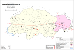 Map showing Tahirpur (#144190) in Bahadurpur CD block | |
 Tahirpur Location in Uttar Pradesh, India | |
| Coordinates: 26.238823°N 81.529181°E[1] | |
| Country India | |
| State | Uttar Pradesh |
| District | Raebareli |
| Area | |
| • Total | 0.261 km2 (0.101 sq mi) |
| Population (2011)[2] | |
| • Total | 327 |
| • Density | 1,300/km2 (3,200/sq mi) |
| Languages | |
| • Official | Hindi |
| Time zone | UTC+5:30 (IST) |
| Vehicle registration | UP-35 |
The 1961 census recorded Tahirpur as comprising 1 hamlet, with a total population of 65 people (37 male and 28 female), in 14 households and 14 physical houses.[3] The area of the village was given as 86 acres.[3]
References
- Do a radial search using these coordinates here https://geonames.nga.mil/namesgaz/.
{{cite web}}: Missing or empty|title=(help) - "Census of India 2011: Uttar Pradesh District Census Handbook - Rae Bareli, Part A (Village and Town Directory)" (PDF). Census 2011 India. pp. 159–67. Retrieved 4 August 2021.
- Census 1961: District Census Handbook, Uttar Pradesh (39 - Raebareli District) (PDF). Lucknow. 1965. pp. xcviii-xcix of section "Salon Tahsil". Retrieved 4 August 2021.
This Raebareli district location article is a stub. You can help Wikipedia by expanding it. |
Текст в блоке "Читать" взят с сайта "Википедия" и доступен по лицензии Creative Commons Attribution-ShareAlike; в отдельных случаях могут действовать дополнительные условия.
Другой контент может иметь иную лицензию. Перед использованием материалов сайта WikiSort.org внимательно изучите правила лицензирования конкретных элементов наполнения сайта.
Другой контент может иметь иную лицензию. Перед использованием материалов сайта WikiSort.org внимательно изучите правила лицензирования конкретных элементов наполнения сайта.
2019-2025
WikiSort.org - проект по пересортировке и дополнению контента Википедии
WikiSort.org - проект по пересортировке и дополнению контента Википедии