world.wikisort.org - India
Pindari Kalan is a village in Amawan block of Rae Bareli district, Uttar Pradesh, India.[2] As of 2011, its population is 3,960, in 671 households.[2] It has one primary school and no healthcare facilities.[2]
Pindari Kalan
Pindāri Kalān | |
|---|---|
Village | |
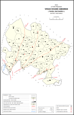 Map showing Pindari Kalan (#290) in Amawan CD block | |
 Pindari Kalan Location in Uttar Pradesh, India | |
| Coordinates: 26.31591°N 81.317444°E[1] | |
| Country India | |
| State | Uttar Pradesh |
| District | Raebareli |
| Area | |
| • Total | 5.696 km2 (2.199 sq mi) |
| Population (2011)[2] | |
| • Total | 3,960 |
| • Density | 700/km2 (1,800/sq mi) |
| Languages | |
| • Official | Hindi |
| Time zone | UTC+5:30 (IST) |
| Vehicle registration | UP-35 |
The 1961 census recorded Pindari Kalan as comprising 15 hamlets, with a total population of 1,661 people (833 male and 828 female), in 356 households and 314 physical houses.[3] The area of the village was given as 1,442 acres.[3]
The 1981 census recorded Pindari Kalan (as "Pendari Kalan") as having a population of 2,210 people, in 420 households, and having an area of 569.82 hectares.[4] The main staple foods were listed as wheat and rice.[4]
References
- "GeoNames Search". Search for "Pindari Kalan" here.
- "Census of India 2011: Uttar Pradesh District Census Handbook - Rae Bareli, Part A (Village and Town Directory)" (PDF). Census 2011 India. pp. 185–201. Retrieved 6 August 2021.
- Census 1961: District Census Handbook, Uttar Pradesh (39 - Raebareli District) (PDF). Lucknow. 1965. pp. xliv-xv of section "Rae Bareli Tahsil". Retrieved 6 August 2021.
- Census 1981 Uttar Pradesh: District Census Handbook Part XIII-A: Village & Town Directory, District Rae Bareli (PDF). 1982. pp. 86–7. Retrieved 6 August 2021.
This Raebareli district location article is a stub. You can help Wikipedia by expanding it. |
Текст в блоке "Читать" взят с сайта "Википедия" и доступен по лицензии Creative Commons Attribution-ShareAlike; в отдельных случаях могут действовать дополнительные условия.
Другой контент может иметь иную лицензию. Перед использованием материалов сайта WikiSort.org внимательно изучите правила лицензирования конкретных элементов наполнения сайта.
Другой контент может иметь иную лицензию. Перед использованием материалов сайта WikiSort.org внимательно изучите правила лицензирования конкретных элементов наполнения сайта.
2019-2026
WikiSort.org - проект по пересортировке и дополнению контента Википедии
WikiSort.org - проект по пересортировке и дополнению контента Википедии