world.wikisort.org - India
Shrigonda is a municipal council in Ahmednagar district in the Indian state of Maharashtra. Shrigonda is located at 18.616°N 74.698°E. It has an average elevation of 561 metres (1840 feet). Per 2001 India census, Shrigonda had a population of 26,331. Males constitute 52% of the population and females 48%. Shrigonda has an average literacy rate of 71%, higher than the national average of 59.5%: male literacy is 77%, and female literacy is 64%. In Shrigonda, 12% of the population is under 6 years of age.[1]
This article has multiple issues. Please help improve it or discuss these issues on the talk page. (Learn how and when to remove these template messages)
|
Shrigonda, Maharashtra, India | |
|---|---|
city | |
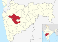
 Shrigonda, Maharashtra, India Location in Maharashtra, India  Shrigonda, Maharashtra, India Shrigonda, Maharashtra, India (Maharashtra) | |
| Coordinates: 18.616°N 74.698°E | |
| Country | |
| State | Maharashtra |
| District | Ahmednagar |
| Government | |
| • Body | Municipal Council |
| Elevation | 561 m (1,841 ft) |
| Population (2011) | |
| • Total | 31,134 |
| Languages | |
| • Official | Marathi |
| Time zone | UTC+5:30 (IST) |
| PIN | 413701 |
| Telephone code | 912487 |
| Vehicle registration | MH-16 |
See also
- Shrigonda Municipal Council
- Ahmednagar district
References
- "Census of India 2001: Data from the 2001 Census, including cities, villages and towns (Provisional)". Census Commission of India. Archived from the original on 16 June 2004. Retrieved 1 November 2008.
Ahmednagar district topics | ||
|---|---|---|
| History |
|  |
| Geography | ||
| Talukas | ||
| Cities and towns | ||
| Monuments |
| |
| Education |
| |
| Lok Sabha constituencies |
| |
| Vidhan Sabha constituencies |
| |
| Dams in District | ||
Текст в блоке "Читать" взят с сайта "Википедия" и доступен по лицензии Creative Commons Attribution-ShareAlike; в отдельных случаях могут действовать дополнительные условия.
Другой контент может иметь иную лицензию. Перед использованием материалов сайта WikiSort.org внимательно изучите правила лицензирования конкретных элементов наполнения сайта.
Другой контент может иметь иную лицензию. Перед использованием материалов сайта WikiSort.org внимательно изучите правила лицензирования конкретных элементов наполнения сайта.
2019-2026
WikiSort.org - проект по пересортировке и дополнению контента Википедии
WikiSort.org - проект по пересортировке и дополнению контента Википедии