world.wikisort.org - India
Kopargaon taluka, is a taluka in Shirdi subdivision of Ahmednagar district in Maharashtra State of India.[1]
Kopargaon taluka | |
|---|---|
Tehsil | |
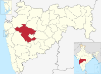
 Location of Kopargaon in Ahmednagar district in Maharashtra | |
| Country | |
| State | Maharashtra |
| District | Ahmednagar district |
| Headquarters | kopargaon |
| Area | |
| • Total | 725.16 km2 (279.99 sq mi) |
| Population (2011) | |
| • Total | 302,452 |
| • Density | 420/km2 (1,100/sq mi) |
| Demographics | |
| • Literacy rate | 85.08 |
| • Sex ratio | 965 |
Area
The table below shows area of the taluka by land type.[2]
| Type of Land | Area (km2) | % of Total Area |
|---|---|---|
| Agriculture | 686.47 | 94.66 |
| Forest | 0 | 0 |
| Other | 38.69 | 5.34 |
| Total | 725.16 | 100 |
Villages
There are around 79 villages in Kopargaon taluka. For a list of villages see Villages in Kopargaon taluka. There are major villages like Karanji bk, Kolapewadi, Manjur, Chas Nali, Sanwaster, Pohegaon, Dhamori, Dauch Khurd, sangvi bhusar, Rawanda, etc.
Population
The table below shows population of the taluka by sex. The data is as per 2001 census.[3]
| Population | % of Total Population | Number of Literate | Literacy (% of Population) | |
|---|---|---|---|---|
| Male | 143502 | 51.82 | 104488 | 72.81 |
| Female | 133435 | 48.18 | 73028 | 54.73 |
| Total | 276937 | 100 | 177516 | 64.1 |
Rain Fall
The Table below details of rainfall from year 1981 to 2004.[4]
| Year | Rainfall (mm) |
|---|---|
| 1981 | 421 |
| 1982 | 389 |
| 1983 | 531 |
| 1984 | 518 |
| 1985 | 300 |
| 1986 | 319 |
| 1987 | 460 |
| 1988 | 575 |
| 1989 | 594 |
| 1990 | 499 |
| 1991 | 296 |
| 1992 | 418 |
| 1993 | 408 |
| 1994 | 440.2 |
| 1995 | 321 |
| 1996 | 537 |
| 1997 | 290 |
| 1998 | 582 |
| 1999 | 384 |
| 2000 | 428 |
| 2001 | 360 |
| 2002 | 366 |
| 2003 | 280 |
| 2004 | 400 |
See also
- Talukas in Ahmednagar district
- Villages in Kopargaon taluka
References
- "Talukas in Ahmednagar district". Archived from the original on 29 September 2011. Retrieved 22 September 2010.
- "Talukas geographic information". Archived from the original on 29 September 2011. Retrieved 22 September 2010.
- "Talukas population information". Archived from the original on 29 September 2011. Retrieved 22 September 2010.
- "Rainfall information of Ahmednagar district". Archived from the original on 8 December 2015. Retrieved 22 September 2010.
| Wikimedia Commons has media related to Kopargaon taluka. |
Ahmednagar district topics | ||
|---|---|---|
| History |
|  |
| Geography | ||
| Talukas |
| |
| Cities and towns |
| |
| Monuments |
| |
| Education |
| |
| Lok Sabha constituencies |
| |
| Vidhan Sabha constituencies |
| |
| Dams in District |
| |
Текст в блоке "Читать" взят с сайта "Википедия" и доступен по лицензии Creative Commons Attribution-ShareAlike; в отдельных случаях могут действовать дополнительные условия.
Другой контент может иметь иную лицензию. Перед использованием материалов сайта WikiSort.org внимательно изучите правила лицензирования конкретных элементов наполнения сайта.
Другой контент может иметь иную лицензию. Перед использованием материалов сайта WikiSort.org внимательно изучите правила лицензирования конкретных элементов наполнения сайта.
2019-2026
WikiSort.org - проект по пересортировке и дополнению контента Википедии
WikiSort.org - проект по пересортировке и дополнению контента Википедии