world.wikisort.org - India
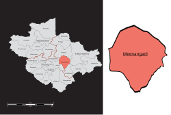
Meenangadi is an old town situated on the highway NH 766 between Kalpetta and Sulthan Bathery in Wayanad District,[6] in Kerala, India. This place is one among the Provinces where the existence of Dolmens provide an historical evidence of earlier civilisation.[7][8] Coffee bean, Black pepper, Ginger, Rice and Areca are the major crops cultivated in this area.[9] Meenangadi is famous for its Fish Market and Cattle Market.[10] The nearest railway station is at Kozhikode at 87 km and airport is Kannur International Airport[11] with 94 km[12] from Meenangadi. Meenangadi is surrounded by, Ambalavayal Panchayat, Kalpetta Taluk towards west, Gudalur Taluk towards East, Mananthavady Taluk towards west.[13][14] Kalpetta, Sultan Bathery, Kozhikode are the nearby Cities and towns to Meenangadi.
Kerala's first carbon neutrality project launched in Meenangadi in June 2016.[15] Upon achieving the goals of the project, Meenangadi will be the first village in India to go completely carbon neutral.[16]
Meenangadi has a population of 33450 According to 2011 Census with two Villages Purakkadi and (Part)Krishnagiri.[17][18]
Meenangadi | |
|---|---|
Town | |
 | |
 Meenangadi  Meenangadi | |
| Coordinates: 11.660779°N 76.155185°E | |
| Country | |
| State | Kerala |
| District | Wayanad |
| Block | Sulthan Bathery |
| First Settlement | Neolithic Age[1][2] |
| Named for | Matsya Avathara Temple and Fish Market |
| Area | |
| • Total | 53.52[3] km2 (13,225.08 acres) |
| Elevation | 773.00 m (2,536.09 ft) |
| Population (2011)[4] | |
| • Total | 33,450 |
| • Estimate (2016[5]) | 34,601 |
| • Density | 630/km2 (1,600/sq mi) |
| Languages | |
| • Official | Malayalam Others:English, Kannada, Tamil, Hindi |
| • Summer (DST) | UTC+5:30 (IST) |
| PIN | 673 591 |
| Telephone code | 91 (0)4936 |
Educational institutions
- Government Polytechnic, Mananthavady Road
- Government Higher Secondary School Meenangadi[19]
- Government Commercial Institute, Meenangadi
- St. Gregorios Teachers' Training College, JECS Campus, Christ Nagar (offering B.Ed., M.Ed. & PhD)
- St. Mary's College, JECS Campus, Christ Nagar (offering BA, B.Com. & BBA courses of Calicut University)
- St. Baselios Arts & Science College, JECS Campus, Christ Nagar
- IHRD Model College of Applied Sciences, Meenangadi[20]
- St. Peter's & St. Paul's English Higher Secondary School
- Sree Vivekananda Vidya Mandir[21]
- Anns English Medium School[22]
Climate
| Climate data for Meenangadi, Kerala | |||||||||||||
|---|---|---|---|---|---|---|---|---|---|---|---|---|---|
| Month | Jan | Feb | Mar | Apr | May | Jun | Jul | Aug | Sep | Oct | Nov | Dec | Year |
| Average high °C (°F) | 27.2 (81.0) |
29 (84) |
30.7 (87.3) |
30.6 (87.1) |
29.6 (85.3) |
26.1 (79.0) |
24.7 (76.5) |
25.3 (77.5) |
26.2 (79.2) |
26.8 (80.2) |
26.5 (79.7) |
26.5 (79.7) |
27.4 (81.4) |
| Average low °C (°F) | 16.6 (61.9) |
17.8 (64.0) |
19.5 (67.1) |
20.7 (69.3) |
20.8 (69.4) |
19.8 (67.6) |
19.4 (66.9) |
19.4 (66.9) |
19.2 (66.6) |
19.4 (66.9) |
18.5 (65.3) |
16.9 (62.4) |
19.0 (66.2) |
| Average precipitation mm (inches) | 4 (0.2) |
9 (0.4) |
17 (0.7) |
95 (3.7) |
185 (7.3) |
513 (20.2) |
1,011 (39.8) |
543 (21.4) |
235 (9.3) |
226 (8.9) |
84 (3.3) |
22 (0.9) |
2,944 (116.1) |
| Source: Climate-Data.org[23] | |||||||||||||
References
- Benhur, Abraham (2012). Megalithic Monuments of South India. pathofdolmens.
- Menon, T. Madhava; Linguistics, International School of Dravidian (2000). A handbook of Kerala. International School of Dravidian Linguistics. ISBN 9788185692272.
- Keralam, Digital. "Meenangadi Grama Panchayath Meenangadi Wayanad Kerala India | Digital Keralam". Digital Keralam.
- http://www.censusindia.gov.in/2011census/dchb/3203_PART_A_WAYANAD.pdf [bare URL PDF]
- http://thanal.co.in/uploads/resource/document/concept-note-carbon-neutral-meenangaadi-grama-panchayat-37116138.pdf [bare URL PDF]
- "Archived copy". Archived from the original on 21 May 2018. Retrieved 14 March 2015.
{{cite web}}: CS1 maint: archived copy as title (link) - "The Path of the Dolmens". pathofdolmens.org.
- Manoj, E. m (30 December 2012). "Megalithic rock-cut tomb found in Wayanad". The Hindu.
- "Official Web Site of Wayanad District". wayanad.nic.in. Archived from the original on 10 July 2007.
- Department, Kerala (India) Animal Husbandry (1974). Report on Quinquennial Livestock Census, 1966: 1966:1. Department of Animal Husbandry, Livestock Census.
- "Home". www.kannurairport.in. Archived from the original on 2 August 2018. Retrieved 24 January 2017.
- "Google Maps". Google Maps.
- . Meenangadi have high connectivity of roads towards Calicut, Mysore and Bangalore. Nearest tourist centers are edakkal caves( ~ 8 Km) and karapuzha dam (~6 Km).http://www.keralatourism.org/routes-locations/meenangadi/id/10029
- "Meenara, Manikkal Panchayat, Thiruvananthapuram District, Kerala, India".
- "Kerala's first carbon neutrality project launched in Wayanad".
- Kerala Achieved What the World Is Struggling With – Becoming Carbon Neutral!, 5 June 2017
- http://www.censusindia.gov.in/2011census/dchb/3203_PART_A_WAYANAD.pdf [bare URL PDF]
- Staff Reporter (4 September 2013). "Meenangadi panchayat plans project for tribals". The Hindu.
- "Official Web Site of Wayanad District". wayanad.nic.in. Archived from the original on 23 January 2009.
- "Model College, Meenagadi". www.ihrd.ac.in.
- "Archived copy". Archived from the original on 18 December 2014. Retrieved 30 March 2020.
{{cite web}}: CS1 maint: archived copy as title (link) - "Anns English Medium School :: Home | Meenengadi | Wayanad | Kerala | India". Archived from the original on 2 April 2015. Retrieved 30 March 2020.
- "CLIMATE: MEENANGADI", Climate-Data.org. Web: .
Wayanad | |||||
|---|---|---|---|---|---|
| History of Wayanad |
| ||||
| Cities |
| ||||
| Transport |
| ||||
| Education in Wayanad |
| ||||
| Visitor attractions |
| ||||
| Places of worship |
| ||||
| Other topics |
| ||||
| |||||
Другой контент может иметь иную лицензию. Перед использованием материалов сайта WikiSort.org внимательно изучите правила лицензирования конкретных элементов наполнения сайта.
WikiSort.org - проект по пересортировке и дополнению контента Википедии