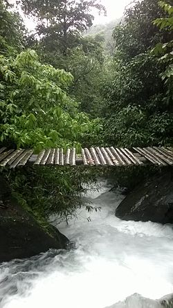
world.wikisort.org - India
Alakode is an emerging town in Kannur district in the Indian state of Kerala. It is located 46 km (29 mi) North of District headquarters Kannur. Alakode is located on Taliparamba-Manakadavu-Coorg Road.[2] Alakode was one of the major centers of Malabar Migration.
Alakode | |
|---|---|
Town | |
 | |
 Alakode Location in Kannur, India  Alakode Alakode (India) | |
| Coordinates: 12.1910°N 75.4673°E | |
| Country | |
| State | Kerala |
| District | Kannur |
| Taluk | Taliparamba |
| Government | |
| • Body | Grama Panchayat |
| Area | |
| • Total | 70.77 km2 (27.32 sq mi) |
| Elevation | 85 m (279 ft) |
| Population (2011) | |
| • Total | 34,878 |
| • Density | 490/km2 (1,300/sq mi) |
| Languages | |
| • Official | Malayalam, English |
| Time zone | UTC+5:30 (IST) |
| PIN | 670571 |
| Telephone code | 04602 |
| ISO 3166 code | IN-KL |
| Vehicle registration | KL 59 |
| Literacy | 95.38% |
| Niyamasabha constituency | Irikkur |
| Lok Sabha constituency | Kannur |
| Website | https://www.lsgkerala.in/alakode |


Demographics
As of 2011 Census, Alakode had a population of 33,173 which constitutes 16,289 males and 16,884 females. Alakode village spreads over an area of 72.68 km2 (28.06 sq mi) with 8,007 families residing it. Population of children in the age group 0-6 was 3,318 which makes up 10.00 % of total population of village. The average sex ratio of Alakode was 1,023 lower than state average of 1,084. The literacy rate of Alakode was 95.38 % compared to 94.00 % of Kerala. Male literacy stands at 96.87 % while female literacy rate was 93.96 %.[3]
Administration
Alakode Grama Panchayat is a part of Taliparamba Block Panchayat. Alakode panchayat has administration over Alakode, Thimiri and Vellad villages. Alakode is politically part of Irikkur (State Assembly constituency) in Kannur Lok Sabha constituency.[4][5]
Transportation
Kerala hill highway (SH 59) passes through Alakode town which connects it with other towns like Cherupuzha, Karuvanchal, Chemperi, Payyavoor, Iritty etc. Mysore and Bangalore can be accessed from east of Ulikkal or Iritty.[6] Taliparamba-Coorg border road is another major road connecting Alakode with Taliparamba and Manakadavu. National Highway (NH 66) passes through Taliparamba town. Goa and Mumbai can be accessed on northern side and Kochi and Trivandrum are accessible from southern side.
The nearest railway stations are Kannapuram and Kannur on Shoranur-Mangalore Section.
The nearest international airport is Kannur of about 46.5 km away. Mangalore and Calicut are other nearby options available.
Economy
Most of the people in Alakode are engaged in agriculture or business. The area is known for exporting hill products like rubber, dry copra, pepper, areca nut, etc. to the industries located in the northern parts of India. Many people migrated to Alakode during the 1940s and 1950s from the Travancore area and currently play a major role in the local economy.[citation needed]
Education
• Mary Matha Arts and Science College, Alakode[7]
• St. Mary's HSS, Alakode
• NSS HSS, Alakode[8]
• Nirmala UP school
Banking
• State Bank of India
• Federal Bank
• Canara Bank
• Kerala Bank
• Kerala Gramin Bank
• Alakode service co-operative bank
• Taliparamba PCARD Bank, Alakode
References
- "alakode elevation map". topographic-map.com.
- "Census of India : Alakode Population - Kannur, Kerala". Registrar General & Census Commissioner, India.
- Kerala, Directorate of Census Operations. District Census Handbook, Kannur (PDF). Thiruvananthapuram: Directorateof Census Operations,Kerala. p. 154,155. Retrieved 14 July 2020.
- "Assembly Constituencies - Corresponding Districts and Parliamentary Constituencies" (PDF). Kerala. Election Commission of India. Archived from the original (PDF) on 4 March 2009. Retrieved 18 October 2008.
- "Niyamasabha constituencies of Kannur". ceo.kerala.gov.in.
- "Hill Highway in Kerala; DPR ready for just 79 kms". Mathrubhumi. Retrieved 13 September 2016.
- "List of degree colleges in Kannur-Kerala". vidyatime.com.
- "Higher Secondary Education Portal". www.dhsekerala.gov.in.
Другой контент может иметь иную лицензию. Перед использованием материалов сайта WikiSort.org внимательно изучите правила лицензирования конкретных элементов наполнения сайта.
WikiSort.org - проект по пересортировке и дополнению контента Википедии