world.wikisort.org - India
Thiruvambady is a major hill town and a suburb in southeastern Kozhikode district in Kerala, India. Thiruvambady is a Panchayat headquarters, and a legislative assembly constituency, situated 35 kilometres (22 mi) from the district headquarters of Kozhikode.[1]
This article has multiple issues. Please help improve it or discuss these issues on the talk page. (Learn how and when to remove these template messages)
|
Thiruvambady | |
|---|---|
Town | |
 | |
 Thiruvambady Location in Kozhikode, Kerala, India | |
| Coordinates: 11°21′39″N 76°00′32″E | |
| Country | |
| State | Kerala |
| District | Kozhikode |
| Taluk | Thamarassery |
| Block Panchayat | Koduvally |
| Government | |
| • MP | Rahul Gandhi |
| • MLA | Linto Joseph – Thiruvambady |
| • Panchayath President | Mercy Pulikkattu – Thiruvambady Panchayath |
| Population (2011) | |
| • Total | 28,820 |
| Languages | |
| • Official | Malayalam, English |
| Time zone | UTC+5:30 (IST) |
| PIN | 673603 |
| Telephone code | 0495 225.... |
| Vehicle registration | KL 57 |
| Sex ratio | 1000:1040 ♂/♀ |
| Literacy | 96% |
Geography
Thiruvambady is 35 kilometres (22 mi) from Kozhikode city and is on the banks of the Iruvanjippuzha River, which is a major tributary of the Chaliyar River. The town is surrounded by mountains, valleys, and waterfalls, such as Thusharagiri Falls and Aripara Falls.
Administration
Thiruvambady Gramapanchayath was established on 1 January 1962 and consists of 17 wards covering an area of 83.96 square kilometres (32.42 sq mi), which includes 9,000 acres (3,600 ha) of forest. Thiruvambady is under Koduvally Block Panchayat and Thamarassery Taluk.
Thiruvambady is part of the Wayanad parliamentary constituency. The current MP is Rahul Gandhi.
In 1977, the Thiruvambady assembly constituency of the Kerala Legislative Assembly was established, consisting of 7 Panchayats. The current MLA is Linto Joseph.
Transportation
Road
Thiruvambady is well connected by road to nearby places. It can be reached by the following routes:
- Thiruvananthapuram - Kochi - Guruvayoor/Thrissur - Pattambi - Perinthalmanna - Manjeri - Areekode - Mukkam - Thiruvambady
- Kozhikode - Kunnamangalam - REC (NIT) - Mukkam (Agastiamuzhi) - Thiruvambady
- Kannur - Koyilandy - Thamarassery - Omassery - Thiruvambady
- Wayanad - Kalpetta - Adivaram - Kaithapoyil - Kodenchery - Thiruvambady
- Nilambur - Akambadam - Kakkadampoyil - Koombara - Koodaranhi - Thiruvambady
- Koduvally - Omassery - Thiruvambady - Pulloorampara - Anakkampoyil
Buses
A KSRTC bus operating centre is in town, as well as a private bus stand. There are buses to nearby places such as Kozhikode, Mukkam, Omassery, Thamarassery, Koduvally, Pulloorampara, Anakkampoyil, Poovaranthode, Koodaranji, and Kodenchery; and KSRTC operates many inter-district routes.
KSRTC buses operates many inter district services from here.
Rail
The nearest railway station is Kozhikode Railway Station, 35 kilometres (22 mi) distant.
Air
The nearest airport is Calicut International Airport, 43 kilometres (27 mi) distant.[2]
Thiruvambady International Airport is a new airport proposal for Calicut city.[3] Restrictions on larger aircraft landing at the existing airport for safety considerations has been reported as one rationale for building a new airport.[4]
Distance chart
The Kilometer chart from Thiruvambady is given below:
| Kozhikode - 35 km | Thamarassery - 15 km |
| Manjeri - 36 km | Mukkam - 6 km |
| Kunnamangalam - 20 km | Koduvally - 12 km |
| Perinthalmanna - 60 km | Areekode - 20 km |
| Palakkad - 122 km | Omassery - 5 km |
| Thrissur - 133 km | Anakkampoyil - 13 km |
| Ernakulam - 202 km | Koodaranji - 5 km |
| Thiruvananthapuram - 414 km | Kodencheri - 10 km |
| Kannur - 113 km | Pulloorampara - 8 km |
| Kalpetta - 53 km | Kakkadampoyil - 19 km |
| Nilambur - 50 km | Punnackal - 5 km |
| Koyilandy - 43 km | Thusharagiri Falls - 18 km |
Notable people from Thiruvambady
- Mathai Chacko – Former MLA and communist leader
- Jacob Thoomkuzhy – Former metropolitan archbishop
Gallery
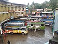 Bus Stand
 Town
Town


References
- "Thiruvambady". Routes & Locations. Keralatourism.org. Retrieved 13 November 2018.
- "CM's support sought for Thiruvambady airport". The Hindu. 25 January 2017. Retrieved 30 December 2020.
- Rajeev, K K (14 October 2016). "Demand for new international airport at Thiruvambadi". The Times of India. Retrieved 7 August 2017.
- "Kerala govt to focus on second airport". Deccan Chronicle. 26 January 2017. Retrieved 7 August 2017.
Malabar region | |
|---|---|
Metropolitan cities: Kozhikode, Malappuram, Kannur | |
| States/UTs |
|
| Districts |
|
| Taluks |
|
| Municipal Corporations |
|
| Municipalities |
|
| Other towns |
|
| Historical regions |
|
Другой контент может иметь иную лицензию. Перед использованием материалов сайта WikiSort.org внимательно изучите правила лицензирования конкретных элементов наполнения сайта.
WikiSort.org - проект по пересортировке и дополнению контента Википедии