world.wikisort.org - India
Mansa district is a district in the state of Punjab, India. The district headquarters is Mansa city. Mansa district was formed on 13 April 1992 from the erst while district of Bathinda.[1] The district has three tehsils: Mansa, Budhlada and Sardulgarh; and five development blocks: Mansa, Budhlada, Sardulgarh, Bhikhi and Jhunir.[2]
Mansa district | |
|---|---|
District of Punjab | |
 Old well in Raipur village | |
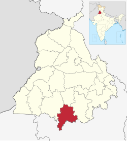 Location in Punjab | |
 Mansa district | |
| Coordinates: 29°59′N 75°23′E | |
| Country | |
| State | Punjab |
| Headquarters | Mansa |
| Area | |
| • Total | 2,174 km2 (839 sq mi) |
| Population (2011) | |
| • Total | 769,751 |
| • Density | 350/km2 (900/sq mi) |
| Languages | |
| • Official | Punjabi, Hindi |
| Time zone | UTC+5:30 (IST) |
| ISO 3166 code | IN-PB |
| Sex ratio | 1000/880 ♂/♀ |
| Literacy | 63% |
| Website | www |
Geography
The district is roughly triangular in shape and is bounded on the northwest by Bathinda district, on the northeast by Sangrur district, and on the south by Haryana state. It is situated on the Bathinda-Jind-Delhi railway and the Barnala-Sardulgarh-Sirsa road. The district is divided into three tehsils, Budhlada, Mansa, and Sardulgarh. The Ghaggar River flows through the Sardulgarh Tehsil in the southwestern corner of the district.
History
This section does not cite any sources. (March 2012) |
Mansa District was formerly a part of the Phulkia Sikh Dynasty (1722–1948) then part of Kaithal Sikh Kingdom (1762–1857). The present district was formed on 13 April 1992 from the erstwhile Bathinda district. The town is said to have been founded by Bhai Gurdas who hailed from Dhingar, Mansa district. He is said to have been married at this place among the Dhaliwal Jat Sikh. Once he came to his in-laws to take his wife along with him but they refused to send her. At this, Bhai Gurdas sat in meditation before the house of his in-laws. After some time, the parents of the girl agreed to send their daughter with Bhai Gurdas. But he refused to take her along with him, stating that he had now renounced the worldly way of life. In his memory, his Smadh was constructed where a fair is held every year in March–April. People in large numbers attend the fair and offer Laddus and Gur (jaggery) at Smadh. Class ‘A’ municipality has been functioning in the town since 1952. The town has two Colleges, viz. Govt. Nehru Memorial Post Graduate College and S.D. Kanya Mahavidyalaya College, 3 Senior Secondary Schools, 90 High Schools, 1 Middle School, 1 Primary School, and one District Library and has one civil hospital, 3 Dispensaries, 1 Ayurvedic, and 4 Homeopathic dispensaries. There are two police stations i.e. PS City and PS Sadar and also a railway station.
Ancient period
The ancient history of the Mansa district has been traced to the Indus Valley civilization. The archaeological finds at different villages of Mansa district are almost similar to those of Harappa and Mohenjo-Daro.[3][4] It is divided into three parts Pre-Harappa, Harappa and Late Harappa.
Demographics
| Year | Pop. | ±% p.a. |
|---|---|---|
| 1951 | 241,932 | — |
| 1961 | 319,389 | +2.82% |
| 1971 | 402,099 | +2.33% |
| 1981 | 486,842 | +1.93% |
| 1991 | 574,662 | +1.67% |
| 2001 | 688,758 | +1.83% |
| 2011 | 769,751 | +1.12% |
| source:[5] | ||
According to the 2011 census Mansa district has a population of 769,751,[7] roughly equal to the US state of Alaska.[8] This gives it a ranking of 489th in India (out of a total of 640). The district has a population density of 350 inhabitants per square kilometre (910/sq mi). Its population growth rate over the decade 2001-2011 was 11.62%. Mansa has a sex ratio of 880 females for every 1000 males and a literacy rate of 62.8%.[7]
At the time of the 2011 census, 96.53% of the population spoke Punjabi and 2.77% Hindi as their first language.[9]
Agriculture and industry
Mansa is situated in the cotton belt of Punjab and therefore popularly called the "Area of white gold". Indeed, agriculture forms the backbone of the district economy.
Mansa is home to the largest Thermal Power Plant of Punjab. The Thermal Power Plant has the capacity to produce 1980MW of electricity
Industrially, the district is very deficient, yet some trade and industry is being carried out in urban areas.
Major cities and towns
Village Ubha
Ubha is situated in Mansa District. It is famous for its temple. Baba Farid Academy Public Senior Secondary School is situated in this village.
Bareta
Bareta is situated on Bathinda–Delhi railway line.
Budhlada
Budhlada was named after the two brothers, Budha and Ladha, who were khatri by caste. It is also situated on Bathinda-Delhi railway line. It was the largest market of Eastern Punjab and a very big recruitment centre for military personnel.[10]
Politics
| No. | Constituency | Name of MLA | Party | Bench | |
|---|---|---|---|---|---|
| 96 | Mansa | Vijay Singla | Aam Aadmi Party | Government | |
| 97 | Sardulgarh | Gurpreet Singh Banawali | Aam Aadmi Party | Government | |
| 98 | Budhlada (SC) | Budhram Singh | Aam Aadmi Party | Government | |
Notable people
- Ajmer Singh Aulakh, Indian author, Sahitya Akademi Award winner for Best Drama Director, hails from the village of Kishagarh Farwaahi
- Aman Dhaliwal, Indian model and actor
- Deep Dhillon, Indian actor
- Gavie Chahal, Indian actor, hails from the village of Sher Khan Wala
- Harmanjeet Singh, Indian poet and lyricist
- Kulwinder Billa, Indian singer, hails from the village of Dhaipi
- Nisha Bano, Indian actress and singer
- Nirmal Rishi, Indian actress of film and television
- Sawarn Singh, Indian Olympic rower
- Sidhu Moose Wala, Indian singer and politician; from the village of Moosa, his namesake
- Shipra Goyal, Indian singer
- Sukhmeet Singh, Indian rower
References
- "About | Mansa". www.mansa.nic.in. Retrieved 6 July 2016.
- "Gurpreet gets Mansa seat". News in English. Ludhiana. The Tribune. 10 January 2012. Retrieved 17 July 2012.
- Lal, B.B; Gupta, S.P. (1984) [1981-82]. Frontier of Indus Valley Civilization. Delhi.
- "Ancient history of Mansa district". B.B. Lal and S.P. Gupta. www.punjabrevenue.nic.in. Archived from the original on 18 July 2011. Retrieved 23 January 2012.
- "Census of India Website : Office of the Registrar General & Census Commissioner, India". www.censusindia.gov.in.
- "Table C-01 Population by Religious Community: Punjab". censusindia.gov.in. Registrar General and Census Commissioner of India.
- "District Census Hand Book – Mansa" (PDF). Census of India. Registrar General and Census Commissioner of India.
- "2010 Resident Population Data". U. S. Census Bureau. Archived from the original on 19 October 2013. Retrieved 30 September 2011.
Alaska 710,231
- "Table C-16 Population by Mother Tongue: Punjab". censusindia.gov.in. Registrar General and Census Commissioner of India.
- Moga, Parminder Singh Grover; Singh, Davinderjit (20 May 2011). Discover Punjab: Attractions of Punjab. Parminder Singh Grover.
External links
State of Punjab, India | ||
|---|---|---|
Capital: Chandigarh | ||
| Topics |
|  |
| Administration |
| |
| Culture |
| |
| Divisions |
| |
| Districts |
| |
| Major Cities | ||
Authority control | |
|---|---|
| General |
|
| National libraries | |
На других языках
[de] Mansa (Distrikt)
Der Distrikt Mansa (Panjabi ਮਾਨਸਾ ਜ਼ਿਲ੍ਹਾ) ist ein Distrikt im indischen Bundesstaat Punjab.- [en] Mansa district, India
[ru] Манса (округ, Индия)
Ма́нса (в.-пандж. ਮਾਨਸਾ ਜ਼ਿਲਾ; англ. Mansa) — округ в индийском штате Пенджаб. Расположен на юге штата. Образован в 1992 году из части территории округа Бхатинда. Административный центр — город Манса. Площадь округа — 2169 км². По данным всеиндийской переписи 2001 года население округа составляло 688 758 человек. Уровень грамотности взрослого населения составлял 52,4 %, что ниже среднеиндийского уровня (59,5 %). Доля городского населения составляла 20,7 %.Другой контент может иметь иную лицензию. Перед использованием материалов сайта WikiSort.org внимательно изучите правила лицензирования конкретных элементов наполнения сайта.
WikiSort.org - проект по пересортировке и дополнению контента Википедии