world.wikisort.org - India
Machhike is a village in the Moga District of the Indian state of Punjab. It is part of the Nihal Singh Wala Assembly Constituency.
This article needs additional citations for verification. (February 2017) |
Machhike | |
|---|---|
 | |
| Coordinates: 30.557°N 75.381°E | |
| Country | India |
| State | Punjab |
| District | Moga |
Geography
It is located 10 km southeast of Nihal Singh Wala, 38 km southeast of Moga, and 60 km southwest of Ludhiana. The Machhike local language is Punjabi.
Demographics
In the 2011 census, the population was 6,411. There is a 56.6% literacy rate with a 24.3% female literacy rate.
| Total | Male | Female | |
|---|---|---|---|
| Population | 6,411 | 3,411 | 3,000 |
| 0-6 years old | 661 | 347 | 314 |
| Scheduled Castes | 2,695 | 1,420 | 1,275 |
| Scheduled Tribes | 0 | 0 | 0 |
| Literates | 3,627 | 2,071 | 1,556 |
| Illiterate | 2,784 | 1,340 | 1,444 |
| Total Workers | 1,936 | 1,771 | 165 |
| Main Worker | 1,880 | 1,722 | 158 |
| Main Worker - Cultivators | 758 | 734 | 24 |
| Main Worker - Agriculture Labourers | 613 | 597 | 16 |
| Main Worker - Household Industries | 22 | 19 | 3 |
| Main Worker - Other | 487 | 372 | 115 |
| Marginal Worker (total) | 56 | 49 | 7 |
| Non Worker | 4,475 | 1,640 | 2,835 |
Images
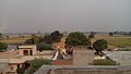 Machhike
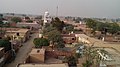 Machhike


References
- "Census of India: Search Details". www.censusindia.gov.in. Retrieved 2019-02-20.
Текст в блоке "Читать" взят с сайта "Википедия" и доступен по лицензии Creative Commons Attribution-ShareAlike; в отдельных случаях могут действовать дополнительные условия.
Другой контент может иметь иную лицензию. Перед использованием материалов сайта WikiSort.org внимательно изучите правила лицензирования конкретных элементов наполнения сайта.
Другой контент может иметь иную лицензию. Перед использованием материалов сайта WikiSort.org внимательно изучите правила лицензирования конкретных элементов наполнения сайта.
2019-2026
WikiSort.org - проект по пересортировке и дополнению контента Википедии
WikiSort.org - проект по пересортировке и дополнению контента Википедии