world.wikisort.org - France
Saint-Agrève is a commune in the Ardèche department in southern France.
This article may be expanded with text translated from the corresponding article in French. (December 2008) Click [show] for important translation instructions.
|
Saint-Agrève | |
|---|---|
Commune | |
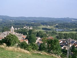
 A general view of Saint-Agrève | |
 Coat of arms | |
Location of Saint-Agrève  | |
 Saint-Agrève  Saint-Agrève | |
| Coordinates: 45°00′39″N 4°23′49″E | |
| Country | France |
| Region | Auvergne-Rhône-Alpes |
| Department | Ardèche |
| Arrondissement | Tournon-sur-Rhône |
| Canton | Haut-Eyrieux |
| Government | |
| • Mayor (2020–2026) | Michel Villemagne[1] |
| Area 1 | 48.56 km2 (18.75 sq mi) |
| Population | 2,377 |
| • Density | 49/km2 (130/sq mi) |
| Time zone | UTC+01:00 (CET) |
| • Summer (DST) | UTC+02:00 (CEST) |
| INSEE/Postal code | 07204 /07320 |
| Elevation | 590–1,183 m (1,936–3,881 ft) (avg. 1,050 m or 3,440 ft) |
| 1 French Land Register data, which excludes lakes, ponds, glaciers > 1 km2 (0.386 sq mi or 247 acres) and river estuaries. | |
Population
| Year | Pop. | ±% p.a. |
|---|---|---|
| 1968 | 2,484 | — |
| 1975 | 2,718 | +1.29% |
| 1982 | 2,723 | +0.03% |
| 1990 | 2,762 | +0.18% |
| 1999 | 2,688 | −0.30% |
| 2007 | 2,565 | −0.58% |
| 2012 | 2,546 | −0.15% |
| 2017 | 2,353 | −1.56% |
| Source: INSEE[3] | ||
See also
References
- "Répertoire national des élus: les maires". data.gouv.fr, Plateforme ouverte des données publiques françaises (in French). 9 August 2021.
- "Populations légales 2019". The National Institute of Statistics and Economic Studies. 29 December 2021.
- Population en historique depuis 1968, INSEE
Wikimedia Commons has media related to Saint-Agrève.
На других языках
[de] Saint-Agrève
Saint-Agrève ist eine französische Stadt mit 2377 Einwohnern (Stand 1. Januar 2019) im Département Ardèche in der Region Auvergne-Rhône-Alpes. Sie gehört zum Gemeindeverband Val Eyrieux.- [en] Saint-Agrève
[es] Saint-Agrève
Saint-Agrève es una población y comuna francesa, ubicada en la región de Ródano-Alpes, departamento de Ardèche, en el distrito de Tournon-sur-Rhône y cantón de Saint-Agrève.[ru] Сент-Агрев
Сент-Агре́в (фр. Saint-Agrève, окс. Sant Agrève) — коммуна во Франции, находится в регионе Рона — Альпы. Департамент коммуны — Ардеш. Административный центр кантона Сент-Агрев. Округ коммуны — Турнон-сюр-Рон.Текст в блоке "Читать" взят с сайта "Википедия" и доступен по лицензии Creative Commons Attribution-ShareAlike; в отдельных случаях могут действовать дополнительные условия.
Другой контент может иметь иную лицензию. Перед использованием материалов сайта WikiSort.org внимательно изучите правила лицензирования конкретных элементов наполнения сайта.
Другой контент может иметь иную лицензию. Перед использованием материалов сайта WikiSort.org внимательно изучите правила лицензирования конкретных элементов наполнения сайта.
2019-2025
WikiSort.org - проект по пересортировке и дополнению контента Википедии
WikiSort.org - проект по пересортировке и дополнению контента Википедии