world.wikisort.org - France
Ambarès-et-Lagrave (French pronunciation: [ɑ̃baʁɛs e laɡʁav]; Ambarés e La Grava in Gascon dialect) is a commune in the Gironde department in the Nouvelle-Aquitaine region of southwestern France.
Ambarès-et-Lagrave | |
|---|---|
Commune | |
 The Town Hall | |
 Coat of arms | |
Location of Ambarès-et-Lagrave  | |
 Ambarès-et-Lagrave  Ambarès-et-Lagrave | |
| Coordinates: 44°55′33″N 0°29′07″W | |
| Country | France |
| Region | Nouvelle-Aquitaine |
| Department | Gironde |
| Arrondissement | Bordeaux |
| Canton | La Presqu'île |
| Intercommunality | Bordeaux Métropole |
| Government | |
| • Mayor (2020–2026) | Nordine Guendez |
| Area 1 | 24.76 km2 (9.56 sq mi) |
| Population | 16,636 |
| • Density | 670/km2 (1,700/sq mi) |
| Time zone | UTC+01:00 (CET) |
| • Summer (DST) | UTC+02:00 (CEST) |
| INSEE/Postal code | 33003 /33440 |
| Elevation | 0–34 m (0–112 ft) (avg. 7 m or 23 ft) |
| 1 French Land Register data, which excludes lakes, ponds, glaciers > 1 km2 (0.386 sq mi or 247 acres) and river estuaries. | |
The inhabitants of the commune are known as Ambarésiens or Ambarésiennes[2]
Geography
Ambarès-et-Lagrave is part of the Bordeaux urban area located to the north of the Bordeaux conurbation between the Garonne and Dordogne. The A10 autoroute passes down the eastern side of the commune from north to south with Exit ![]() 42 → Ambarès-et-Lagrave, Saint-Loubès in the commune. The commune is mostly urban with small areas of forest in the north and south and farmland in the west and north.[3]
42 → Ambarès-et-Lagrave, Saint-Loubès in the commune. The commune is mostly urban with small areas of forest in the north and south and farmland in the west and north.[3]
Ambarès-et-Lagrave is part of the Bordeaux Métropole.
Transport
- TER Aquitaine
The commune is served by two railway stations: the Grave-d'Ambarès station and La Gorp station which have regular links with Bordeaux.
- TBC Network
| Liane | 7 | Les Aubiers ⇔ Ambarès-et-Lagrave-Parabelle | |
| Flexo | 49 | Ambares (Mon-Sat) | Ambarès-et-Lagrave-Collège C. Massé ⇔ Ambarès-et-Lagrave-La Gorp then the Flexo zone of Ambarès |
| Flexo | 50 | Ambarès (Soirée) | Stalingrad ⇔ Ambarès-et-Lagrave-Europe then serves on demand stops to Bec d'Ambès |
| Line | 90 | Bassens-La Chênaie ⇔ Carbon-Blanc-La Mouline or Saint-Louis-de-Montferrand-Belle Rive | |
| Line | 92 | Stalingrad ⇔ Ambès-Escarraguel or -Fort Lajard | |
| Line | 93 | Schooldays only | Lycée de Lormont ⇔ Ambès-Fort Lajard |
| Line | 94 | Schooldays only | Lycée de Lormont ⇔ Ambarès-et-Lagrave-Parabelle |
| Line | 95 | Schooldays only | Ambarès-et-Lagrave-Collège Massé ⇔ Ambarès-et-Lagrave-Parabelle |
| Line | 96 | Schooldays only | Lycée de Lormont ⇔ Saint-Louis-de-Montferrand-Belle Rive |
- Trans Gironde Network
| 201 | Buttinière ⇔ Blaye-Tourist Office |
| 202 | Buttinière or Blaye-Tourist Office ⇔ Blaye-Tourist Office or Saint-Ciers-sur-Gironde-Église or Pleine-Selve-Chez Pidoux |
| 301 | Buttinière ⇔ Sante-Eulalie-Argentière or Izon-Le Pin or Libourne-Gare Routière |
Neighbouring communes and villages
Places adjacent to Ambarès-et-Lagrave | ||||||||||||||||
|---|---|---|---|---|---|---|---|---|---|---|---|---|---|---|---|---|
| ||||||||||||||||
History
In the 12th century the city of Ambarès belonged to a vast feudal domain comprising a large part of the marshes of Entre-deux-Mers (Between two seas). Later this area became the Barony of Montferrand.
The ancient parish of Ambarès was almost entirely under the jurisdiction of the Lords of Gua who levied tithes from the 15th century.
The Lagrave district was attached to the commune of Ambarès in 1818.[4]
Heraldry
 |
Blazon: Azure, a baton sinister Argent cabled Sable; at dexter chief a conical tower Argent masoned sable port the same; at middle chief a lion contourned of Or; at sinister base a domed castle flanked by two towers embattled of three pieces, all of Argent masoned in sable, port and windows the same; at fesse point a key of Or, with bow in chief and bit to sinister debruised by another key the same in fesse bow to dexter and bit to chief.
|
Administration
This list is incomplete; you can help by adding missing items. (April 2021) |
List of Successive Mayors[5]
| From | To | Name | Party |
|---|---|---|---|
| 1853 | Antoine François Jules Eymond | ||
| 2001 | 2004 | Henri Houdebert | PS |
| 2004 | 2020 | Michel Héritié | PS |
| 2020 | 2026 | Nordine Guendez |
Twinning
Ambarès-et-Lagrave has twinning associations with:[6]
 Kelheim (Bavaria, Germany) since 1989.
 Midsomer Norton (Somerset, UK) since 1985.
Demography
In 2017 the commune had 16,344 inhabitants. The population of Ambarès-et-Lagrave has more than doubled between 1962 and 1999. This significant increase in the population is probably due to its proximity to the city of Bordeaux.
|
| ||||||||||||||||||||||||||||||||||||||||||||||||||||||||||||||||||||||||||||||||||||||||||||||||||||||||||||||||||
| Source: EHESS[4] and INSEE[7] | |||||||||||||||||||||||||||||||||||||||||||||||||||||||||||||||||||||||||||||||||||||||||||||||||||||||||||||||||||
Economy
Although the tertiary sector (services) is predominant in Ambarès-et-Lagrave, the town also has many jobs in industry (secondary sector).
- Allocation of Workers (2009, INSEE):
| Sector | Ambarès-et-Lagrave (2009) | All France (2009) |
|---|---|---|
| Agriculture (primary) | 1.6% | 1.2% |
| Industry (secondary) | 27.7% | 21.0% |
| Services (tertiary) | 70.6% | 77.8% |
Unemployment rate: 9.8% (2009, INSEE)
Culture and heritage

Civil heritage
The commune has many buildings and structures that are registered as historical monuments:
- A Lavoir (Public Laundry) at La Gorp (1893)
 [8]
[8] - The Château Beauséjour (19th century)[9] was probably rebuilt in the middle of the 19th century but as farm buildings it may be older. The old house was listed as Pouyau on the Belleyme map and in the old Land Registry.
- The Château du Tillac (17th century)[10] was the noble house of the Joly de Bonneau family. It was probably built in the 17th century perhaps at the site of an old house as it is located on one of the peaks at the end the peninsula.
- The Chauvette House at 10 Rue de la Commanderie des Templiers (18th century)[11]
- A House at 27 Rue Edmond-Faulat (20th century)[12]
- A House at 6-8 Rue Edmond-Faulat (19th century)[13]
- The Charron House at 9 Rue Edmond-Faulat (17th century)[14]
- The Château de Formont (19th century)[15] was a former noble house on one of the peaks of the end of the peninsula and is shown on the Belleyme map. The building may have been built in the early 18th century as indicated by the date it bore of 1723 which is now destroyed.
- The Café Duthil at 11 Avenue de la Gare (19th century)[16]
- A House at 7 Rue Guillaume-Peychaud (18th century)[17]
- The Château du Gua (1866)[18] was a former noble house of the Laroque, Donissan, and Pineau families. It was known early in the 15th century and mentioned on the Belleyme map. The house was completely destroyed and rebuilt in 1866.
- The Le Gaès Farmhouse at 22 Avenue de la Libération (18th century)[19]
- The Rousseau House at 61 Avenue de la Libération (18th century)[20]
- A Wine Warehouse at 69 bis Avenue de la Libération (1837)[21]
- The former Covered Market / Town Hall at the Place du Maréchal-Leclerc (1836)[22]
- The Château Saint-Denis (17th century)[23] was perhaps an ancient noble house but not listed as such on the Belleyme map. Probably built in the 17th century for the Pineau family according to a U-shaped plan (as amended). It was the property of the actor Louis Jouvet in 1930.
- The Château Peychaud (17th century)[24][25] was a lordship documented since the 16th century belonging to the Fayet family. The old castle was probably rebuilt in 1680 and in the early 18th century when it included the current building flanked to the north by agricultural areas.
- The Château Bellevue (19th century)[26] was probably rebuilt in the middle of the 19th century on the site of a former U-shaped house mentioned as Puymanot on the Belleyme map and the old Land Registry. It has been converted into a school since 1980.
- The Château Durandeau (19th century)[27] was a former noble house of the Rishon family shown on the Belleyme map. The building may have been built in the 17th century and rebuilt in the 18th century then extensively restored in the middle of the 19th century.
- The Le Grain House at 32 Avenue du Roy (18th century)[28]
- The Beaujet House at 83 Avenue du Roy (18th century)[29]
- The Town Hall / School at Place de la Victoire (19th century)[30]
- The War Memorial at Place de la Victoire (1921)[31]
- A Monumental Column at Rue de la Vierge (1885)[32]
- Mills (18th century)[33]
- Winemakers' Huts (19th-20th century)[34]
- Houses, Manors, and Farms (18th-20th century)[35]
- Montferrand Marsh (17th century)[36]
Religious heritage
The commune has several religious sites that are registered as historical monuments:
- The Parish Church of Saint Pierre (11th century)[37][38] The church contains a large number of items that are registered as historical objects.[37][38]
- The Chapel of Saint Denis (19th century)[39]
- The Cemetery at Rue Victor-Hugo (19th century)[40]
- The Presbytery at 3 Rue Victor-Hugo (18th century)[41]
- The former Church of the Templars Notre-Dame-de-la-Grave at Rue de la Vierge (12th century)[42]
- Monumental Crosses (19th century)[43]
Picture Gallery
 Chapel Saint-Denis
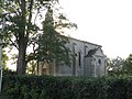 Chapel Saint-Denis
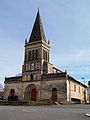 Church of Saint-Pierre
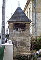 A Dovecote
 The War Memorial


Sports
The Ambarésienne Sports Association (ASA) was founded in 1970 and is a sports association affiliated with the French Federation of Omnisports Clubs (FFCO). Its purpose is to provide sport for all. The ASA had more than 2,500 members and 23 sections in 2012.
Notable people linked to the commune
- Members of the musical group Noir Désir recorded part of their debut album at Ambarès near La Blanche (water point) and one of the members of the group lives in Ambarès.
- André Lignac, born in Ambarès and was deputy mayor of the town for over 50 years.
- Marc Oraison (1914-1979), born in Ambarès, priest and doctor.
See also
References
- "Populations légales 2019". The National Institute of Statistics and Economic Studies. 29 December 2021.
- Inhabitants of Gironde (in French)
- Google Maps
- Des villages de Cassini aux communes d'aujourd'hui: Commune data sheet Ambarès-et-Lagrave, EHESS. (in French)
- List of Mayors of France
- National Commission for Decentralised cooperation (in French)
- Population en historique depuis 1968, INSEE
- Ministry of Culture, Mérimée IA33001187 Lavoir at La Gorp (in French)
- Ministry of Culture, Mérimée IA33001193 Château Beauséjour (in French)
- Ministry of Culture, Mérimée IA33001208 Château du Tillac (in French)
- Ministry of Culture, Mérimée IA33001207 Chauvette House at 10 Rue de la Commanderie des Templiers (in French)
- Ministry of Culture, Mérimée IA33001190 House at 27 Rue Edmond-Faulat (in French)
- Ministry of Culture, Mérimée IA33001188 House at 6-8 Rue Edmond-Faulat (in French)

- Ministry of Culture, Mérimée IA33001189 House at 9 Rue Edmond-Faulat (in French)
- Ministry of Culture, Mérimée IA33001196 Château de Formont (in French)
- Ministry of Culture, Mérimée IA33001201 Café Duthil at 11 Avenue de la Gare (in French)
- Ministry of Culture, Mérimée IA33001194 House at 7 Rue Guillaume-Peychaud (in French)
- Ministry of Culture, Mérimée IA33001198 Château du Gua (in French)
- Ministry of Culture, Mérimée IA33001199 Le Gaès Farmhouse at 22 Avenue de la Libération (in French)
- Ministry of Culture, Mérimée IA33001202 Rousseau House at 61 Avenue de la Libération (in French)
- Ministry of Culture, Mérimée IA33001202 Wine Warehouse at 69 bis Avenue de la Libération (in French)
- Ministry of Culture, Mérimée IA33001202 Covered Market / Town Hall at the Place du Maréchal-Leclerc (in French)
- Ministry of Culture, Mérimée IA33001206 Château Saint-Denis (in French)
- Ministry of Culture, Mérimée IA33001204 Château Peychaud (in French)
- Ministry of Culture, Mérimée PA00083109 Château Peychaud (in French)
- Ministry of Culture, Mérimée IA33001192 Château Bellevue (in French)
- Ministry of Culture, Mérimée IA33001195 Château Durandeau (in French)
- Ministry of Culture, Mérimée IA33001197 Le Grain House at 32 Avenue du Roy (in French)
- Ministry of Culture, Mérimée IA33001191 Beaujet House at 83 Avenue du Roy (in French)
- Ministry of Culture, Mérimée IA33001184 Beaujet Town Hall / School at Place de la Victoire (in French)
- Ministry of Culture, Mérimée IA33001178 War Memorial at Place de la Victoire (in French)
- Ministry of Culture, Mérimée IA33001125 Monumental Column at Rue de la Vierge (in French)
- Ministry of Culture, Mérimée IA33001181 Mills (in French)
- Ministry of Culture, Mérimée IA33001180 Winemakers' Huts (in French)
- Ministry of Culture, Mérimée IA33001115 Houses, Manors, and Farms (in French)
- Ministry of Culture, Mérimée IA33001258 Montferrand Marsh (in French)
- Ministry of Culture, Mérimée IA33001182 Church of Saint Pierre (in French)
- Ministry of Culture, Mérimée PA00083110 Church of Saint Pierre (in French)
- Ministry of Culture, Mérimée IA33001205 Chapel of Saint Denis (in French)
- Ministry of Culture, Mérimée IA33001200 Cemetery at Rue Victor-Hugo (in French)
- Ministry of Culture, Mérimée IA33001185 Presbytery at 3 Rue Victor-Hugo (in French)
- Ministry of Culture, Mérimée IA33001183 Church of the Templars Notre-Dame-de-la-Grave at Rue de la Vierge (in French)
- Ministry of Culture, Mérimée IA33001179 Monumental Crosses (in French)
External links
- Ambarès-et-Lagrave official website (in French)
- Ambarès-et-Lagrave on the old National Geographic Institute website (in French)
- Ambarésienne Sports Association official website (in French)
- Ambarès-et-Lagrave on Géoportail, National Geographic Institute (IGN) website (in French)
- Ambares and la Grave on the 1750 Cassini Map

Authority control | |
|---|---|
| General |
|
| National libraries | |
| Other |
|
На других языках
[de] Ambarès-et-Lagrave
Ambarès-et-Lagrave (okzitanisch Ambarés e La Grava) ist eine französische Stadt mit 16.636 Einwohnern (Stand 1. Januar 2019) im Département Gironde in der Region Nouvelle-Aquitaine. Die Stadt liegt im Arrondissement Bordeaux und im Kanton La Presqu’île.- [en] Ambarès-et-Lagrave
Другой контент может иметь иную лицензию. Перед использованием материалов сайта WikiSort.org внимательно изучите правила лицензирования конкретных элементов наполнения сайта.
WikiSort.org - проект по пересортировке и дополнению контента Википедии