world.wikisort.org - China
Longjing (simplified Chinese: 龙井; traditional Chinese: 龍井; pinyin: Lóngjǐng; Chosŏn'gŭl: 룡정; Hangul: 룽징) is a county-level city in Yanbian Korean Autonomous Prefecture, southeastern Jilin province, China. It lies on the Tumen River opposite the North Korean city Hoeryong.
Longjing
龙井市 · 룡정시 | |
|---|---|
County-level city | |
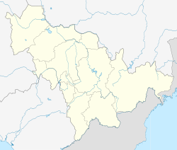
 Longjing Location in Jilin province | |
| Coordinates: 42°46′N 129°26′E | |
| Country | People's Republic of China |
| Province | Jilin |
| Prefecture | Yanbian |
| Seat | Anmin Subdistrict |
| Area | |
| • County-level city | 2,208.0 km2 (852.5 sq mi) |
| • Urban | 31.05 km2 (11.99 sq mi) |
| Elevation | 266 m (873 ft) |
| Population (2017)[1] | |
| • County-level city | 178,000 |
| • Density | 81/km2 (210/sq mi) |
| • Urban | 117,800 |
| Time zone | UTC+8 (China Standard) |
| Website | |
| Longjing, Jilin | |||||||
|---|---|---|---|---|---|---|---|
| Simplified Chinese | 龙井市 | ||||||
| Traditional Chinese | 龍井市 | ||||||
| |||||||
| Chinese Korean name | |||||||
| Chosŏn'gŭl | 룡정시 | ||||||
| |||||||
| South Korean name | |||||||
| Hangul | 룽징 시 | ||||||
| |||||||
Its population is approximately 258,000. It borders Yanji and Tumen City on the northeast, Helong to the southwest, and Antu County in the southwest. The border length is 142.5 kilometres (88.5 mi).
Yun Dong-ju studied in Longjing.[citation needed]
Administrative divisions
Longjing has two subdistricts, six towns and two townships:[2]
- Subdistricts
- Anmin Subdistrict (安民街道 / 안민가도)
- Longmen Subdistrict (龙门街道 / 룡문가도)
- Towns
- Chaoyangchuan (朝阳川镇 / 조양천진)
- Dongshengyong (东盛涌镇 / 동성용진)
- Kaishantun (开山屯镇 / 개산둔진)
- Laotougou (老头沟镇 / 로두구진)
- Sanhe (三合镇 / 삼합진)
- Zhixin (智新镇 / 지신진)
- Townships
- Baijin Township (白金乡 / 백금향)
- Dexin Township (德新乡 /덕신향)
Climate
| Climate data for Longjing (1981−2010) | |||||||||||||
|---|---|---|---|---|---|---|---|---|---|---|---|---|---|
| Month | Jan | Feb | Mar | Apr | May | Jun | Jul | Aug | Sep | Oct | Nov | Dec | Year |
| Record high °C (°F) | 6.8 (44.2) |
15.1 (59.2) |
20.7 (69.3) |
33.1 (91.6) |
33.8 (92.8) |
36.7 (98.1) |
37.1 (98.8) |
37.0 (98.6) |
32.7 (90.9) |
29.3 (84.7) |
19.4 (66.9) |
11.6 (52.9) |
37.1 (98.8) |
| Average high °C (°F) | −6.7 (19.9) |
−1.7 (28.9) |
5.3 (41.5) |
15.1 (59.2) |
21.1 (70.0) |
24.7 (76.5) |
26.7 (80.1) |
26.9 (80.4) |
22.1 (71.8) |
14.6 (58.3) |
3.7 (38.7) |
−4.4 (24.1) |
12.3 (54.1) |
| Daily mean °C (°F) | −13.3 (8.1) |
−8.6 (16.5) |
−1.2 (29.8) |
7.7 (45.9) |
14.0 (57.2) |
18.4 (65.1) |
21.4 (70.5) |
21.5 (70.7) |
15.1 (59.2) |
7.3 (45.1) |
−2.5 (27.5) |
−10.6 (12.9) |
5.8 (42.4) |
| Average low °C (°F) | −18.8 (−1.8) |
−14.6 (5.7) |
−7.2 (19.0) |
0.9 (33.6) |
7.6 (45.7) |
13.3 (55.9) |
17.2 (63.0) |
17.1 (62.8) |
9.4 (48.9) |
1.0 (33.8) |
−7.7 (18.1) |
−15.8 (3.6) |
0.2 (32.4) |
| Record low °C (°F) | −30.9 (−23.6) |
−28.2 (−18.8) |
−23.6 (−10.5) |
−11.2 (11.8) |
−1.8 (28.8) |
5.4 (41.7) |
8.9 (48.0) |
7.1 (44.8) |
−1.2 (29.8) |
−10.8 (12.6) |
−24.5 (−12.1) |
−29.1 (−20.4) |
−30.9 (−23.6) |
| Average precipitation mm (inches) | 5.4 (0.21) |
6.7 (0.26) |
11.7 (0.46) |
33.0 (1.30) |
62.8 (2.47) |
83.0 (3.27) |
136.4 (5.37) |
114.9 (4.52) |
65.9 (2.59) |
24.0 (0.94) |
13.3 (0.52) |
7.2 (0.28) |
564.3 (22.19) |
| Average relative humidity (%) | 60 | 56 | 53 | 54 | 61 | 72 | 80 | 80 | 76 | 64 | 61 | 61 | 65 |
| Source: China Meteorological Data Service Center[3] | |||||||||||||
References
- Ministry of Housing and Urban-Rural Development, ed. (2019). China Urban Construction Statistical Yearbook 2017. Beijing: China Statistics Press. p. 50. Retrieved 11 January 2020.
- "延边朝鲜族自治州-行政区划网 www.xzqh.org" (in Chinese). xzqh.org. Retrieved 2011-04-28.
- 中国地面气候标准值月值(1981-2010) (in Simplified Chinese). China Meteorological Data Service Center. Retrieved 24 August 2022.
External links
- Official website (Chinese)
На других языках
- [en] Longjing, Jilin
[ru] Лунцзин
Лунцзи́н (кит. упр. 龙井, пиньинь Lóngjǐng, кор. 룡정) — городской уезд Яньбянь-Корейского автономного округа провинции Гирин (КНР).Текст в блоке "Читать" взят с сайта "Википедия" и доступен по лицензии Creative Commons Attribution-ShareAlike; в отдельных случаях могут действовать дополнительные условия.
Другой контент может иметь иную лицензию. Перед использованием материалов сайта WikiSort.org внимательно изучите правила лицензирования конкретных элементов наполнения сайта.
Другой контент может иметь иную лицензию. Перед использованием материалов сайта WikiSort.org внимательно изучите правила лицензирования конкретных элементов наполнения сайта.
2019-2025
WikiSort.org - проект по пересортировке и дополнению контента Википедии
WikiSort.org - проект по пересортировке и дополнению контента Википедии