world.wikisort.org - China
Liuhe (Chinese: 柳河; pinyin: Liǔhé) is a county of southwestern Jilin province, China, bordering Liaoning province to the southwest. It is under the administration of Tonghua City, with a population of 360,000[when?] residing in an area of 3,348 km2 (1,293 sq mi).
Liuhe County
柳河县 | |
|---|---|
County | |
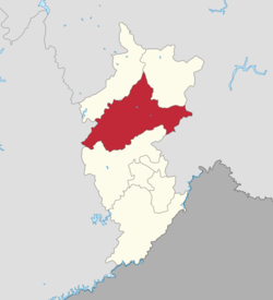 Location of Liuhe County (red) in Tonghua (yellow) | |
 Liuhe Location in Jilin province | |
| Coordinates: 42°17′N 125°45′E | |
| Country | People's Republic of China |
| Province | Jilin |
| Prefecture-level city | Tonghua |
| County seat | Liuhe Town (柳河镇) |
| Area | |
| • Total | 3,348 km2 (1,293 sq mi) |
| Elevation | 419 m (1,375 ft) |
| Population | |
| • Total | 360,000 |
| • Density | 110/km2 (280/sq mi) |
| Time zone | UTC+8 (China Standard) |
| Postal code | 135300 |
Administrative divisions
There are 11 towns, one ethnic town, and three townships.[1]
|
Towns:
|
Townships:
|
Climate
| Climate data for Liuhe (1981−2010) | |||||||||||||
|---|---|---|---|---|---|---|---|---|---|---|---|---|---|
| Month | Jan | Feb | Mar | Apr | May | Jun | Jul | Aug | Sep | Oct | Nov | Dec | Year |
| Record high °C (°F) | 5.7 (42.3) |
13.3 (55.9) |
18.3 (64.9) |
29.8 (85.6) |
33.5 (92.3) |
34.7 (94.5) |
36.1 (97.0) |
35.1 (95.2) |
29.9 (85.8) |
27.5 (81.5) |
19.4 (66.9) |
10.2 (50.4) |
36.1 (97.0) |
| Average high °C (°F) | −7.3 (18.9) |
−2.7 (27.1) |
4.5 (40.1) |
14.6 (58.3) |
21.2 (70.2) |
25.6 (78.1) |
27.3 (81.1) |
26.8 (80.2) |
21.8 (71.2) |
14.3 (57.7) |
3.4 (38.1) |
−4.4 (24.1) |
12.1 (53.8) |
| Daily mean °C (°F) | −14.7 (5.5) |
−9.9 (14.2) |
−1.6 (29.1) |
8.0 (46.4) |
14.8 (58.6) |
19.9 (67.8) |
22.5 (72.5) |
21.4 (70.5) |
14.9 (58.8) |
7.3 (45.1) |
−2.4 (27.7) |
−10.9 (12.4) |
5.8 (42.4) |
| Average low °C (°F) | −20.7 (−5.3) |
−16.2 (2.8) |
−7.1 (19.2) |
1.8 (35.2) |
8.6 (47.5) |
14.4 (57.9) |
18.1 (64.6) |
16.9 (62.4) |
9.1 (48.4) |
1.4 (34.5) |
−7.5 (18.5) |
−16.4 (2.5) |
0.2 (32.4) |
| Record low °C (°F) | −38.6 (−37.5) |
−34.8 (−30.6) |
−25.9 (−14.6) |
−12.6 (9.3) |
−3.7 (25.3) |
4.6 (40.3) |
9.2 (48.6) |
3.7 (38.7) |
−4.5 (23.9) |
−12.5 (9.5) |
−27.3 (−17.1) |
−33.0 (−27.4) |
−38.6 (−37.5) |
| Average precipitation mm (inches) | 8.3 (0.33) |
11.5 (0.45) |
22.3 (0.88) |
44.6 (1.76) |
67.7 (2.67) |
95.8 (3.77) |
189.2 (7.45) |
166.3 (6.55) |
61.1 (2.41) |
42.0 (1.65) |
25.7 (1.01) |
12.3 (0.48) |
746.8 (29.41) |
| Average relative humidity (%) | 68 | 65 | 60 | 56 | 59 | 69 | 79 | 80 | 75 | 66 | 67 | 68 | 68 |
| Source: China Meteorological Data Service Center[2] | |||||||||||||
References
- 2011年统计用区划代码和城乡划分代码:柳河县 (in Chinese). National Bureau of Statistics of the People's Republic of China. Retrieved 2012-07-18.
- 中国地面气候标准值月值(1981-2010) (in Simplified Chinese). China Meteorological Data Service Center. Retrieved 24 August 2022.
This Jilin location article is a stub. You can help Wikipedia by expanding it. |
Текст в блоке "Читать" взят с сайта "Википедия" и доступен по лицензии Creative Commons Attribution-ShareAlike; в отдельных случаях могут действовать дополнительные условия.
Другой контент может иметь иную лицензию. Перед использованием материалов сайта WikiSort.org внимательно изучите правила лицензирования конкретных элементов наполнения сайта.
Другой контент может иметь иную лицензию. Перед использованием материалов сайта WikiSort.org внимательно изучите правила лицензирования конкретных элементов наполнения сайта.
2019-2026
WikiSort.org - проект по пересортировке и дополнению контента Википедии
WikiSort.org - проект по пересортировке и дополнению контента Википедии