world.wikisort.org - Canada
Sainte-Hélène-de-Chester is a municipality located in the Centre-du-Québec region of Quebec, Canada.
Sainte-Hélène-de-Chester | |
|---|---|
Municipality | |
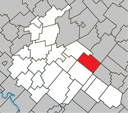 Location within Arthabaska RCM. | |
 Sainte-Hélène-de-Chester Location in southern Quebec. | |
| Coordinates: 46°02′N 71°42′W[1] | |
| Country | |
| Province | |
| Region | Centre-du-Québec |
| RCM | Arthabaska |
| Constituted | January 1, 1859 |
| Government | |
| • Mayor | Lionel Fréchette |
| • Federal riding | Richmond—Arthabaska |
| • Prov. riding | Drummond–Bois-Francs |
| Area | |
| • Total | 84.10 km2 (32.47 sq mi) |
| • Land | 83.96 km2 (32.42 sq mi) |
| Population (2011)[3] | |
| • Total | 358 |
| • Density | 4.3/km2 (11/sq mi) |
| • Pop 2006-2011 | |
| Time zone | UTC−5 (EST) |
| • Summer (DST) | UTC−4 (EDT) |
| Postal code(s) | G0P 1H0 |
| Area code(s) | 819 |
| Highways | |
| Website | www |
It was formerly a township municipality named Chester-Est, but it changed its name and its status on May 3, 2008.[4]
The old Sainte-Hélène-de-Chester and Trottier Mill were two former small towns within this municipality.
Sources
References
- "Reference number 401316 in Banque de noms de lieux du Québec". toponymie.gouv.qc.ca (in French). Commission de toponymie du Québec.
- "Geographic code 39035 in the official Répertoire des municipalités". www.mamh.gouv.qc.ca (in French). Ministère des Affaires municipales et de l'Habitation.
- "(Code 2439035) Census Profile". 2011 census. Statistics Canada. 2012.
- http://www.stat.gouv.qc.ca/publications/referenc/pdf2008/modif_mai08.pdf%5B%5D
Places adjacent to Sainte-Hélène-de-Chester, Quebec | ||||||||||||||||
|---|---|---|---|---|---|---|---|---|---|---|---|---|---|---|---|---|
| ||||||||||||||||
| Cities |
|
|---|---|
| Municipalities |
|
| Parishes |
|
| Townships |
|
| |
Authority control | |
|---|---|
| General |
|
| National libraries | |
This Quebec location article is a stub. You can help Wikipedia by expanding it. |
Текст в блоке "Читать" взят с сайта "Википедия" и доступен по лицензии Creative Commons Attribution-ShareAlike; в отдельных случаях могут действовать дополнительные условия.
Другой контент может иметь иную лицензию. Перед использованием материалов сайта WikiSort.org внимательно изучите правила лицензирования конкретных элементов наполнения сайта.
Другой контент может иметь иную лицензию. Перед использованием материалов сайта WikiSort.org внимательно изучите правила лицензирования конкретных элементов наполнения сайта.
2019-2025
WikiSort.org - проект по пересортировке и дополнению контента Википедии
WikiSort.org - проект по пересортировке и дополнению контента Википедии