world.wikisort.org - Canada
Saint-Rémi-de-Tingwick is a municipality located in the Centre-du-Québec region of Quebec, Canada.
Saint-Rémi-de-Tingwick | |
|---|---|
Municipality | |
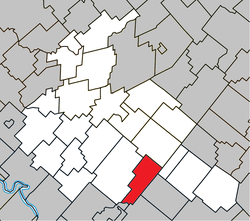 Location within Arthabaska RCM. | |
 Saint-Rémi-de-Tingwick Location in southern Quebec. | |
| Coordinates: 45°52′N 71°49′W[1] | |
| Country | |
| Province | |
| Region | Centre-du-Québec |
| RCM | Arthabaska |
| Constituted | January 1, 1882 |
| Government | |
| • Mayor | Estelle Luneau |
| • Federal riding | Richmond—Arthabaska |
| • Prov. riding | Drummond–Bois-Francs |
| Area | |
| • Total | 73.80 km2 (28.49 sq mi) |
| • Land | 73.33 km2 (28.31 sq mi) |
| Population (2011)[3] | |
| • Total | 474 |
| • Density | 6.5/km2 (17/sq mi) |
| • Pop 2006-2011 | |
| Postal code(s) | J0A 1K0 |
| Area code(s) | 819 |
| Highways | No major routes |
| Website | www.st-remi-de- tingwick.qc.ca |
References
- "Reference number 57573 in Banque de noms de lieux du Québec". toponymie.gouv.qc.ca (in French). Commission de toponymie du Québec.
- "Geographic code 39020 in the official Répertoire des municipalités". www.mamh.gouv.qc.ca (in French). Ministère des Affaires municipales et de l'Habitation.
- "(Code 2439020) Census Profile". 2011 census. Statistics Canada. 2012.
Places adjacent to Saint-Rémi-de-Tingwick, Quebec | ||||||||||||||||
|---|---|---|---|---|---|---|---|---|---|---|---|---|---|---|---|---|
| ||||||||||||||||
| Cities |
|
|---|---|
| Municipalities |
|
| Parishes |
|
| Townships |
|
| |
This Quebec location article is a stub. You can help Wikipedia by expanding it. |
Текст в блоке "Читать" взят с сайта "Википедия" и доступен по лицензии Creative Commons Attribution-ShareAlike; в отдельных случаях могут действовать дополнительные условия.
Другой контент может иметь иную лицензию. Перед использованием материалов сайта WikiSort.org внимательно изучите правила лицензирования конкретных элементов наполнения сайта.
Другой контент может иметь иную лицензию. Перед использованием материалов сайта WikiSort.org внимательно изучите правила лицензирования конкретных элементов наполнения сайта.
2019-2026
WikiSort.org - проект по пересортировке и дополнению контента Википедии
WikiSort.org - проект по пересортировке и дополнению контента Википедии