world.wikisort.org - Canada
Arthabaska Regional County Municipality is a regional county municipality located in the Centre-du-Québec region of Quebec. Its seat is Victoriaville.[2]
This article may be expanded with text translated from the corresponding article in Spanish. (June 2015) Click [show] for important translation instructions.
|
Arthabaska | |
|---|---|
Regional county municipality | |
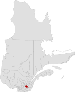 Location in Quebec | |
| Coordinates: 45°55′N 72°05′W[1] | |
| Country | Canada |
| Province | Quebec |
| Region | Centre-du-Québec |
| Effective | January 1, 1982 |
| County seat | Victoriaville |
| Government | |
| • Type | Prefecture |
| • Prefect | Lionel Fréchette |
| Area | |
| • Total | 1,910.60 km2 (737.69 sq mi) |
| • Land | 1,890.18 km2 (729.80 sq mi) |
| Population (2016)[3] | |
| • Total | 72,014 |
| • Density | 38.1/km2 (99/sq mi) |
| • Change 2011-2016 | |
| • Dwellings | 33,483 |
| Time zone | UTC−05:00 (EST) |
| • Summer (DST) | UTC−04:00 (EDT) |
| Area code(s) | 819 |
| Website | www |
| [4] | |
Subdivisions
There are 23 subdivisions within the RCM:[2]
|
|
|
|
Demographics
Mother tongue from 2016 Canadian Census[3]
| Language | Population | Pct (%) |
|---|---|---|
| French only | 69,175 | 97.1% |
| English only | 520 | 0.7% |
| Both English and French | 215 | 0.3% |
| Other languages | 1,335 | 1.9% |
Attractions
- Cinq-Chicots School of the Row (Saint-Christophe-d'Arthabaska)
- LaPierre Mill (Norbertville)
- Laurier Museum (Victoriaville)
- Marie-Victorin Park (Kingsey Falls)
- Postes Pavilion Hotel (Victoriaville)
- Rivière Nicolet Trout Fishing Post (Notre-Dame-de-Ham)
- Saint-Michel Mountain (Victoriaville)
- St-Médard Church (1874) (Warwick)
Transportation
Access Routes
Highways and numbered routes that run through the municipality, including external routes that start or finish at the county border:[5]
|
|
|
|
See also
- List of regional county municipalities and equivalent territories in Quebec
References
- Reference number 141121 of the Commission de toponymie du Québec (in French)
- Geographic code 390 in the official Répertoire des municipalités (in French)
- "Census Profile, 2016 Census: Arthabaska, Municipalité régionale de comté [Census division], Quebec". Statistics Canada. Retrieved November 26, 2019.
- "(Code 2439) Census Profile". 2011 census. Statistics Canada. 2012.
- Official Transport Quebec Road Map
External links
Adjacent Counties & Equivalent Territories | ||||||||||||||||
|---|---|---|---|---|---|---|---|---|---|---|---|---|---|---|---|---|
| ||||||||||||||||
| Regional county municipalities and equivalent territories |
|
|---|---|
| Municipalities | |
Administrative divisions of Quebec | |
Authority control | |
|---|---|
| General | |
| National libraries | |
| Other |
|
Текст в блоке "Читать" взят с сайта "Википедия" и доступен по лицензии Creative Commons Attribution-ShareAlike; в отдельных случаях могут действовать дополнительные условия.
Другой контент может иметь иную лицензию. Перед использованием материалов сайта WikiSort.org внимательно изучите правила лицензирования конкретных элементов наполнения сайта.
Другой контент может иметь иную лицензию. Перед использованием материалов сайта WikiSort.org внимательно изучите правила лицензирования конкретных элементов наполнения сайта.
2019-2026
WikiSort.org - проект по пересортировке и дополнению контента Википедии
WikiSort.org - проект по пересортировке и дополнению контента Википедии