world.wikisort.org - Canada
Sainte-Élizabeth-de-Warwick is a municipality located in the Centre-du-Québec region of Quebec, Canada.
Sainte-Élizabeth-de-Warwick | |
|---|---|
Municipality | |
 Location within Arthabaska RCM. | |
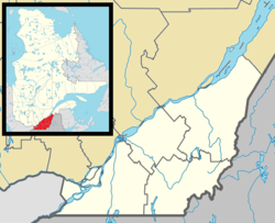  Sainte-Élizabeth-de-Warwick Location in southern Quebec. | |
| Coordinates: 45°55′N 72°05′W[1] | |
| Country |  Canada |
| Province |  Quebec |
| Region | Centre-du-Québec |
| RCM | Arthabaska |
| Constituted | May 18, 1887 |
| Government | |
| • Mayor | Jeannine Moisan |
| • Federal riding | Richmond—Arthabaska |
| • Prov. riding | Drummond–Bois-Francs |
| Area | |
| • Total | 51.60 km2 (19.92 sq mi) |
| • Land | 52.08 km2 (20.11 sq mi) |
| There is an apparent contradiction between two authoritative sources | |
| Population (2016)[3] | |
| • Total | 372 |
| • Density | 7.2/km2 (19/sq mi) |
| • Pop 2011-2016 |  0.5% |
| Postal code(s) | J0A 1M0 |
| Area code(s) | 819 |
| Highways | No major routes |
| Website | www.sainte-elizabeth -de-warwick.ca |
Before February 2, 2008, the name was spelled Sainte-Élisabeth-de-Warwick.[4]
The municipality is located in the Township of Warwick mainly in the western part of range IV.
References
- "Reference number 400662 in Banque de noms de lieux du Québec". toponymie.gouv.qc.ca (in French). Commission de toponymie du Québec.
- "Geographic code 39090 in the official Répertoire des municipalités". www.mamh.gouv.qc.ca (in French). Ministère des Affaires municipales et de l'Habitation.
- "(Code 2439090) Census Profile". 2011 census. Statistics Canada. 2012.
- http://www.stat.gouv.qc.ca/publications/referenc/pdf2008/Modif_fev08.pdf%5B%5D
Places adjacent to Sainte-Élizabeth-de-Warwick, Quebec | ||||||||||||||||
|---|---|---|---|---|---|---|---|---|---|---|---|---|---|---|---|---|
| ||||||||||||||||


| Cities |
|
|---|---|
| Municipalities |
|
| Parishes |
|
| Townships |
|
| |

| Authority control |
|
|---|

Текст в блоке "Читать" взят с сайта "Википедия" и доступен по лицензии Creative Commons Attribution-ShareAlike; в отдельных случаях могут действовать дополнительные условия.
Другой контент может иметь иную лицензию. Перед использованием материалов сайта WikiSort.org внимательно изучите правила лицензирования конкретных элементов наполнения сайта.
Другой контент может иметь иную лицензию. Перед использованием материалов сайта WikiSort.org внимательно изучите правила лицензирования конкретных элементов наполнения сайта.
2019-2026
WikiSort.org - проект по пересортировке и дополнению контента Википедии
WikiSort.org - проект по пересортировке и дополнению контента Википедии