world.wikisort.org - Canada
Hampden is a township municipality of about 200 people in Le Haut-Saint-François Regional County Municipality, in the Estrie region of Quebec, Canada.
Hampden | |
|---|---|
Township municipality | |
 Pain de Sucre | |
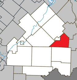 Location within Le Haut-Saint-François RCM | |
 Hampden Location in southern Quebec | |
| Coordinates: 45.5°N 71.25°W[1] | |
| Country | |
| Province | |
| Region | Estrie |
| RCM | Le Haut-Saint-François |
| Constituted | January 1, 1874 |
| Government | |
| • Mayor | Bertrand Prévost |
| • Federal riding | Compton—Stanstead |
| • Prov. riding | Mégantic |
| Area | |
| • Total | 111.80 km2 (43.17 sq mi) |
| • Land | 111.88 km2 (43.20 sq mi) |
| There is an apparent contradiction between two authoritative sources | |
| Population (2016)[3] | |
| • Total | 176 |
| • Density | 1.6/km2 (4/sq mi) |
| • Pop 2011-2016 | |
| Time zone | UTC−5 (EST) |
| • Summer (DST) | UTC−4 (EDT) |
| Postal code(s) | J0B 1Y0 |
| Area code | 819 |
| Highways | |
| Website | www |
Demographics
In the 2021 Census of Population conducted by Statistics Canada, Hampden had a population of 193 living in 87 of its 114 total private dwellings, a change of 9.7% from its 2016 population of 176. With a land area of 111.68 km2 (43.12 sq mi), it had a population density of 1.7/km2 (4.5/sq mi) in 2021.[4]
References
- "Reference number 27855 in Banque de noms de lieux du Québec". toponymie.gouv.qc.ca (in French). Commission de toponymie du Québec.
- "Geographic code 41075 in the official Répertoire des municipalités". www.mamh.gouv.qc.ca (in French). Ministère des Affaires municipales et de l'Habitation.
- "Census Profile, 2016 Census - Hampden, Canton (Municipalité de) [Census subdivision], Quebec and Brome-Missisquoi, Municipalité régionale de comté [Census division], Quebec". 8 February 2017.
- "Population and dwelling counts: Canada, provinces and territories, and census subdivisions (municipalities), Quebec". Statistics Canada. February 9, 2022. Retrieved August 28, 2022.
External links
 Media related to Hampden, Quebec at Wikimedia Commons
Places adjacent to Hampden, Quebec | |
|---|---|
| Cities & Towns |
|
|---|---|
| Municipalities | |
| Townships | |
| |
This Estrie location article is a stub. You can help Wikipedia by expanding it. |
Текст в блоке "Читать" взят с сайта "Википедия" и доступен по лицензии Creative Commons Attribution-ShareAlike; в отдельных случаях могут действовать дополнительные условия.
Другой контент может иметь иную лицензию. Перед использованием материалов сайта WikiSort.org внимательно изучите правила лицензирования конкретных элементов наполнения сайта.
Другой контент может иметь иную лицензию. Перед использованием материалов сайта WikiSort.org внимательно изучите правила лицензирования конкретных элементов наполнения сайта.
2019-2026
WikiSort.org - проект по пересортировке и дополнению контента Википедии
WikiSort.org - проект по пересортировке и дополнению контента Википедии