world.wikisort.org - Canada
Milan is a municipality of about 300 people in Le Granit Regional County Municipality in the Estrie region in Quebec, Canada.
Milan | |
|---|---|
Municipality | |
 | |
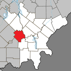 Location within Le Granit RCM | |
 Milan Location in southern Quebec | |
| Coordinates: 45°36′N 71°08′W[1] | |
| Country | |
| Province | |
| Region | Estrie |
| RCM | Le Granit |
| Constituted | 1 June 1948 |
| Named for | Milan, Italy[1] |
| Government | |
| • Mayor | Claude Turcotte |
| • Federal riding | Mégantic—L'Érable |
| • Prov. riding | Mégantic |
| Area | |
| • Total | 130.80 km2 (50.50 sq mi) |
| • Land | 129.44 km2 (49.98 sq mi) |
| Population (2021)[3] | |
| • Total | 318 |
| • Density | 2.5/km2 (6/sq mi) |
| • Pop 2016–2021 | |
| • Dwellings | 212 |
| Time zone | UTC−5 (EST) |
| • Summer (DST) | UTC−4 (EDT) |
| Postal code(s) | G0Y 1E0 |
| Area code | 819 |
| Highways | |
| Website | www |
The community was established 1877 by Scottish immigrants from Lewis, and originally known as Marsden. Due to confusion with the township of Marston, the community's name was changed to Milan some years later.
Climate
| Climate data for Milan | |||||||||||||
|---|---|---|---|---|---|---|---|---|---|---|---|---|---|
| Month | Jan | Feb | Mar | Apr | May | Jun | Jul | Aug | Sep | Oct | Nov | Dec | Year |
| Record high °C (°F) | 16 (61) |
16 (61) |
21.5 (70.7) |
28 (82) |
30 (86) |
31.5 (88.7) |
33.3 (91.9) |
32.2 (90.0) |
30 (86) |
26.7 (80.1) |
21.7 (71.1) |
17.2 (63.0) |
33.3 (91.9) |
| Average high °C (°F) | −6.6 (20.1) |
−5.1 (22.8) |
0.7 (33.3) |
7.5 (45.5) |
16.1 (61.0) |
20.7 (69.3) |
22.8 (73.0) |
21.5 (70.7) |
16.5 (61.7) |
10 (50) |
2.7 (36.9) |
−3.7 (25.3) |
8.6 (47.5) |
| Daily mean °C (°F) | −11.9 (10.6) |
−10.6 (12.9) |
−4.8 (23.4) |
2.4 (36.3) |
10 (50) |
14.8 (58.6) |
17.3 (63.1) |
16.1 (61.0) |
11.3 (52.3) |
5.3 (41.5) |
−1.3 (29.7) |
−8.5 (16.7) |
3.3 (37.9) |
| Average low °C (°F) | −17.2 (1.0) |
−16 (3) |
−10.2 (13.6) |
−2.8 (27.0) |
3.9 (39.0) |
9 (48) |
11.7 (53.1) |
10.7 (51.3) |
6 (43) |
0.6 (33.1) |
−5.4 (22.3) |
−13.3 (8.1) |
−1.9 (28.6) |
| Record low °C (°F) | −38.3 (−36.9) |
−39 (−38) |
−34.5 (−30.1) |
−22.8 (−9.0) |
−12.2 (10.0) |
−2.2 (28.0) |
0 (32) |
−1.1 (30.0) |
−8.5 (16.7) |
−12.8 (9.0) |
−26 (−15) |
−35 (−31) |
−39 (−38) |
| Average precipitation mm (inches) | 105.8 (4.17) |
89.2 (3.51) |
101.1 (3.98) |
85.8 (3.38) |
105.7 (4.16) |
127.5 (5.02) |
125.9 (4.96) |
137.9 (5.43) |
115.8 (4.56) |
104.7 (4.12) |
109.8 (4.32) |
113.1 (4.45) |
1,322.4 (52.06) |
| Source: Environment Canada[4] | |||||||||||||
References
Wikimedia Commons has media related to Milan, Quebec.
- "Reference number 41064 in Banque de noms de lieux du Québec". toponymie.gouv.qc.ca (in French). Commission de toponymie du Québec.
- "Geographic code 30040 in the official Répertoire des municipalités". www.mamh.gouv.qc.ca (in French). Ministère des Affaires municipales et de l'Habitation.
- "Tableau de profil, Profil du recensement, Recensement de la population de 2021". 9 February 2022.
- Environment Canada Canadian Climate Normals 1971–2000, accessed 17 July 2010
| Cities |
|
|---|---|
| Municipalities |
|
| Parishes |
|
| Townships |
|
| |
Authority control | |
|---|---|
| General |
|
| National libraries | |
This Estrie location article is a stub. You can help Wikipedia by expanding it. |
Текст в блоке "Читать" взят с сайта "Википедия" и доступен по лицензии Creative Commons Attribution-ShareAlike; в отдельных случаях могут действовать дополнительные условия.
Другой контент может иметь иную лицензию. Перед использованием материалов сайта WikiSort.org внимательно изучите правила лицензирования конкретных элементов наполнения сайта.
Другой контент может иметь иную лицензию. Перед использованием материалов сайта WikiSort.org внимательно изучите правила лицензирования конкретных элементов наполнения сайта.
2019-2026
WikiSort.org - проект по пересортировке и дополнению контента Википедии
WikiSort.org - проект по пересортировке и дополнению контента Википедии