world.wikisort.org - Canada
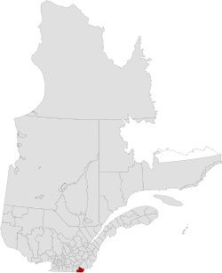
Coaticook is a regional county municipality in the Estrie region of Quebec, Canada. The seat is Coaticook.
This article may be expanded with text translated from the corresponding article in Spanish. (June 2015) Click [show] for important translation instructions.
|
Coaticook | |
|---|---|
Regional county municipality | |
 | |
| Coordinates: 45°08′N 71°48′W[1] | |
| Country | |
| Province | |
| Region | Estrie |
| Effective | January 1, 1982 |
| County seat | Coaticook |
| Government | |
| • Type | Prefecture |
| • Prefect | Réjean Masson |
| Area | |
| • Total | 1,354.70 km2 (523.05 sq mi) |
| • Land | 1,339.80 km2 (517.30 sq mi) |
| Population (2016)[3] | |
| • Total | 18,497 |
| • Density | 13.8/km2 (36/sq mi) |
| • Change 2011-2016 | |
| Time zone | UTC−5 (EST) |
| • Summer (DST) | UTC−4 (EDT) |
| Area code(s) | 819 |
| Website | www |
| [4] | |
History
On September 3, 1783, as a result of the signing of the Treaty of Paris the American Revolutionary War ended with Great Britain. Quebec's border with the states of Vermont and New Hampshire was established at 45 degrees north latitude.[5][6]
Subdivisions
There are 12 subdivisions within the RCM:[2]
|
|
|
Demographics
Mother tongue data from Canada 2016 Census[3]
| Language | Population | Pct (%) |
|---|---|---|
| French only | 16,055 | 87.7% |
| English only | 1,850 | 10.1% |
| Both English and French | 185 | 1.0% |
| Other languages | 215 | 1.2% |
Transportation
Access Routes
Highways and numbered routes that run through the municipality, including external routes that start or finish at the county border:[7]
|
|
|
|
See also
- List of regional county municipalities and equivalent territories in Quebec
References
- "Reference number 141109 in Banque de noms de lieux du Québec". toponymie.gouv.qc.ca (in French). Commission de toponymie du Québec.
- "Geographic code 440 in the official Répertoire des municipalités". www.mamh.gouv.qc.ca (in French). Ministère des Affaires municipales et de l'Habitation.
- "Census Profile, 2016 Census: Coaticook, Municipalité régionale de comté [Census division], Quebec". Statistics Canada. Retrieved December 4, 2019.
- "(Code 2444) Census Profile". 2011 census. Statistics Canada. 2012.
- Van Zandt, Franklin K. Boundaries of the United States and the Several States. Geological Survey Professional Paper 909. Washington, DC; Government Printing Office, 1976. The Standard Compilation for its subject. P. 12.
- Parry, Clive, ed. Consolidated Treaty Series. 231 Volumes. Dobbs Ferry, New York City; Oceana Publications, 1969-1981. Volume 48; pp. 481; 487; 491-492.
- Official Transport Quebec Road Map
External links
- Coaticook Regional County Municipality website (in French)
Adjacent Counties & Equivalent Territories | ||||||||||||||||
|---|---|---|---|---|---|---|---|---|---|---|---|---|---|---|---|---|
| ||||||||||||||||
| Regional county municipalities and equivalent territories |
|
|---|---|
| Municipalities |
|
Administrative divisions of Quebec | |
Authority control | |
|---|---|
| General |
|
| National libraries | |
| Other |
|
Текст в блоке "Читать" взят с сайта "Википедия" и доступен по лицензии Creative Commons Attribution-ShareAlike; в отдельных случаях могут действовать дополнительные условия.
Другой контент может иметь иную лицензию. Перед использованием материалов сайта WikiSort.org внимательно изучите правила лицензирования конкретных элементов наполнения сайта.
Другой контент может иметь иную лицензию. Перед использованием материалов сайта WikiSort.org внимательно изучите правила лицензирования конкретных элементов наполнения сайта.
2019-2026
WikiSort.org - проект по пересортировке и дополнению контента Википедии
WikiSort.org - проект по пересортировке и дополнению контента Википедии