world.wikisort.org - Canada
East Angus (French pronunciation: [istɛ̃ɡys]) is a city in Le Haut-Saint-François Regional County Municipality, in Quebec, Canada. The city had a population of 3,741 as of the Canada 2011 Census.
This article may be expanded with text translated from the corresponding article in French. (October 2020) Click [show] for important translation instructions.
|
East Angus | |
|---|---|
City | |
 | |
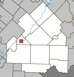 Location within Le Haut-Saint-François RCM | |
 East Angus Location in southern Quebec | |
| Coordinates: 45°29′N 71°40′W[1] | |
| Country | |
| Province | |
| Region | Estrie |
| RCM | Le Haut-Saint-François |
| Constituted | March 14, 1912 |
| Government | |
| • Mayor | Robert G. Roy |
| • Federal riding | Compton—Stanstead |
| • Prov. riding | Mégantic |
| Area | |
| • Total | 8.30 km2 (3.20 sq mi) |
| • Land | 7.91 km2 (3.05 sq mi) |
| Population (2011)[3] | |
| • Total | 3,741 |
| • Density | 472.7/km2 (1,224/sq mi) |
| • Pop 2006-2011 | |
| Time zone | UTC−5 (EST) |
| • Summer (DST) | UTC−4 (EDT) |
| Postal code(s) | J0B 1R0 |
| Area code | 819 |
| Highways | |
| Website | www |
Demographics
In the 2021 Census of Population conducted by Statistics Canada, East Angus had a population of 3,840 living in 1,653 of its 1,718 total private dwellings, a change of 4.9% from its 2016 population of 3,659. With a land area of 7.84 km2 (3.03 sq mi), it had a population density of 489.8/km2 (1,268.6/sq mi) in 2021.[4]
References
- "Reference number 142194 in Banque de noms de lieux du Québec". toponymie.gouv.qc.ca (in French). Commission de toponymie du Québec.
- "Geographic code 41060 in the official Répertoire des municipalités". www.mamh.gouv.qc.ca (in French). Ministère des Affaires municipales et de l'Habitation.
- "(Code 2441060) Census Profile". 2011 census. Statistics Canada. 2012.
- "Population and dwelling counts: Canada, provinces and territories, and census subdivisions (municipalities), Quebec". Statistics Canada. February 9, 2022. Retrieved August 29, 2022.
External links
 Media related to East Angus, Quebec at Wikimedia Commons
| Cities & Towns |
|
|---|---|
| Municipalities | |
| Townships | |
| |
Authority control | |
|---|---|
| General |
|
| National libraries | |
This Estrie location article is a stub. You can help Wikipedia by expanding it. |
Текст в блоке "Читать" взят с сайта "Википедия" и доступен по лицензии Creative Commons Attribution-ShareAlike; в отдельных случаях могут действовать дополнительные условия.
Другой контент может иметь иную лицензию. Перед использованием материалов сайта WikiSort.org внимательно изучите правила лицензирования конкретных элементов наполнения сайта.
Другой контент может иметь иную лицензию. Перед использованием материалов сайта WikiSort.org внимательно изучите правила лицензирования конкретных элементов наполнения сайта.
2019-2026
WikiSort.org - проект по пересортировке и дополнению контента Википедии
WikiSort.org - проект по пересортировке и дополнению контента Википедии