world.wikisort.org - Canada
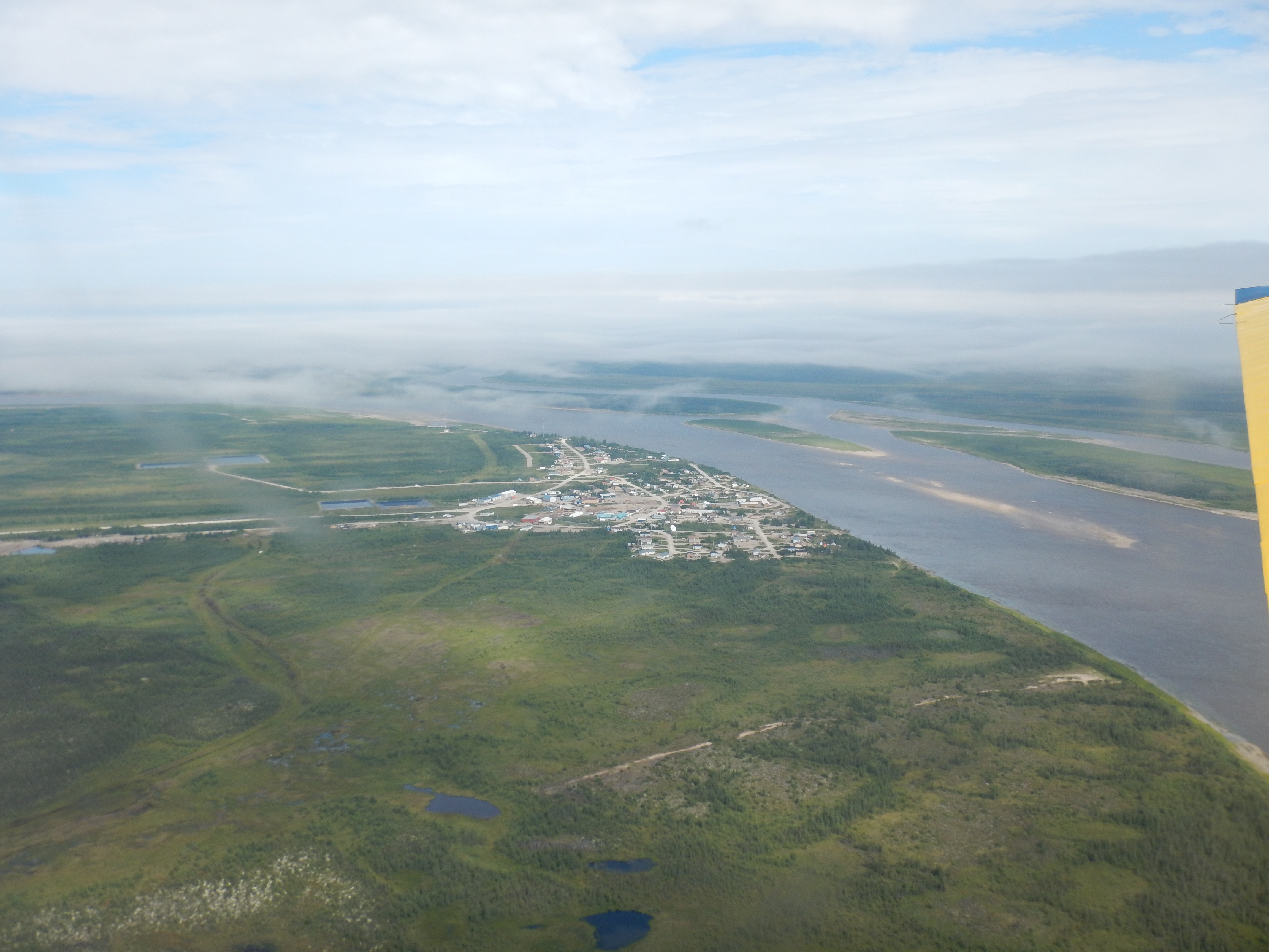
Fort Severn First Nation (ᐗᔕᐦᐅ ᐃᓂᓂᐗᐠ [Waśaho Ininiwak] in Cree) is a Western Swampy Cree First Nation band government located on Hudson Bay and is the most northern community in Ontario, Canada. In 2001, the population was 401, consisting of 90 families in an area of 40 square kilometres. The legal name of the reserve is Fort Severn 89, with the main settlement of Fort Severn (ᐗᔕᐦᐅᐠ [Waśahohk]).
Fort Severn 89 | |
|---|---|
Indian reserve | |
| Fort Severn Indian Reserve No. 89 | |
 Fort Severn 89 | |
| Coordinates: 55°59′N 87°38′W | |
| Country | |
| Province | |
| District | Kenora |
| First Nation | Fort Severn |
| Area | |
| • Land | 44.07 km2 (17.02 sq mi) |
| Population (2016)[2] | |
| • Total | 361 |
| • Density | 8.2/km2 (21/sq mi) |
| Website | fortsevern.firstnation.ca |
![Sign at Fort Severn Airport in English (Fort Severn) and Cree (ᐗᔕᐦᐅᐠ [Waśahohk]). Summer 2015](http://upload.wikimedia.org/wikipedia/commons/b/be/Fort_severn_Airport_Sign.jpg)
The town is linked by a winter/ice road called the Wapusk Trail during the winter to Peawanuck, Ontario in the east, and Shamattawa and Gillam, Manitoba to the west.
Fort Severn is policed by the Nishnawbe-Aski Police Service, an Indigenous-based service.
History
This area was inhabited for thousands of years by varying cultures of indigenous peoples. At the time of European contact, the historic Swampy Cree, an Algonquian-speaking people, lived in the area.
In 1689 the Hudson's Bay Company built Fort Severn at this site, originally naming it Fort James;[3] it was one of the earliest English fur trading posts in the New World. After years of international competition between the English and French, with their wars playing out in North America, the French attacked the outpost and pillaged it in 1782 when they were allies of the Thirteen Colonies during the American Revolutionary War.
In the early 20th century, when the federal government negotiated a treaty with the First Nations, it set aside land for a native reserve in the Rocksand area at the confluence of the Severn and Sachigo Rivers, with the consent of the leaders at the time. In 1973, the reserve was relocated to the mouth of the Severn River on Hudson Bay, for more direct access to shipping. The reserve achieved full status on January 11, 1980.
Government
The local band council consists of an elected chief, a deputy chief, and four band councilors.
Community services
There is no hospital in Fort Severn, with medical needs provided either at the local nursing station or via Keewaytinook Okimakanak Telemedicine (KOTM) link.[4] The Community Doctor (Christopher Arthur Giles) travels in every month to do regular check-ups, follow-ups, and schedule appointments and surgeries. Specialists such as optometrists, dentists, and hygienists travel to Fort Severn every two to three months.
Transportation
There are only local roads in town and residents travel by car, snowmobile, four-wheelers, or walking.
The Fort Severn Airport is located a short distance from the settlement and is reached by an access road.
Education
Wasaho Cree Nation School is the full functioning school providing primary education needs. It was built in 2016, preparing students for 21st century learning. Keewaytinook Internet High School is housed in a small building and provides distance learning for residents needing secondary education.[5]
Climate
Fort Severn has a subarctic climate (Dfc) and is one of the coldest communities in Ontario. Summers typically have cool to mild weather with short heatwaves, while winters are severely cold and long, lasting from October to sometimes through May.[6]
| Climate data for Fort Severn | |||||||||||||
|---|---|---|---|---|---|---|---|---|---|---|---|---|---|
| Month | Jan | Feb | Mar | Apr | May | Jun | Jul | Aug | Sep | Oct | Nov | Dec | Year |
| Record high °F (°C) | 33.3 (0.7) |
33.1 (0.6) |
51.4 (10.8) |
61.7 (16.5) |
81.5 (27.5) |
94.5 (34.7) |
95.2 (35.1) |
90.7 (32.6) |
85.3 (29.6) |
77.7 (25.4) |
53.2 (11.8) |
36.7 (2.6) |
95.2 (35.1) |
| Average high °F (°C) | −1.1 (−18.4) |
0.9 (−17.3) |
14.8 (−9.6) |
27.7 (−2.4) |
42.2 (5.7) |
56.9 (13.8) |
65.2 (18.4) |
64.4 (18.0) |
54.5 (12.5) |
41.3 (5.2) |
22.2 (−5.4) |
5.4 (−14.8) |
32.9 (0.5) |
| Daily mean °F (°C) | −9.7 (−23.2) |
−9 (−23) |
3 (−16) |
17.9 (−7.8) |
33.9 (1.1) |
46.3 (7.9) |
54.4 (12.4) |
54.7 (12.6) |
46.3 (7.9) |
35.7 (2.1) |
15.8 (−9.0) |
−1.5 (−18.6) |
24.0 (−4.5) |
| Average low °F (°C) | −18.2 (−27.9) |
−18.9 (−28.3) |
−8.8 (−22.7) |
8 (−13) |
25.6 (−3.6) |
35.6 (2.0) |
43.6 (6.4) |
45 (7) |
38.1 (3.4) |
30 (−1) |
9.4 (−12.6) |
−8.3 (−22.4) |
15.1 (−9.4) |
| Record low °F (°C) | −46.7 (−43.7) |
−50.6 (−45.9) |
−39.1 (−39.5) |
−22.5 (−30.3) |
−2.4 (−19.1) |
24.3 (−4.3) |
31.3 (−0.4) |
31.1 (−0.5) |
23.4 (−4.8) |
7.7 (−13.5) |
−27.4 (−33.0) |
−49.5 (−45.3) |
−50.6 (−45.9) |
| [citation needed] | |||||||||||||
In popular culture
Fort James, a British settlement controlled by a governor who reports to the king and who represents Hudson Bay Company,[7] is the principal setting of the 2016 TV series, Frontier. As Ann Foster describes for ScreenerTV, "'Frontier' is set in the coastal settlement of Fort James: A snowy, treacherous pocket of land that would, in a century’s time, become part of Canada."[8]
A town by the name of Fort Severn is featured in several episodes of the 1996 anime series After War Gundam X.
References
- "Fort Severn 89 census profile". 2011 Census of Population. Statistics Canada. Retrieved 27 May 2015.
- "Fort Severn 89 census profile". 2016 Census of Population. Statistics Canada. Retrieved 20 May 2016.
- "Ontario Forts: page 4". www.northamericanforts.com. Retrieved 21 April 2018.
- "Telehealth and Telemedicine - Fort Severn First Nation". fortsevern.firstnation.ca. Retrieved 21 April 2018.
- "Fort Severn - Keewaytinook Internet High School". kihs1.knet.ca. Retrieved 21 April 2018.
- Canada, Environment and Climate Change (2011-10-31). "Station Results - Historical Data - Climate - Environment and Climate Change Canada". climate.weather.gc.ca. Retrieved 2020-08-11.
- Getz, Dana (January 19, 2017). "Is 'Frontier' Based On A True Story? The Netflix Show Has Historical Roots". Bustle.
- Foster, Ann (January 19, 2017). "Jason Momoa makes Canadian history riveting in Netflix's 'Frontier'". screenertv.com.
Places adjacent to Fort Severn First Nation | ||||||||||||||||
|---|---|---|---|---|---|---|---|---|---|---|---|---|---|---|---|---|
| ||||||||||||||||

Authority control | |
|---|---|
| General | |
| National libraries | |
Другой контент может иметь иную лицензию. Перед использованием материалов сайта WikiSort.org внимательно изучите правила лицензирования конкретных элементов наполнения сайта.
WikiSort.org - проект по пересортировке и дополнению контента Википедии