world.wikisort.org - Canada
Attawapiskat 91A is the main reserve of the Attawapiskat First Nation, near the mouth of the Attawapiskat River in Kenora District, Ontario, Canada.
Attawapiskat 91A
ᐋᐦᑕᐙᐱᐢᑲᑐᐎ | |
|---|---|
Indian reserve | |
| Attawapiskat Indian Reserve No. 91A | |
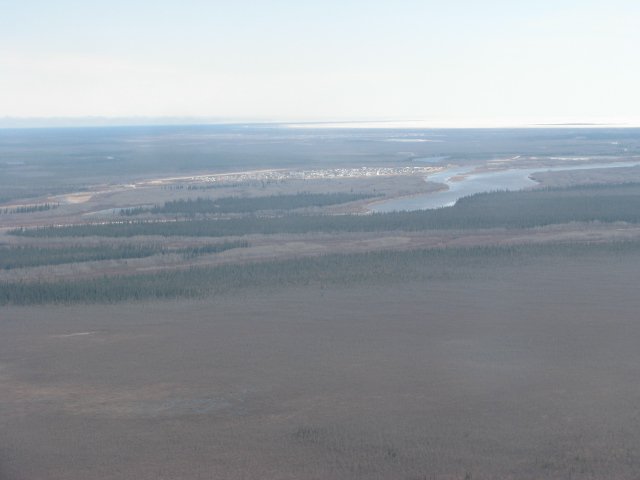 Attawapiskat Settlement between Attawapiskat River and James Bay | |
 Attawapiskat 91A | |
| Coordinates: 52°55′N 82°26′W | |
| Country | |
| Province | |
| Division | Kenora District |
| First Nation | Attawapiskat |
| Established | 1950 |
| Government | |
| • Chief | Ignace Gull |
| Area | |
| • Land | 1.19 km2 (0.46 sq mi) |
| Population (2011) | |
| • Total | Incompletely enumerated[1] 1,929[2] |
| Time zone | UTC-5 (EST) |
| • Summer (DST) | UTC-4 (EDT) |
| Postal code span | P0L 1A0 |
| Area code(s) | 705 |
| Website | www.attawapiskat.org |
References
- "Attawapiskat 91A census profile". 2011 Census of Population. Statistics Canada. Retrieved 2015-05-20.
- Linda Goyette (December 10, 2010). "Attawapiskat: The State of First Nations Education in Canada". Canadian Geographic. Retrieved 2011-12-03.
External links
Places adjacent to Attawapiskat 91A | |
|---|---|
Kenora District, Ontario | ||
|---|---|---|
| Cities |
|  |
| Towns |
| |
| Townships |
| |
| First Nations |
| |
| Indian reserves |
| |
| Indian settlements |
| |
| Unorganized areas | ||
| Local services boards |
| |
| Unincorporated communities |
| |
| ||
This article about an Indian reserve in Ontario is a stub. You can help Wikipedia by expanding it. |
Текст в блоке "Читать" взят с сайта "Википедия" и доступен по лицензии Creative Commons Attribution-ShareAlike; в отдельных случаях могут действовать дополнительные условия.
Другой контент может иметь иную лицензию. Перед использованием материалов сайта WikiSort.org внимательно изучите правила лицензирования конкретных элементов наполнения сайта.
Другой контент может иметь иную лицензию. Перед использованием материалов сайта WikiSort.org внимательно изучите правила лицензирования конкретных элементов наполнения сайта.
2019-2026
WikiSort.org - проект по пересортировке и дополнению контента Википедии
WikiSort.org - проект по пересортировке и дополнению контента Википедии