 Bear skin drying
 Kateri Tekakwitha church
 Government building
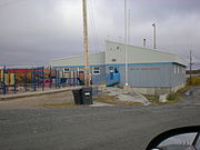 Kaw Tay Whee School
world.wikisort.org - Canada
Dettah[pronunciation?], sometimes, incorrectly, as Detah,[7] is a First Nations[8] community in the North Slave Region of the Northwest Territories, Canada. Located just southeast of the capital of Yellowknife, it is a 6.5 km (4.0 mi) drive from that city by ice road across the north arm of Great Slave Lake in winter or a 27 km (17 mi) drive via the Ingraham Trail, year-round. The name means 'Burnt Point' in the Dogrib language and refers to a traditional fishing camp used by the Dene for hundreds of years.
Dettah
Tʼèɂehdaà | |
|---|---|
Yellowknives Dene First Nation (Dettah) | |
 | |
 Dettah  Dettah | |
| Coordinates: 62°24′40″N 114°18′30″W[1] | |
| Country | Canada |
| Territory | Northwest Territories |
| Region | North Slave Region |
| Territorial electoral district | Tu Nedhé-Wiilideh |
| Census division | Region 6 |
| Government | |
| • Chief | Edward Sangris |
| • Chief Executive Officer | Lena Black |
| • MLA | Bob Bromley |
| Area | |
| • Land | 1.12 km2 (0.43 sq mi) |
| Elevation | 179 m (587 ft) |
| Population (2021)[3] | |
| • Total | 192 |
| • Density | 171.9/km2 (445/sq mi) |
| Time zone | UTC−07:00 (MST) |
| • Summer (DST) | UTC−06:00 (MDT) |
| Canadian Postal code | X1A |
| Area code(s) | 867 |
| Telephone exchanges | 444 445 446 669 765 766 873 920 |
| Sources: Department of Municipal and Community Affairs,[4] Prince of Wales Northern Heritage Centre,[5] Canada Flight Supplement[6] | |
Demographics
In the 2021 Canadian census conducted by Statistics Canada, Dettah recorded a population of 192 living in 79 of its 85 total private dwellings, a change of -12.3% from its 2016 population of 219. With a land area of 1.12 km2 (0.43 sq mi), it had a population density of 171.4/km2 in 2021.[3]
Both it and Ndilǫ are the communities of the Yellowknives. Dettah is represented by the Yellowknives Dene First Nation (Dettah) and are part of the Akaitcho Territory Government.[9]
| Year | Pop. | ±% |
|---|---|---|
| 1976 | 126 | — |
| 1981 | 143 | +13.5% |
| 1986 | 131 | −8.4% |
| 1991 | 150 | +14.5% |
| 1996 | 190 | +26.7% |
| 2001 | 234 | +23.2% |
| 2006 | 247 | +5.6% |
| 2011 | 210 | −15.0% |
| 2016 | 219 | +4.3% |
| 2021 | 192 | −12.3% |
| Source: Statistics Canada [3][10][11][12][13][14][15][16][17] | ||
|
| |||||||||||||||||||||||||||||||||||||||||||||||||||||||||||||||
| Sources: NWT Bureau of Statistics (2008 - 2019),[18] NWT Bureau of Statistics (2001 - 2017)[19] | ||||||||||||||||||||||||||||||||||||||||||||||||||||||||||||||||
Gallery


Climate
Dettah has a subarctic climate (Dfc) with long, severely cold winters and short but mild, sometimes warm summers. Dettah and Yellowknife experience the sunniest springs and summers out of all of Canada's cities.
Weather records are from Yellowknife Airport, approximately 9 km (5.6 mi) northwest of Dettah
| Climate data for Yellowknife (Yellowknife Airport) WMO ID: 71936; coordinates 62°27′46″N 114°26′25″W; elevation: 205.7 m (675 ft); 1981–2010 normals, extremes 1942–present | |||||||||||||
|---|---|---|---|---|---|---|---|---|---|---|---|---|---|
| Month | Jan | Feb | Mar | Apr | May | Jun | Jul | Aug | Sep | Oct | Nov | Dec | Year |
| Record high humidex | 2.9 | 6.1 | 8.9 | 20.2 | 25.6 | 34.0 | 35.4 | 34.3 | 27.2 | 18.1 | 6.3 | 1.6 | 35.4 |
| Record high °C (°F) | 3.4 (38.1) |
6.2 (43.2) |
9.3 (48.7) |
20.4 (68.7) |
26.3 (79.3) |
31.1 (88.0) |
32.5 (90.5) |
32.6 (90.7) |
26.1 (79.0) |
19.0 (66.2) |
7.8 (46.0) |
2.8 (37.0) |
32.6 (90.7) |
| Mean maximum °C (°F) | −7.3 (18.9) |
−4.9 (23.2) |
1.6 (34.9) |
11.4 (52.5) |
20.6 (69.1) |
26.3 (79.3) |
28.4 (83.1) |
26.5 (79.7) |
19.3 (66.7) |
10.2 (50.4) |
1.1 (34.0) |
−5.0 (23.0) |
28.8 (83.8) |
| Average high °C (°F) | −21.6 (−6.9) |
−18.1 (−0.6) |
−10.8 (12.6) |
0.4 (32.7) |
9.7 (49.5) |
18.1 (64.6) |
21.3 (70.3) |
18.1 (64.6) |
10.4 (50.7) |
0.9 (33.6) |
−10.0 (14.0) |
−17.8 (0.0) |
0.0 (32.0) |
| Daily mean °C (°F) | −25.6 (−14.1) |
−22.9 (−9.2) |
−16.8 (1.8) |
−5.3 (22.5) |
4.6 (40.3) |
13.3 (55.9) |
17.0 (62.6) |
14.2 (57.6) |
7.2 (45.0) |
−1.7 (28.9) |
−13.7 (7.3) |
−21.8 (−7.2) |
−4.3 (24.3) |
| Average low °C (°F) | −29.5 (−21.1) |
−27.5 (−17.5) |
−22.7 (−8.9) |
−11.0 (12.2) |
−0.5 (31.1) |
8.5 (47.3) |
12.6 (54.7) |
10.2 (50.4) |
4.0 (39.2) |
−4.2 (24.4) |
−17.5 (0.5) |
−25.7 (−14.3) |
−8.6 (16.5) |
| Mean minimum °C (°F) | −42.1 (−43.8) |
−39.8 (−39.6) |
−36.3 (−33.3) |
−25.7 (−14.3) |
−9.3 (15.3) |
1.9 (35.4) |
7.7 (45.9) |
3.6 (38.5) |
−2.6 (27.3) |
−15.8 (3.6) |
−31.1 (−24.0) |
−38.5 (−37.3) |
−43.1 (−45.6) |
| Record low °C (°F) | −51.2 (−60.2) |
−51.2 (−60.2) |
−43.3 (−45.9) |
−40.6 (−41.1) |
−22.8 (−9.0) |
−4.4 (24.1) |
0.6 (33.1) |
−0.6 (30.9) |
−9.7 (14.5) |
−28.9 (−20.0) |
−44.4 (−47.9) |
−48.3 (−54.9) |
−51.2 (−60.2) |
| Record low wind chill | −64.0 | −61.0 | −56.8 | −53.2 | −31.8 | −11.2 | 0.0 | −4.8 | −16.4 | −36.3 | −54.7 | −58.9 | −64.0 |
| Average precipitation mm (inches) | 14.3 (0.56) |
14.1 (0.56) |
13.9 (0.55) |
11.3 (0.44) |
18.4 (0.72) |
28.9 (1.14) |
40.8 (1.61) |
39.3 (1.55) |
36.3 (1.43) |
30.3 (1.19) |
24.8 (0.98) |
16.2 (0.64) |
288.6 (11.36) |
| Average rainfall mm (inches) | 0.1 (0.00) |
0.0 (0.0) |
0.2 (0.01) |
2.5 (0.10) |
13.8 (0.54) |
28.9 (1.14) |
40.8 (1.61) |
39.2 (1.54) |
32.7 (1.29) |
12.1 (0.48) |
0.3 (0.01) |
0.2 (0.01) |
170.7 (6.72) |
| Average snowfall cm (inches) | 19.7 (7.8) |
20.0 (7.9) |
18.5 (7.3) |
10.3 (4.1) |
4.7 (1.9) |
0.0 (0.0) |
0.0 (0.0) |
0.1 (0.0) |
3.5 (1.4) |
20.9 (8.2) |
36.5 (14.4) |
23.5 (9.3) |
157.6 (62.0) |
| Average precipitation days (≥ 0.2 mm) | 10.7 | 10.0 | 8.4 | 5.0 | 6.6 | 7.6 | 9.6 | 10.5 | 11.2 | 13.4 | 14.4 | 11.2 | 118.5 |
| Average rainy days (≥ 0.2 mm) | 0.2 | 0.1 | 0.3 | 1.2 | 5.3 | 7.5 | 9.6 | 10.4 | 10.6 | 5.5 | 0.6 | 0.2 | 51.3 |
| Average snowy days (≥ 0.2 cm) | 11.9 | 11.0 | 9.2 | 4.4 | 2.1 | 0.1 | 0.0 | 0.1 | 1.2 | 10.0 | 16.0 | 12.8 | 78.6 |
| Average relative humidity (%) | 64.6 | 61.6 | 54.7 | 52.5 | 45.9 | 45.2 | 47.9 | 55.7 | 64.7 | 75.2 | 77.8 | 69.2 | 59.6 |
| Mean monthly sunshine hours | 50.6 | 107.3 | 188.4 | 276.4 | 335.7 | 373.8 | 358.0 | 276.2 | 157.7 | 65.0 | 42.7 | 24.6 | 2,256.5 |
| Percent possible sunshine | 26.8 | 43.5 | 51.8 | 62.2 | 60.8 | 63.0 | 61.2 | 55.5 | 40.3 | 21.0 | 20.2 | 15.4 | 43.5 |
| Average ultraviolet index | 0 | 0 | 1 | 2 | 4 | 5 | 5 | 4 | 2 | 1 | 0 | 0 | 2 |
| Source 1: Environment and Climate Change Canada[20][21][22][23] and Weather Atlas[24] wind chill[25] | |||||||||||||
| Source 2: Météo Climat (mean maximum)[26] (mean minimum)[27] | |||||||||||||
References
- "Dettah". Geographical Names Data Base. Natural Resources Canada.
- "Dettah". Geographical Names Data Base. Natural Resources Canada.
- "Population and dwelling counts: Canada, provinces and territories, and census subdivisions (municipalities), Northwest Territories". Statistics Canada. February 9, 2022. Retrieved February 18, 2022.
- "NWT Communities - Dettah". Government of the Northwest Territories: Department of Municipal and Community Affairs. Retrieved 2017-10-29.
- "Northwest Territories Official Community Names and Pronunciation Guide". Prince of Wales Northern Heritage Centre. Yellowknife: Education, Culture and Employment, Government of the Northwest Territories. Archived from the original on 2016-01-13. Retrieved 2016-01-13.
- Canada Flight Supplement. Effective 0901Z 16 July 2020 to 0901Z 10 September 2020.
- We've spelled this N.W.T. community's name wrong for almost 50 years
- Differences in Community Government Structures
- Indian and Northern Affairs Canada Archived 2007-06-11 at archive.today
- "Population and dwelling counts, for Canada, provinces and territories, and census subdivisions (municipalities), 2016 and 2011 censuses – 100% data (Northwest Territories)". Statistics Canada. February 8, 2017. Retrieved February 1, 2022.
- "1981 Census of Canada: Census subdivisions in decreasing population order" (PDF). Statistics Canada. May 1992. Retrieved February 1, 2021.
- "1986 Census: Population - Census Divisions and Census Subdivisions" (PDF). Statistics Canada. September 1987. Retrieved February 1, 2022.
- "91 Census: Census Divisions and Census Subdivisions - Population and Dwelling Counts" (PDF). Statistics Canada. April 1992. Retrieved February 1, 2022.
- "96 Census: A National Overview - Population and Dwelling Counts" (PDF). Statistics Canada. April 1997. Retrieved February 1, 2022.
- "Population and Dwelling Count Amendments". Statistics Canada. July 4, 2012. Retrieved February 1, 2022.
- "Population and dwelling counts, for Canada, provinces and territories, and census subdivisions (municipalities), 2006 and 2001 censuses - 100% data (Northwest Territories)". Statistics Canada. August 20, 2021. Retrieved February 1, 2022.
- "Population and dwelling counts, for Canada, provinces and territories, and census subdivisions (municipalities), 2011 and 2006 censuses (Northwest Territories)". Statistics Canada. July 25, 2021. Retrieved February 1, 2022.
- Dettah – Statistical Profile at the GNWT
- Population Estimates By Community from the GNWT
- "Yellowknife A". Canadian Climate Normals 1981–2010. Environment and Climate Change Canada. Climate ID: 2204100. Retrieved 10 March 2015.
- "Daily Data Report for April 2010". Canadian Climate Data. Environment and Climate Change Canada. Climate ID: 2204100. Retrieved 16 June 2016.
- "Daily Data Report for June 2013". Canadian Climate Data. Environment and Climate Change Canada. Climate ID: 2204101. Retrieved 16 June 2016.
- "Daily Data Report for May 2015". Canadian Climate Data. Environment and Climate Change Canada. Climate ID: 2204101. Retrieved 16 June 2016.
- "Yellowknife, Canada - Monthly weather forecast and Climate data". Weather Atlas. Retrieved 3 July 2019.
- "Refroidissement éolien (wind chill)". Données des stations pour le calcul des normales climatiques au Canada de 1981 à 2010 (in French). Environment and Climate Change Canada. Retrieved 2 March 2022.
- "Météo climat stats for Yellowknife". Météo Climat. Retrieved 2 March 2022.
- "Météo climat stats for Yellowknife". Météo Climat. Retrieved 2 March 2022.
Further reading
- Northwest Territories, and BHP Billiton Diamonds Inc. Communities and Diamonds Socio-Economic Impacts in the Communities of Behchoko, Gameti, Whati, Wekweeti, Detah, Ndilo, Lutsel Kʼe, and Yellowknife: 2005 Annual Report of the Government of the Northwest Territories Under the BHP Billiton, Diavik and De Beers Socio-Economic Agreements. [Yellowknife]: Govt. of the Northwest Territories, 2006.
External links
![]() Media related to Dettah at Wikimedia Commons
Media related to Dettah at Wikimedia Commons
| Dehcho Region |
|
|---|---|
| Inuvik Region | |
| North Slave Region | |
| Sahtu Region |
|
| South Slave Region |
|
| |
Текст в блоке "Читать" взят с сайта "Википедия" и доступен по лицензии Creative Commons Attribution-ShareAlike; в отдельных случаях могут действовать дополнительные условия.
Другой контент может иметь иную лицензию. Перед использованием материалов сайта WikiSort.org внимательно изучите правила лицензирования конкретных элементов наполнения сайта.
Другой контент может иметь иную лицензию. Перед использованием материалов сайта WikiSort.org внимательно изучите правила лицензирования конкретных элементов наполнения сайта.
2019-2026
WikiSort.org - проект по пересортировке и дополнению контента Википедии
WikiSort.org - проект по пересортировке и дополнению контента Википедии