world.wikisort.org - Canada
The North Slave Region or Tłicho Region is one of five administrative regions in the Northwest Territories of Canada. It is the most populous of the five regions, with a population of almost 23,000. According to Municipal and Community Affairs the region consists of eight communities with the regional office situated in Yellowknife and a sub-office in Behchokǫ̀.[1] With the exception of Yellowknife, the communities are predominantly First Nations.
North Slave Region | |
|---|---|
Administrative region | |
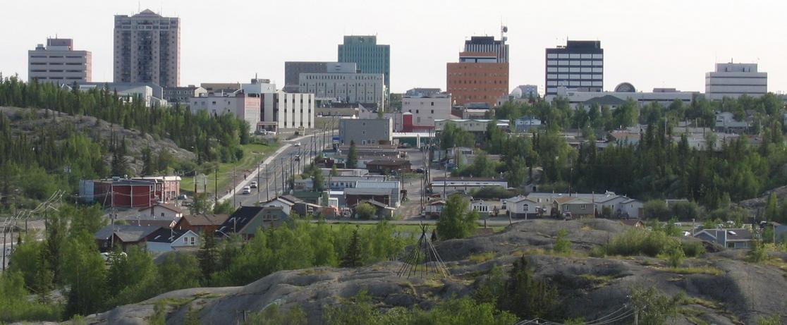
 Canadian Shield in Yellowknife | |
 Location within the Northwest Territories | |
| Country | Canada |
| Territory | Northwest Territories |
| Federal riding | Northwest Territories |
| Territorial ridings | Monfwi Tu Nedhé-Wiilideh Yellowknife
|
| Regional offices[1] | Yellowknife Behchokǫ̀ (sub-office) |
| Population (2016) | |
| • Total | 23,144 |
| Time zone | UTC−07:00 (MST) |
| • Summer (DST) | UTC−06:00 (MDT) |
| Highways | |

Communities
The North Slave Region includes the following communities:
| Community | Demographics (2016) | ||||||
|---|---|---|---|---|---|---|---|
| Name[2] | Type[3] | Census[4] | Aboriginal Population Profile[5] | ||||
| Official | Traditional | Total | First Nations | Métis | Inuit | Other | |
| Behchokǫ̀ | Tlicho community government | 1,874 | 1,720 | 60 | 10 | 160 | |
| Detah | T'èɂehda | Designated authority | 219 | 205 | 0 | 0 | 10 |
| Gamèti | Tlicho community government | 278 | 275 | 0 | 0 | 10 | |
| Łutselk'e | Designated authority | 303 | 270 | 0 | 10 | 35 | |
| Ndilǫ | Yellowknives community | Included in Yellowknife | |||||
| Wekweètì | Tlicho community government | 129 | 120 | 0 | 10 | 10 | |
| Whatì | Tlicho community government | 470 | 440 | 10 | 0 | 25 | |
| Yellowknife | Sǫ̀mbak'è | City | 19,569 | 3,200 | 1,280 | 625 | 17,550 |

|
| |||||||||||||||||||||||||||||||||||||||||||||||||||||||||
| Sources: NWT Bureau of Statistics (2001 - 2017)[6] | ||||||||||||||||||||||||||||||||||||||||||||||||||||||||||
Notes
^ a: 2001 estimated population. Included with Yellowknife
References
- North Slave Region
- "Northwest Territories Official Community Names and Pronunciation Guide". Prince of Wales Northern Heritage Centre. Yellowknife: Education, Culture and Employment, Government of the Northwest Territories. Archived from the original on 2016-01-13. Retrieved 2016-01-13.
- "Differences in Community Government Structures" (PDF). Maca.gov.nt.ca. Retrieved 18 December 2014.
- "Population and dwelling counts, for Canada, provinces and territories, and census subdivisions (municipalities), 2016 and 2011 censuses – 100% data".
- "Aboriginal Population Profile, 2016 census". Statistics Canada. Retrieved 1 July 2019.
- Population Estimates By Community from the GNWT
External links
Places adjacent to North Slave Region | ||||||||||||||||
|---|---|---|---|---|---|---|---|---|---|---|---|---|---|---|---|---|
| ||||||||||||||||
Subdivisions of the Northwest Territories | |||||||
|---|---|---|---|---|---|---|---|
| Census divisions |
| ||||||
| Former census divisions |
| ||||||
| Dehcho Region |
| ||||||
| Inuvik Region |
| ||||||
| North Slave Region |
| ||||||
| Sahtu Region |
| ||||||
| South Slave Region |
| ||||||
| Weather stations (outside of communities) |
| ||||||
| Mine sites |
| ||||||
| DEW line and NWS sites |
| ||||||
| Hudson's Bay Company trading posts |
| ||||||
| Former districts |
| ||||||
| |||||||
На других языках
[de] North Slave Region
Die North Slave Region ist eine von fünf Verwaltungsregionen in den Northwest Territories. Die Region besteht aus sieben Gemeinden. Die Regionalverwaltung hat ihren Hauptsitz in Yellowknife und eine Außenstelle in Behchokò. Mit Ausnahme von Yellowknife wird die Region vor allem von First Nations bewohnt.- [en] North Slave Region
Текст в блоке "Читать" взят с сайта "Википедия" и доступен по лицензии Creative Commons Attribution-ShareAlike; в отдельных случаях могут действовать дополнительные условия.
Другой контент может иметь иную лицензию. Перед использованием материалов сайта WikiSort.org внимательно изучите правила лицензирования конкретных элементов наполнения сайта.
Другой контент может иметь иную лицензию. Перед использованием материалов сайта WikiSort.org внимательно изучите правила лицензирования конкретных элементов наполнения сайта.
2019-2026
WikiSort.org - проект по пересортировке и дополнению контента Википедии
WikiSort.org - проект по пересортировке и дополнению контента Википедии