world.wikisort.org - Brazil
Quixeramobim (formally Santo Antônio do Boqueirão de Quixeramobim; formerly Nova Vila do Campo Maior) is a municipality in central State of Ceará, northeastern Brazil. It has a population of about 81,778 (2020 est). The local biome is caatinga hiperxerófila.
Quixeramobim | |
|---|---|
Municipality | |
 Coat of arms | |
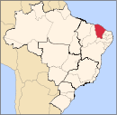
 Location in Ceará state | |
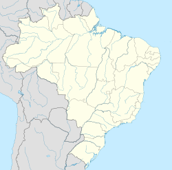  Quixeramobim Location in Brazil | |
| Coordinates: 5°12′S 39°17′W | |
| Country | Brazil |
| Region | Northeast |
| State | Ceará |
| Population (2020 [1]) | |
| • Total | 81,778 |
| Time zone | UTC−3 (BRT) |
Climate
Semi-arid tropical warm with rainfall concentrated from February to April. The average temperature is 26-28C and the average annual rainfall is 499 mm.[2]
The Paus Brancos district of the municipality was designated a priority area for conservation and sustainable use when the Caatinga Ecological Corridor was created in 2006.[3]
History
It was founded in the 17th Century on lands adjacent to Rio Ibu (Quixeramobim) and became a municipality in 1755.
Economy
The primary economic occupations are farming and ranching.
Famous Residents
Antônio Conselheiro (1830-1879), religious leader
References
- IBGE 2020
- Wernstadt, Frederick L.; World Climatic Data; published 1972 by Climatic Data Press; p. 102.
- Mattos, Marluza (2006), Ministério cria Corredor Ecológico da Caatinga (in Portuguese), Ministério do Meio Ambiente, retrieved 2016-11-01
 Municipalities of Ceará Municipalities of Ceará | |||||||||||||||||||||
|---|---|---|---|---|---|---|---|---|---|---|---|---|---|---|---|---|---|---|---|---|---|
Capital: Fortaleza | |||||||||||||||||||||
|  | ||||||||||||||||||||
|
| |||||||||||||||||||||
| |||||||||||||||||||||
| |||||||||||||||||||||
| |||||||||||||||||||||
| |||||||||||||||||||||
 | This Ceará, Brazil location article is a stub. You can help Wikipedia by expanding it. |
На других языках
- [en] Quixeramobim, Ceará
[ru] Кишерамобин
Кишерамобин (порт. Quixeramobim) — муниципалитет в Бразилии, входит в штат Сеара. Составная часть мезорегиона Сертойнс-Сеаренсис. Входит в экономико-статистический микрорегион Сертан-ди-Кишерамобин. Население составляет 68 966 человек на 2007 год. Занимает площадь 3 275,838 км². Плотность населения — 18,1 чел./км².Другой контент может иметь иную лицензию. Перед использованием материалов сайта WikiSort.org внимательно изучите правила лицензирования конкретных элементов наполнения сайта.
WikiSort.org - проект по пересортировке и дополнению контента Википедии