world.wikisort.org - Brazil
Eusébio is a Brazilian municipality in the state of Ceará, in the Northeast region of the country. Located in the Metropolitan Region of Fortaleza, 24 kilometers from the capital, it has 79 km² of land area and an estimated population of 54,337 inhabitants, according to estimates by the Brazilian Institute of Geography and Statistics in 2020. The access route is CE-040.
Eusébio | |
|---|---|
Municipality | |
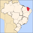
 Eusébio Location in Brazil | |
| Coordinates: 3°53′24″S 38°27′3″W | |
| Country | Brazil |
| Region | Northeast |
| State | Ceará |
| Area | |
| • Total | 79.0 km2 (30.5 sq mi) |
| Population (2020 [1]) | |
| • Total | 54,337 |
| • Density | 690/km2 (1,800/sq mi) |
| Time zone | UTC−3 (BRT) |
References
External links
- Official website of the municipal administration
Capital: Fortaleza | |||||||||||||||||||||
|  | ||||||||||||||||||||
|
| |||||||||||||||||||||
| |||||||||||||||||||||
| |||||||||||||||||||||
| |||||||||||||||||||||
| |||||||||||||||||||||
This Ceará, Brazil location article is a stub. You can help Wikipedia by expanding it. |
На других языках
- [en] Eusébio, Ceará
[ru] Эузебиу (Сеара)
Эузебиу (порт. Eusébio) — муниципалитет в Бразилии, входит в штат Сеара. Составная часть мезорегиона Агломерация Форталеза. Входит в экономико-статистический микрорегион Форталеза. Население составляет 39 697 человек на 2006 год. Занимает площадь 78,65 км². Плотность населения — 518,4 чел./км².Текст в блоке "Читать" взят с сайта "Википедия" и доступен по лицензии Creative Commons Attribution-ShareAlike; в отдельных случаях могут действовать дополнительные условия.
Другой контент может иметь иную лицензию. Перед использованием материалов сайта WikiSort.org внимательно изучите правила лицензирования конкретных элементов наполнения сайта.
Другой контент может иметь иную лицензию. Перед использованием материалов сайта WikiSort.org внимательно изучите правила лицензирования конкретных элементов наполнения сайта.
2019-2026
WikiSort.org - проект по пересортировке и дополнению контента Википедии
WikiSort.org - проект по пересортировке и дополнению контента Википедии